Ceredigion Coast Path on:
[Wikipedia]
[Google]
[Amazon]


 The Ceredigion Coast Path ( cy, Llwybr Arfordir Ceredigion) is a waymarked long distance footpath in the
. ''BBC News Wales''. BBC. 17 October 2011. Retrieved 2 January 2012.
The Official Guide to the Ceredigion Coast Path
{{coord, 52.2477, -4.2557, dim:50000_region:GB, display=title Recreational walks in Wales Long-distance footpaths in Wales Coastal paths in Wales Tourist attractions in Ceredigion Coast of Ceredigion


 The Ceredigion Coast Path ( cy, Llwybr Arfordir Ceredigion) is a waymarked long distance footpath in the
 United Kingdom
The United Kingdom of Great Britain and Northern Ireland, commonly known as the United Kingdom (UK) or Britain, is a country in Europe, off the north-western coast of the continental mainland. It comprises England, Scotland, Wales and North ...
, on the coast of Ceredigion
Ceredigion ( , , ) is a county in the west of Wales, corresponding to the historic county of Cardiganshire. During the second half of the first millennium Ceredigion was a minor kingdom. It has been administered as a county since 1282. Cer ...
, Wales
Wales ( cy, Cymru ) is a Countries of the United Kingdom, country that is part of the United Kingdom. It is bordered by England to the Wales–England border, east, the Irish Sea to the north and west, the Celtic Sea to the south west and the ...
. It is in length, running along the coast of Cardigan Bay
Cardigan Bay ( cy, Bae Ceredigion) is a large inlet of the Irish Sea, indenting the west coast of Wales between Bardsey Island, Gwynedd in the north, and Strumble Head, Pembrokeshire at its southern end. It is the largest bay in Wales.
Geo ...
from Cardigan to Ynyslas
Ynyslas (, meaning "Blue Island") is a small Welsh village about 1.5 miles north of Borth and 8 miles north of Aberystwyth, within the county of Ceredigion. It is sandwiched between a long sandy beach in Cardigan Bay and the beach in the Dyfi E ...
The path forms one section of the Wales Coast Path
The Wales Coast Path ( cy, Llwybr Arfordir Cymru) is a designated long-distance trail which follows, or runs close to, the coastline of Wales.
Launched in 2012, the footpath is long and was heralded as the first dedicated coast path in the wor ...
, an long-distance walking route around the whole coast of Wales from Chepstow
Chepstow ( cy, Cas-gwent) is a town and community in Monmouthshire, Wales, adjoining the border with Gloucestershire, England. It is located on the tidal River Wye, about above its confluence with the River Severn, and adjoining the wester ...
to Queensferry, opened in 2012.All-Wales Coast Path Nears Completion. ''BBC News Wales''. BBC. 17 October 2011. Retrieved 2 January 2012.
Background
The Ceredigion Coast Path project was funded under the EU'sObjective 1
The regional policy of the European Union (EU), also referred as Cohesion Policy, is a policy with the stated aim of improving the economic well-being of regions in the European Union and also to avoid regional disparities. More than one third ...
programme for West Wales and the Valleys. There were previously existing lengthy public rights of way along the coastline, but the scheme allowed for these to be linked together – by creating new public access routes – to make a continuous route. The path was opened throughout in July 2008.
Description
The coast path runs along the Welsh Heritage Coast from Cardigan northwards along Cardigan Bay to Ynyslas near (Borth
Borth ( cy, Y Borth) is a village and seaside resort in Ceredigion, Mid Wales, 7 miles (11 km) north of Aberystwyth on the Ceredigion Coast Path. The community includes the settlement of Ynyslas. The population was 1,399 in 2011. From be ...
), a little to the north of Aberystwyth
Aberystwyth () is a university and seaside town as well as a community in Ceredigion, Wales. Located in the historic county of Cardiganshire, means "the mouth of the Ystwyth". Aberystwyth University has been a major educational location in ...
. The official start, in Cardigan, is the bronze otter next to the bridge on the northern bank of the River Teifi
, name_etymology =
, image = File:Llyn Teifi - geograph.org.uk - 41773.jpg
, image_size =
, image_caption = Llyn Teifi, the source of the Teifi
, map =
, map_size =
, map_caption ...
.() The end is at the Ynyslas war memorial.()
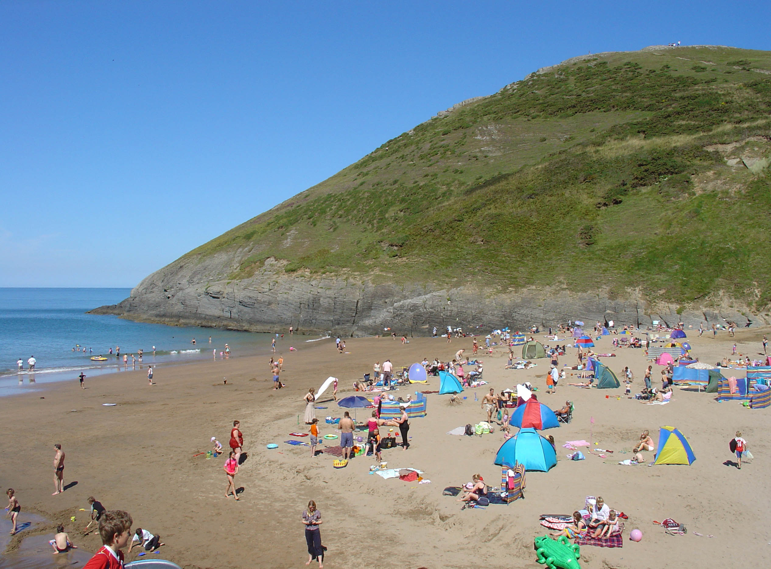
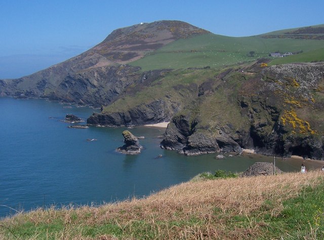
The path crosses a variety of landscapes, such as the dune system at Ynyslas, high cliffs, storm beaches, sandy bays and sea caves. The path passes through small villages and some well-known tourist resorts and offers a close insight into this stretch of coast, recently officially opened up to walkers via this route, some parts of which are still under development.
There are four sections that are designated as Heritage Coast, and two areas within Cardigan Bay are marine Special Areas of Conservation
A Special Area of Conservation (SAC) is defined in the European Union's Habitats Directive (92/43/EEC), also known as the ''Directive on the Conservation of Natural Habitats and of Wild Fauna and Flora''. They are to protect the 220 habitats and ap ...
because of their importance for wildlife. This section of coastline is renowned for bottlenose dolphin
Bottlenose dolphins are aquatic mammals in the genus ''Tursiops.'' They are common, cosmopolitan members of the family Delphinidae, the family of oceanic dolphins. Molecular studies show the genus definitively contains two species: the common ...
s, grey seal
The grey seal (''Halichoerus grypus'') is found on both shores of the North Atlantic Ocean. In Latin Halichoerus grypus means "hook-nosed sea pig". It is a large seal of the family Phocidae, which are commonly referred to as "true seals" or " ...
s and porpoises.
Ceredigion Coast Path sections
The Ceredigion Coast Path can be accessed by road at a number of points, so that it can readily be split into the following eleven sections: * Cardigan toMwnt
A scanning tunneling microscopy image of a single-walled carbon nanotube
Rotating single-walled zigzag carbon nanotube
A carbon nanotube (CNT) is a tube made of carbon with diameters typically measured in nanometers.
''Single-wall carbon nan ...
: – ''Note: There is a temporary route connecting Gwbert
Gwbert (), also known as Gwbert-on-Sea, is a cliff-top coastal village in Y Ferwig community, Ceredigion, Wales. It lies at the most southerly coastal point of Ceredigion, on the eastern shore of the Teifi estuary, from where there are views west ...
with Mwnt; the actual Ceredigion Coast Path section within that vicinity is currently unavailable because of legal proceedings.''
* Mwnt to Aberporth:
* Aberporth to Tresaith
Tresaith (otherwise Tre-saith) is a coastal village in Ceredigion, Wales, between Aberporth and Llangranog. It is linked to the former by a two-mile section of the Ceredigion Coast Path, part of the Wales Coast Path. Tresaith is within the Cered ...
:
* Tresaith to Penbryn
Penbryn () is a small coastal village and community in Ceredigion, Wales, about from Cardigan.
History
Corbalengi Stone
Standing in a field between Penbryn and Tresaith (grid reference SN28905137) is the 6th century Corbalengi Stone. This 1 ...
:
* Penbryn to Llangrannog
Llangrannog (sometimes spelt as Llangranog) is both a village and a community in Ceredigion, Wales, southwest of New Quay. It lies in the narrow valley of the River Hawen, which falls as a waterfall near the middle of the village. Llangran ...
:
* Llangrannog to Cwmtydu:
* Cwmtydu to New Quay
New Quay ( cy, Cei Newydd) is a seaside town (and electoral ward) in Ceredigion, Wales, with a resident population of around 1,200 people, reducing to 1,082 at the 2011 census. Located south-west of Aberystwyth on Cardigan Bay with a harbour a ...
:
* New Quay to Aberaeron
Aberaeron, previously anglicised as Aberayron, is a town, community, and electoral ward between Aberystwyth and Cardigan, in Ceredigion, Wales. Ceredigion County Council offices are in Aberaeron. The name of the town is Welsh for ''mouth of ...
:
* Aberaeron to Llanrhystud
Llanrhystud is a seaside village and electoral division on the A487 road in the county of Ceredigion, in Wales, 9 miles (14 km) south of Aberystwyth, and 7 miles (11 km) north of Aberaeron. It takes its name from an early Welsh saint. Th ...
:
* Llanrhystud to Aberystwyth
Aberystwyth () is a university and seaside town as well as a community in Ceredigion, Wales. Located in the historic county of Cardiganshire, means "the mouth of the Ystwyth". Aberystwyth University has been a major educational location in ...
:
* Aberystwyth to Borth
Borth ( cy, Y Borth) is a village and seaside resort in Ceredigion, Mid Wales, 7 miles (11 km) north of Aberystwyth on the Ceredigion Coast Path. The community includes the settlement of Ynyslas. The population was 1,399 in 2011. From be ...
(Ynyslas):
Whilst a long-distance path in its own right, it is linked at both ends as part of the Wales Coast Path. It meets the Pembrokeshire Coast Path
The Pembrokeshire Coast Path ( cy, Llwybr Arfordir Sir Benfro), often called the Pembrokeshire Coastal Path, is a designated National Trail in Pembrokeshire, southwest Wales. Established in 1970, it is a long-distance walking route, mostly a ...
National Trail
National Trails are long distance footpaths and bridleways in England and Wales. They are administered by Natural England, a statutory agency of the UK government, and Natural Resources Wales (successor body to the Countryside Council for Wal ...
at St Dogmaels after crossing the tidal stretch of the River Teifi
, name_etymology =
, image = File:Llyn Teifi - geograph.org.uk - 41773.jpg
, image_size =
, image_caption = Llyn Teifi, the source of the Teifi
, map =
, map_size =
, map_caption ...
via the old bridge in Cardigan.
Access
Although the Ceredigion Coast Path is a long-distance path, it can easily be split into smaller sections. Some of the sections are challenging, given the undulating nature of the path, but some of the flatter sections are quite suitable for walkers of lesser or limited ability. Recently, for instance, work completed between Aberporth and Tresaith has re-routed the path to avoid steps. Also, the Aberporth Inclusive Access Cliff Top Trail is a high-quality surfaced path built to wheelchair gradient standards. Many of the coastal villages and towns were visited by the Cardi Bach bus service run between Cardigan and New Quay, particularly aimed at walkers. Introduced in 2004, it initially carried 1,000 passengers a year and only ran in the summer. This figure had risen to 4,600 by 2010. As a result of this success, the service was extended to operate all year round (six days a week over the summer and three days a week at other times) from 2012 until September 2014, with funding from the Rural Development Plan. Funding ended in September 2014 and the service closed. The northern part of the Ceredigion Coast Path, at Borth and Aberystwyth, can be accessed by train on the Cambrian Line.References
External links
The Official Guide to the Ceredigion Coast Path
{{coord, 52.2477, -4.2557, dim:50000_region:GB, display=title Recreational walks in Wales Long-distance footpaths in Wales Coastal paths in Wales Tourist attractions in Ceredigion Coast of Ceredigion