|
Westerschelde
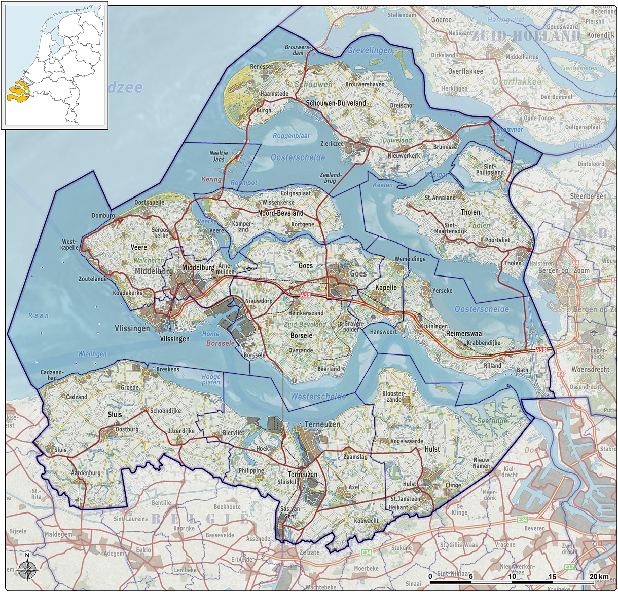
The Western Scheldt ( nl, Westerschelde) in the province of Zeeland in the southwestern Netherlands, is the estuary of the Scheldt river. This river once had several estuaries, but the others are now disconnected from the Scheldt, leaving the Westerschelde as its only direct route to the sea. The Western Scheldt is an important shipping route to the Port of Antwerp, Belgium. Unlike the Eastern Scheldt estuary, it could not be closed off from the sea by a dam as part of the Delta Works. Instead, the dykes around it have been heightened and reinforced. Over the years, many ships have sunk in the Western Scheldt. Following an agreement between the Dutch and Belgian governments in 1995, many of the wrecks have been removed to improve shipping access to Antwerp. It was expected that the last 38 wrecks in the shipping channel would be removed during 2003. The largest wreck was the long '' Alan A. Dale'', which was removed in June 2003. The Western Scheldt was freed from German oc ... [...More Info...] [...Related Items...] OR: [Wikipedia] [Google] [Baidu] |
Scheldt
The Scheldt (french: Escaut ; nl, Schelde ) is a river that flows through northern France, western Belgium, and the southwestern part of the Netherlands, with its mouth at the North Sea. Its name is derived from an adjective corresponding to Old English ' ("shallow"), Modern English ''shoal'', Low German ''schol'', West Frisian ''skol'', and Swedish (obsolete) ''skäll'' ("thin"). Course The headwaters of the Scheldt are in Gouy, in the Aisne department of northern France. It flows north through Cambrai and Valenciennes, and enters Belgium near Tournai. Ghent developed at the confluence of the Lys, one of its main tributaries, and the Scheldt, which then turns east. Near Antwerp, the largest city on its banks, the Scheldt flows west into the Netherlands toward the North Sea. Originally there were two branches from that point: the Oosterschelde (Eastern Scheldt); and the Westerschelde (Western Scheldt). In the 19th century, however, the Dutch built a dyke that cut ... [...More Info...] [...Related Items...] OR: [Wikipedia] [Google] [Baidu] |
Delta Works
The Delta Works ( nl, Deltawerken) is a series of construction projects in the southwest of the Netherlands to protect a large area of land around the Rhine–Meuse–Scheldt delta from the sea. Constructed between 1954 and 1997, the works consist of dams, sluices, locks, dykes, levees, and storm surge barriers located in the provinces of South Holland and Zeeland. The aim of the dams, sluices, and storm surge barriers was to shorten the Dutch coastline, thus reducing the number of dikes that had to be raised. Along with the Zuiderzee Works, the Delta Works have been declared one of the Seven Wonders of the Modern World by the American Society of Civil Engineers. History The estuaries of the rivers Rhine, Meuse and Schelde have been subject to flooding over the centuries. After building the Afsluitdijk (19271932), the Dutch started studying the damming of the Rhine-Meuse Delta. Plans were developed to shorten the coastline and turn the delta into a group of freshwat ... [...More Info...] [...Related Items...] OR: [Wikipedia] [Google] [Baidu] |
Zeeland Van Boven
, nl, Ik worstel en kom boven("I struggle and emerge") , anthem = "Zeeuws volkslied"("Zeelandic Anthem") , image_map = Zeeland in the Netherlands.svg , map_alt = , map_caption = Location of Zeeland in the Netherlands , pushpin_map = , pushpin_label_position = , pushpin_map_alt = , pushpin_map_caption = , coordinates = , coor_pinpoint = , coordinates_footnotes = , subdivision_type = Country , subdivision_name = Netherlands , established_title = , established_date = , founder = , seat_type = Capital , seat = Middelburg , seat1_type = Largest city , seat1 = Terneuzen , government ... [...More Info...] [...Related Items...] OR: [Wikipedia] [Google] [Baidu] |
Zeeland
, nl, Ik worstel en kom boven("I struggle and emerge") , anthem = "Zeeuws volkslied"("Zeelandic Anthem") , image_map = Zeeland in the Netherlands.svg , map_alt = , map_caption = Location of Zeeland in the Netherlands , pushpin_map = , pushpin_label_position = , pushpin_map_alt = , pushpin_map_caption = , coordinates = , coor_pinpoint = , coordinates_footnotes = , subdivision_type = Country , subdivision_name = Netherlands , established_title = , established_date = , founder = , seat_type = Capital , seat = Middelburg , seat1_type = Largest city , seat1 = Terneuzen , government ... [...More Info...] [...Related Items...] OR: [Wikipedia] [Google] [Baidu] |
Kruiningen
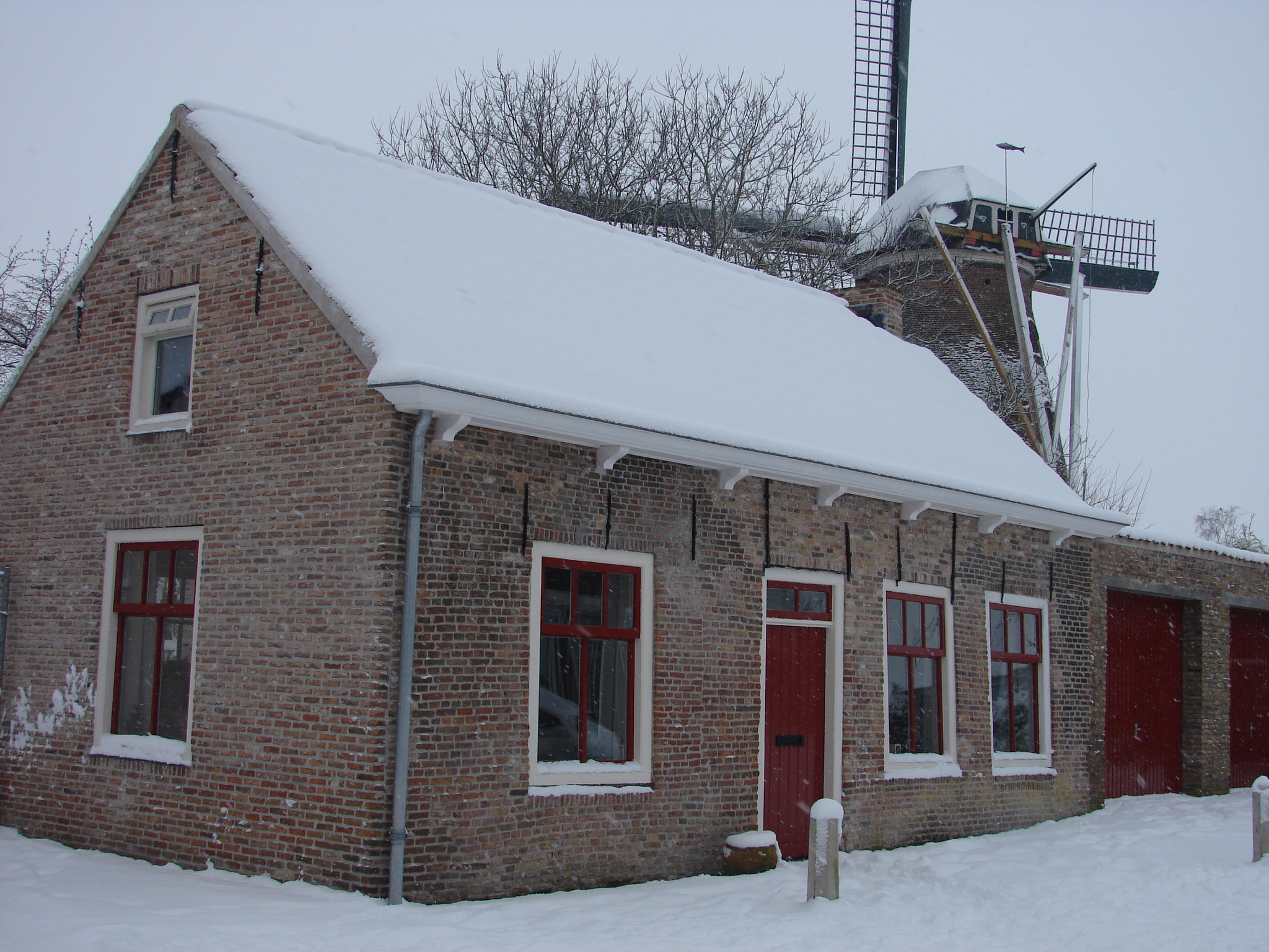
Kruiningen is a village in the Dutch province of Zeeland. It is located in the municipality of Reimerswaal, about 5 km south of the village of Yerseke.''ANWB Topografische Atlas Nederland'', Topografische Dienst and ANWB, 2005. Kruiningen has a station on the railway line Bergen op Zoom - Vlissingen. Kruiningen achieved some notoriety as departure and arrival of the ferry Kruiningen- Perkpolder. In 2003, this ferry closed in connection with the opening of the Westerscheldetunnel. History The place where Kruiningen was built, was one of the islands that later formed Zuid-Beveland. The area was diked by monks of the abbeys of Ten Duinen and Ter Doest. Kruiningen was hit hard during the Flood of 1953, 62 people died and the entire village came for six months under the influence of the tides. The Johanneskerk was rebuilt in the 15th and 16th century after a fire in the 14th century. In the church Church may refer to: Religion * Church (building), a building for Christian ... [...More Info...] [...Related Items...] OR: [Wikipedia] [Google] [Baidu] |
Sedimentation Enhancing Strategies
Sedimentation enhancing strategies are Environmental resource management, environmental management projects aiming to restore and facilitate land-building processes in River delta, deltas. Sediment availability and deposition are important because deltas naturally Subsidence, subside and therefore need sediment accumulation to maintain their elevation, particularly considering increasing rates of sea-level rise. Sedimentation enhancing strategies aim to increase sedimentation on the delta plain primarily by restoring the exchange of water and sediments between rivers and low-lying delta plains. Sedimentation enhancing strategies can be applied to encourage Elevation, land elevation gain to offset sea-level rise. Interest in sedimentation enhancing strategies has recently increased due to their ability to raise land elevation, which is important for the long-term sustainability of deltas. Benefits of sedimentation enhancing strategies When compared to conventional Flood control, fl ... [...More Info...] [...Related Items...] OR: [Wikipedia] [Google] [Baidu] |
Breskens
Breskens is a harbour town on the Westerschelde in the municipality of Sluis in the province of Zeeland, in the south-western Netherlands. Its population is 4,787 (). The town is noted for the ''Visserijfeesten'' (Fishery Festival), the largest festival in Zeeland. A ferry connection exists between Breskens and Vlissingen. After the opening of the Western Scheldt Tunnel near Terneuzen in 2003, the ferry now only carries pedestrian and bicycle traffic. Sights The lighthouse of Breskens is the oldest remaining cast-iron lighthouse in the Netherlands. It was built in 1867 and became a monument in 1982. History In early 1487 Maximilian I, Holy Roman Emperor, granted the coastal region of the Scheldt as a fief to Philip of Cleves. The coastal areas were drained and the village of Breskens was founded in 1510. On 14 May 1940, with the German army approaching, the Dutch government fled to London. Queen Wilhelmina initially ordered the British captain removing her from the Hag ... [...More Info...] [...Related Items...] OR: [Wikipedia] [Google] [Baidu] |
Eastern Scheldt
The Eastern Scheldt ( nl, Oosterschelde) is a former estuary in the province of Zeeland, Netherlands, between Schouwen-Duiveland and Tholen on the north and Noord-Beveland and Zuid-Beveland on the south. It also features the largest national park in the Netherlands, founded in 2002. Landscape and history During the Roman Era it was the major mouth of the Scheldt River. Before the St. Felix's Flood of 1530, it flowed north as a river from the east end of the Westerschelde, turned west a little west of Bergen op Zoom, and then west along the north edge of what is now the Verdronken Land van Reimerswaal, and after that widened into an estuary. Later parts of that lost land were reclaimed, restricting part of the connection to the Scheldt River to a narrow channel called the Kreekrak, which silted up and became unnavigable. In 1867 the Kreekrak was closed off with a railway embankment, connecting in the process the island of Zuid-Beveland to the mainland of North Brabant. Fr ... [...More Info...] [...Related Items...] OR: [Wikipedia] [Google] [Baidu] |
Vlissingen
Vlissingen (; zea, label= Zeelandic, Vlissienge), historically known in English as Flushing, is a municipality and a city in the southwestern Netherlands on the former island of Walcheren. With its strategic location between the Scheldt river and the North Sea, Vlissingen has been an important harbour for centuries. It was granted city rights in 1315. In the 17th century Vlissingen was a main harbour for ships of the Dutch East India Company (VOC). It is also known as the birthplace of Admiral Michiel de Ruyter. Vlissingen is mainly noted for the yards on the Scheldt where most of the ships of the Royal Netherlands Navy (''Koninklijke Marine'') are built. Geography The municipality of Vlissingen consists of the following places: * City: Vlissingen * Villages: Oost-Souburg, Ritthem, and West-Souburg * Hamlet: Groot-Abeele History The fishermen's hamlet that came into existence at the estuary of the Schelde around AD 620 has grown over its 1,400-year history into the ... [...More Info...] [...Related Items...] OR: [Wikipedia] [Google] [Baidu] |
Terneuzen
Terneuzen () is a city and municipality in the southwestern Netherlands, in the province of Zeeland, in the middle of Zeelandic Flanders. With almost 55,000 inhabitants, it is the most populous municipality of Zeeland. History First mentioned in 1325, Terneuzen was a strategically located port on the waterways to Ghent, in present-day Belgium. It received city rights in 1584. Tradition has it that Terneuzen was once the home of the legendary Flying Dutchman, Van der Decken, a captain who cursed God and was condemned to sail the seas forever, as described in the Frederick Marryat novel ''The Phantom Ship'' and the Richard Wagner opera '' The Flying Dutchman''. Before 1877, the city was often called Neuzen. Geography The city of Terneuzen is located on the southern shore of the Western Scheldt estuary. The municipality of Terneuzen consists of the following population centres: Economy The Ghent–Terneuzen Canal is still an important shipping route connecti ... [...More Info...] [...Related Items...] OR: [Wikipedia] [Google] [Baidu] |
Ferry
A ferry is a ship, watercraft or amphibious vehicle used to carry passengers, and sometimes vehicles and cargo, across a body of water. A passenger ferry with many stops, such as in Venice, Italy, is sometimes called a water bus or water taxi. Ferries form a part of the public transport systems of many waterside cities and islands, allowing direct transit between points at a capital cost much lower than bridges or tunnels. Ship connections of much larger distances (such as over long distances in water bodies like the Mediterranean Sea) may also be called ferry services, and many carry vehicles. History In ancient times The profession of the ferryman is embodied in Greek mythology in Charon, the boatman who transported souls across the River Styx to the Underworld. Speculation that a pair of oxen propelled a ship having a water wheel can be found in 4th century Roman literature "''Anonymus De Rebus Bellicis''". Though impractical, there is no reason why it could not ... [...More Info...] [...Related Items...] OR: [Wikipedia] [Google] [Baidu] |
Small Waterplane Area Twin Hull
A small waterplane area twin hull, better known by the acronym SWATH, is a catamaran design that minimizes hull cross section area at the sea's surface. Minimizing the ship's volume near the surface area of the sea, where wave energy is located, minimizes a vessel's response to sea state, even in high seas and at high speeds. The bulk of the displacement necessary to keep the ship afloat is located beneath the waves, where it is less affected by wave action. Wave excitation drops exponentially as depth increases, so wave action normally does not affect a submerged submarine at all. Placing the majority of a ship's displacement under the waves is similar in concept to creating a ship that rides atop twin submarines. Effects The twin-hull design provides a stable platform and large, broad decks. Compared with conventional catamarans, SWATH vessels have more surface drag, but less wave drag. They are less susceptible to wave motion but more sensitive to payload, which affect ... [...More Info...] [...Related Items...] OR: [Wikipedia] [Google] [Baidu] |


_p523_BRESKENS.jpg)


