|
Thiès
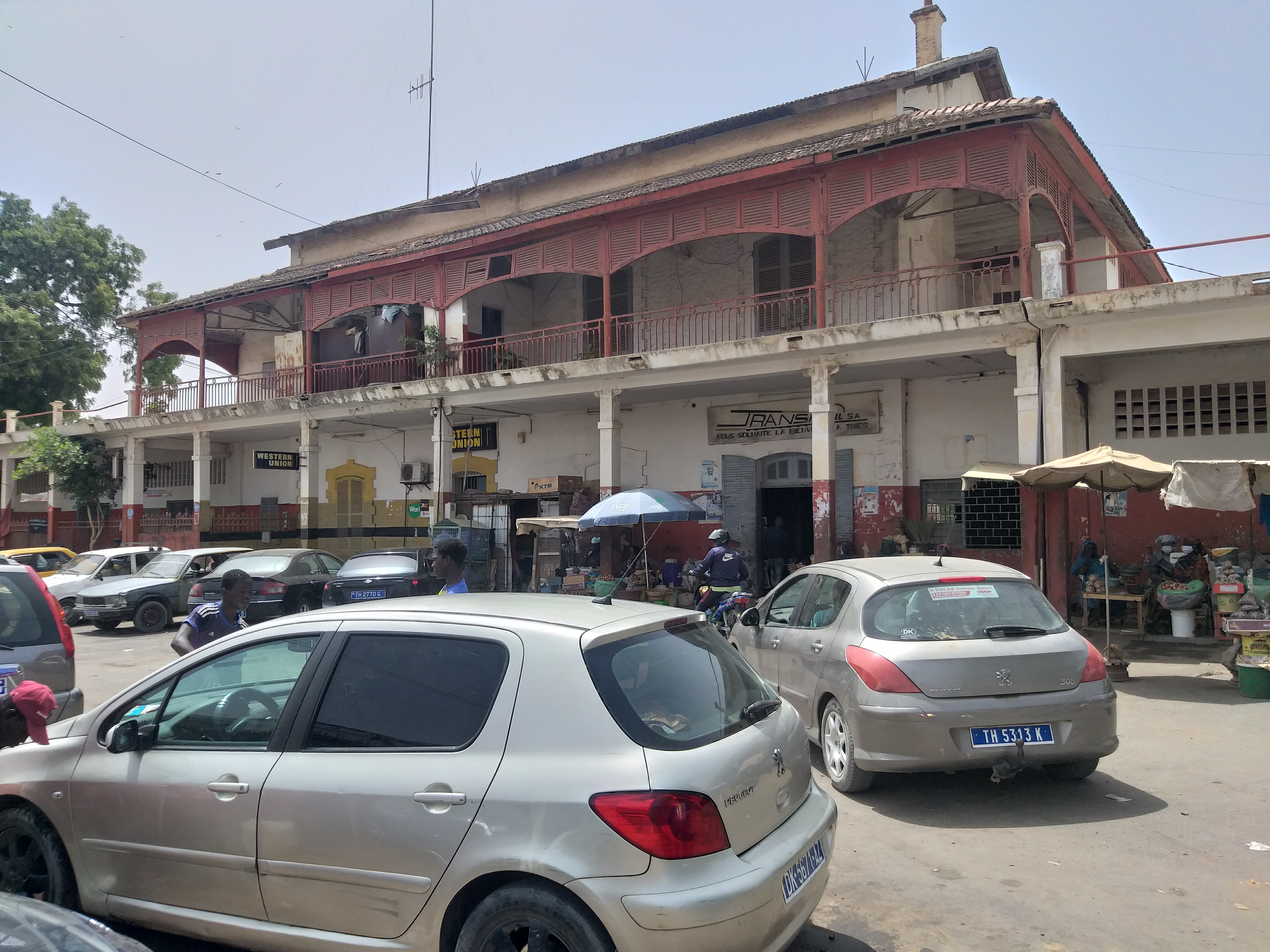
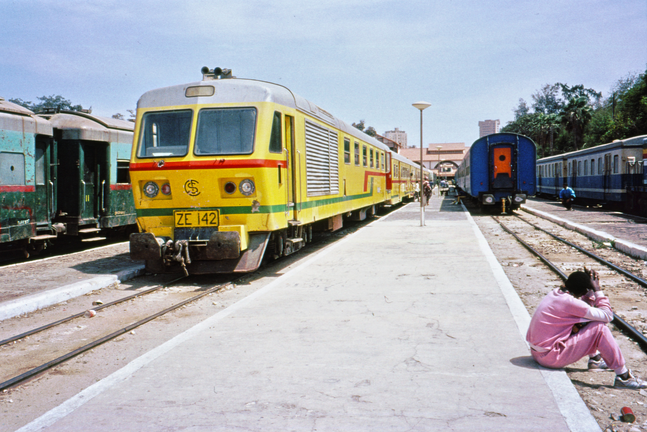
Thiès (; ar, ثيس, Ṯyass; Noon: ''Chess'') is the third largest city in Senegal with a population officially estimated at 320,000 in 2005. It lies east of Dakar on the N2 road and at the junction of railway lines to Dakar, Bamako and St-Louis. It is the capital of Thiès Region and is a major industrial city. History Before colonization, the Thiès Plateau was a wooded frontier between the kingdoms of Cayor and Baol inhabited by the Serer-Noon, an ethnic sub-group of the Serer people. The Serer-Noon still inhabit the Thiès-Nones neighborhood of the south-west city today. They speak the Noon language, one of the Cangin languages. The village of Dianxene, belonging to the kingdom of Cayor, was founded on the strategically important plateau in the 17th century. In 1860, it had only 75 inhabitants. The French founded a military post there in 1864, becoming an important force in the city's development ever since. The Spiritans founded a mission there in the late 19th cen ... [...More Info...] [...Related Items...] OR: [Wikipedia] [Google] [Baidu] |
Thiès Region
Thiès is a region of western Senegal. The capital is also called Thiès. Geography Thiès has two coastlines, one in the north with the Grande Côte housing the Niayes vegetable market, one to the south with the Petite Côte, one of the tourist areas of Senegal. Principally the main passageway between the peninsula and the rest of the country, the region of Thiès has received a communication route connected to the first rail line and new road infrastructure. Thiès is relatively small, yet it is the most populous region after Dakar, with a population of 2,709,112 inhabitants at the end 2007. The coastal communities are dependent on fishing, growing crops, and coastal tourism for subsistence. The interior of the region was the peanut basin. Phosphates are also mined there. History The Thiès Region has always been occupied by the Serer people since States headed by ancient Serer Lamanes, the ancient Serers and Timeline of Serer history, their ancestors. However, in the pre ... [...More Info...] [...Related Items...] OR: [Wikipedia] [Google] [Baidu] |
Serer People
The Serer people are a West African ethnoreligious group."Charisma and Ethnicity in Political Context: A Case Study in the Establishment of a Senegalese Religious Clientele" Leonardo A. Villalón, Journal of the , Vol. 63, No. 1 (1993), p. 95, on behalf of the International African Institute They are the third-largest ethnic group in Senegal, making up 15% of the Senegalese pop ... [...More Info...] [...Related Items...] OR: [Wikipedia] [Google] [Baidu] |
Senegal
Senegal,; Wolof: ''Senegaal''; Pulaar: 𞤅𞤫𞤲𞤫𞤺𞤢𞥄𞤤𞤭 (Senegaali); Arabic: السنغال ''As-Sinighal'') officially the Republic of Senegal,; Wolof: ''Réewum Senegaal''; Pulaar : 𞤈𞤫𞤲𞤣𞤢𞥄𞤲𞤣𞤭 𞤅𞤫𞤲𞤫𞤺𞤢𞥄𞤤𞤭 (Renndaandi Senegaali); Arabic: جمهورية السنغال ''Jumhuriat As-Sinighal'') is a country in West Africa, on the Atlantic Ocean coastline. Senegal is bordered by Mauritania to the north, Mali to the east, Guinea to the southeast and Guinea-Bissau to the southwest. Senegal nearly surrounds the Gambia, a country occupying a narrow sliver of land along the banks of the Gambia River, which separates Senegal's southern region of Casamance from the rest of the country. Senegal also shares a maritime border with Cape Verde. Senegal's economic and political capital is Dakar. Senegal is notably the westernmost country in the mainland of the Old World, or Afro-Eurasia. It owes its name to the ... [...More Info...] [...Related Items...] OR: [Wikipedia] [Google] [Baidu] |
Cangin Languages
The Cangin languages are spoken by 200,000 people (as of 2007) in a small area east of Dakar, Senegal. They are the languages spoken by the Serer people who do not speak the Serer language (''Serer-Sine''). Because the people are ethnically Serer, the Cangin languages are commonly thought to be dialects of the Serer language. However, they are not closely related; Serer is closer to Fulani than it is to Cangin. Languages The Cangin languages are: Lehar and Noon are particularly close, as are Ndut and Palor, though not quite to the point of easy intelligibility. Safen is transparently closer to Lehar–Noon than to Palor–Ndut. Reconstruction Merrill (2018: 451) reconstructs Proto-Cangin as follows.Merrill, John Thomas Mayfield. 2018. The Historical Origin of Consonant Mutation in the Atlantic Languages'. Doctoral dissertation, University of California, Berkeley. See also *Serer language Serer, often broken into differing regional dialects such as Serer-Sine and Serer ... [...More Info...] [...Related Items...] OR: [Wikipedia] [Google] [Baidu] |
Noon Language
Noon (''Non, None, Serer-Noon, Serer-Non'') is a Cangin language of Senegal spoken in the Thiès region (14°47'0"N / 16°55'0"W). There is an estimated population of 10,000''-'' 50,000 speakers worldwide, rendering this language to be vulnerable.'' Ethnologue'' reports that it is 84% cognate (and 52% intelligible) with Lehar, essentially a divergent dialect, and 68% cognate with the other Cangin languages. The Noon people identify themselves ethnically as Serer. However, their language, often called Serer-Noon on the assumption that it is a Serer dialect, is not closely related to the principal language of the Serer population, Serer-Sine. Status Like many of the local languages in Senegal, the Noon language is officially recognized as one of the national languages of country. Orthography The Noon language is written using the Latin alphabet. In 2005, a decree was passed by the Senegalese Government in order to regulate the spelling to ''Noon''. It has been proposed that ... [...More Info...] [...Related Items...] OR: [Wikipedia] [Google] [Baidu] |
Serer-Noon
The Serer-Noon also called Noon (sometimes spelt ''Non'' or ''None'') are an ethnic people who occupy western Senegal. They are part of the Serer people though they do not speak the Serer-Sine language natively. Territory They are found primarily in Senegal in the region of Thiès in areas like Fandène, Peykouk, Silman, Diankhène and Dioung. Ndiaye, Ousmane Sémou, "Diversité et unicité sérères : l’exemple de la région de Thiès", Éthiopiques, no 54, vol. 7, 2e semestre 199/ref> As well as being present in Senegal, they are also found in the Gambia. Population In the Thies area alone, their population is 32,900. Collectively, the Serer people make-up the third largest ethnic group in Senegal. History In his Sketches of Senegal (1853), Abbé Boilat described them as "the most beautiful black people... tall and beautiful posture... who are always well dressed, very strong and independent" During the 19th century muslim marabout jihads in Senegambia, the Serer-No ... [...More Info...] [...Related Items...] OR: [Wikipedia] [Google] [Baidu] |
N3 Road (Senegal)
The N3 road is one of the national roads of Senegal. It connects the west and the east of the country by a direct route across the middle from Thiès in the west via Bambey, Diourbel, Mbacké, Touba, Dahra, Linguère and Ranérou to Ouro Sogui and Malem on the eastern border with Mauritania. The N3 connects with the N2 road at both ends (Thiès and Ouro Sogui). See also * N1 road * N2 road * N4 road * N5 road * N6 road * N7 road * Transport in Senegal This article describes the system of transport in Senegal, both public and private.This system comprises roads (both paved and unpaved), rail transport, water transport, and air transportation. Roads The system of roads in Senegal is extensive ... Road transport in Senegal {{Africa-road-stub ... [...More Info...] [...Related Items...] OR: [Wikipedia] [Google] [Baidu] |
Regions Of Senegal
Senegal is subdivided into 14 regions (French: ''régions'', singular''région''), each of which is administered by a ''Conseil Régional'' (pl.: ''Conseils Régionaux'') elected by population weight at the arrondissement level. Senegal is further subdivided into 45 departments, 103 arrondissements (neither of which have administrative function) and by ''collectivités locales'' (the 14 ''regions'', 110 ''communes'', and 320 ''communautés rurales'') which elect administrative officers. from Union des ''Associations d’ Elus Locaux (UAEL) du Sénégal''. See also the law creating current local government structures Code de ... [...More Info...] [...Related Items...] OR: [Wikipedia] [Google] [Baidu] |
Léopold Sédar Senghor
Léopold Sédar Senghor (; ; 9 October 1906 – 20 December 2001) was a Senegalese poet, politician and cultural theorist who was the first president of Senegal (1960–80). Ideologically an African socialist, he was the major theoretician of Négritude. Senghor was a proponent of African culture, black identity and African empowerment within the framework of French-African ties. He advocated for the extension of full civil and political rights for France's African territories while arguing that French Africans would be better off within a federal French structure than as independent nation-states. Senghor became the first President of independent Senegal. He fell out with his long-standing associate Mamadou Dia who was Prime Minister of Senegal, arresting him on suspicion of fomenting a coup and imprisoning him for 12 years. Senghor established an authoritarian single-party state in Senegal where all rival political parties were prohibited. Senghor was also the founder of t ... [...More Info...] [...Related Items...] OR: [Wikipedia] [Google] [Baidu] |
Dakar–Saint-Louis Railway
The railroad linking Dakar (Senegal) to Saint-Louis, Senegal, Saint-Louis was the first railroad line in French West Africa when it opened in 1885. It is no longer in service. References Further reading *. Metre gauge railways in Senegal {{Africa-rail-transport-stub ... [...More Info...] [...Related Items...] OR: [Wikipedia] [Google] [Baidu] |
N2 Road (Senegal)
The N2 road is one of the national roads of Senegal. It connects the west and the east of the country in a large arc following the northern frontier from the outskirts of the capital Dakar via Thiès, Louga, Saint-Louis, Richard Toll, Thilogne, Ouro Sogui, Kidira and Nayé on the border with Mali. See also * N1 road * N3 road * N4 road * N5 road * N6 road * N7 road * Transport in Senegal This article describes the system of transport in Senegal, both public and private.This system comprises roads (both paved and unpaved), rail transport, water transport, and air transportation. Roads The system of roads in Senegal is extensive ... Road transport in Senegal {{Africa-road-stub ... [...More Info...] [...Related Items...] OR: [Wikipedia] [Google] [Baidu] |
Peninsula
A peninsula (; ) is a landform that extends from a mainland and is surrounded by water on most, but not all of its borders. A peninsula is also sometimes defined as a piece of land bordered by water on three of its sides. Peninsulas exist on all continents. The size of a peninsula can range from tiny to very large. The largest peninsula in the world is the Arabian Peninsula. Peninsulas form due to a variety of causes. Etymology Peninsula derives , which is translated as 'peninsula'. itself was derived , or together, 'almost an island'. The word entered English in the 16th century. Definitions A peninsula is usually defined as a piece of land surrounded on most, but not all sides, but is sometimes instead defined as a piece of land bordered by water on three of its sides. A peninsula may be bordered by more than one body of water, and the body of water does not have to be an ocean or a sea. A piece of land on a very tight river bend or one between two rivers is sometimes s ... [...More Info...] [...Related Items...] OR: [Wikipedia] [Google] [Baidu] |

.jpg)


