|
Nuremberg
Nuremberg ( ; german: link=no, Nürnberg ; in the local East Franconian dialect: ''Nämberch'' ) is the second-largest city of the German state of Bavaria after its capital Munich, and its 518,370 (2019) inhabitants make it the 14th-largest city in Germany. On the Pegnitz River (from its confluence with the Rednitz in Fürth onwards: Regnitz, a tributary of the River Main) and the Rhine–Main–Danube Canal, it lies in the Bavarian administrative region of Middle Franconia, and is the largest city and the unofficial capital of Franconia. Nuremberg forms with the neighbouring cities of Fürth, Erlangen and Schwabach a continuous conurbation with a total population of 800,376 (2019), which is the heart of the urban area region with around 1.4 million inhabitants, while the larger Nuremberg Metropolitan Region has approximately 3.6 million inhabitants. The city lies about north of Munich. It is the largest city in the East Franconian dialect area (colloquially: "F ... [...More Info...] [...Related Items...] OR: [Wikipedia] [Google] [Baidu] |
Nuremberg Airport
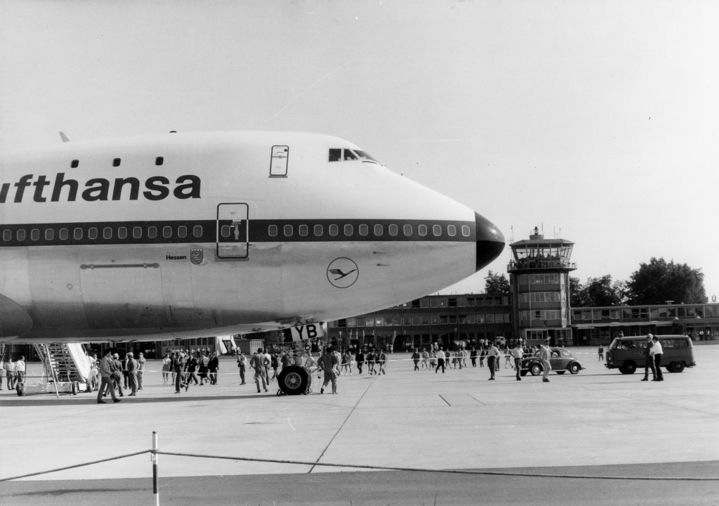
Nuremberg Airport , german: link=no, Albrecht Dürer Flughafen Nürnberg, is the international airport of the Franconian metropolitan area of Nuremberg and the second-busiest airport in Bavaria after Munich Airport. With about 4.1 million passengers handled in 2019, it is Germany's 10th busiest airport. It is located approximately 5 km north of Nuremberg's city centre and offers flights within Germany as well as to European metropolitan and leisure destinations, especially along the Mediterranean Sea, on the Canary Islands and in Egypt. airport-nuremberg.de – Summer 2013 schedule History Before the current airport Prior to World War II, the Nuremberg area was served by a number of airfields in quick succession, all of which became inadequate in the face of the rapid development of aviation or fell victim to the same wars that had played a part in their construction. The first airfield in the area was built in 1915 by the Bavarian Army in the neighboring town of Fürth ... [...More Info...] [...Related Items...] OR: [Wikipedia] [Google] [Baidu] |
Franconia
Franconia (german: Franken, ; Franconian dialect: ''Franggn'' ; bar, Frankn) is a region of Germany, characterised by its culture and Franconian languages, Franconian dialect (German: ''Fränkisch''). The three Regierungsbezirk, administrative regions of Lower Franconia, Lower, Middle Franconia, Middle and Upper Franconia (largest cities, respectively: Würzburg, Nuremberg and Bamberg) in the Bavaria, State of Bavaria are part of the cultural region of Franconia, as are the adjacent East Franconian, Franconian-speaking South Thuringia, south of the Rennsteig ridge (largest city: Suhl), Heilbronn-Franconia (largest city: Schwäbisch Hall) in the state of Baden-Württemberg, and small parts of the state of Hesse. Those parts of the Vogtland lying in the state of Saxony (largest city: Plauen) are sometimes regarded as Franconian as well, because the Vogtlandian dialects are mostly East Franconian. The inhabitants of Saxon Vogtland, however, mostly do not consider themselves as Fran ... [...More Info...] [...Related Items...] OR: [Wikipedia] [Google] [Baidu] |
Nuremberg Castle
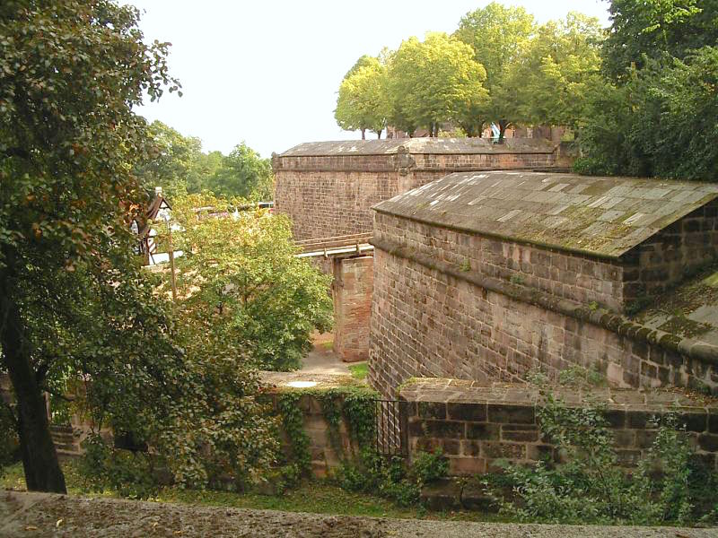
Nuremberg Castle (german: Nürnberger Burg) is a group of medieval fortified buildings on a sandstone ridge dominating the historical center of Nuremberg in Bavaria, Germany. The castle, together with the city walls, is considered to be one of Europe's most formidable medieval fortifications.Fehring, Günther P. and Ress, Anton. ''Die Stadt Nürnberg.'' 2. Auflage bearbeitet von Wilhelm Schwemmer. Deutscher Kunstverlag, München, , S. 152ff. It represented the power and importance of the Holy Roman Empire and the outstanding role of the Imperial City of Nuremberg.''Imperial Castle of Nuremberg,'' Bavarian Admini ... [...More Info...] [...Related Items...] OR: [Wikipedia] [Google] [Baidu] |
Fürth
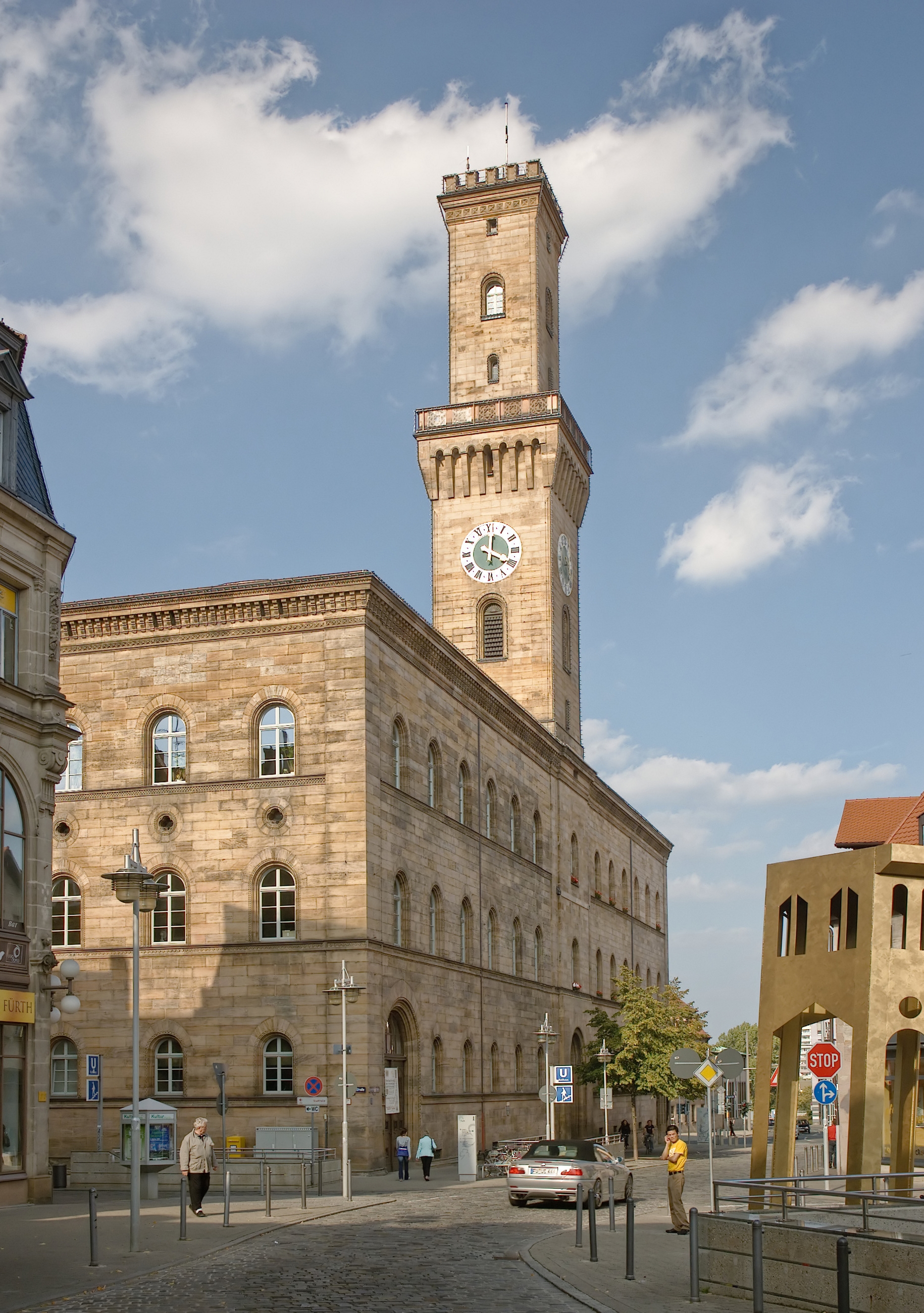
Fürth (; East Franconian: ; yi, פיורדא, Fiurda) is a city in northern Bavaria, Germany, in the administrative division ('' Regierungsbezirk'') of Middle Franconia. It is now contiguous with the larger city of Nuremberg, the centres of the two cities being only apart. Fürth is one of 23 "major centres" in Bavaria. Fürth, Nuremberg, Erlangen and some smaller towns form the "Middle Franconian Conurbation", which is one of the 11 German metropolitan regions. Fürth celebrated its thousand year anniversary in 2007, its first mention being on 1 November 1007. Geography The historic centre of the town is to the east and south of the rivers Rednitz and Pegnitz, which join to form the Regnitz to the northwest of the Old Town. To the west of the town, on the far side of the Main-Danube Canal, is the Fürth municipal forest (''Fürther Stadtwald''). To the east of Fürth, at roughly the same latitude, lies Nuremberg, and to the north is the fertile market-gardening area ... [...More Info...] [...Related Items...] OR: [Wikipedia] [Google] [Baidu] |
Erlangen
Erlangen (; East Franconian: ''Erlang'', Bavarian: ''Erlanga'') is a Middle Franconian city in Bavaria, Germany. It is the seat of the administrative district Erlangen-Höchstadt (former administrative district Erlangen), and with 116,062 inhabitants (as of 30 March 2022), it is the smallest of the eight major cities ('' Großstadt'') in Bavaria. The number of inhabitants exceeded the threshold of 100,000 in 1974, making Erlangen a major city according to the statistical definition officially used in Germany. Together with Nuremberg, Fürth, and Schwabach, Erlangen forms one of the three metropolises in Bavaria. With the surrounding area, these cities form the European Metropolitan Region of Nuremberg, one of 11 metropolitan areas in Germany. The cities of Nuremberg, Fürth, and Erlangen also form a triangle on a map, which represents the heartland of the Nuremberg conurbation. An element of the city that goes back a long way in history, but is still noticeable, is the settl ... [...More Info...] [...Related Items...] OR: [Wikipedia] [Google] [Baidu] |
Frauenkirche, Nuremberg
The Frauenkirche ("Church of Our Lady") is a church in Nuremberg, Germany. It stands on the eastern side of the main market. An example of brick Gothic Brick Gothic (german: Backsteingotik, pl, Gotyk ceglany, nl, Baksteengotiek) is a specific style of Gothic architecture common in Northeast and Central Europe especially in the regions in and around the Baltic Sea, which do not have resourc ... architecture, it was built on the initiative of Charles IV, Holy Roman Emperor between 1352 and 1362. The church contains many sculptures, some of them heavily restored. Numerous works of art from the Middle Ages are kept in the church, such as the so-called Tucher Altar (c. 1440, originally the high altar of the Augustinians, Augustinian church of St. Vitus), and two monuments by Adam Kraft (c. 1498). History The church was built in the grand market, in place of the former Jewish synagogue, which was destroyed during the pogrom of 1349 following an outbreak of Black Death. The archi ... [...More Info...] [...Related Items...] OR: [Wikipedia] [Google] [Baidu] |
Nuremberg Metropolitan Region
The Nuremberg Metropolitan Region comprises 3.5 million people on 21,800 square kilometers. With a gross domestic product of 134 billion euros and about 1.9 million employees, this metropolitan area is one of the strongest economic areas in Germany. The major cities are Nuremberg, Fürth, Erlangen, Bayreuth and Bamberg. Geographic The Nuremberg Metropolitan Region encloses geographically the administrative region of Middle Franconia, whole Upper Franconia, two territorial authorities of Lower Franconia and about half of the Upper Palatinate. Cities and rural district of the region The region includes the cities Ansbach, Amberg, Bamberg, Bayreuth, Coburg, Erlangen, Fürth, Hof, Nuremberg, Schwabach and Weiden in der Oberpfalz as well as the rural districts of Amberg-Sulzbach, Ansbach, Bamberg, Bayreuth, Coburg, Erlangen-Höchstadt, Forchheim, Fürth, Haßberge, Hof, Kitzingen, Kronach, Kulmbach, Lichtenfels, Neumarkt in der Oberpfalz, Neustadt an der Aisch, Bad ... [...More Info...] [...Related Items...] OR: [Wikipedia] [Google] [Baidu] |
University Hospital
A university hospital is an institution which combines the services of a hospital with the education of medical students and with medical research. These hospitals are typically affiliated with a medical school or university. The following is a list of such hospitals. Algeria The Algerian Ministry of Health, Population and Hospital Reform maintains 15 public university teaching hospital centers (French: ''Centre Hospitalo-Universitaire'' or CHU) with 13,755 beds and one public university hospital (EHU) with 773 beds. * CHU Mustapha Pacha in Algiers Province, established in 1854 *CHU Lamine Debaghine in Algiers Province *CHU Nafissa Hamoud in Algiers Province *CHU Issad Hassani in Algiers Province *CHU Ibn Sina Anaba in Annaba Province *CHU Dorban in Annaba Province *CHU Hospital of Mother and Child El Bouni in Annaba Province *CHU Sainte Thérèse in Annaba Province *CHU Annaba Anti-Cancer Center in Annaba Province *CHU Béjaïa in Béjaïa Province *CHU Blida in Blida Pr ... [...More Info...] [...Related Items...] OR: [Wikipedia] [Google] [Baidu] |
Rhine–Main–Danube Canal
The Rhine–Main–Danube Canal (German: ''Rhein-Main-Donau-Kanal''; also called Main-Danube Canal, RMD Canal or Europa Canal), is a canal in Bavaria, Germany. Connecting the Main and the Danube rivers across the European Watershed, it runs from Bamberg via Nuremberg to Kelheim. The canal connects the North Sea and Atlantic Ocean to the Black Sea, providing a navigable artery between the Rhine delta (at Rotterdam in the Netherlands), and the Danube Delta in south-eastern Romania and south-western Ukraine (or Constanța, through the Danube–Black Sea Canal). The present canal was completed in 1992 and is long. Early history Projects for connecting the Danube and Rhine basins by canal have a long history. In 793, the Emperor Charlemagne ordered the construction of a canal—the '' Fossa Carolina'' (German: ''Karlsgraben'')—connecting the Swabian Rezat, a tributary of the Rednitz, to the Altmühl near Treuchtlingen. Betwe ... [...More Info...] [...Related Items...] OR: [Wikipedia] [Google] [Baidu] |
Bavaria
Bavaria ( ; ), officially the Free State of Bavaria (german: Freistaat Bayern, link=no ), is a state in the south-east of Germany. With an area of , Bavaria is the largest German state by land area, comprising roughly a fifth of the total land area of Germany. With over 13 million inhabitants, it is second in population only to North Rhine-Westphalia, but due to its large size its population density is below the German average. Bavaria's main cities are Munich (its capital and largest city and also the third largest city in Germany), Nuremberg, and Augsburg. The history of Bavaria includes its earliest settlement by Iron Age Celtic tribes, followed by the conquests of the Roman Empire in the 1st century BC, when the territory was incorporated into the provinces of Raetia and Noricum. It became the Duchy of Bavaria (a stem duchy) in the 6th century AD following the collapse of the Western Roman Empire. It was later incorporated into the Holy Roman Empire, be ... [...More Info...] [...Related Items...] OR: [Wikipedia] [Google] [Baidu] |
Pegnitz (river)
The Pegnitz () is a river in Franconia in the German state of Bavaria. The Pegnitz has its source in the town of the same name at an altitude of and meets the Rednitz at in Fürth to form the Regnitz river. But often esp. by local people the long Fichtenohe is regarded as upper course of the Pegnitz. The Fichtenohe source is in Lindenhardt Forest north of Pegnitz town. The Pegnitz is about long, with Fichtenohe . The river is inhabited by numerous ducks, coots, swans, and gulls. Tributaries * Fichtenohe (left tributary) * Flembach (left tributary) * Hirschbach (left tributary) * Högenbach (left tributary from the Pommelsbrunn direction) * Happurger Bach (left tributary) * Sittenbach (right tributary) * Hammerbach (left tributary) * Sandbach (left tributary) * Schnaittach (right tributary) * Röttenbach (right tributary) * Bitterbach (right tributary) * Röthenbach (left tributary) * Langwassergraben (right tributary) * Tiefgraben (right tributary) * Goldbach (left tri ... [...More Info...] [...Related Items...] OR: [Wikipedia] [Google] [Baidu] |
Pegnitz River
The Pegnitz () is a river in Franconia in the German state of Bavaria. The Pegnitz has its source in the town of the same name at an altitude of and meets the Rednitz at in Fürth to form the Regnitz river. But often esp. by local people the long Fichtenohe is regarded as upper course of the Pegnitz. The Fichtenohe source is in Lindenhardt Forest north of Pegnitz town. The Pegnitz is about long, with Fichtenohe . The river is inhabited by numerous ducks, coots, swans, and gulls. Tributaries * Fichtenohe (left tributary) * Flembach (left tributary) * Hirschbach (left tributary) * Högenbach (left tributary from the Pommelsbrunn direction) * Happurger Bach (left tributary) * Sittenbach (right tributary) * Hammerbach (left tributary) * Sandbach (left tributary) * Schnaittach (right tributary) * Röttenbach (right tributary) * Bitterbach (right tributary) * Röthenbach (left tributary) * Langwassergraben (right tributary) * Tiefgraben (right tributary) * Goldbach (left tri ... [...More Info...] [...Related Items...] OR: [Wikipedia] [Google] [Baidu] |


