|
List Of Settlements In Lancashire By Population
This is a list of settlements in Lancashire by population based on the results of the 2011 census. The next United Kingdom census will take place in 2021. In 2011, there were 49 built-up area subdivisions with 5,000 or more inhabitants in Lancashire, shown in the table below. Population ranking The "settlements" in this table are the "Built-up area subdivisions" used by the Office for National Statistics in the 2011 United Kingdom census. "Built-up areas" and their subdivisions were previously known as "Urban areas" and are defined as areas of built-up land of at least 20 hectares which are separated from other built-up areas by at least 200m. They were named algorithmically, based on the name of a city, town or other settlement found on Ordnance Survey mapping within the area. These areas do not always coincide with current or former local authority boundaries or other definitions of settlements: Bamber Bridge Built-up area subdivision, for example, had a 2011 population of ... [...More Info...] [...Related Items...] OR: [Wikipedia] [Google] [Baidu] |
Blackpool
Blackpool is a seaside resort in Lancashire, England. Located on the North West England, northwest coast of England, it is the main settlement within the Borough of Blackpool, borough also called Blackpool. The town is by the Irish Sea, between the River Ribble, Ribble and River Wyre, Wyre rivers, and is north of Liverpool and northwest of Manchester. At the 2011 United Kingdom census, 2011 census, the Unitary authorities of England, unitary authority of Blackpool had an estimated population of 139,720 while the urban settlement had a population of 147,663, making it the List of settlements in Lancashire by population, most populous settlement in Lancashire, and the fifth-most populous in North West England after Manchester, Liverpool, Bolton and Warrington. The Blackpool Urban Area, wider built-up area (which also includes additional settlements outside the unitary authority) had a population of 239,409, making it the fifth-most populous urban area in the North West after t ... [...More Info...] [...Related Items...] OR: [Wikipedia] [Google] [Baidu] |
Ormskirk
Ormskirk is a market town in the West Lancashire district of Lancashire, England, north of Liverpool, northwest of St Helens, southeast of Southport and southwest of Preston. Ormskirk is known for its gingerbread. Geography and administration Ormskirk lies on sloping ground on the side of a ridge, whose highest point is above sea-level, at the centre of the West Lancashire Plain, and has been described as a "planned borough", laid out in the 13th century.Lancashire County Council Ormskirk historic town assessment, Lancashire County Council, 2006 Ormskirk is an , surrounded by the |
Office For National Statistics
The Office for National Statistics (ONS; cy, Swyddfa Ystadegau Gwladol) is the executive office of the UK Statistics Authority, a non-ministerial department which reports directly to the UK Parliament. Overview The ONS is responsible for the collection and publication of statistics related to the economy, population and society of the UK; responsibility for some areas of statistics in Scotland, Northern Ireland and Wales is devolved to the devolved governments for those areas. The ONS functions as the executive office of the National Statistician, who is also the UK Statistics Authority's Chief Executive and principal statistical adviser to the UK's National Statistics Institute, and the 'Head Office' of the Government Statistical Service (GSS). Its main office is in Newport near the United Kingdom Intellectual Property Office and Tredegar House, but another significant office is in Titchfield in Hampshire, and a small office is in London. ONS co-ordinates data collection wi ... [...More Info...] [...Related Items...] OR: [Wikipedia] [Google] [Baidu] |
Lancashire
Lancashire ( , ; abbreviated Lancs) is the name of a historic county, ceremonial county, and non-metropolitan county in North West England. The boundaries of these three areas differ significantly. The non-metropolitan county of Lancashire was created by the Local Government Act 1972. It is administered by Lancashire County Council, based in Preston, and twelve district councils. Although Lancaster is still considered the county town, Preston is the administrative centre of the non-metropolitan county. The ceremonial county has the same boundaries except that it also includes Blackpool and Blackburn with Darwen, which are unitary authorities. The historic county of Lancashire is larger and includes the cities of Manchester and Liverpool as well as the Furness and Cartmel peninsulas, but excludes Bowland area of the West Riding of Yorkshire transferred to the non-metropolitan county in 1974 History Before the county During Roman times the area was part of the Bri ... [...More Info...] [...Related Items...] OR: [Wikipedia] [Google] [Baidu] |
List Of Urban Areas In The United Kingdom
This is a list of the most populous urban areas in the United Kingdom based on the United Kingdom Census 2011, 2011 census, as defined by the Office for National Statistics (ONS). Definition The methodology used by ONS in 2011 is set out in ''2011 Built-up Areas – Methodology and Guidance'', published in June 2013. When ONS reported the results of the 2011 UK census, it used the term "built-up area" rather than the term "urban area" as used in previous censuses. ONS states, however, that the criteria used to define "built-up area" have not changed: In reporting the United Kingdom Census 2001, 2001 census, ONS gave a clearer definition of the term "built-up" as follows: Most populous The list below shows the most populated urban areas in the United Kingdom as defined by the Office for National Statistics (ONS), but as readily referenced at Citypopulation.de. The list includes all urban areas with a population in excess of 100,000 at the 2011 census. Map See also *City ... [...More Info...] [...Related Items...] OR: [Wikipedia] [Google] [Baidu] |
United Kingdom Census 2021
The decennial 2021 censuses of England and Wales and of Northern Ireland took place on 21 March 2021, and the census of Scotland took place on 20 March 2022. The censuses were administered by the Office for National Statistics (ONS) in England and Wales, by the Northern Ireland Statistics and Research Agency (NISRA) in Northern Ireland, and by the National Records of Scotland in Scotland. These were the first British censuses for which most of the data was gathered online, and two of them went ahead despite the COVID-19 pandemic, in part because the information obtained will assist government and public understanding of the pandemic's impact. Enumeration in Scotland was postponed, and took place in 2022, the plans for it having been delayed because of the pandemic. The censuses in 2021 and 2022 follows on from Beyond 2011, a project by the UK Statistics Authority to assess the value, cost, and alternatives to a census in 2021. The project recommended a census in 2021, and amongst ... [...More Info...] [...Related Items...] OR: [Wikipedia] [Google] [Baidu] |
Census In The United Kingdom
Coincident full censuses have taken place in the different jurisdictions of the United Kingdom every ten years since 1801, with the exceptions of 1941 (during the Second World War), Ireland in 1921/Northern Ireland in 1931,https://www.nisra.gov.uk/sites/nisra.gov.uk/files/publications/1926-census-preliminary-report.PDF and Scotland in 2021. In addition to providing detailed information about national demographics, the results of the census play an important part in the calculation of resource allocation to regional and local service providers by the UK government. 2021 United Kingdom census, The most recent UK census took place in England, Wales and Northern Ireland on 21 March 2021. Because of the COVID-19 pandemic in the United Kingdom, COVID-19 pandemic, the census in Scotland was delayed to 20 March 2022. History Tax assessments (known in the later Empire as the indiction) were made in Britain in Roman Britain, Roman times, but detailed records have not survived. In the 7th ... [...More Info...] [...Related Items...] OR: [Wikipedia] [Google] [Baidu] |
United Kingdom Census 2011
A Census in the United Kingdom, census of the population of the United Kingdom is taken every ten years. The 2011 census was held in all countries of the UK on 27 March 2011. It was the first UK census which could be completed online via the Internet. The Office for National Statistics (ONS) is responsible for the census in England and Wales, the General Register Office for Scotland (GROS) is responsible for the census in Scotland, and the Northern Ireland Statistics and Research Agency (NISRA) is responsible for the census in Northern Ireland. The Office for National Statistics is the executive office of the UK Statistics Authority, a non-ministerial department formed in 2008 and which reports directly to Parliament. ONS is the UK Government's single largest statistical producer of independent statistics on the UK's economy and society, used to assist the planning and allocation of resources, policy-making and decision-making. ONS designs, manages and runs the census in England an ... [...More Info...] [...Related Items...] OR: [Wikipedia] [Google] [Baidu] |
Heysham
Heysham ( ) is a coastal town in Lancashire, England, overlooking Morecambe Bay. It is a Heysham Port, ferry port, with services to the Isle of Man and Ireland, and the site of two Heysham nuclear power station, nuclear power stations. Demography Administratively, Heysham is part of the City of Lancaster, Lancaster city district, with three wards: Heysham Central (with a population of 4,397, increasing to 4,478 at the 2011 Census), Heysham North (5,477 decreasing to 5,274 at the 2011 Census) and Heysham South (6,262; increasing to 7,264 at the 2011 Census). Together they had a population of 16,136 (2001 census), and 17,016 (2011 census). These include areas beyond the village of Heysham itself, which has a population of about 6,500. History Of historical interest are the stone-hewn graves in the ruins of the ancient St Patrick's Chapel, Heysham, St. Patrick's Chapel, close to St Peter's Church, Heysham, St Peter's Church. They are thought to date from the 11th century, and are ... [...More Info...] [...Related Items...] OR: [Wikipedia] [Google] [Baidu] |
Fulwood, Lancashire
Fulwood is an area and unparished area in Lancashire, England, forming much of the northern half of the unparished part of the City of Preston district. It had a population of 28,535 in 2011 and is made up of five wards. For several reasons, despite its close proximity to Preston, it has remained distinctly separated. Historically, Fulwood was governed independently from Preston until 1974. Furthermore, since the majority of the area is encompassed under The Fulwood Conservation Area, it has remained geographically separate from Preston. History Fulewde, 1199; Fulewude, 1228; Fulwode, 1297. The extract below by John Marius Wilson, Imperial Gazetteer of England and Wales (1870–72) described Fulwood and its history during its early Victorian foundations: "FULWOOD, a township-chapelry in Lancaster parish, Lancashire; on the Lancaster and Preston railway, 1.5 mile N of Preston. It has a station on the railway; and its post town is Preston. Acres, 2077. Real property, £6,218. P ... [...More Info...] [...Related Items...] OR: [Wikipedia] [Google] [Baidu] |
Bacup
Bacup ( , ) is a town in the Rossendale Borough in Lancashire, England, in the South Pennines close to Lancashire's boundaries with West Yorkshire and Greater Manchester. The town is in the Rossendale Valley and the upper Irwell Valley, east of Rawtenstall, north of Rochdale, and south of Burnley. At the 2011 Census, Bacup had a population of 13,323. Bacup emerged as a settlement following the Anglo-Saxon settlement of Britain in the Early Middle Ages. For centuries, it was a small and obscure centre of domestic flannel and woollen cloth production, and many of the original weavers' cottages survive today as listed buildings. Following the Industrial Revolution, Bacup became a mill town, growing up around the now covered over bridge crossing the River Irwell and the north–south / east-west crossroad at its centre. During that time its landscape became dominated by distinctive and large rectangular woollen and cotton mills. Bacup received a charter of incorporation in 1882, ... [...More Info...] [...Related Items...] OR: [Wikipedia] [Google] [Baidu] |
Colne
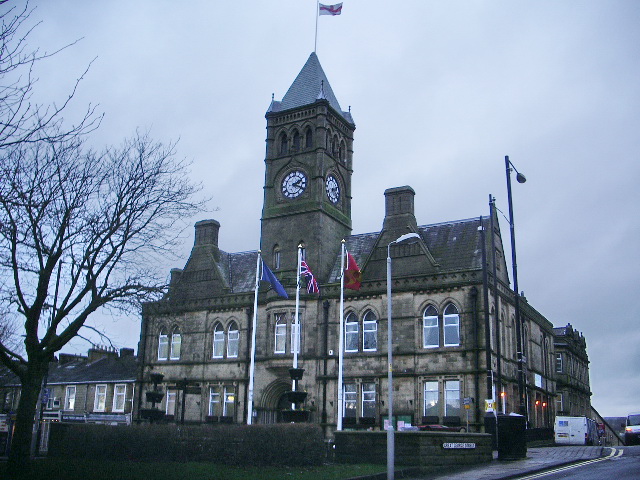
Colne () is a market town and civil parish in the Borough of Pendle in Lancashire, England. Located northeast of Nelson, north-east of Burnley, east of Preston and west of Leeds. The town should not be confused with the unrelated Colne Valley around the River Colne near Huddersfield in West Yorkshire. Colne is close to the southern entrance to the Aire Gap, the lowest crossing of the Pennine watershed. The M65 terminates west of the town and from here two main roads take traffic onwards towards the Yorkshire towns of Skipton (A56) and Keighley (A6068). Colne railway station is the terminus of the East Lancashire railway line. Colne adjoins the Pendle parishes of Foulridge, Laneshaw Bridge, Trawden Forest, Nelson, Barrowford and Blacko. History Settlement in the area can be traced back to the Stone Age. A Mesolithic camp site, a Bronze Age burial site and stone tools from the Bronze and Stone Ages have been discovered at nearby Trawden. There are also the remains of an I ... [...More Info...] [...Related Items...] OR: [Wikipedia] [Google] [Baidu] |


