|
List Of Places In Cheshire
This is a list of places within the ceremonial county boundaries of Cheshire, in North West England. A B C D E F G H I K L M N O P R S T U V W See also * List of Cheshire settlements by population * List of civil parishes in Cheshire * Places of interest in Cheshire * List of places in England Here is a list of places, divided by ceremonial counties of England. See also * Toponymy of England * Toponymical list of counties of the United Kingdom *List of generic forms in British place names * List of places in the United Kingdom * Sub ... {{Cheshire ! *Places Cheshire ... [...More Info...] [...Related Items...] OR: [Wikipedia] [Google] [Baidu] |
Cheshire
Cheshire ( ) is a ceremonial and historic county in North West England, bordered by Wales to the west, Merseyside and Greater Manchester to the north, Derbyshire to the east, and Staffordshire and Shropshire to the south. Cheshire's county town is the cathedral city of Chester, while its largest town by population is Warrington. Other towns in the county include Alsager, Congleton, Crewe, Ellesmere Port, Frodsham, Knutsford, Macclesfield, Middlewich, Nantwich, Neston, Northwich, Poynton, Runcorn, Sandbach, Widnes, Wilmslow, and Winsford. Cheshire is split into the administrative districts of Cheshire West and Chester, Cheshire East, Halton, and Warrington. The county covers and has a population of around 1.1 million as of 2021. It is mostly rural, with a number of towns and villages supporting the agricultural and chemical industries; it is primarily known for producing chemicals, Cheshire cheese, salt, and silk. It has also had an impact on popular culture, producing not ... [...More Info...] [...Related Items...] OR: [Wikipedia] [Google] [Baidu] |
Beeston Castle Gate
Beeston may refer to: People * Beeston (surname) Places in the United Kingdom * Beeston, Bedfordshire, a hamlet *Beeston, Cheshire, a village and civil parish **Beeston Castle * Beeston, Leeds, West Yorkshire, a suburb of Leeds ** Beeston railway station (West Yorkshire) *Beeston, Norfolk, a village *Beeston Regis *Beeston St Andrew *the former parish of Beeston St Lawrence now part of Ashmanhaugh *the parish of Beeston with Bittering * Beeston Beck (Norfolk), a minor watercourse *Beeston, Nottinghamshire, a town in Nottinghamshire ** Beeston railway station ** Beeston (UK Parliament constituency) ** Beeston Urban District * Beeston Tor, Staffordshire Other uses * Beeston Brewery Company, a brewery based in Beeston, Nottinghamshire (1880–1922) See also *Breaston Breaston ( ) is a large village and civil parish in the Erewash district, in the south-east of Derbyshire and lies approximately east of the city of Derby and west of the city of Nottingham. The popula ... [...More Info...] [...Related Items...] OR: [Wikipedia] [Google] [Baidu] |
Alpraham
Alpraham is a village and civil parish in Cheshire, England, on the A51 road between Nantwich and Chester, seven miles north-west of Nantwich. The population is around 400. The Travellers Rest public house is on the Campaign for Real Ale's National Inventory of Historic Pub Interiors. It was built in about 1850 and extended in 1937, and the interwar interior remains largely unchanged.heritagepubs.org.ukHistoric Pub Interiors accessdate: 17/08/2014 Demography The 2001 Census gave the parish's population as 373, rising to 407 in 162 households in the 2011 Census. The population density was 0.6 persons/hectare in 2011, well below the average of 3.2 persons/hectare for Cheshire East. History Alpraham was mentioned in the Domesday book as belonging to Edwin, Earl of Mercia Edwin (Old English: ''Ēadwine'') (died 1071) was the elder brother of Morcar, Earl of Northumbria, son of Ælfgār, Earl of Mercia and grandson of Leofric, Earl of Mercia. He succeeded to his fa ... [...More Info...] [...Related Items...] OR: [Wikipedia] [Google] [Baidu] |
Allostock
Allostock is a village and civil parishes in England, civil parish in the unitary authority of Cheshire West and Chester and the ceremonial county of Cheshire, England, about five miles south of Knutsford and 20 miles south of Manchester. Allostock was formerly in the borough of Vale Royal until it was abolished on 1 April 2009 to form Cheshire West and Chester. Allostock is located on an affluent of the river Weaver. It had a population of 816 according to the 2011 census data as well as 325 households. John Bartholemew wrote this in 1887 about Allostock: :"Allostock, township, Great Budworth par., mid. Cheshire, 5 miles S. of Knutsford, 3017 ac., pop. 501." Origin Allostock's name was developed from the Old English word 'Lostock', which means a place of piggeries. The first part of the name, added to distinguish it from Lostock Gralam, may be from 'Hall', or from 'Auld' or 'Old Lostock' which eventually led to the name Allostock. Despite it being overlooked in the Dooms ... [...More Info...] [...Related Items...] OR: [Wikipedia] [Google] [Baidu] |
Alsager
Alsager ( ) is a town and civil parish in the unitary authority of Cheshire East in Cheshire, England. It is located to the north-west of Stoke-on-Trent and east of Crewe. The town's population was 13,389 at the 2021 census. ''The Mere'' is a lake in the centre of Alsager; this isolated pool, once the focal point of the town, is only accessible by two fenced public viewing areas and by local residents who have gardens adjoining the waters. Alsager has hosted an annual summer carnival since 1998; until June 2009, it was located in Milton Park, but it had since moved to the Alsager School playing fields to increase capacity, until moving back to Milton Park in 2017. In 2008, Alsager was awarded Fairtrade Town status by the Fairtrade Foundation. History The civil parish is bordered by the parishes of Betchton to the north, Church Lawton to the north-east and east, Kidsgrove to the south-east, Audley Rural to the south, Haslington to the west, and Hassall to the north-we ... [...More Info...] [...Related Items...] OR: [Wikipedia] [Google] [Baidu] |
Aldford
Aldford is a village and former civil parish, now in the parish of Aldford and Saighton, in the county of Cheshire, England. (). The village is approximately to the south of Chester, on the east bank of the River Dee. The Aldford Brook joins the Dee just north of the village. In the 2001 census, the population of the village was 213. The population of the civil parish was recorded as 272 in the 2011 census. History The name Aldford means "Old Ford" and likely derives from Old English. Aldford Castle dates back over 800 years. The village was a township in Broxton Hundred. A civil parish from 1866, it was abolished in 2015 to form Aldford and Saighton civil parish. The population was 331 in 1801, rising to 521 in 1851, then 113 in 1901 and decreasing to 96 by 1951. Between 1960 and 1991, the village was the location of a Royal Observer Corps monitoring bunker, to be used in the event of a nuclear attack. No trace of the bunker remains today. Landmarks Most of the b ... [...More Info...] [...Related Items...] OR: [Wikipedia] [Google] [Baidu] |
Aldersey
Aldersey is a civil parish in the unitary authority of Cheshire West and Chester and the ceremonial county of Cheshire, England England is a country that is part of the United Kingdom. It shares land borders with Wales to its west and Scotland to its north. The Irish Sea lies northwest and the Celtic Sea to the southwest. It is separated from continental Europe b .... It contains the villages of Aldersey Green and Aldersey Park , and is about south-east of Chester. According to the 2001 census the parish had a population of 72, increasing to 132 at the 2011 census. See also * Listed buildings in Aldersey References Civil parishes in Cheshire {{Cheshire-geo-stub ... [...More Info...] [...Related Items...] OR: [Wikipedia] [Google] [Baidu] |
Alderley Edge
Alderley Edge is a village and civil parish in Cheshire, England. In 2011, it had a population of 4,780. Alderley Edge is northwest of Macclesfield and south of Manchester, at the base of a steep and thickly wooded sandstone escarpment, Alderley Edge, which is the area's chief topographical feature and overlooks the Cheshire Plain. Alderley Edge is known for its affluence and expensive houses, falling inside Cheshire's Golden Triangle. Alderley Edge has a selection of cafes and designer shops and has attracted numerous Premier League footballers, actors and multi-millionaire businesspeople. It is one of the most expensive and sought-after places to live in the UK outside central London. History The area around Alderley Edge provides proof of occupation since the Mesolithic period with flint implements being found along the line of the sandstone outcrop. Evidence of copper mining in the Bronze Age has also been found to the south of the area. In 1995 members of the ... [...More Info...] [...Related Items...] OR: [Wikipedia] [Google] [Baidu] |
Agden, Macclesfield
Agden is a civil parish in the Borough of Cheshire East and the ceremonial county of Cheshire, England. It is near High Legh, and about south-west from Manchester City Centre. It is the site of Agden Hall. According to the 2001 census, the population of the civil parish was 142.2001 Census Details. Accessed 15-May-2007. Because the population is so small, it does not have a parish council, instead, relying on a parish meeting
A parish meeting, in England, is a m ...
[...More Info...] [...Related Items...] OR: [Wikipedia] [Google] [Baidu] |
Agden, Chester
Agden is a small civil parish in the unitary authority of Cheshire West and Chester and the ceremonial county of Cheshire, England. It is the site of Agden Hall. The parish has a parish meeting rather than a parish council. At the 2001 census it had a population of 42. Retrieved 2009-12-10 See also *Listed buildings in Agden, Cheshire West an ...
[...More Info...] [...Related Items...] OR: [Wikipedia] [Google] [Baidu] |
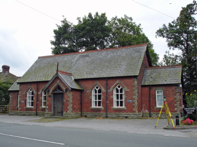
Adlington, Cheshire
Adlington is a village and civil parish in the unitary authority of Cheshire East and the ceremonial county of Cheshire, England. It is known as ''Eduluintune'' in the Domesday Book. According to the 2001 census the civil parish had a population of 1,081 people across 401 households. There is a mixed, non-denominational primary school in the village. A railway station, located on the Manchester–Stoke-On-Trent line, is used mainly by commuters to Manchester and Stockport. History Adlington was a chapelry and township in Prestbury ancient parish.Youngs, F. A. (1991). page 5 It became a separate civil parish in 1866, and had slight changes to its civil parish boundaries in 1936. It was in Hamestan hundred, which later became Macclesfield Hundred and, later still, was assigned to be part of Macclesfield Poor Law Union and Rural Sanitary District. When Macclesfield Rural District council was established in 1894, Adlington became a civil parish within it. In 1974, local gov ... [...More Info...] [...Related Items...] OR: [Wikipedia] [Google] [Baidu] |
Acton Bridge
Map of the civil parish of Acton Bridge within the former borough of Vale Royal Acton Bridge (formerly Acton) is a village and civil parish in Cheshire, England. Located within the unitary authority of Cheshire West and Chester on the River Weaver, it is near the Trent and Mersey Canal at approximately 53˚ 16′ N, 2˚ 36′ W. It has a population of 602, increasing to 631 at the 2011 Census. Acton Bridge is served by its own railway station, operated by London Northwestern. Acton Bridge Parish Council meets in the Parish Rooms. There is an active Community Association, and a number of other organisations exist within the village. History This section is adapted (with permission) from ''Snapshots in Time'', a book about the village published by the Acton Bridge WI to mark the Millennium in 2000. Acton Bridge is a small village of 265 households and about 600 inhabitants, situated four miles west of Northwich in Cheshire, on the south bank of the River Weaver. It is on the We ... [...More Info...] [...Related Items...] OR: [Wikipedia] [Google] [Baidu] |


