|
Dirillo
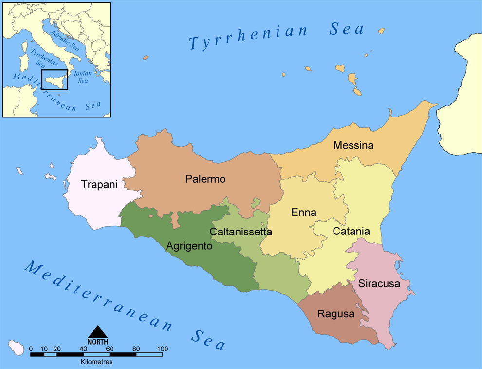
The Dirillo, or Acate, is a river in Sicily which springs from the Hyblaean Mountains and flows through the areas of Vizzini, Licodia Eubea, Mazzarrone, Chiaramonte Gulfi, Acate, Vittoria, Gela. It enters the Strait of Sicily south-east of the town of Gela. As the largest river in the area it is sometimes known as the ''Fiume Grande''. The river was known in antiquity as the Achates ( grc, Ἀχάτης). It was noted by Silius Italicus for the remarkable clearness of its waters. Theophrastus in his treatise ''On Stones'' (ca. 315 B.C.) indicates that the name of the gemstone ''achates'' (agate) was based on the source of such stones from this river. Pliny the Elder makes the same connection in his ''Naturalis Historia'' [...More Info...] [...Related Items...] OR: [Wikipedia] [Google] [Baidu] |
Lago Dirillo
Dirillo Lake is an artificial lake to the south of Licodia Eubea in the Province of Catania, Sicily, Italy, which was formed in the 1950s by damming the river Dirillo The Dirillo, or Acate, is a river in Sicily which springs from the Hyblaean Mountains and flows through the areas of Vizzini, Licodia Eubea, Mazzarrone, Chiaramonte Gulfi, Acate, Vittoria, Sicily, Vittoria, Gela. It enters the Strait of Sicily so .... Lakes of Sicily {{Sicily-geo-stub ... [...More Info...] [...Related Items...] OR: [Wikipedia] [Google] [Baidu] |
Agate
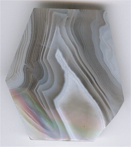
Agate () is a common rock formation, consisting of chalcedony and quartz as its primary components, with a wide variety of colors. Agates are primarily formed within volcanic and metamorphic rocks. The ornamental use of agate was common in Ancient Greece, in assorted jewelry and in the seal stones of Greek warriors, while bead necklaces with pierced and polished agate date back to the 3rd millennium BCE in the Indus Valley civilisation. Etymology The stone was given its name by Theophrastus, a Greek philosopher and naturalist, who discovered the stone along the shore line of the Dirillo River or Achates ( grc, Ἀχάτης) in Sicily, sometime between the 4th and 3rd centuries BCE. Formation and properties Agate minerals have the tendency to form on or within pre-existing rocks, creating difficulties in accurately determining their time of formation. Their host rocks have been dated to have formed as early as the Archean Eon. Agates are most commonly found as nodules wi ... [...More Info...] [...Related Items...] OR: [Wikipedia] [Google] [Baidu] |
Rivers Of Italy
This is a list of rivers which are at least partially located in Italy. They are organized according to the body of water they drain into, with the exceptions of Sicily and Sardinia, which are listed separately. At the bottom, all of the rivers are also listed alphabetically. Italian rivers are generally shorter than those of other European regions because Italy is partly a Italian Peninsula, peninsula along which the Apennines, Apennine chain rises, dividing the waters into two opposite sides. The longest Italian river is the Po (river), Po, which flows for along the Po Valley. Rivers in Italy total about 1,200, and give rise, compared to other List of sovereign states and dependent territories in Europe, European countries, to a large number of marine mouths. This is due to the relative abundance of rain events in Italy, and to the presence of the Alps, Alpine chain rich in snowfields and glaciers in the northern part of the country, in the presence of the Apennines in the cent ... [...More Info...] [...Related Items...] OR: [Wikipedia] [Google] [Baidu] |
Acate
Acate ( Sicilian: ''Acati'' or ''Vischiri'') is a small town and ''comune'' in the south of Sicily, Italy, part of the province of Ragusa. It is located in the Dirillo River valley, from Ragusa. Until 1938 it was called Biscari, and its history dates back until the 14th century. During World War II it was the location of the Biscari Massacre, in which American troops killed numerous unarmed German and Italian soldiers. Twin towns * Chambly, France France (), officially the French Republic ( ), is a country primarily located in Western Europe. It also comprises of Overseas France, overseas regions and territories in the Americas and the Atlantic Ocean, Atlantic, Pacific Ocean, Pac ... References Municipalities of the Province of Ragusa {{sicily-geo-stub ... [...More Info...] [...Related Items...] OR: [Wikipedia] [Google] [Baidu] |
Akrillai
Akrillai ( grc, Ἄκριλλαι) and Akrilla ( grc, Ἄκριλλα), Acrillae (in Latin) was an ancient Greek colony located in the modern province of Ragusa, Sicily, Italy, where the town of Chiaramonte Gulfi stands today. The ruins of the old colony can be found in the ''contrada'' (quarter) Piano del Conte-Morana and Piano Grillo. A necropolis dating from the 6th-5th century BC has been identified in the ''contrada'' Paraspola-Pirruna. The name appears in different forms among different authors: Akrilla, Akrille; in ancient sources: Akrillaiu; the name is variously written by Latin writers Acrilla and Acrille. History Hellenic era The city was founded by the Corinthian and Syracusan colonists at the same time of Kamarina (598 BC), overlooking the Valley of the Hipparis to establish their power against the city of Gela, founded by a Cretan-Rhodian effort. Akrillai was also a road-station on the route from Syracuse to Gela and Akragas. By passing via Akrai and Kasmenai, ... [...More Info...] [...Related Items...] OR: [Wikipedia] [Google] [Baidu] |
Licodia Eubea
Licodia Eubea ( scn, Licuddìa) is a town and ''comune'' in the Metropolitan City of Catania, on the island of Sicily, southern Italy. It is bounded by the comuni of Caltagirone, Chiaramonte Gulfi, Giarratana, Grammichele, Mazzarrone, Mineo, Monterosso Almo and Vizzini. It rises over an internal hilly area, above sea level. Situated above a hill overlooking the valley of the Dirillo river, Licodia Eubea boasts a rich production of olives, almonds, citrus fruits, and excellent table grapes, that can be tasted during the annual Sagra dell'Uva (Grapes' festival) held in the month of September. Cattle breeding, as well as horse, sheep, and goat farms, are flourishing, not to mention the production of absolutely delicious typical Sicilian cheeses. Among the notable buildings in the town are Santa Margherita, the ''mother church'' of the town, erected during the 17th century, preserving the emblem of the Santapau family on its front portal, the Chiesa del Rosario of the 18th century, ... [...More Info...] [...Related Items...] OR: [Wikipedia] [Google] [Baidu] |
Iblei
The Hyblaean Mountains ( scn, Munt'Ibblei; it, Monti Iblei; la, Hyblaei montes) is a mountain range in south-eastern Sicily, Italy. It straddles the provinces of Ragusa, Syracuse and Catania. The highest peak of the range is Monte Lauro, at 986 m. History The name derives from the Siculi king Hyblon, who gave a portion of his territory to Greek colonists to build the town of Megara Hyblaea. Geology The range is composed of white limestone rocks, characterized by Karst topography. Originally a plateau, rivers have eroded the landscape, forming numerous deep canyons. In the coastal area sandstone is also present. In some areas, such as that of Monte Lauro (once part of a submerged volcanic complex), volcanic rocks are also present. The hyblaean area is characterized by a high seismic risk. Landscape The Hyblaean Mountains are characterized by gentle slopes, interrupted by sharp valleys. In the central area are numerous woods which are intermingled with dry stone walls of ty ... [...More Info...] [...Related Items...] OR: [Wikipedia] [Google] [Baidu] |
Province Of Ragusa
The Province of Ragusa ( it, Provincia di Ragusa; Sicilian: ''Pruvincia 'i Rausa'') was a province in the autonomous region of Sicily in southern Italy, located in the south-east of the island. Following the abolition of the Sicilian provinces, it was replaced in 2015 by the Free municipal consortium of Ragusa. Its capital is the city of Ragusa, which is the most southerly provincial capital in Italy. Geography From Scoglitti to Pozzallo, the Ragusan coastline is approximately long. Along the Ragusan coast are many fishing villages such as Kaukana, Punta Secca, Marina di Ragusa and Marina di Modica. The Hyblaean Mountains are dominating the north of the province and its highest peaks are Monte Lauro, Monte Casale and Monte Arcibessi. The rivers of the province are the Irminio, Dirillo and Ippari and the only lake in the province is the Lago di Santa Rosalia along the course of the Irminio river. The skyline of Ragusa is punctuated by the towers, domes and cupolas of the many ch ... [...More Info...] [...Related Items...] OR: [Wikipedia] [Google] [Baidu] |
Sicily
(man) it, Siciliana (woman) , population_note = , population_blank1_title = , population_blank1 = , demographics_type1 = Ethnicity , demographics1_footnotes = , demographics1_title1 = Sicilian , demographics1_info1 = 98% , demographics1_title2 = , demographics1_info2 = , demographics1_title3 = , demographics1_info3 = , timezone1 = CET , utc_offset1 = +1 , timezone1_DST = CEST , utc_offset1_DST = +2 , postal_code_type = , postal_code = , area_code_type = ISO 3166 code , area_code = IT-82 , blank_name_sec1 = GDP (nominal) , blank_info_sec1 = €89.2 billion (2018) , blank1_name_sec1 = GDP per capita , blank1_info_sec1 ... [...More Info...] [...Related Items...] OR: [Wikipedia] [Google] [Baidu] |
Gela
Gela (Sicilian and ; grc, Γέλα) is a city and (municipality) in the Autonomous Region of Sicily, Italy; in terms of area and population, it is the largest municipality on the southern coast of Sicily. Gela is part of the Province of Caltanissetta and is the only in Italy with a population and area that exceed those of the provincial capital. Gela was founded in 698 BC by Greek colonists from Rhodes and Crete; it was an influential ''polis'' in Sicily in the 7th and 6th centuries BC and became one of the most powerful cities until the 5th c. BC. Aeschylus, the famous playwright, lived here and died in 456 BC. In 1943, during the Invasion of Sicily, the Allied forces made their first landing on the island at Gela.La Monte, John L. & Lewis, Winston B. ''The Sicilian Campaign, 10 July17 August 1943'' (1993) United States Government Printing Office pp.56-96 History Ancient era Archaeology has shown that the acropolis of Gela was occupied during the Copper Age in ... [...More Info...] [...Related Items...] OR: [Wikipedia] [Google] [Baidu] |
Hyblaean Mountains
The Hyblaean Mountains ( scn, Munt'Ibblei; it, Monti Iblei; la, Hyblaei montes) is a mountain range in south-eastern Sicily, Italy. It straddles the provinces of Ragusa, Syracuse and Catania. The highest peak of the range is Monte Lauro, at 986 m. History The name derives from the Siculi king Hyblon, who gave a portion of his territory to Greek colonists to build the town of Megara Hyblaea. Geology The range is composed of white limestone rocks, characterized by Karst topography. Originally a plateau, rivers have eroded the landscape, forming numerous deep canyons. In the coastal area sandstone is also present. In some areas, such as that of Monte Lauro (once part of a submerged volcanic complex), volcanic rocks are also present. The hyblaean area is characterized by a high seismic risk. Landscape The Hyblaean Mountains are characterized by gentle slopes, interrupted by sharp valleys. In the central area are numerous woods which are intermingled with dry stone walls of ... [...More Info...] [...Related Items...] OR: [Wikipedia] [Google] [Baidu] |


