|
Iblei
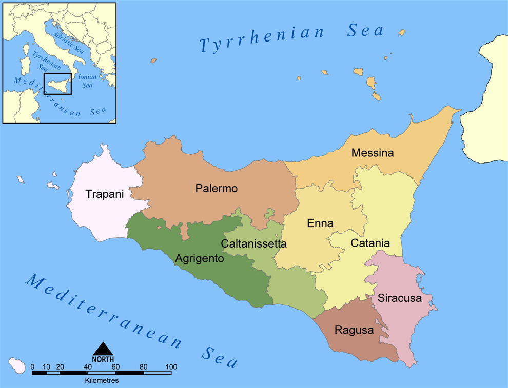
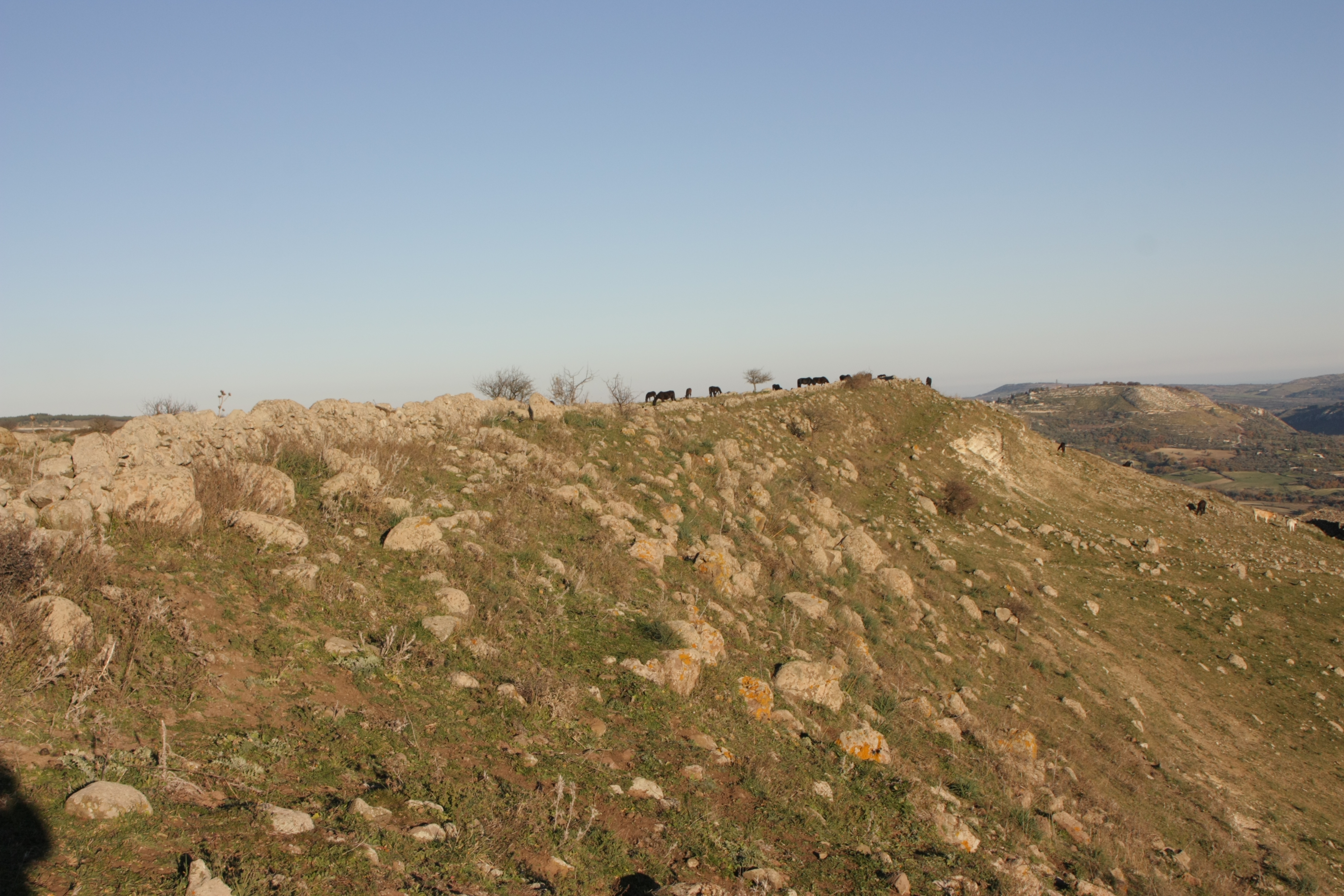
The Hyblaean Mountains ( scn, Munt'Ibblei; it, Monti Iblei; la, Hyblaei montes) is a mountain range in south-eastern Sicily, Italy. It straddles the provinces of Ragusa, Syracuse and Catania. The highest peak of the range is Monte Lauro, at 986 m. History The name derives from the Siculi king Hyblon, who gave a portion of his territory to Greek colonists to build the town of Megara Hyblaea. Geology The range is composed of white limestone rocks, characterized by Karst topography. Originally a plateau, rivers have eroded the landscape, forming numerous deep canyons. In the coastal area sandstone is also present. In some areas, such as that of Monte Lauro (once part of a submerged volcanic complex), volcanic rocks are also present. The hyblaean area is characterized by a high seismic risk. Landscape The Hyblaean Mountains are characterized by gentle slopes, interrupted by sharp valleys. In the central area are numerous woods which are intermingled with dry stone walls ... [...More Info...] [...Related Items...] OR: [Wikipedia] [Google] [Baidu] |
Province Of Ragusa
The Province of Ragusa ( it, Provincia di Ragusa; Sicilian: ''Pruvincia 'i Rausa'') was a province in the autonomous region of Sicily in southern Italy, located in the south-east of the island. Following the abolition of the Sicilian provinces, it was replaced in 2015 by the Free municipal consortium of Ragusa. Its capital is the city of Ragusa, which is the most southerly provincial capital in Italy. Geography From Scoglitti to Pozzallo, the Ragusan coastline is approximately long. Along the Ragusan coast are many fishing villages such as Kaukana, Punta Secca, Marina di Ragusa and Marina di Modica. The Hyblaean Mountains are dominating the north of the province and its highest peaks are Monte Lauro, Monte Casale and Monte Arcibessi. The rivers of the province are the Irminio, Dirillo and Ippari and the only lake in the province is the Lago di Santa Rosalia along the course of the Irminio river. The skyline of Ragusa is punctuated by the towers, domes and cupolas of ... [...More Info...] [...Related Items...] OR: [Wikipedia] [Google] [Baidu] |
Monte Raci
Monte Raci is a mountain reaching 610 metres located in the Sicilian province of Ragusa and is one of the Hyblaen chain. It is located in the Chiaramonte Gulfi commune A commune is an alternative term for an intentional community. Commune or comună or comune or other derivations may also refer to: Administrative-territorial entities * Commune (administrative division), a municipality or township ** Communes of .... Due to its rounded shape Monte Raci has been the subject of many photographers and advertising material. References {{Reflist Raci Province of Ragusa ... [...More Info...] [...Related Items...] OR: [Wikipedia] [Google] [Baidu] |
Province Of Ragusa
The Province of Ragusa ( it, Provincia di Ragusa; Sicilian: ''Pruvincia 'i Rausa'') was a province in the autonomous region of Sicily in southern Italy, located in the south-east of the island. Following the abolition of the Sicilian provinces, it was replaced in 2015 by the Free municipal consortium of Ragusa. Its capital is the city of Ragusa, which is the most southerly provincial capital in Italy. Geography From Scoglitti to Pozzallo, the Ragusan coastline is approximately long. Along the Ragusan coast are many fishing villages such as Kaukana, Punta Secca, Marina di Ragusa and Marina di Modica. The Hyblaean Mountains are dominating the north of the province and its highest peaks are Monte Lauro, Monte Casale and Monte Arcibessi. The rivers of the province are the Irminio, Dirillo and Ippari and the only lake in the province is the Lago di Santa Rosalia along the course of the Irminio river. The skyline of Ragusa is punctuated by the towers, domes and cupolas of ... [...More Info...] [...Related Items...] OR: [Wikipedia] [Google] [Baidu] |
Monte Lauro
Mount Lauro is a mountain reaching 986 metres located in south-eastern Sicily belonging to the chain of Hyblaean Mountains, stretching between the three provinces of Catania, Ragusa and Siracusa. Monte Lauro is part of a complex of extinct volcanoes having formed under the sea during the Miocene epoch. Its slopes currently host more than 2330 hectares of Mediterranean coniferous forests, extending into the territories of Buccheri, Buscemi, Chiaramonte Gulfi, Ferla, Giarratana, Licodia Eubea, Monterosso Almo, Vizzini, and Carlentini. Many rivers originate there, including the 'Ánapo, by Roberto Mirisola Dirillo, and Irminio. Mount Lauro's name ... [...More Info...] [...Related Items...] OR: [Wikipedia] [Google] [Baidu] |
Ragusa, Italy
Ragusa (; scn, Rausa ; la, Ragusia) is a city and ''comune'' in southern Italy. It is the capital of the province of Ragusa, on the island of Sicily, with 73,288 inhabitants in 2016. It is built on a wide limestone hill between two deep valleys, Cava San Leonardo and Cava Santa Domenica. Together with seven other cities in the Val di Noto, it is part of a UNESCO World Heritage Site. History The origins of Ragusa can be traced back to the 2nd millennium BC, when there were several Sicel settlements in the area. The current district of Ragusa Ibla has been identified as Hybla Heraea. The ancient city, located on a hill, came into contact with nearby Greek colonies, and grew thanks to the nearby port of Camerina. After a short period of Carthaginian rule, it fell into the hands of the ancient Romans and the Byzantines, who fortified the city and built a large castle. Ragusa was occupied by the Arabs in 848 AD and remained under their rule until the 11th century, when ... [...More Info...] [...Related Items...] OR: [Wikipedia] [Google] [Baidu] |
Buscemi
Buscemi (IPA: / buʃˈʃɛmi /; Buxema / buʃˈʃɛma / in Sicilian) is an Italian town of 968 inhabitants of the free municipal consortium of Syracuse in Sicily. Origin of the name The origin of the present name is traced back to ar, قَلْعَة أَبِي شَامَة, translit=qalʾat ʾabī šāma , a phrase thus reported in 1154 by the Hammudite geographer Muhammad al-Idrisi. The usually offered translation of the original Arabic name is 'Castello di quel dal neo', or 'Castle of the man with the mole'. The term qalʾat ar, قَلْعَة, translit=qalʾa means 'castle', 'fortress', which denotes the significant strategic and military position that Buscemi possessed in the past and which it still demonstrates today by means of an excellent view of the Anapo valley. As for ʾabū ar, أَبُو, translit=ʾabū it is the construct state of ar, أَب, translit=ʾab, lit=father, whose subsequent apheresis of the initial syllable is comparable through the Maltese bu, an ... [...More Info...] [...Related Items...] OR: [Wikipedia] [Google] [Baidu] |
Almond
The almond (''Prunus amygdalus'', syn. ''Prunus dulcis'') is a species of tree native to Iran and surrounding countries, including the Levant. The almond is also the name of the edible and widely cultivated seed of this tree. Within the genus '' Prunus'', it is classified with the peach in the subgenus ''Amygdalus'', distinguished from the other subgenera by corrugations on the shell ( endocarp) surrounding the seed. The fruit of the almond is a drupe, consisting of an outer hull and a hard shell with the seed, which is not a true nut. ''Shelling'' almonds refers to removing the shell to reveal the seed. Almonds are sold shelled or unshelled. Blanched almonds are shelled almonds that have been treated with hot water to soften the seedcoat, which is then removed to reveal the white embryo. Once almonds are cleaned and processed, they can be stored over time. Almonds are used in many food cuisines, often featuring prominently in desserts, such as marzipan. The almond t ... [...More Info...] [...Related Items...] OR: [Wikipedia] [Google] [Baidu] |
Serra Brugio
Serra (Latin for "saw") may refer to: People * Serra (footballer) (born 1961), Portuguese footballer * Serra (surname) * Serra (given name) Cities, towns, municipalities Brazil *Serra, Espírito Santo, a city in the Greater Vitória area *Amparo do Serra, in Minas Gerais * Araçoiaba da Serra, in São Paulo * Itapecerica da Serra, in São Paulo * Mirante da Serra, in Rondônia *Natividade da Serra, in São Paulo * Pé de Serra, in Bahia * Redenção da Serra, in São Paulo * Rio Grande da Serra, in São Paulo *Santa Maria da Serra, in São Paulo * São Lourenço da Serra, in São Paulo *Serra Azul, in São Paulo * Serra do Navio, in Amapá * Serra do Navio, in Amapá * Serra Negra, in São Paulo *Serra Talhada, in Pernambuco * Taboão da Serra, in São Paulo Italy * La Serra, San Miniato, in Tuscany * Serra (Rocca Santa Maria), in Abruzzo *Serra d'Aiello, in Calabria *Serra de' Conti, in Marche *Serra Pedace, in Calabria *Serra Riccò, in Liguria *Serra San Bruno Serra San ... [...More Info...] [...Related Items...] OR: [Wikipedia] [Google] [Baidu] |
Monte Arcibessi
Monte Arcibessi is a mountain located in the Sicilian province of Ragusa and is one of the highest peaks in the Hyblaen Mountain chain. It stretches between the Chiaramonte Gulfi and Ragusa communes. With its adjacent mountains, Monte Arcibessi is a part of the Miocene volcanic submarine complex, but they are no longer active. There are fortified settlements (''castellieri'') of the Bronze Age and Iron Age in the area of Monte Arcibessi. Prehistoric inhabitants, remnants of Archaic Greek settlements, signs from the Hellenistic and Roman Roman or Romans most often refers to: *Rome, the capital city of Italy *Ancient Rome, Roman civilization from 8th century BC to 5th century AD *Roman people, the people of ancient Rome *'' Epistle to the Romans'', shortened to ''Romans'', a lette ... periods and Byzantine and Medieval remains. As one of the highest in the area, it is the site of numerous antenna installations for radio stations and television transmitters. References {{ ... [...More Info...] [...Related Items...] OR: [Wikipedia] [Google] [Baidu] |
Monte Casale
Monte Casale is a mountainous elevation on Sicily in Italy, reaching 910m above sea level, which (with the neighbouring Monte Lauro) formed part of the oldest volcanic formation of the Hyblaean Mountains. Their peaks form the boundary between the present-day provinces of Syracuse and Ragusa and the watershed between the Irminio and Anapo rivers. It is notable for its important archaeological remains, discovered by Paolo Orsi early in the 20th century and identified by him with the ancient Greek city of Casmene Casmenae or Kasmenai ( grc, Κασμέναι, Casmene in Italian) was an ancient Greek colony located on the Hyblaean Mountains, founded in 644 BC by the Syracusans at a strategic position for the control of central Sicily. It was also inte .... {{coord, 37, 05, 47, N, 14, 49, 17, E, type:mountain_source:kolossus-itwiki, display=title Casale ... [...More Info...] [...Related Items...] OR: [Wikipedia] [Google] [Baidu] |
Ispica
Ispica (, ) is a city and '' comune'' in the south of Sicily, Italy. It is from Ragusa, from Syracuse, and away from La Valletta, on the coast of Malta. The first mention in a document of Ispica occurred in 1093, in a list of churches and ecclesiastic departments for administrative purposes, but the territory has been colonized since the Bronze Age. The city is located on a hill. The main economical activity consists of farming and organic products, especially carrot, zucchini, tomatoes, olives, vineyards. Ispica is the largest producer of organic carrot of southern Italy with about 18,000 tons of annual production. There is of coastline, most of which is sand and dunes, and an island (Porri island) at from the coast. The town also hosts examples of Sicilian Baroque architecture such as the Vincenzo Sinatra's Basilica di Santa Maria Maggiore, the Annunziata Church, the Carmine monastery, and the St. Barthelemy cathedral. Ispica was destroyed by the 1693 Sicily earthqua ... [...More Info...] [...Related Items...] OR: [Wikipedia] [Google] [Baidu] |
Necropolis Of Pantalica
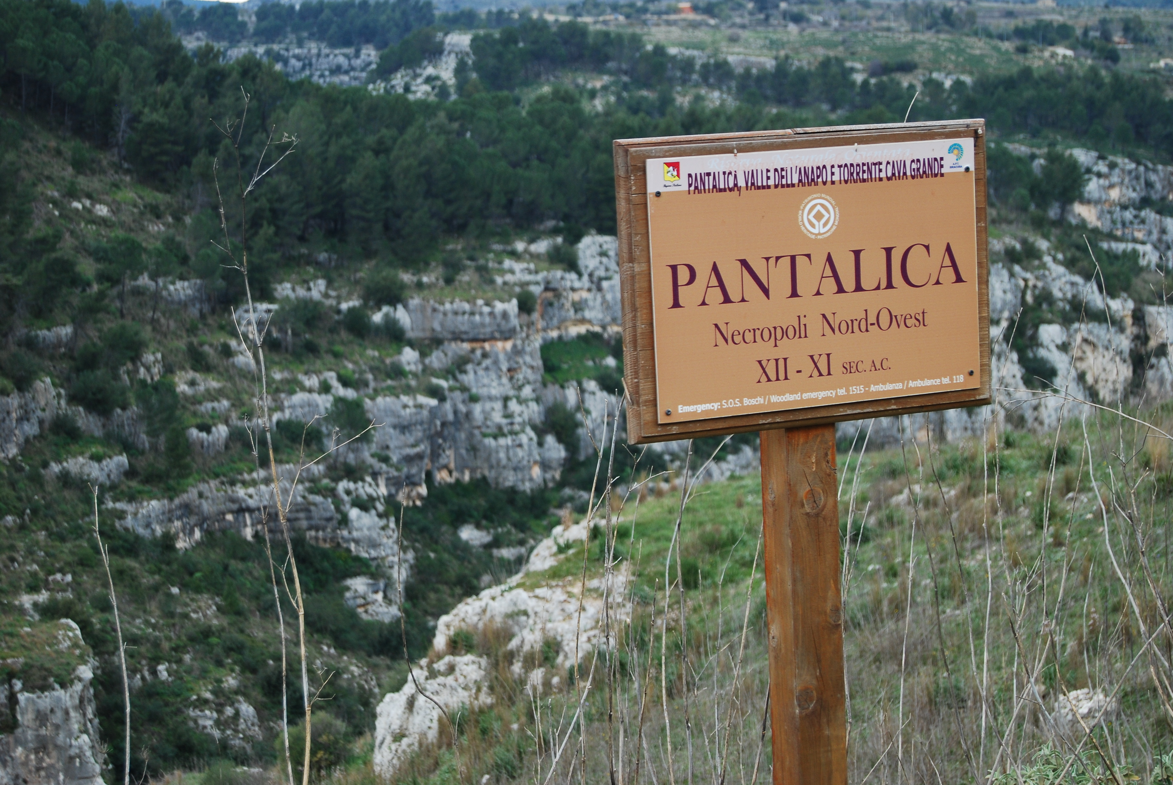
The Necropolis of Pantalica is a collection of cemeteries with rock-cut chamber tombs in southeast Sicily, Italy. Dating from the 13th to the 7th centuries BC, there was thought to be over 5,000 tombs, although the most recent estimate suggests a figure of just under 4,000. They extend around the flanks of a large promontory located at the junction of the Anapo river with its tributary, the Calcinara, about northwest of Syracuse. Together with the city of Syracuse, Pantalica was listed as a UNESCO World Heritage Site in 2005. Geography Pantalica is located on a limestone promontory surrounded by a deep gorge formed by the Anapo and Calcinara rivers between the towns of Ferla and Sortino in south-eastern Sicily. In addition to its archaeological interest it is an important nature reserve (Riserva Naturale Orientata Pantalica), with a variety of local flora and fauna and natural caves (notably the Grotta dei Pipistrelli (Bat Cave)). Various pathways facilitate visitor access, in ... [...More Info...] [...Related Items...] OR: [Wikipedia] [Google] [Baidu] |


.jpg)


