|
Departments Of Honduras
Honduras is divided into 18 departments ( Spanish: ''departamentos''). Each department is headed by a governor, who is appointed by the President of Honduras. The governor represents the executive branch in the region in addition to acting as intermediary between municipalities and various national authorities; resolves issues arising between municipalities; oversees the penitentiaries and prisons in his department; and regularly works with the various Secretaries of State that form the President's Cabinet. To be eligible for appointment as governor, the individual must a) live for five consecutive years in the department; b) be Honduran; c) be older than 18 years of age and; d) know how to read and write. Evolution of Honduras's territorial organization 1825: The constitutional congress convened in that year orders that the state be divided into seven departments: Comayagua, Santa Bárbara, Tegucigalpa, Choluteca, Yoro, Olancho, and Gracias (later renamed Lempira). 1834: An extr ... [...More Info...] [...Related Items...] OR: [Wikipedia] [Google] [Baidu] |
Honduras
Honduras, officially the Republic of Honduras, is a country in Central America. The republic of Honduras is bordered to the west by Guatemala, to the southwest by El Salvador, to the southeast by Nicaragua, to the south by the Pacific Ocean at the Gulf of Fonseca, and to the north by the Gulf of Honduras, a large inlet of the Caribbean Sea. Its capital and largest city is Tegucigalpa. Honduras was home to several important Mesoamerican cultures, most notably the Maya, before the Spanish Colonization in the sixteenth century. The Spanish introduced Catholicism and the now predominant Spanish language, along with numerous customs that have blended with the indigenous culture. Honduras became independent in 1821 and has since been a republic, although it has consistently endured much social strife and political instability, and remains one of the poorest countries in the Western Hemisphere. In 1960, the northern part of what was the Mosquito Coast was transferred from Nicara ... [...More Info...] [...Related Items...] OR: [Wikipedia] [Google] [Baidu] |
El Paraíso Department
El Paraíso () is one of the 18 departments ''(departamentos)'' into which Honduras is divided. The territory of El Paraíso was initially part of the departments of Tegucigalpa (renamed Francisco Morazán in 1943) and Olancho after Central America gained its independence in 1825. The department of El Paraíso was created with municipalities taken from the departments of Tegucigalpa and Olancho on 28 May 1869 by congressional decree in the third political division of Honduras, during the presidential term of José María Medina. Initially El Paraíso included the jurisdictions of Danlí, Yuscarán and Texiguat, along with the town of Guinope. On December 28, 1878, Texiguat was moved to the department of Tegucigalpa, but subsequently moved back into El Paraíso on October 28, 1886. The departmental capital is Yuscarán. El Paraíso is bordered to the north by the department of Olancho, to the south by the department of de Choluteca, to the east by the Republic of Nicaragua, and ... [...More Info...] [...Related Items...] OR: [Wikipedia] [Google] [Baidu] |
Gracias
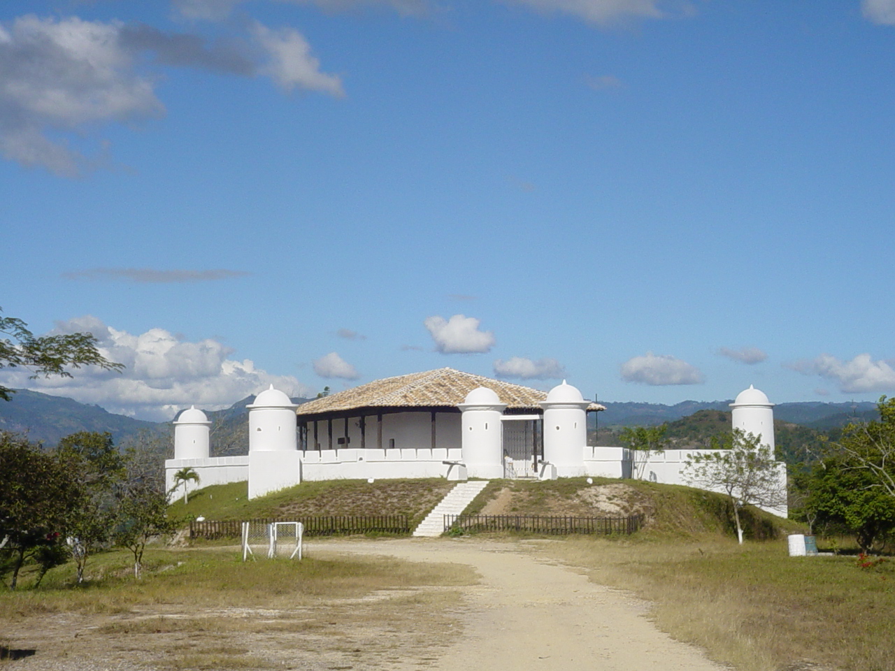
Gracias () is a small Honduran town/municipality that was founded in 1536, and is the capital of Lempira Department. The municipality has a population of 57,182 and the town a population of 16,680 (2020 calculation). It is located in the mountainous center of western Honduras. Etymology The word ''gracias'' means "thanks" in Spanish. It is said that upon arriving at the site of the city of Gracias, the Spanish explorers, tired after having trekked through the mountainous terrain, said "''Gracias a Dios hemos llegado a tierra plana''," meaning "Thank God we have arrived at flat land." History Foundation The city was founded in October 1536 under the name of "Gracias a Dios" by Gonzalo de Alvarado y Chávez, Pedro de Alvarado's first cousin, in a place called Opoa, near the banks of the Higuito River. During The viceregal era, Gracias was very important for the Spanish and had some years of growth, before being eclipsed by the cities of Antigua Guatemala and Comayagua. On ... [...More Info...] [...Related Items...] OR: [Wikipedia] [Google] [Baidu] |
Lempira Department
Lempira is one of the 18 departments in Honduras. located in the western part of the country, it is bordered by the departments of Ocotepeque and Copán to the west, Intibucá to the east, and Santa Bárbara to the north. To its south lies the El Salvador–Honduras border. The departmental capital is Gracias. It was named Gracias department until 1943. In colonial times, Gracias was an early important administrative center for the Spaniards. It eventually lost importance to Antigua, in Guatemala. Lempira is a rugged department, and it is relatively isolated from the rest of the country. The highest mountain peak in Honduras, Cerro las Minas, is in Lempira. The department was named after Lempira, a local chieftain of the Lenca people who fought against the Spanish conquistadores in the early 16th century. Opals are mined near the town of Erandique. The department covers a total surface area of 4,290 km². In 2005, had an estimated population of 277,910. Municipalities ... [...More Info...] [...Related Items...] OR: [Wikipedia] [Google] [Baidu] |
La Paz, Honduras
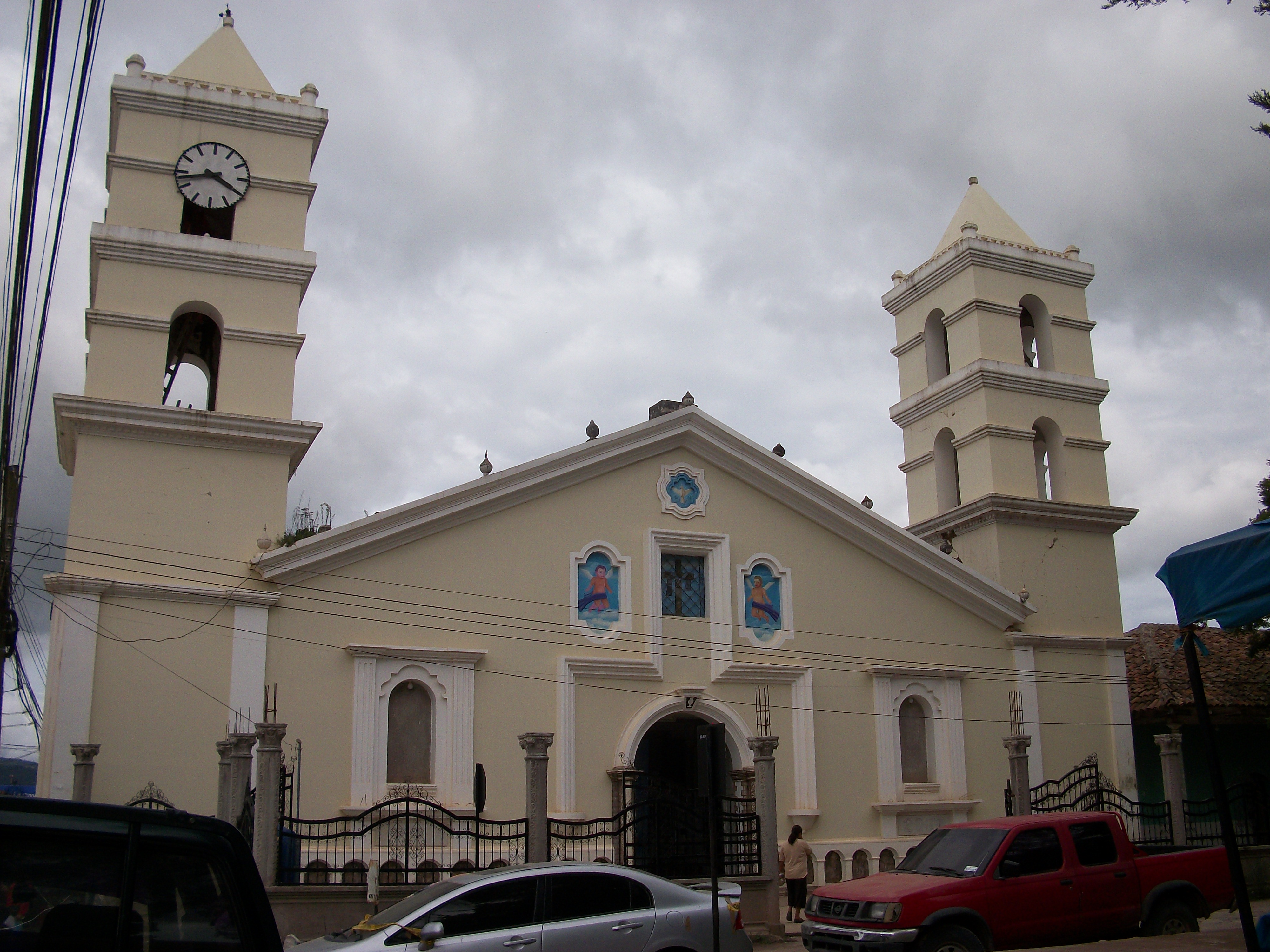
La Paz () is the capital city of the La Paz Department of Honduras. The town, founded in 1792, has a population of 30,020 (2020 est.). La Paz is located 750 m (2461 feet) above sea level on the Comayagua River near the Cordillera de Montecillos in an area that has mountainous terrain with thick jungle cover. History The town dates back to 1750 when two Spanish colonies existed in the area. The town's title was given on 14 September 1848, when the name "La Paz" was officially recognized by a decree from Comayagua; in 1861, it was given the status of a city, and in 1869 it was made a departmental seat. Demographics At the time of the 2013 Honduras census, La Paz municipality had a population of 43,980. Of these, 91.32% were Mestizo, 4.78% White, 2.42% Indigenous (2.19% Lenca), 1.32% Black or Afro-Honduran and 0.16% others. Economy Major industries in and around the city include henequen and coffee farming, cattle raising, timber processing, tanning, distilling and some minin ... [...More Info...] [...Related Items...] OR: [Wikipedia] [Google] [Baidu] |
La Paz Department (Honduras)
La Paz () is one of the 18 political and geographic departments of Honduras. The departmental capital is the city of La Paz. The department covers a total surface area of 2,331 km². In 2015, it had an estimated population of 206,065. Municipalities # Aguaqueterique # Cabañas # Cane # Chinacla # Guajiquiro # La Paz # Lauterique # Marcala Marcala is a town, with a population of 14,360 (2020 calculation), and a municipality in the Honduran department of La Paz. The region is known for its coffee production, boasting the first "protected origin denomination" for coffee. Marcala has ... # Mercedes de Oriente # Opatoro # San Antonio del Norte # San José # San Juan # San Pedro de Tutule # Santa Ana # Santa Elena # Santa María # Santiago de Puringla # Yarula References External links * Departments of Honduras {{Honduras-geo-stub ... [...More Info...] [...Related Items...] OR: [Wikipedia] [Google] [Baidu] |
Roatán
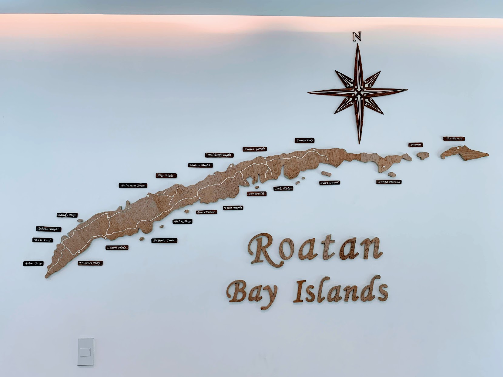
Roatán () is an island in the Caribbean, about off the northern coast of Honduras. It is located between the islands of Utila and Guanaja, and is the largest of the Bay Islands of Honduras. The island was formerly known in English as Ruatan and Rattan. It is approximately long, and less than across at its widest point. The island consists of two municipalities: José Santos Guardiola in the east and Roatán, including the Cayos Cochinos, further south in the west. Geography The island rests on an exposed ancient coral reef, rising to about above sea level. Offshore reefs offer opportunities for diving. Most habitation is in the western half of the island. The most populous town of the island is Coxen Hole, capital of Roatán municipality, located in the southwest. West of Coxen Hole are the settlements of Gravel Bay, Flowers Bay and Pensacola on the south coast, and Sandy Bay, West End and West Bay on the north coast. To the east of Coxen Hole are the settlements of ... [...More Info...] [...Related Items...] OR: [Wikipedia] [Google] [Baidu] |
Bay Islands Department
The Bay Islands ( es, Islas de la Bahía; ) is a group of islands off the coast of Honduras. Collectively, the islands form one of the 18 departments of Honduras. The departmental capital is Coxen Hole, on the island of Roatán. Geography The Bay Islands consist of eight islands and 53 small cays lying to off the northern coast of Honduras. These islands have been administered as a department of the Republic of Honduras since 1872.Central American English Central American English, By John A. Holm, Geneviève Escure, Elissa Warantz. Central American English Volume I, 1983. Retrieved March 2, 2013. Located on the Caribbea ... [...More Info...] [...Related Items...] OR: [Wikipedia] [Google] [Baidu] |
La Esperanza, Honduras
La Esperanza () is the capital city and a municipality of the same name of the department of Intibucá, Honduras. La Esperanza is famous for having the coolest climate in Honduras. It is considered the heart of the ''Ruta Lenca'' (Lenca Trail), a region of Lenca ethnic influence that spans Honduras from Santa Rosa de Copan to Choluteca. Sites on the Lenca Trail have been designated by the government and United Nations development in order to encourage more cultural tourism, and help create new markets for the traditional crafts, such as pottery, practiced by the Lenca, in order to preserve their culture. The city of La Esperanza is merged indistinguishably with the city of Intibucá, the head of the neighboring municipality of Intibucá. Intibucá is the older of the twin cities and was originally an indigenous Lenca community, while La Esperanza is the newer ladino community. Although the two cities have separate municipal governments, they are often referred to jointly as ' ... [...More Info...] [...Related Items...] OR: [Wikipedia] [Google] [Baidu] |
Intibucá Department
Intibucá () is one of the 18 departments in the Republic of Honduras. Intibucá covers a total surface area of . Its capital is the city of La Esperanza, in the municipality of La Esperanza. History The department of Intibucá was created on April 16, 1883 upon recommendation of the Governor of the department of Gracias (now called Lempira), Jose Maria Cacho in 1869. He advised that the vast size of Gracias made it difficult to govern and that it would be desirable to divide it into more than one department. On March 7, 1883 Decree No. 10 was issued, which called for the creation of a new department to be named Intibucá in April of that year. The town of La Esperanza was designated to be the capital of the new department. To create the new department, territory from both the departments of Gracias and La Paz were reassigned. Geography The department of Intibucá is situated between latitudes 13°51'E and 14°42'N and longitudes 87°46'W and 88°42'W. It is bounded on ... [...More Info...] [...Related Items...] OR: [Wikipedia] [Google] [Baidu] |
Puerto Lempira
Puerto Lempira or Auhya Yari is the Miskito capital of the Gracias a Dios department in northeastern Honduras, located on the shores of the Caratasca Lagoon. Though it does not have paved roads, it is the largest town in the La Mosquitia region. The town is named for the 16th century leader of the indigenous Lenca peoples, Lempira, who directed an ultimately unsuccessful resistance against the Spanish ''conquistador'' forces in the 1530s. Puerto Lempira became the departmental capital in 1975, prior to which it was Brus Laguna. In the 1980s, the town became a centre for CIA operations against the Sandinistas. Its population is 20,190 (2020 calculation). Puerto Lempira is sister city to Plattsburgh, New York, US, and has been since 2011. Demographics At the time of the 2013 Honduras census, Puerto Lempira municipality had a population of 47,528. Of these, 82.41% were Indigenous (81.98% Miskito), 14.86% Mestizo, 1.34% Afro-Honduran or Black, 1.27% White and 0.13% others. ... [...More Info...] [...Related Items...] OR: [Wikipedia] [Google] [Baidu] |
Gracias A Dios Department
Gracias a Dios (; "Thanks to God", or "Thank God") is one of the 18 departments (''departamentos'') into which Honduras is divided. The departmental capital is Puerto Lempira; until 1975 it was Brus Laguna. History Once a part of the Mosquito Coast, it was formed in 1957 from all of Mosquitia territory and parts of Colón and Olancho departments, with the boundary running along 85° W from Cape Camarón south. The department is rather remote and inaccessible by land, although local airlines fly to the main cities. Geography Gracias a Dios department covers a total surface area of 16,997 km² and, in 2015, had an estimated population of 94,450. Although it is the second largest department in the country, it is sparsely populated, and contains extensive pine savannas, swamps, and rainforests. However, the expansion of the agricultural frontier is a perennial threat to the natural bounty of the department. The department contains the Caratasca Lagoon, the largest lagoon i ... [...More Info...] [...Related Items...] OR: [Wikipedia] [Google] [Baidu] |


