|
Bodmin
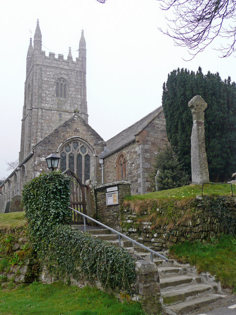
Bodmin () is a town and civil parish in Cornwall, England, United Kingdom. It is situated south-west of Bodmin Moor. The extent of the civil parish corresponds fairly closely to that of the town so is mostly urban in character. It is bordered to the east by Cardinham parish, to the southeast by Lanhydrock parish, to the southwest and west by Lanivet parish, and to the north by Helland parish. Bodmin had a population of 14,736 as of the 2011 Census. It was formerly the county town of Cornwall until the Crown Courts moved to Truro which is also the administrative centre (before 1835 the county town was Launceston). Bodmin was in the administrative North Cornwall District until local government reorganisation in 2009 abolished the District (''see also Cornwall Council''). The town is part of the North Cornwall parliamentary constituency, which is represented by Scott Mann MP. Bodmin Town Council is made up of sixteen councillors who are elected to serve a term of four years. ... [...More Info...] [...Related Items...] OR: [Wikipedia] [Google] [Baidu] |
Bodmin Moor
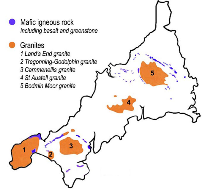
Bodmin Moor ( kw, Goon Brenn) is a granite moorland in north-eastern Cornwall, England. It is in size, and dates from the Carboniferous period of geological history. It includes Brown Willy, the highest point in Cornwall, and Rough Tor, a slightly lower peak. Many of Cornwall's rivers have their sources here. It has been inhabited since at least the Neolithic era, when primitive farmers started clearing trees and farming the land. They left their megalithic monuments, hut circles and cairns, and the Bronze Age culture that followed left further cairns, and more stone circles and stone rows. By medieval and modern times, nearly all the forest was gone and livestock rearing predominated. The name Bodmin Moor is relatively recent. An early mention is in the ''Royal Cornwall Gazette'' of 28 November 1812. The upland area was formerly known as Fowey Moor after the River Fowey, which rises within it. Geology Bodmin Moor is one of five granite plutons in Cornwall that make up pa ... [...More Info...] [...Related Items...] OR: [Wikipedia] [Google] [Baidu] |
Cornwall
Cornwall (; kw, Kernow ) is a historic county and ceremonial county in South West England. It is recognised as one of the Celtic nations, and is the homeland of the Cornish people. Cornwall is bordered to the north and west by the Atlantic Ocean, to the south by the English Channel, and to the east by the county of Devon, with the River Tamar forming the border between them. Cornwall forms the westernmost part of the South West Peninsula of the island of Great Britain. The southwesternmost point is Land's End and the southernmost Lizard Point. Cornwall has a population of and an area of . The county has been administered since 2009 by the unitary authority, Cornwall Council. The ceremonial county of Cornwall also includes the Isles of Scilly, which are administered separately. The administrative centre of Cornwall is Truro, its only city. Cornwall was formerly a Brythonic kingdom and subsequently a royal duchy. It is the cultural and ethnic origin of the Cornish dias ... [...More Info...] [...Related Items...] OR: [Wikipedia] [Google] [Baidu] |
Saint Petroc
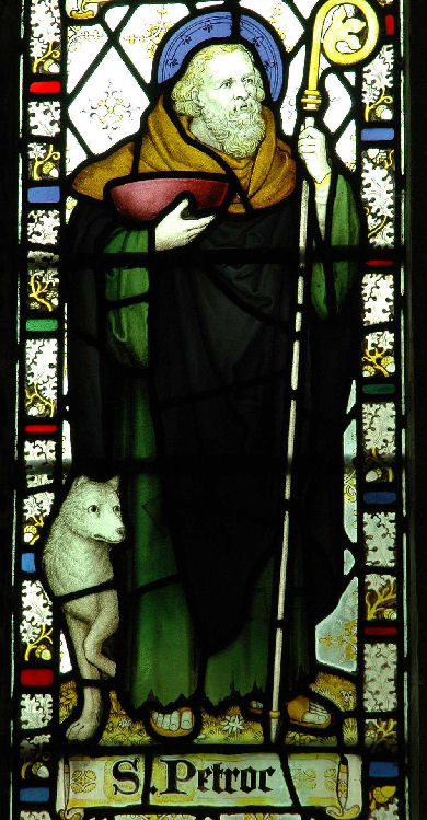
Saint Petroc or Petrock ( lat-med, Petrocus; cy, Pedrog; french: link=no, Perreux; ) was a British prince and Christian saint. Probably born in South Wales, he primarily ministered to the Britons of Devon (Dewnans) and Cornwall (Kernow) then forming the kingdom of Dumnonia where he is associated with a monastery at Padstow, which is named after him (Pedroc-stowe, or 'Petrock's Place'). Padstow appears to have been his earliest major cult centre, but Bodmin became the major centre for his veneration when his relics were moved to the monastery there in the later ninth century. Bodmin monastery became one of the wealthiest Cornish foundations by the eleventh century. There is a second ancient dedication to him nearby at Little Petherick or "Saint Petroc Minor". In Devon ancient dedications total a probable seventeen (plus Timberscombe just over the border in Somerset), mostly coastal and including one within the old Roman walls of Exeter as well as the villages of Petrockstowe an ... [...More Info...] [...Related Items...] OR: [Wikipedia] [Google] [Baidu] |
Launceston, Cornwall
Launceston ( or , locally or , kw, Lannstevan; rarely spelled Lanson as a local abbreviation) is a town, ancient borough, and civil parish in Cornwall, England, United Kingdom. It is west of the middle stage of the River Tamar, which constitutes almost the entire border between Cornwall and Devon. The landscape of the town is generally steep particularly at a sharp south-western knoll topped by Launceston Castle. These gradients fall down to the River Kensey and smaller tributaries. The town centre itself is bypassed and is no longer physically a main thoroughfare. The A388 still runs through the town close to the centre. The town remains figuratively the "gateway to Cornwall", due to having the A30, one of the two dual carriageways into the county, pass directly next to the town. The other dual carriageway and alternative main point of entry is the A38 at Saltash over the Tamar Bridge and was completed in 1962. There are smaller points of entry to Cornwall on minor ... [...More Info...] [...Related Items...] OR: [Wikipedia] [Google] [Baidu] |
Lanhydrock
Lanhydrock ( kw, Lannhedrek, meaning "church enclosure of St Hydrock") is a civil parish centred on a country estate and mansion in Cornwall, United Kingdom. The parish lies south of the town of Bodmin and is bounded to the north by Bodmin parish, to the south by Lanlivery parish and to the west by Lanivet parish. The population was 171 in the 2001 census.GENUKI website Lanhydrock; retrieved May 2010 This increased to 186 in the 2011 census. The Parish Council meets every two months in Lanhydrock Memorial Hall. The parish is dominated by and its estate of 360 hectares (890 acres). Much of the present house dates back to |
Dunmere, Cornwall
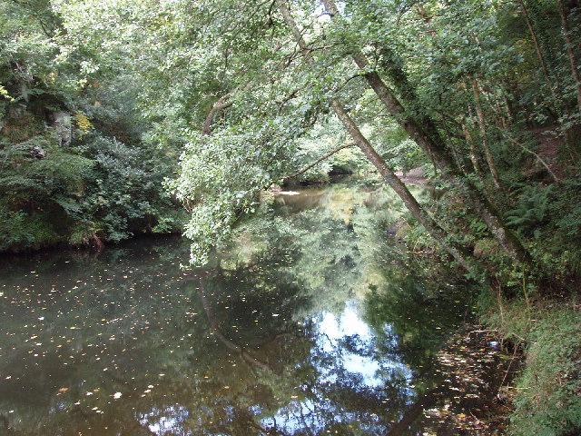
Dunmere is a hamlet in Cornwall, England, United Kingdom. It is situated one mile northwest of Bodmin in the valley of the River CamelOrdnance Survey: Landranger map sheet 200 ''Newquay & Bodmin'' on the A389 road. The former branch of the Bodmin and Wenford Railway to Wenfordbridge crossed the A389 road at Dunmere. This section of the railway now forms part of the Camel Trail, a long-distance footpath and cycle trail. Boscarne Junction railway station, the current terminus of the railway, is situated a mile (1.6 km) west of Dunmere. Dunmere has a pub, The Borough Arms. Governance In local government terms, Dunmere is within the civil parish of Bodmin and the unitary authority Cornwall Council Cornwall Council ( kw, Konsel Kernow) is the unitary authority for Cornwall in the United Kingdom, not including the Isles of Scilly, which has its own unitary council. The council, and its predecessor Cornwall County Council, has a tradition o ... division of Bodmin St Mary' ... [...More Info...] [...Related Items...] OR: [Wikipedia] [Google] [Baidu] |
North Cornwall
North Cornwall ( kw, An Tiredh Uhel) is an area of Cornwall, England, United Kingdom. It is also the name of a former local government district, which was administered from Bodmin and Wadebridge . Other towns in the area are Launceston, Bude, Padstow, and Camelford. North Cornwall is an area of outstanding natural beauty that is of great geological and scientific interest. It includes the only part of Cornwall that is formed of carboniferous rocks, the northern area of North Cornwall District. The rest of the district lies on Devonian sedimentary strata and the granite of Bodmin Moor. A similar area is covered by the North Cornwall parliamentary constituency. Parishes of North Cornwall Geography North Cornwall has a stretch of coastline that borders the Celtic Sea to the north. The Carboniferous sandstone cliffs that surround Bude (and stretch down as far south as Crackington Haven) were formed during the Carboniferous period, around 300 million years ago. They are part ... [...More Info...] [...Related Items...] OR: [Wikipedia] [Google] [Baidu] |
Lanivet
Lanivet ( kw, Lanneves) is a village and civil parish in Cornwall, England, United Kingdom. The village is situated approximately southwest of Bodmin, and before the Bodmin by-pass was built, the A30 road between London and Land's End passed through the village. The Saints' Way long-distance footpath passes Lanivet near its half-way point. The parish includes the hamlets of Bodwanick, Bokiddick, Lamorick, St Ingunger, Trebell, Tregullon, Tremore, and Woodly. Part of St Lawrence is also in this parish. An electoral ward of the same name surrounds Bodmin. Its population at the 2011 census was 4,241. Notable buildings and antiquities The church tower is built in the Perpendicular style and in 1878 had six bells. Renovations to the porch, nave and aisles were completed in that year along with the extension of the burial ground by enclosing an adjacent field. Within the church are monuments of the Courtenays of Tremere. In the churchyard are two ancient stone crosses and a rar ... [...More Info...] [...Related Items...] OR: [Wikipedia] [Google] [Baidu] |
North Cornwall (UK Parliament Constituency)
North Cornwall is a constituency represented in the House of Commons of the UK Parliament by Scott Mann, a Conservative since the 2015 general election. Like all British constituencies, the seat elects one Member of Parliament (MP) by the first past the post system of election at least every five years. The seat was created in 1918. Since 1950, the constituency has been held by MPs from either the Conservative Party or the Liberal Democrats (including the party's predecessor, the Liberal Party). History This constituency was created under the Representation of the People Act 1918. With exceptions in 1997 and 2001 the seat's margin of victory has been less than 20% of the vote; it has been consistently fought over between and won by the Conservative Party and the Liberal Democrats's candidate (or predecessor party in the latter case), and can be considered a marginal seat. In 1997 and 2001 the seat turned out strongly overall for the latter party. However, in the 2019 gen ... [...More Info...] [...Related Items...] OR: [Wikipedia] [Google] [Baidu] |
Cardinham
Cardinham ( kw, Kardhinan) (the spelling 'Cardynham' is almost obsolete) is a civil parishes in England, civil parish and a village in mid Cornwall, England. The village is approximately three-and-a-half miles (6 km), east-northeast of Bodmin. The hamlets of Fletchersbridge, Millpool, Milltown, Mount, Cornwall, Mount, Old Cardinham Castle and Welltown are in the parish. Large areas which were once deciduous woodland are now plantations of conifers known as Cardinham Woods and managed by Forestry England. Edmund John Glynn, of Glynn House in the parish, rebuilt the house at Glynn in 1805 (it has a front of nine bays and a portico). Early history Richard Fitz Turold (Thorold) was an Anglo-Norman landowner of the eleventh century, mentioned in the Domesday Survey. He had a castle at Cardinham, where he was a major tenant and steward of Robert of Mortain. The holding included the manor of Penhallam. His son was William Fitz Richard of Cardinham. Restormel Castle belonged to th ... [...More Info...] [...Related Items...] OR: [Wikipedia] [Google] [Baidu] |
Carminow Cross
Carminow Cross is a stone Celtic cross near a major road junction southeast of Bodmin in mid-Cornwall, England. Immediately to the north is Castle Canyke, an Iron Age fort. The cross is a Grade II* listed building In the United Kingdom, a listed building or listed structure is one that has been placed on one of the four statutory lists maintained by Historic England in England, Historic Environment Scotland in Scotland, in Wales, and the Northern Irel .... In the late 19th century and early 20th century the cross was half hidden in a hedge at the back of some cottages which then formed the hamlet of Carminow Cross. A. G. Langdon conjectured that its original position was at the crossroads, before it was moved into the hedge. When road widening was undertaken in the mid-20th century it was moved to its present position surrounded by grass verge. References External links Castle Canyke themodernantiquarian.com National Heritage List for England Buildings and stru ... [...More Info...] [...Related Items...] OR: [Wikipedia] [Google] [Baidu] |
Michael An Gof
Michael Joseph (died 27 June 1497), better known as Michael An Gof, was one of the leaders of the Cornish rebellion of 1497, along with Thomas Flamank. Background The rebels marched on London to protest against King Henry VII's levy of a tax to pay for an invasion of Scotland in response to the Scots' support of the pretender Perkin Warbeck. The Cornish believed that this was a northern affair and had nothing to do with them; they also believed that the tax was the work of the King's corrupt counsellors and marched to London to bring this to the King's attention. March on London A blacksmith (An Gof) named Michael Joseph lived at St Keverne on the Lizard peninsula. He is described as "a notable prating fellow who by thrusting himself forward on every occasion, and being loudest in every complaint against the government, acquired an authority among these simple people, and was ready to lead them to any desperate enterprise". Michael Joseph was chosen by the people of St. Ke ... [...More Info...] [...Related Items...] OR: [Wikipedia] [Google] [Baidu] |


