|
Arch Dam
An arch dam is a concrete dam that is curved upstream in plan. The arch dam is designed so that the force of the water against it, known as hydrostatic pressure, presses against the arch, causing the arch to straighten slightly and strengthening the structure as it pushes into its foundation or abutments. An arch dam is most suitable for narrow canyons or gorges with steep walls of stable rock to support the structure and stresses. Since they are thinner than any other dam type, they require much less construction material, making them economical and practical in remote areas. Classification In general, arch dams are classified based on the ratio of the base thickness to the structural height (b/h) as: * Thin, for b/h less than 0.2, * Medium-thick, for b/h between 0.2 and 0.3, and * Thick, for b/h ratio over 0.3. Arch dams classified with respect to their structural height are: * Low dams up to , * Medium high dams between , * High dams over . History The developm ... [...More Info...] [...Related Items...] OR: [Wikipedia] [Google] [Baidu] |
Katse Dam
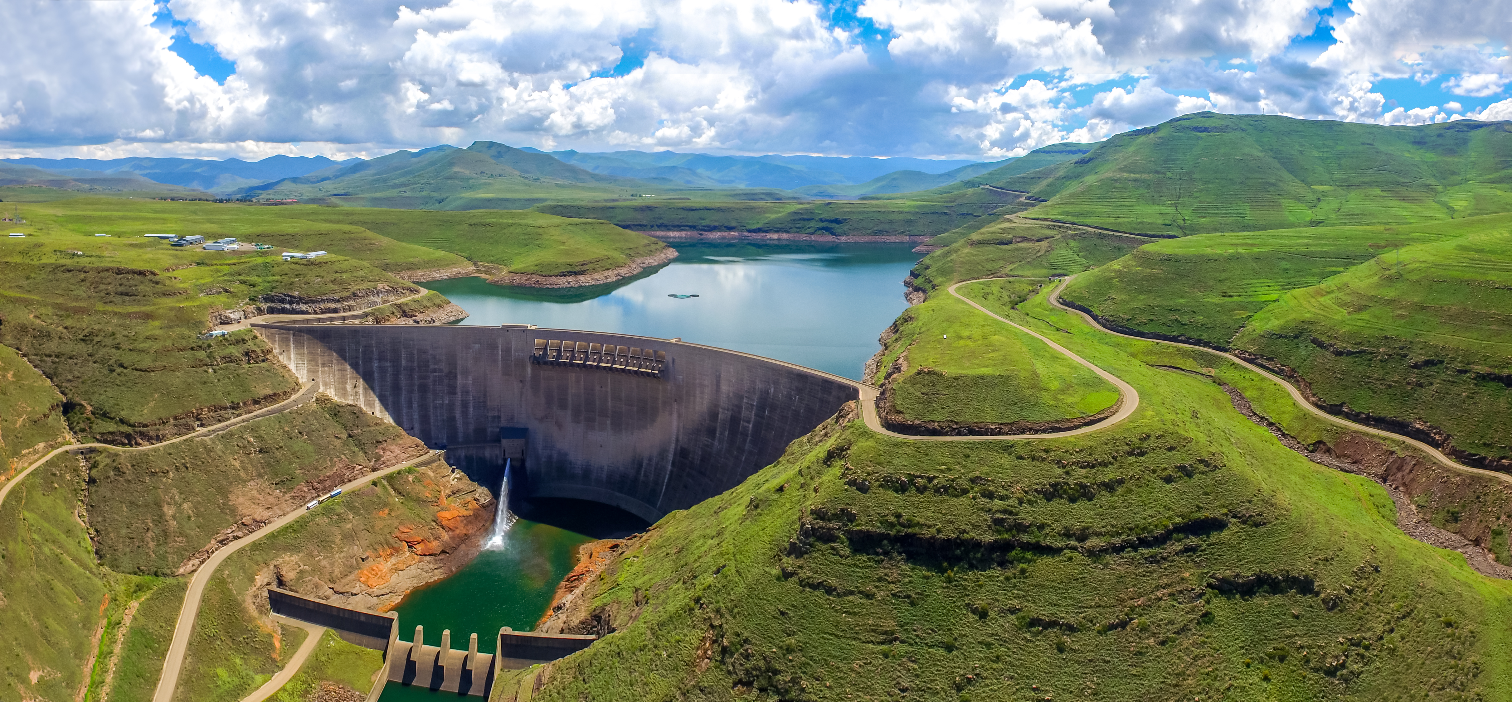
The Katse Dam, a concrete arch dam on the Malibamat'so River in Lesotho, is Africa's second largest double-curvature arch dam. (The Tekezé Dam, completed in early 2009, is now Africa's largest double curvature dam). The dam is part of the Lesotho Highlands Water Project, which will eventually include five large dams in remote rural areas. The dam is just below the confluence of the Bokong River, which forms the western arm of the Katse reservoir. The potential of the project was identified by the South African civil engineer Ninham Shand in 1953 as a possible means to supplement the water supply of South Africa's industrial heartland in the Witwatersrand. The World Bank arranged a treaty between the governments of South Africa and Lesotho, allowing the project to proceed. Construction The dam was built by a consortium of Bouygues, Concor, Group 5, Hochtief, Impregilo, Kier Group and Sterling International. The dam was completed in 1996 and the reservoir filled with water b ... [...More Info...] [...Related Items...] OR: [Wikipedia] [Google] [Baidu] |
Kebar Dam
The Kebar Dam is a masonry arch dam on the Kebar River, Iran, located near a town of the same name, 23 km southeast of Qom, near the village of Zanburak in Jannatabad, Qom. The dam is an early arch dam and was the first arch dam constructed by the Mongolians, around 1300 AD. It is the oldest surviving arch dam. The dam is 26m tall and 55m wide and was constructed for irrigation water supply. It was originally 24m tall but 2m of height was added in either the beginning or middle of the 17th century. The arch of the dam was of normal curvature with a radius of 35m and angle of 45-degrees. While the dam sat on limestone, its curve rested on two winged walls that served as abutments. The downstream face of the dam was vertical until near its abutment where it slightly curves out. Near the dam's right, or western, abutment there is a 10m deep cylindrical hole which served as an intake and outlet works for the dam. The outlet works is located at the bottom and is a larger opening b ... [...More Info...] [...Related Items...] OR: [Wikipedia] [Google] [Baidu] |
Jinping-I Dam
The Jinping-I Dam () also known as the Jinping-I Hydropower Station or Jinping 1st Cascade, is a tall arch dam on the Jinping Bend of the Yalong River (Yalong Jiang) in Liangshan, Sichuan, China. Construction on the project began in 2005 and was completed in 2014. Its power station has a 3,600 MW capacity to produce between 16 and 18 TW·h (billion kW·h) annually. Supplying the power station is a reservoir created by the 305-meter-tall arch dam, the tallest in the world. The project's objective is to supply energy for expanding industrialization and urbanization, improve flood protection, and prevent erosion. History Harnessing hydropower on the Jinping bend of the Yalong River has been in planning for decades. The length of bend around the Jinping Mountains is 150 km but the downstream (northbound) part of the river on the opposite side is only separated by 16 km. Between that distance, there is an elevation drop of 310 m, creating an excellent situation for ... [...More Info...] [...Related Items...] OR: [Wikipedia] [Google] [Baidu] |
Morrow Point Dam
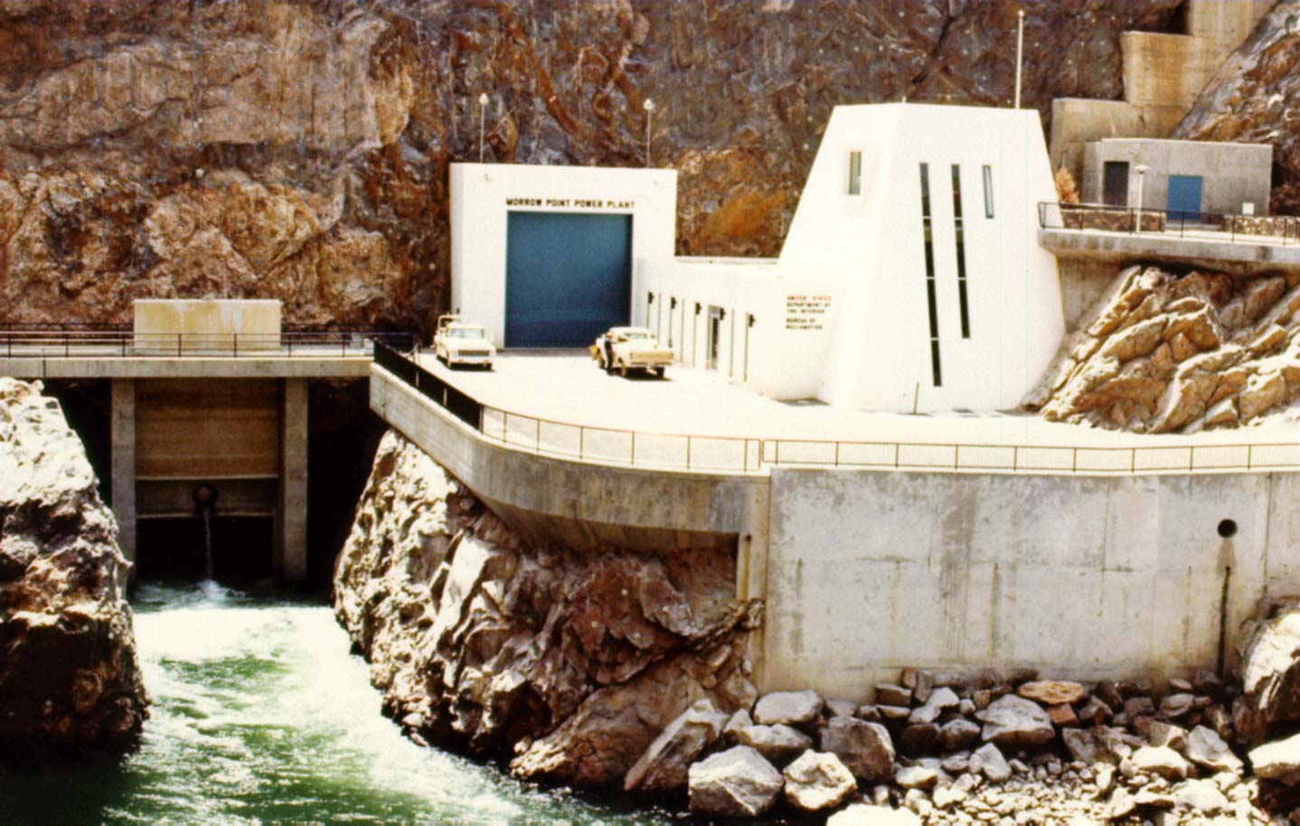
Morrow Point Dam is a concrete double-arch dam on the Gunnison River located in Colorado, the first dam of its type built by the U.S. Bureau of Reclamation. Located in the upper Black Canyon of the Gunnison, it creates Morrow Point Reservoir, and is within the National Park Service-operated Curecanti National Recreation Area. The dam is between the Blue Mesa Dam (upstream) and the Crystal Dam (downstream). Morrow Point Dam and reservoir are part of the Bureau of Reclamation's Wayne N. Aspinall Unit of the Colorado River Storage Project, which retains the waters of the Colorado River and its tributaries for agricultural and municipal use in the American Southwest. The dam's primary purpose is hydroelectric power generation. Description The dam, powerplant and reservoir are contained in pre-Cambrian metamorphic rocks, primarily micaceous quartzite, quartz-mica, mica and biotite schist Schist ( ) is a medium-grained metamorphic rock showing pronounced schistosity. This means ... [...More Info...] [...Related Items...] OR: [Wikipedia] [Google] [Baidu] |
Oklahoma
Oklahoma (; Choctaw: ; chr, ᎣᎧᎳᎰᎹ, ''Okalahoma'' ) is a state in the South Central region of the United States, bordered by Texas on the south and west, Kansas on the north, Missouri on the northeast, Arkansas on the east, New Mexico on the west, and Colorado on the northwest. Partially in the western extreme of the Upland South, it is the 20th-most extensive and the 28th-most populous of the 50 United States. Its residents are known as Oklahomans and its capital and largest city is Oklahoma City. The state's name is derived from the Choctaw words , 'people' and , which translates as 'red'. Oklahoma is also known informally by its nickname, " The Sooner State", in reference to the settlers who staked their claims on land before the official opening date of lands in the western Oklahoma Territory or before the Indian Appropriations Act of 1889, which increased European-American settlement in the eastern Indian Territory. Oklahoma Territory and Indian Territo ... [...More Info...] [...Related Items...] OR: [Wikipedia] [Google] [Baidu] |
Pensacola Dam
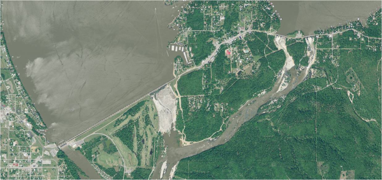
The Pensacola Dam, also known as the Grand River Dam, is a multiple- arch buttress dam on the Grand River in-between Disney and Langley in the U.S. state of Oklahoma. The dam is operated by the Grand River Dam Authority and creates Grand Lake o' the Cherokees. After decades of vision and planning, it was constructed between 1938 and 1940 for the purposes of hydroelectric power generation, flood control and recreation. It is Oklahoma's first hydroelectric power plant and is referred to as the longest multiple-arch dam in the world. Background The idea to construct a dam on the Grand River originated in the late 1800s with Henry C. Holderman, a Cherokee Nation citizen, who wanted to provide electric power to the Cherokee Nation. Holderman and a few colleagues soon conducted the first survey of the river in 1895 on their own handmade houseboat. Holderman later left the United States at the age of 16 and worked on dam projects in India and Africa before returning to Oklahoma. ... [...More Info...] [...Related Items...] OR: [Wikipedia] [Google] [Baidu] |
Enguri Dam, Georgia
The Enguri ( ka, ენგური, tr, xmf, ინგირი, ingiri, ab, Егры, ''Egry'' russian: Ингури, ''Inguri'') is a river in western Georgia. It is long, and has a drainage basin of . National Statistics Office of Georgia, Tbilisi, 2020, p. 12. It originates near in northeastern and plays an important role providing hydroelectric power to the area. [...More Info...] [...Related Items...] OR: [Wikipedia] [Google] [Baidu] |
Lac De Montsalvens
Lac de Montsalvens is a reservoir in the Canton of Fribourg, Switzerland. The reservoir has a capacity of 12.6 million m³ and a surface area of . It was built on the Jogne river, before the gorges, and below the road to Jaun Pass, between the villages of Broc and Charmey. The Grand Council of the canton of Fribourg decided construction of the dam on 17/18 May 1918. Designed by Alfred Stucky, the construction was completed by 1920 and in 1921 the reservoir filled for the first time. Thanks to a forced conduct, electricity is produced at the Electrobroc power plant, located at Broc near the Cailler factory. See also *List of lakes of Switzerland *List of mountain lakes of Switzerland This is a list of high-altitude lakes in Switzerland. It includes all significant lakes, natural or artificial, with an area over 4 hectares and a height over 800 metres above sea level. This height approximately corresponds to the transiti ... References External links * * Reser ... [...More Info...] [...Related Items...] OR: [Wikipedia] [Google] [Baidu] |
Elasticity (physics)
In physics and materials science, elasticity is the ability of a body to resist a distorting influence and to return to its original size and shape when that influence or force is removed. Solid objects will deform when adequate loads are applied to them; if the material is elastic, the object will return to its initial shape and size after removal. This is in contrast to ''plasticity'', in which the object fails to do so and instead remains in its deformed state. The physical reasons for elastic behavior can be quite different for different materials. In metals, the atomic lattice changes size and shape when forces are applied (energy is added to the system). When forces are removed, the lattice goes back to the original lower energy state. For rubbers and other polymers, elasticity is caused by the stretching of polymer chains when forces are applied. Hooke's law states that the force required to deform elastic objects should be directly proportional to the distanc ... [...More Info...] [...Related Items...] OR: [Wikipedia] [Google] [Baidu] |
Alaska
Alaska ( ; russian: Аляска, Alyaska; ale, Alax̂sxax̂; ; ems, Alas'kaaq; Yup'ik: ''Alaskaq''; tli, Anáaski) is a state located in the Western United States on the northwest extremity of North America. A semi-exclave of the U.S., it borders the Canadian province of British Columbia and the Yukon territory to the east; it also shares a maritime border with the Russian Federation's Chukotka Autonomous Okrug to the west, just across the Bering Strait. To the north are the Chukchi and Beaufort Seas of the Arctic Ocean, while the Pacific Ocean lies to the south and southwest. Alaska is by far the largest U.S. state by area, comprising more total area than the next three largest states (Texas, California, and Montana) combined. It represents the seventh-largest subnational division in the world. It is the third-least populous and the most sparsely populated state, but by far the continent's most populous territory located mostly north of the 60th parallel, ... [...More Info...] [...Related Items...] OR: [Wikipedia] [Google] [Baidu] |
Juneau
The City and Borough of Juneau, more commonly known simply as Juneau ( ; tli, Dzánti K'ihéeni ), is the capital city of the state of Alaska. Located in the Gastineau Channel and the Alaskan panhandle, it is a unified municipality and the second- largest city in the United States by area. Juneau was named the capital of Alaska in 1906, when the government of what was then the District of Alaska was moved from Sitka as dictated by the U.S. Congress in 1900. The municipality unified on July 1, 1970, when the city of Juneau merged with the city of Douglas and the surrounding Greater Juneau Borough to form the current municipality, which is larger by area than both Rhode Island and Delaware. Downtown Juneau () is nestled at the base of Mount Juneau and across the channel from Douglas Island. As of the 2020 census, the City and Borough had a population of 32,255, making it the third-most populous city in Alaska after Anchorage and Fairbanks. Juneau experiences a daily influ ... [...More Info...] [...Related Items...] OR: [Wikipedia] [Google] [Baidu] |
Salmon Creek Dam
The Salmon Creek Dam is a concrete arch dam on the Salmon Creek, northwest of Juneau, Alaska. Built in 1914, it is the world's first constant-angle arch variable radius dam. Since it was built, over 100 such dams have been constructed all over the world. The dam was designated as a National Historic Civil Engineering Landmark by the American Society of Civil Engineers in 2022. The dam was built by the Alaska-Gastineau Mining Company to meet the electrical energy needs for mining operations. The dam continues to be fully functional for hydroelectric generation, as one of the drinking water sources to Juneau city and for aquaculture and fishing. When built, adoption of the constant arch design for the dam reduced costs by 20% because less concrete was needed to construct the dam. Of the two hydroelectric power stations built at the initial stage (one at the upper level and the other at the lower level) – the latter one is still in use after a new powerhouse was built adjoining ... [...More Info...] [...Related Items...] OR: [Wikipedia] [Google] [Baidu] |


