Woolooga, Queensland on:
[Wikipedia]
[Google]
[Amazon]
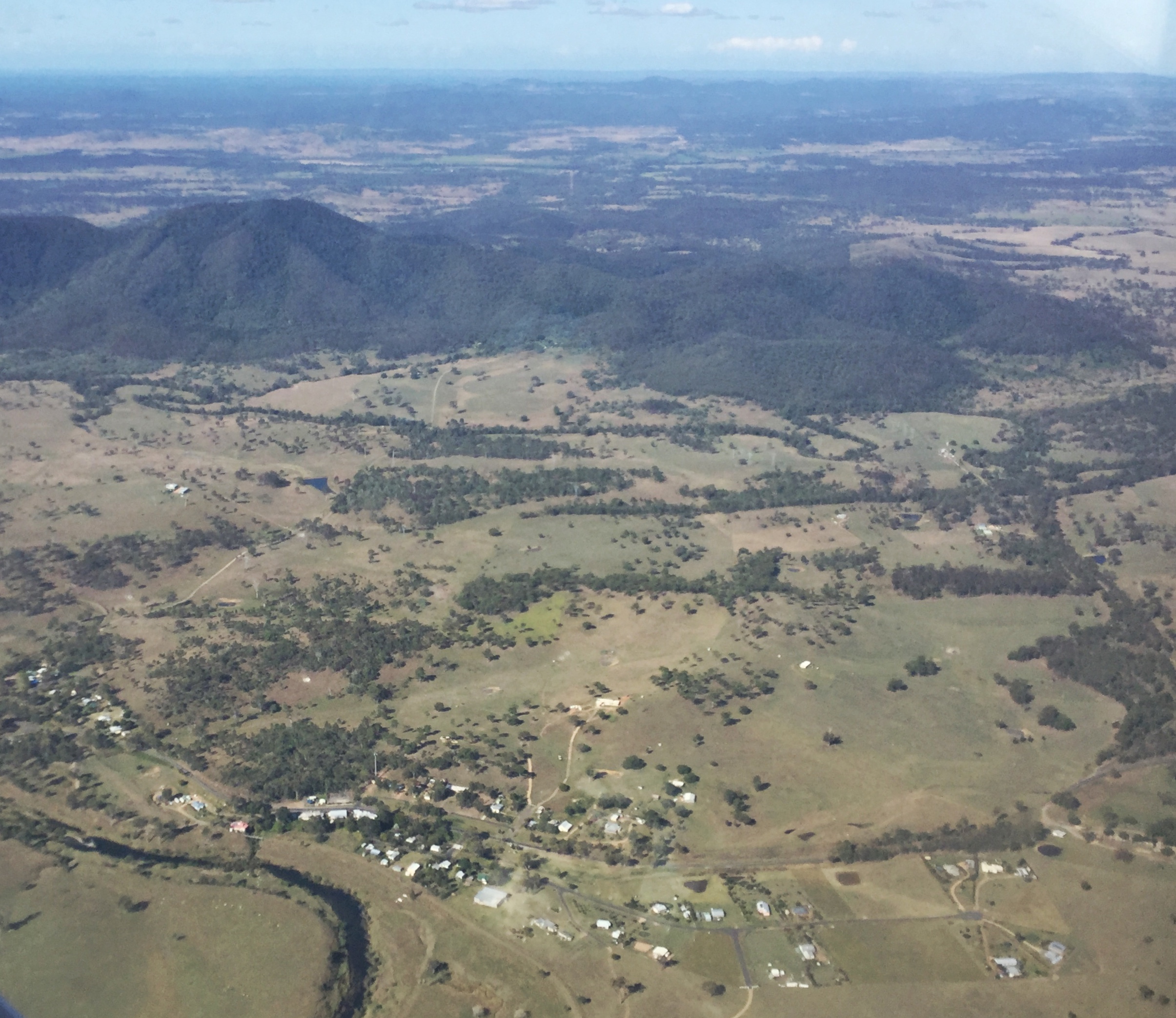
Woolooga is a rural town and
 Around 1848, John Murray decided to become a pastoral squatter and chose to go to the frontier region of
  Woolooga State School opened on 20 January 1913.
Wonga Upper Provisional School opened on 13 July 1914. On 1 December 1914 it became Wonga Upper State School. It closed in 1959.
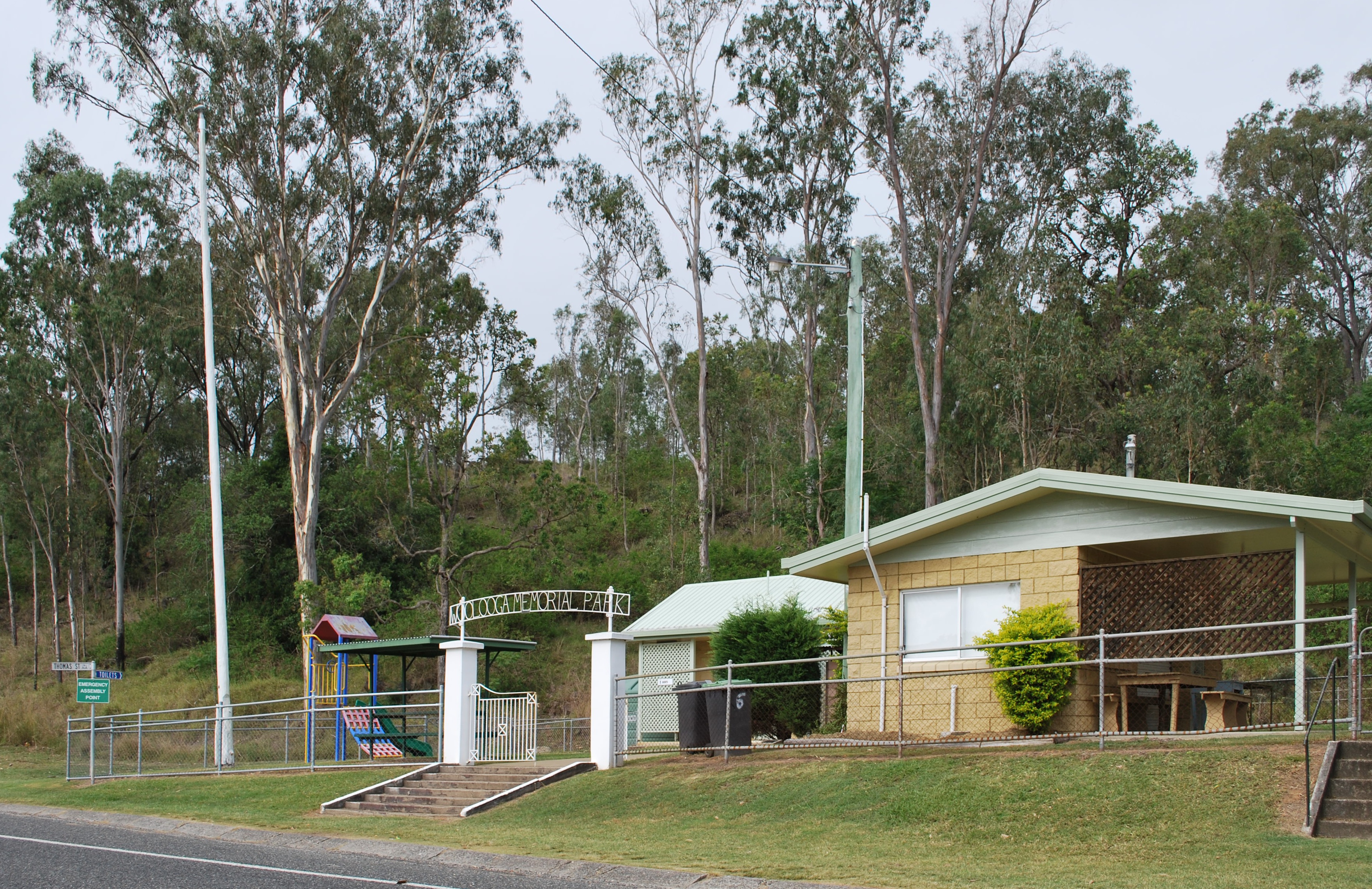
The Woolooga Memorial Park commemorates those who served in war. It is located in Thomas Street.
At the , Woolooga and the surrounding rural area had a population of 319.
Woolooga was affected by the
locality
Locality may refer to:
* Locality (association), an association of community regeneration organizations in England
* Locality (linguistics)
* Locality (settlement)
* Suburbs and localities (Australia), in which a locality is a geographic subdivis ...
in the Gympie Region
The Gympie Region is a local government area in the Wide Bay–Burnett region of Queensland, Australia, about north of Brisbane, the state capital. It is between the Sunshine Coast and Hervey Bay and centred on the town of Gympie. It was creat ...
, Queensland
)
, nickname = Sunshine State
, image_map = Queensland in Australia.svg
, map_caption = Location of Queensland in Australia
, subdivision_type = Country
, subdivision_name = Australia
, established_title = Before federation
, established_ ...
, Australia. In the the locality of Woolooga had a population of 247 people.
The town is located in the Gympie Region
The Gympie Region is a local government area in the Wide Bay–Burnett region of Queensland, Australia, about north of Brisbane, the state capital. It is between the Sunshine Coast and Hervey Bay and centred on the town of Gympie. It was creat ...
local government area, north of the state capital, Brisbane
Brisbane ( ) is the capital and most populous city of the states and territories of Australia, Australian state of Queensland, and the list of cities in Australia by population, third-most populous city in Australia and Oceania, with a populati ...
.
Geography
The town is located in the south of the locality. The railway line from Theebine to Nanango passes from the east to the south-west through the locality, but the line is no longer operating. The town was served by the Woolooga railway station () while the eastern part was served by the Boowoogum railway station (), both of which are now abandoned. The Wide Bay Creek meanders from the south-west of the locality to the east.History
Wide Bay-Burnett
WIDE or Wide may refer to:
*Wide (cricket)
*Wide and narrow data, terms used to describe two different presentations for tabular data
*WIDE Project, Widely Integrated Distributed Environment
*Wide-angle Infinity Display Equipment
*WIDE-LP, a radio ...
in the north of the colony of New South Wales
)
, nickname =
, image_map = New South Wales in Australia.svg
, map_caption = Location of New South Wales in AustraliaCoordinates:
, subdivision_type = Country
, subdivision_name = Australia
, established_title = Before federation
, es ...
to obtain land. Murray occupied the Walooga run about 40 kilometers west of Gympie
Gympie ( ) is a city and a Suburbs and localities (Australia), locality in the Gympie Region, Queensland, Australia. In the Wide Bay-Burnett District, Gympie is about north of the state capital, Brisbane. The city lies on the Mary River (Queen ...
. To the south was Widgee
Widgee is a rural Suburbs and localities (Australia), locality in the Gympie Region, Queensland, Australia. In the , Widgee had a population of 794 people.
History
The name is believed to have originated from the Aboriginal words ''Witchee Witche ...
Widgee taken up by the Tooth brothers, to the south-west Kilkivan occupied by J D MacTaggart, and to the north-west was Henry Cox Corfield's Gigoomgan run. Even though it appears that Murray lived on Walooga up to 1852, he had never met the conditions to hold the rights to the property and in late 1850 it was declared a vacant run. Murray went on to serve with the Australian native police
Australian native police units, consisting of Aboriginal Australians, Aboriginal troopers under the command (usually) of at least one white officer, existed in various forms in all Australian mainland colonies during the nineteenth and, in some ...
, a paramilitary force, for nearly twenty years.
In 1850 tenders were called for the lease of Crown Lands
Crown land (sometimes spelled crownland), also known as royal domain, is a territorial area belonging to the monarch, who personifies the Crown. It is the equivalent of an entailed estate and passes with the monarchy, being inseparable from it. ...
known as Walooga. The boundaries of the pastoral run were described as:- "To start from Walooga Hut on Kilkivan Creek, west to Mount Warren ; from thence by a line south to a tree marked J; from thence by a line east 12½ miles to a tree marked M; from thence north by a line to the creek ; and from thence to the starting point (Walooga Hut) 10½ miles, it being understood that Kilkivan Creek forms the northern boundary." William Powell became the licensee for the pastoral run of Walooga in May 1854. In 1858 the license for Walooga was transferred to Robert Tooth, who had the license for several adjoining runs severally known as Widgee Widgee. Land use at this time was large-scale wool growing. By 1868 Walooga was described as a vacated sheep station, and in 1869 these runs were transferred to the Bank of New South Wales
The Bank of New South Wales (BNSW), also known commonly as The Wales, was the first bank in Australia, being established in Sydney in 1817 and situated on Broadway, New South Wales, Broadway. During the 19th century, the bank opened branches ...
. In August that year 120,300 acres of the runs that comprised Widgee station were resumed for the purpose of selection.
Woolooga was a site of frontier war Frontier war may refer to:
* The Xhosa Wars, (1779–1879) also known as the Cape Frontier Wars;
* The Australian frontier wars, (1788–1934)
* The Western theater of the American Revolutionary War
The Western theater of the American Revolu ...
in the 1850s and 1860s.
Robert Stuart Lord and his brother Alfred Percy Lord won land in selection ballots in 1875 and 1876.
Woolooga railway station was named in 1886 by the Queensland Railways Department
Queensland Rail (QR) is a railway operator in Queensland, Australia. Owned by the Queensland Government, it operates local and long-distance passenger services, as well as owning and maintaining approximately 6,600 kilometres of track and relate ...
and subsequently became used as the town and locality name. It is reported to be an Aboriginal
Aborigine, aborigine or aboriginal may refer to:
*Aborigines (mythology), in Roman mythology
* Indigenous peoples, general term for ethnic groups who are the earliest known inhabitants of an area
*One of several groups of indigenous peoples, see ...
word from the Kabi language
Kabi Kabi, also spelt Gabi-Gabi/Gubbi Gubbi, is a language of Queensland in Australia, formerly spoken by the Kabi Kabi people of South-east Queensland. The main dialect, Kabi Kabi, is extinct, but there are still 24 people with knowledge of th ...
with ''wului'' meaning ''smoke'' and ''tha'' meaning ''ground/place''. Woolooga State School opened on 20 January 1913.
Wonga Upper Provisional School opened on 13 July 1914. On 1 December 1914 it became Wonga Upper State School. It closed in 1959.
The Woolooga Memorial Park commemorates those who served in war. It is located in Thomas Street.
At the , Woolooga and the surrounding rural area had a population of 319.
Woolooga was affected by the
 2010–2011 Queensland floods
A series of floods hit Queensland, Australia, beginning in November 2010. The floods forced the evacuation of thousands of people from towns and cities. At least 90 towns and over 200,000 people were affected. Damage initially was estimated at ...
. A wall of water rushed through the town, inundating the public hall and the pub. The general store was also severely damaged by the flood.
In the , Woolooga had a population of 274 people.
In the the locality of Woolooga had a population of 247 people.
Heritage listings
Woolooga has a number ofheritage-listed
This list is of heritage registers, inventories of cultural properties, natural and man-made, tangible and intangible, movable and immovable, that are deemed to be of sufficient heritage value to be separately identified and recorded. In many ...
sites, including:
* Theebine - Kilkivan railway line: Woolooga Rail Bridge ()
Education
Woolooga State School is a government primary (Prep-6) school for boys and girls at Edwards Road (). In 2018, the school had an enrolment of 14 students with 2 teachers and 5 non-teaching staff (2 full-time equivalent). There is no secondary school. The nearest government secondary schools are Kilkivan State School (to Year 10) in neighbouring Kilkivan to the south-west andJames Nash State High School
James Nash State High School is an independent coeducational public secondary school located in Gympie in the Wide Bay–Burnett region in Queensland, Australia. The school has a total enrolment of more than 1200 students each year, with an of ...
in Gympie
Gympie ( ) is a city and a Suburbs and localities (Australia), locality in the Gympie Region, Queensland, Australia. In the Wide Bay-Burnett District, Gympie is about north of the state capital, Brisbane. The city lies on the Mary River (Queen ...
to the south-east.
Amenities
Woolooga Memorial Park is in Thomas Street (also known as the Bauple Woolooga Road) at the corner of Booker Street (). It commemorates those who have served Australia during times of war with their names listed on a brass Honour Roll.References
External links
{{authority control Towns in Queensland Gympie Region Localities in Queensland