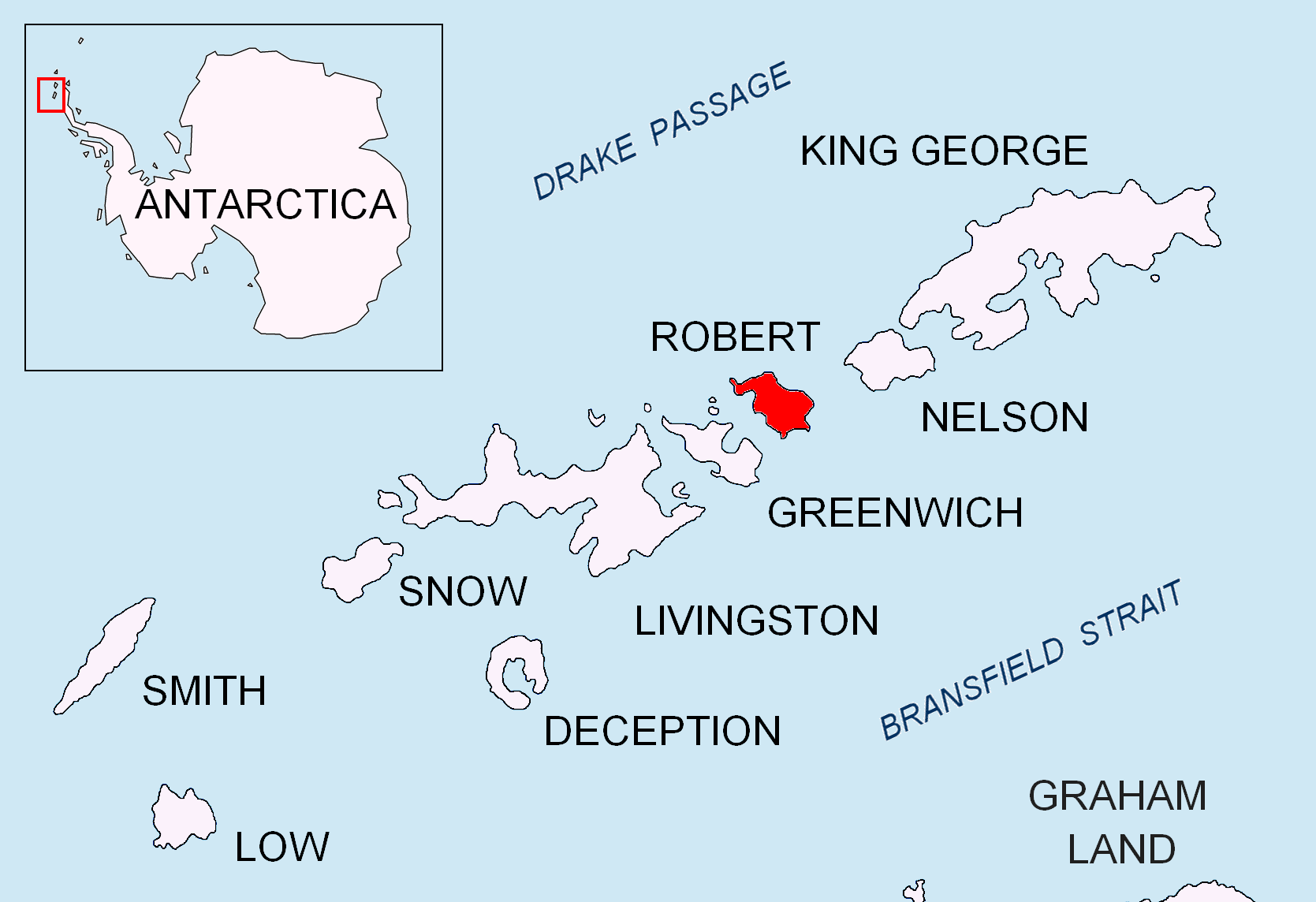
Ugarchin Point on:
[Wikipedia]
[Google]
[Amazon]

 Ugarchin Point ( bg, нос Угърчин, ‘Nos Ugarchin’ \'nos u-g&r-'chin\) is a point on the northeast coast of
Antarctic Digital Database (ADD).
Scale 1:250000 topographic map of Antarctica. Scientific Committee on Antarctic Research (SCAR). Since 1993, regularly updated.
Ugarchin Point.
SCAR Composite Antarctic Gazetteer
Bulgarian Antarctic Gazetteer.
Antarctic Place-names Commission. (details in Bulgarian
basic data
in English)
Ugarchin Point.
Copernix satellite image Headlands of Robert Island Bulgaria and the Antarctic {{RobertIsland-geo-stub

 Ugarchin Point ( bg, нос Угърчин, ‘Nos Ugarchin’ \'nos u-g&r-'chin\) is a point on the northeast coast of
 Robert Island
Robert Island or Mitchells Island or Polotsk Island or Roberts Island is an island long and wide, situated between Nelson Island and Greenwich Island in the South Shetland Islands, Antarctica. Robert Island is located at . Surface area . T ...
in the South Shetland Islands
The South Shetland Islands are a group of Antarctic islands with a total area of . They lie about north of the Antarctic Peninsula, and between southwest of the nearest point of the South Orkney Islands. By the Antarctic Treaty of 1 ...
, Antarctica
Antarctica () is Earth's southernmost and least-populated continent. Situated almost entirely south of the Antarctic Circle and surrounded by the Southern Ocean, it contains the geographic South Pole. Antarctica is the fifth-largest cont ...
projecting 300 m into Nelson Strait. Named after the town of Ugarchin
Ugarchin ( bg, Угърчин ) is a town located along the Kamenitsa river in the Lovech Province in central northern Bulgaria. It is the administrative centre of the homonymous Ugarchin Municipality. The town is about 30 kilometers away in the ...
in northern Bulgaria
Bulgaria (; bg, България, Bǎlgariya), officially the Republic of Bulgaria,, ) is a country in Southeast Europe. It is situated on the eastern flank of the Balkans, and is bordered by Romania to the north, Serbia and North Macedo ...
.
Location
The point is located at , which is 4.7 km west ofSmirnenski Point
Smirnenski Point ( bg, нос Смирненски, ‘Nos Smirnenski’ \'nos 'smir-nen-ski\) is a narrow, ice-free point on the east coast of Robert Island projecting 1.1 km into Nelson Strait in the South Shetland Islands, Antarctica, and ...
and 4.2 km southeast of Newell Point (Bulgarian early mapping in 2009).
Maps
* L.L. Ivanov. Antarctica: Livingston Island and Greenwich, Robert, Snow and Smith Islands. Scale 1:120000 topographic map. Troyan: Manfred Wörner Foundation, 2010. (First edition 2009. )Antarctic Digital Database (ADD).
Scale 1:250000 topographic map of Antarctica. Scientific Committee on Antarctic Research (SCAR). Since 1993, regularly updated.
References
Ugarchin Point.
SCAR Composite Antarctic Gazetteer
Bulgarian Antarctic Gazetteer.
Antarctic Place-names Commission. (details in Bulgarian
basic data
in English)
External links
Ugarchin Point.
Copernix satellite image Headlands of Robert Island Bulgaria and the Antarctic {{RobertIsland-geo-stub