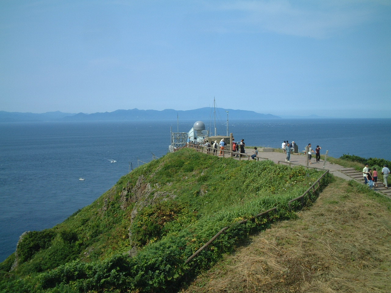
Tsugaru Strait on:
[Wikipedia]
[Google]
[Amazon]


 The is a strait between


Honshu
, historically called , is the largest and most populous island of Japan. It is located south of Hokkaidō across the Tsugaru Strait, north of Shikoku across the Inland Sea, and northeast of Kyūshū across the Kanmon Straits. The island ...
and Hokkaido
is Japan, Japan's Japanese archipelago, second largest island and comprises the largest and northernmost Prefectures of Japan, prefecture, making up its own List of regions of Japan, region. The Tsugaru Strait separates Hokkaidō from Honshu; th ...
in northern Japan connecting the Sea of Japan with the Pacific Ocean
The Pacific Ocean is the largest and deepest of Earth's five oceanic divisions. It extends from the Arctic Ocean in the north to the Southern Ocean (or, depending on definition, to Antarctica) in the south, and is bounded by the contine ...
. It was named after the western part of Aomori Prefecture
is a prefecture of Japan in the Tōhoku region. The prefecture's capital, largest city, and namesake is the city of Aomori. Aomori is the northernmost prefecture on Japan's main island, Honshu, and is bordered by the Pacific Ocean to the ea ...
. The Seikan Tunnel passes under it at its narrowest point 12.1 miles (19.5 km) between Tappi Misaki on the Tsugaru Peninsula in Aomori Prefecture
is a prefecture of Japan in the Tōhoku region. The prefecture's capital, largest city, and namesake is the city of Aomori. Aomori is the northernmost prefecture on Japan's main island, Honshu, and is bordered by the Pacific Ocean to the ea ...
, Honshu, and Shirakami Misaki on the Matsumae Peninsula in Hokkaido.
Western maps made prior to the 20th century also referred to this waterway as the Strait of Sangar.
Japan's territorial waters extend to three nautical miles (5.6 km) into the strait instead of the usual twelve, reportedly to allow nuclear
Nuclear may refer to:
Physics
Relating to the nucleus of the atom:
*Nuclear engineering
*Nuclear physics
*Nuclear power
*Nuclear reactor
*Nuclear weapon
*Nuclear medicine
*Radiation therapy
*Nuclear warfare
Mathematics
*Nuclear space
* Nuclear ...
-armed United States Navy
The United States Navy (USN) is the maritime service branch of the United States Armed Forces and one of the eight uniformed services of the United States. It is the largest and most powerful navy in the world, with the estimated tonnage ...
warships and submarines to transit the strait without violating Japan's prohibition against nuclear weapons in its territory. The part of the Seikan Tunnel that passes under the strait is considered to be under Japanese jurisdiction. The part of the Tsugaru Strait considered to be in international waters
The terms international waters or transboundary waters apply where any of the following types of bodies of water (or their drainage basins) transcend international boundaries: oceans, large marine ecosystems, enclosed or semi-enclosed region ...
is still within Japan's exclusive economic zone.
The Tsugaru Strait has eastern and western necks, both approximately 20 km across with maximum depths of 200 m and 140 m respectively.
There are also ferry services that operate across the strait, including the Tsugaru Kaikyō Ferry and the Seikan ferry
The is a privately owned ferry service crossing the Tsugaru Strait, which separates the Japanese islands of Hokkaido and Honshu. The company, , was founded in 1973 and runs between the cities of Aomori on the northern tip of Honshu and Hako ...
.
On September 26, 1954, 1,172 people died when the ferry '' Tōya Maru'' sank in the strait.
Thomas Blakiston
Thomas Wright Blakiston (27 December 1832 – 15 October 1891) was an English explorer and naturalist.
Early life and career
Born in Lymington, Hampshire, Blakiston was the son of Major John Blakiston. His grandfather was Sir Matthew Blak ...
, an English explorer and naturalist, noticed that animals in Hokkaido were related to northern Asian species, whereas those on Honshu to the south were related to those from southern Asia. The Tsugaru Strait was therefore established as a major zoogeographical boundary, and became known as ''Blakiston's Line
The Blakiston Line or Blakiston's Line is a faunal boundary line drawn between two of the four largest islands of Japan: Hokkaidō in the north and Honshū, south of it. It can be compared with faunal boundary lines like the Wallace Line. Certain ...
'' or the "Blakiston Line".
On July 20, 2019, Emma-Claire Fierce became the first French woman to swim across the strait in a swimsuit in 9 hours and 51 minutes.
See also
* Exclusive economic zone of Japan * Geography of JapanReferences
External links
* {{Authority control Straits of Japan Landforms of Aomori Prefecture Landforms of Hokkaido