Trikala (regional unit) on:
[Wikipedia]
[Google]
[Amazon]
Trikala ( el, Περιφερειακή ενότητα Τρικάλων) is one of the


 The area of Trikala was relatively obscure in
www.issuu.com/dialogosnews
Prefectural map of Trikala
*https://web.archive.org/web/20051027171013/http://www.greecebyclick.com/regions/central/trikala/index.cfm * {{Authority control Prefectures of Greece Regional units of Thessaly
regional units of Greece
The 74 regional units of Greece ( el, περιφερειακές ενότητες, ; sing. , ) are the country's Seventy-four second-level administrative units. They are divisions of the country's 13 regions, and are further divided into municipa ...
, forming the northwestern part of the region
In geography, regions, otherwise referred to as zones, lands or territories, are areas that are broadly divided by physical characteristics (physical geography), human impact characteristics (human geography), and the interaction of humanity and t ...
of Thessaly
Thessaly ( el, Θεσσαλία, translit=Thessalía, ; ancient Thessalian: , ) is a traditional geographic and modern administrative region of Greece, comprising most of the ancient region of the same name. Before the Greek Dark Ages, Thes ...
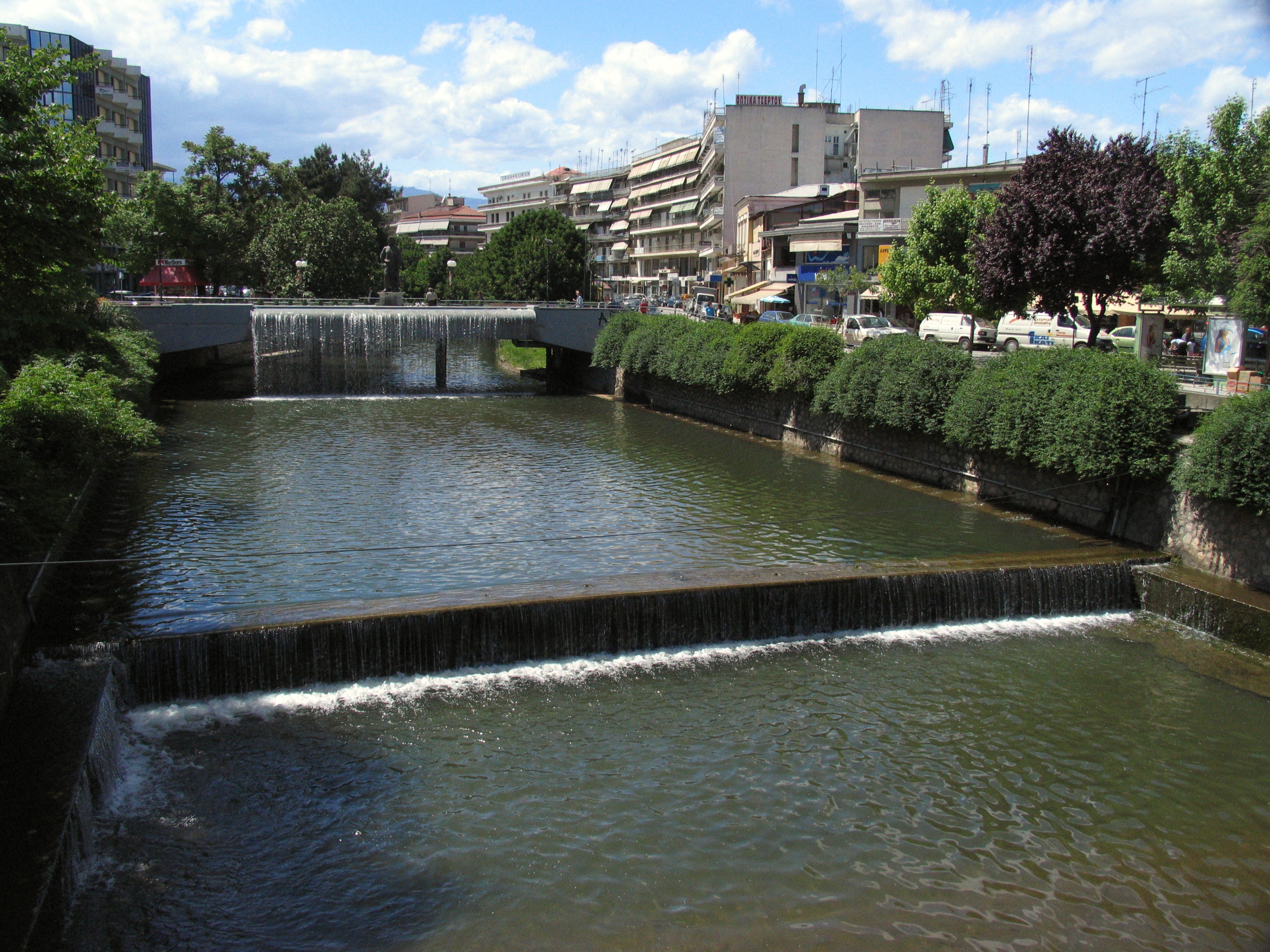
. Its capital is the town of Trikala
Trikala ( el, Τρίκαλα; rup, Trikolj) is a city in northwestern Thessaly, Greece, and the capital of the Trikala regional unit. The city straddles the Lithaios river, which is a tributary of Pineios. According to the Greek National Stati ...
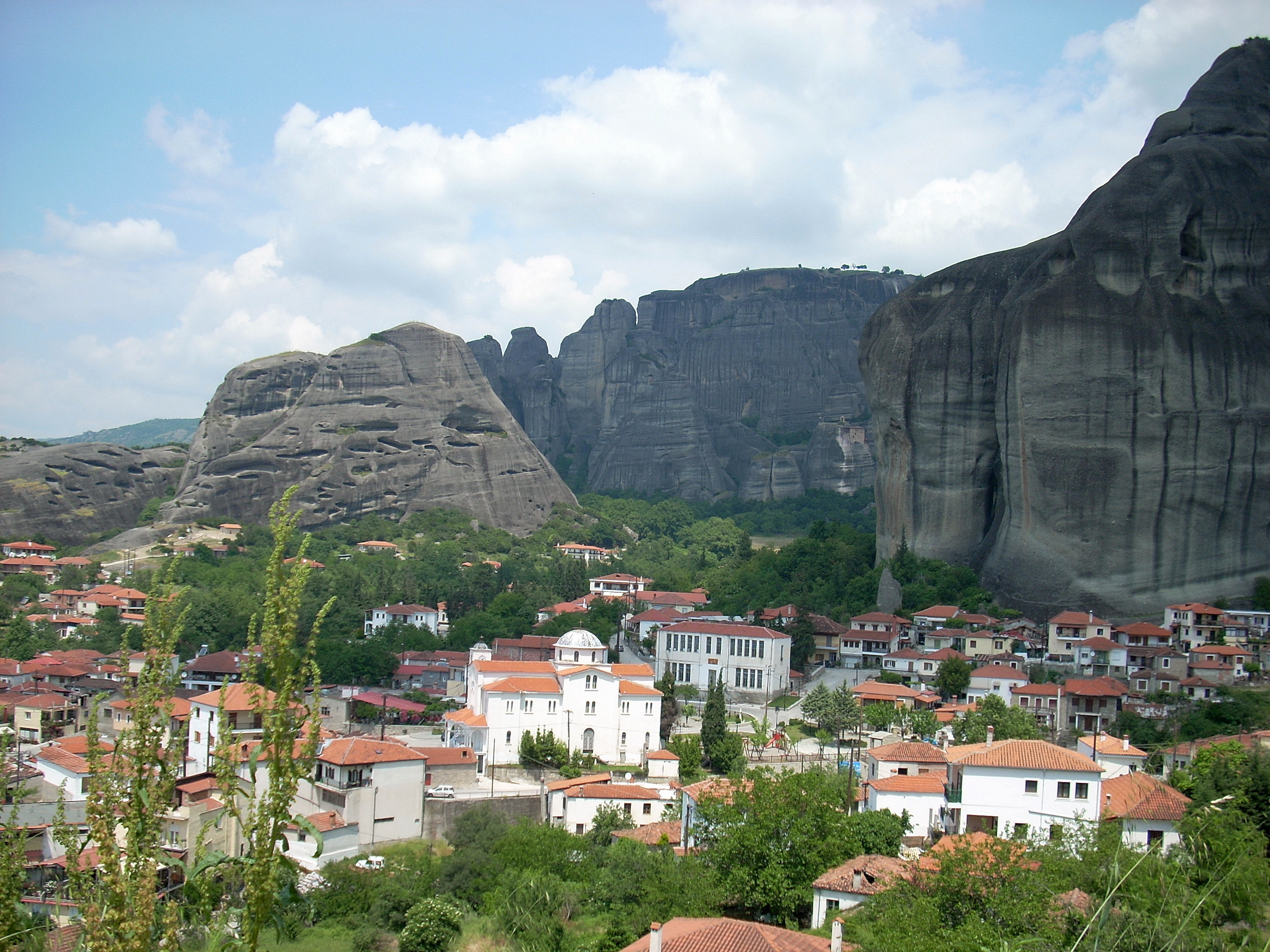
. The regional unit includes the town of Kalampaka
Kalabaka ( el, Καλαμπάκα, ''Kalabáka'', alternative transliterations are ''Kalambaka'' and ''Kalampaka'') is a town and seat of the municipality of Meteora in the Trikala regional unit, part of Thessaly in Greece. The population was ...
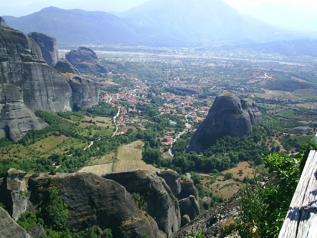
and the Meteora
The Meteora (; el, Μετέωρα, ) is a rock formation in central Greece hosting one of the largest and most precipitously built complexes of Eastern Orthodox monasteries, second in importance only to Mount Athos.Sofianos, D.Z.: "Metéora". ...
monastery complex.
Geography
Trikala borders the regional units ofKarditsa
Karditsa ( el, Καρδίτσα ) is a city in western Thessaly in mainland Greece. The city of Karditsa is the capital of Karditsa regional unit of region of Thessaly.
Inhabitation is attested from 9000 BC. Karditsa ls linked with GR-30, the ...
to the south, Arta to the southwest, Ioannina
Ioannina ( el, Ιωάννινα ' ), often called Yannena ( ' ) within Greece, is the capital and largest city of the Ioannina regional unit and of Epirus, an administrative region in north-western Greece. According to the 2011 census, the c ...
to the west, Grevena
Grevena ( el, Γρεβενά, ''Grevená'', , rup, Grebini) is a town and municipality in Western Macedonia, northern Greece, capital of the Grevena regional unit. The town's current population is 13,374 citizens (2011). It lies about from Athe ...
to the north and Larissa
Larissa (; el, Λάρισα, , ) is the capital and largest city of the Thessaly region in Greece. It is the fifth-most populous city in Greece with a population of 144,651 according to the 2011 census. It is also capital of the Larissa regiona ...
to the east.
The southeastern part belongs to the Thessalian Plain
The Thessalian plain ( el, Θεσσαλική πεδιάδα, Θεσσαλικός κάμπος) is the dominant geographical feature of the Greek region of Thessaly.
The plain is formed by the Pineios River and its tributaries and is surrounded ...
. The forested Pindus
The Pindus (also Pindos or Pindhos; el, Πίνδος, Píndos; sq, Pindet; rup, Pindu) is a mountain range located in Northern Greece and Southern Albania. It is roughly 160 km (100 miles) long, with a maximum elevation of 2,637 metres ...
mountain range dominates the western part. The northern part of Trikala is also mountainous and made up of forests and barren lands, the ranges here are Chasia
Chasia ( el, Χάσια) is a forested mountain range in the northern Trikala (Thessaly) and the southern Grevena (Western Macedonia) regional units, northern Greece. It is an eastern extension of the Pindus mountain range. The elevation of its ...
and Antichasia. Its major river is the Pineios, flowing to the south and east.
Its climate is mainly of Mediterranean character, with hot summers and cold winters, along with temperate climate conditions by the mountains.
Administration
The regional unit Trikala is subdivided into 4 municipalities. These are (number as in the map in the infobox): *Farkadona
Farkadona ( el, Φαρκαδόνα, ; before 1955: Τσιότι, , ) is a municipality in the southeastern Trikala regional unit, part of Thessaly in Greece. In 2011 its population was 2,652 for the town and 13,396 for the municipality. It is loc ...
(4)
*Meteora
The Meteora (; el, Μετέωρα, ) is a rock formation in central Greece hosting one of the largest and most precipitously built complexes of Eastern Orthodox monasteries, second in importance only to Mount Athos.Sofianos, D.Z.: "Metéora". ...
(2)
*Pyli
Pyli ( el, Πύλη) is a municipality in the Trikala regional unit, Greece. Situated 18 km west of Trikala, right at the bottom of two mountains Itamos, and Koziakas, which mark the beginning of the Pindos mountainline, Pyli marks the entra ...
(3)
*Trikala
Trikala ( el, Τρίκαλα; rup, Trikolj) is a city in northwestern Thessaly, Greece, and the capital of the Trikala regional unit. The city straddles the Lithaios river, which is a tributary of Pineios. According to the Greek National Stati ...
(1)
Prefecture
Trikala was created as aprefecture
A prefecture (from the Latin ''Praefectura'') is an administrative jurisdiction traditionally governed by an appointed prefect. This can be a regional or local government subdivision in various countries, or a subdivision in certain international ...
( el, Νομός Τρικάλων) in 1882. As a part of the 2011 Kallikratis government reform, the regional unit Trikala was created out of the former prefecture Trikala. The prefecture had the same territory as the present regional unit. At the same time, the municipalities were reorganised, according to the table below.
Provinces
Trikala prefecture had two provinces, named Trikala andKalampaka
Kalabaka ( el, Καλαμπάκα, ''Kalabáka'', alternative transliterations are ''Kalambaka'' and ''Kalampaka'') is a town and seat of the municipality of Meteora in the Trikala regional unit, part of Thessaly in Greece. The population was ...
, after the two largest towns.
*Province of Trikala
Trikala ( el, Τρίκαλα; rup, Trikolj) is a city in northwestern Thessaly, Greece, and the capital of the Trikala regional unit. The city straddles the Lithaios river, which is a tributary of Pineios. According to the Greek National Stati ...
*Province of Kalampaka
Kalabaka ( el, Καλαμπάκα, ''Kalabáka'', alternative transliterations are ''Kalambaka'' and ''Kalampaka'') is a town and seat of the municipality of Meteora in the Trikala regional unit, part of Thessaly in Greece. The population was ...
''Note:'' Provinces no longer hold any legal status in Greece
Greece,, or , romanized: ', officially the Hellenic Republic, is a country in Southeast Europe. It is situated on the southern tip of the Balkans, and is located at the crossroads of Europe, Asia, and Africa. Greece shares land borders with ...
.
History


 The area of Trikala was relatively obscure in
 ancient Thessaly
Thessaly or Thessalia (Attic Greek: , ''Thessalía'' or , ''Thettalía'') was one of the traditional regions of Ancient Greece. During the Mycenaean period, Thessaly was known as Aeolia, a name that continued to be used for one of the major tribes ...
, as well as during the periods of Macedonian, Romans
Roman or Romans most often refers to:
*Rome, the capital city of Italy
* Ancient Rome, Roman civilization from 8th century BC to 5th century AD
*Roman people, the people of ancient Rome
*''Epistle to the Romans'', shortened to ''Romans'', a lette ...
, and Byzantine
The Byzantine Empire, also referred to as the Eastern Roman Empire or Byzantium, was the continuation of the Roman Empire primarily in its eastern provinces during Late Antiquity and the Middle Ages, when its capital city was Constantinopl ...
rule. Under the Ottomans
The Ottoman Turks ( tr, Osmanlı Türkleri), were the Turkic founding and sociopolitically the most dominant ethnic group of the Ottoman Empire ( 1299/1302–1922).
Reliable information about the early history of Ottoman Turks remains scarce, ...
, Trikala was known as "Tırhala" and became the seat of the Sanjak of Tirhala
The Sanjak of Tirhala or Trikala (Ottoman Turkish: ; el, λιβάς/σαντζάκι Τρικάλων) was second-level Ottoman province ( or ) encompassing the region of Thessaly. Its name derives from the Turkish version of the name of the town ...
, encompassing most of Thessaly, until the late 18th century. Despite a number of rebellions against Ottoman rule, the area remained under Ottoman control until joined with the independent Kingdom of Greece
The Kingdom of Greece ( grc, label=Greek, Βασίλειον τῆς Ἑλλάδος ) was established in 1832 and was the successor state to the First Hellenic Republic. It was internationally recognised by the Treaty of Constantinople, where ...
in 1881.
Upon annexation by Greece, Trikala became the seat of one of the two prefectures
A prefecture (from the Latin ''Praefectura'') is an administrative jurisdiction traditionally governed by an appointed prefect. This can be a regional or local government subdivision in various countries, or a subdivision in certain international ...
in which Thessaly was divided (the other being Larissa Prefecture). The area was briefly occupied by the Ottomans again during the Greco-Turkish War of 1897
The Greco-Turkish War of 1897 or the Ottoman-Greek War of 1897 ( or ), also called the Thirty Days' War and known in Greece as the Black '97 (, ''Mauro '97'') or the Unfortunate War ( el, Ατυχής πόλεμος, Atychis polemos), was a w ...
, and by the Italians and Germans during the Axis occupation of Greece in World War II. In 1947, the southern part was split off as Karditsa Prefecture
Karditsa ( el, Περιφερειακή ενότητα Καρδίτσας, ) is one of the regional units of Greece. It is part of the region of Thessaly. Its name is derived from its capital Karditsa, a small city of approximately 40,000 people.
...
.
Economy
Agriculture
The agriculture of the area is famous, and produces a part of the country's production also in export. Its well-known production includesfruit
In botany, a fruit is the seed-bearing structure in flowering plants that is formed from the ovary after flowering.
Fruits are the means by which flowering plants (also known as angiosperms) disseminate their seeds. Edible fruits in particu ...
and vegetables
Vegetables are parts of plants that are consumed by humans or other animals as food. The original meaning is still commonly used and is applied to plants collectively to refer to all edible plant matter, including the flowers, fruits, stems, ...
, cotton
Cotton is a soft, fluffy staple fiber that grows in a boll, or protective case, around the seeds of the cotton plants of the genus ''Gossypium'' in the mallow family Malvaceae. The fiber is almost pure cellulose, and can contain minor perce ...
, olive
The olive, botanical name ''Olea europaea'', meaning 'European olive' in Latin, is a species of small tree or shrub in the family Oleaceae, found traditionally in the Mediterranean Basin. When in shrub form, it is known as ''Olea europaea'' ...
s, cattle
Cattle (''Bos taurus'') are large, domesticated, cloven-hooved, herbivores. They are a prominent modern member of the subfamily Bovinae and the most widespread species of the genus ''Bos''. Adult females are referred to as cows and adult mal ...
and other foodstuffs
Food is any substance consumed by an organism for nutritional support. Food is usually of plant, animal, or fungal origin, and contains essential nutrients, such as carbohydrates, fats, proteins, vitamins, or minerals. The substance is ing ...
.
Communications
Newspapers
*''I Enimerosi'' *''I Erevna'' *''dialogos-weekly newspaper of Trikala'' "t.24310-33263,fax.2431-500059www.issuu.com/dialogosnews
Transport
There are a number of highways and the main railway fromVolos
Volos ( el, Βόλος ) is a coastal port city in Thessaly situated midway on the Greek mainland, about north of Athens and south of Thessaloniki. It is the sixth most populous city of Greece, and the capital of the Magnesia regional unit ...
to Meteora
The Meteora (; el, Μετέωρα, ) is a rock formation in central Greece hosting one of the largest and most precipitously built complexes of Eastern Orthodox monasteries, second in importance only to Mount Athos.Sofianos, D.Z.: "Metéora". ...
crosses Thessaly
Thessaly ( el, Θεσσαλία, translit=Thessalía, ; ancient Thessalian: , ) is a traditional geographic and modern administrative region of Greece, comprising most of the ancient region of the same name. Before the Greek Dark Ages, Thes ...
. The region is directly linked to the rest of Europe
Europe is a large peninsula conventionally considered a continent in its own right because of its great physical size and the weight of its history and traditions. Europe is also considered a Continent#Subcontinents, subcontinent of Eurasia ...
through International Airport of Central Greece
Nea Anchialos National Airport ( gr, Κρατικός Αερολιμένας Νέας Αγχιάλου) is an airport located near the town of Nea Anchialos in Greece. It serves the department of Magnesia and is also known as ''Central Greece A ...
located in Nea Anchialos
Nea Anchialos ( el, Νέα Αγχίαλος) is a town and a former municipality in Magnesia, Thessaly, Greece. Since the 2011 local government reform it is part of the municipality Volos, of which it is a municipal unit. It is situated southwest ...
in a small distance from Trikala. In the 1980s, the Trikala Bypass was opened and between 1998 and 2006, the Via Egnatia
The Via Egnatia was a road constructed by the Romans in the 2nd century BC. It crossed Illyricum, Macedonia, and Thracia, running through territory that is now part of modern Albania
Albania ( ; sq, Shqipëri or ), or , also or . of ...
was under construction with tunnels and bridges ; the first section was opened in 2002, and the final section in 2006.
*Greek National Road 6
Greek National Road 6 ( el, Εθνική Οδός 6, abbreviated as EO6) is a national road in north-central Greece. It begins at the port of Igoumenitsa and ends at Volos, passing through the towns Ioannina, Metsovo, Trikala and Larissa. The s ...
, NW, N, Cen., SE
*Greek National Road 15
Greek National Road 15 ( el, Εθνική Οδός 15, abbreviated as EO15) is a single carriageway road in northern Greece. It connects Agios Germanos, near the border with North Macedonia, with the Greek National Road 6 near Kalampaka. It pa ...
, NW
*Greek National Road 30
National Road 30 ( el, Εθνική Οδός 30, abbreviated as EO30) is a single carriageway road in central Greece. It connects the cities of Arta and Volos, via Trikala and Karditsa.
Route
The western end of the Greek National Road 30 is i ...
, SW, S
Sports
* AO Trikala *Trikala 2000 BC
A.S. Trikala 2000 B.C. was a Greek professional basketball club located in Trikala, Greece. The club was commonly known as either shortly Trikala or Trikala 2000. Trikala previously competed in the Greek League, the top tier of Greek basketbal ...
* A.O. Trikala 1963 F.C.
*G.S. Trikala
GS may stand for:
Businesses and organizations
* Goldman Sachs, one of the world's largest global investment banks
* Global Star Software, a former Canadian video game publisher
* GS (Swedish union), a trade union in Sweden
* GS Group, a Korean ...
* G.E.A. Trikala
* G.A.S. Trikala "Zeus"
See also
*List of settlements in the Trikala regional unit
This is a list of settlements in the Trikala regional unit, Greece.
* Achladea
* Achladochori
* Agia Kyriaki
* Agia Paraskevi
* Agiofyllo
* Agios Nikolaos
* Agios Prokopios
* Agios Vissarion
* Agnantia
* Agrelia
* Aidona
* Amaranto
* ...
References
External links
Prefectural map of Trikala
*https://web.archive.org/web/20051027171013/http://www.greecebyclick.com/regions/central/trikala/index.cfm * {{Authority control Prefectures of Greece Regional units of Thessaly