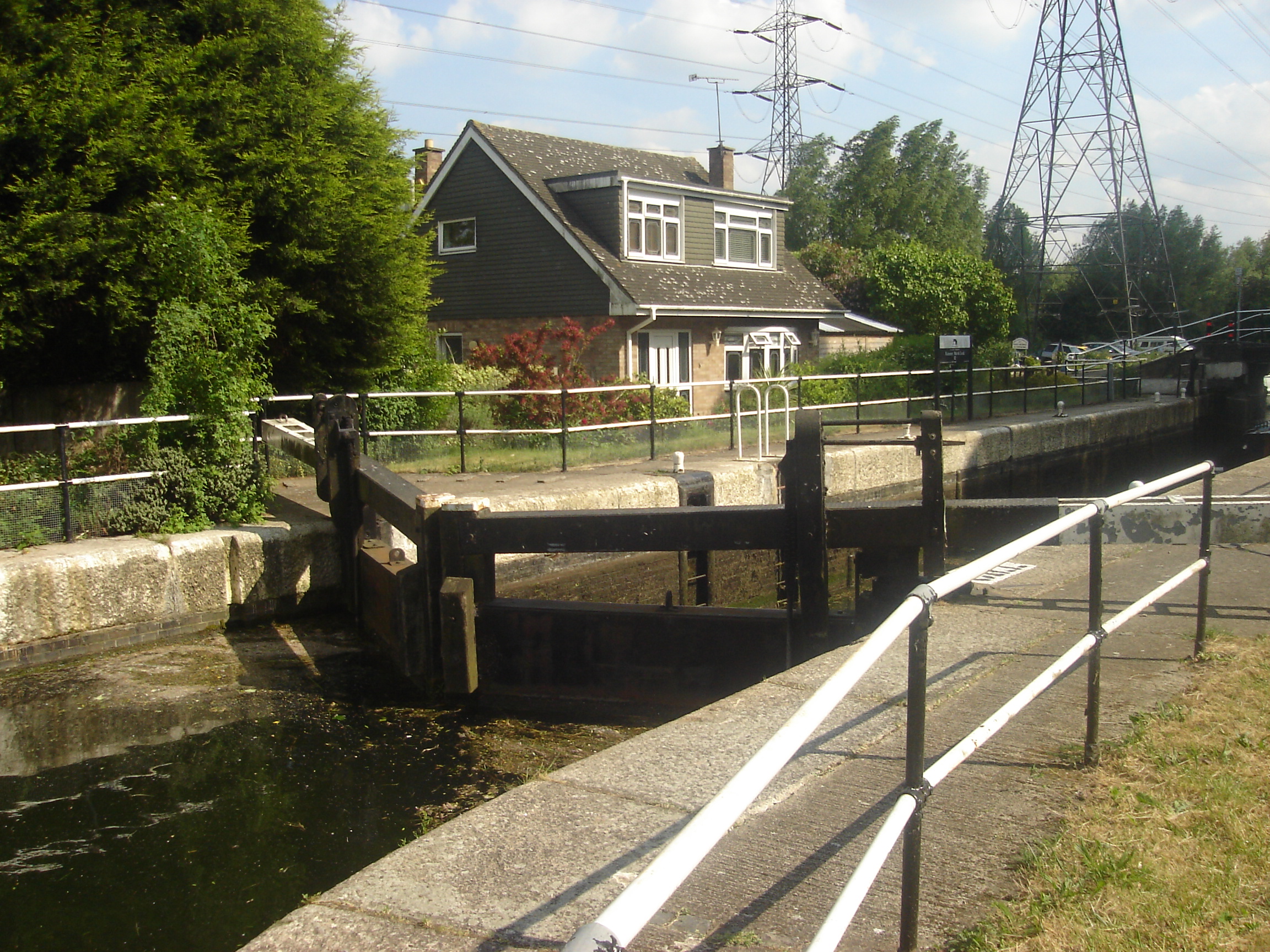
Rammey Marsh Lock on:
[Wikipedia]
[Google]
[Amazon]
Rammey Marsh Lock (No 12) is a

 The lock and the adjoining cut are of 1864. Across the lock tail, a reused cast- iron footbridge dated 1835.
River Lea Anglers Club
Retrieved 2 December 2014
London's canals- Rammey Marsh Lock footbridge
Rammey Marsh
lock
Lock(s) may refer to:
Common meanings
*Lock and key, a mechanical device used to secure items of importance
*Lock (water navigation), a device for boats to transit between different levels of water, as in a canal
Arts and entertainment
* ''Lock ...
on the River Lee Navigation
The Lee Navigation is a canalised river incorporating the River Lea (also called the River Lee along the sections that are navigable). It flows from Hertford Castle Weir to the River Thames at Bow Creek; its first lock is Hertford Lock and its ...
at Enfield, London
Enfield is a large town in north London, England, north of Charing Cross. It had a population of 156,858 in 2018. It includes the areas of Botany Bay, Brimsdown, Bulls Cross, Bullsmoor, Bush Hill Park, Clay Hill, Crews Hill, Enfield Hig ...
, England
England is a country that is part of the United Kingdom. It shares land borders with Wales to its west and Scotland to its north. The Irish Sea lies northwest and the Celtic Sea to the southwest. It is separated from continental Europe b ...
. The area adjacent to the lock is known as Rammey Marsh
Rammey Marsh is located in the Lee Valley Park at Enfield Lock, Enfield, and covers approximately . The site is owned and managed by the Lee Valley Regional Park Authority.River Lee Flood Relief Channel
The Lee Flood Relief Channel (FRC) is located in the Lea Valley and flows between Ware, Hertfordshire, and Stratford, east London. Work started on the channel in 1947 following major flooding and it was fully operational by 1976. The channel in ...
.
Etymology
Rammey Marsh is marked thus on theOrdnance Survey
Ordnance Survey (OS) is the national mapping agency for Great Britain. The agency's name indicates its original military purpose (see ordnance and surveying), which was to map Scotland in the wake of the Jacobite rising of 1745. There was a ...
map of 1887, named from ''Ramhey'' 1538, ''Rammey'' 1610, probably 'island (of dry ground in marsh) where rams are pastured', from Old English
Old English (, ), or Anglo-Saxon, is the earliest recorded form of the English language, spoken in England and southern and eastern Scotland in the early Middle Ages. It was brought to Great Britain by Anglo-Saxon settlers in the mid-5th c ...
''ramm'' and ''ēg''.
History
Public access
Vehicular access only from the north viaLea Valley Walk
The Lea Valley Walk is a long-distance path located between Leagrave, the source of the River Lea near Luton, and the Thames, at Limehouse Basin, Limehouse, east London. From its source much of the walk is rural. At Hertford the path follows t ...
. Which can be accessed at Lea Road.
Pedestrian and cycle access via the towpath
A towpath is a road or trail on the bank of a river, canal, or other inland waterway. The purpose of a towpath is to allow a land vehicle, beasts of burden, or a team of human pullers to tow a boat, often a barge. This mode of transport w ...
which forms part of the Lea Valley Walk.
Angling
Angling is a fishing technique that uses a fish hook or "angle" (from Old English ''angol'') attached to a fishing line to tether individual fish in the mouth. The fishing line is usually manipulated via a fishing rod, although rodless techni ...
is allowed on the River Lee Navigation towpath downstream of Ramney Marsh Lock. Information from the River Lea Anglers Club.Retrieved 2 December 2014
Public transport
Nearest stationEnfield Lock
Enfield Lock is an area in the London Borough of Enfield, north London. It is approximately located east of the Hertford Road between Turkey Street and the Holmesdale Tunnel overpass, and extends to the River Lee Navigation, including the Enfi ...
or Waltham Cross
External links
London's canals- Rammey Marsh Lock footbridge
Rammey Marsh
References
Enfield, London Locks of London Geography of the London Borough of Enfield Locks of the Lee Navigation {{London-struct-stub