|
Lea Valley Walk
The Lea Valley Walk is a long-distance path located between Leagrave, the source of the River Lea near Luton, and the Thames, at Limehouse Basin, Limehouse, east London. From its source much of the walk is rural. At Hertford the path follows the towpath of the River Lee Navigation, and it becomes increasingly urbanised as it approaches London. The walk was opened in 1993 and is waymarked throughout using a swan logo. Route Stage 1 Leagrave - Hatfield Approximately The walk can be accessed close to Leagrave railway station at Leagrave Common where there are a number of springs and ponds from which the Lea forms. The first part of the walk is through the suburbs of Luton. After passing through Wardown Park the path joins the A6 road and goes through the town centre passing St Mary's Church as it heads close to the runways of Luton Airport. The A505 road is crossed as the trail makes its way through open countryside towards Harpenden. The path descends into the Lea Val ... [...More Info...] [...Related Items...] OR: [Wikipedia] [Google] [Baidu] |
Wardown Park
Wardown Park is situated on the River Lea in Luton. The park has various sporting facilities, is home to the Wardown Park Museum and contains formal gardens. The park is located between ''Old Bedford Road'' and the A6, ''New Bedford Road'' and is within walking distance of the town centre. History The area that became Wardown Park was a farmhouse and country residence in the 1800s. The park itself started out as a private estate owned by Richard How. Richard's son, Robert built the first property within the park, called Bramingham Shott, which still stands and now houses the museum. In the early 1870s the estate was taken over by local solicitor, Frank Chapman-Scargill. He rebuilt much of the earlier house in 1879 for a total cost of £10,000. Scargill left Luton and the house and property was let to J Forder who renamed the estate Wardown. Frank Chapman's last surviving son (Jasper Chapman Scargill) died in Ireland 22 October 2012 at the age of 97 (93 years after the death o ... [...More Info...] [...Related Items...] OR: [Wikipedia] [Google] [Baidu] |
Swan
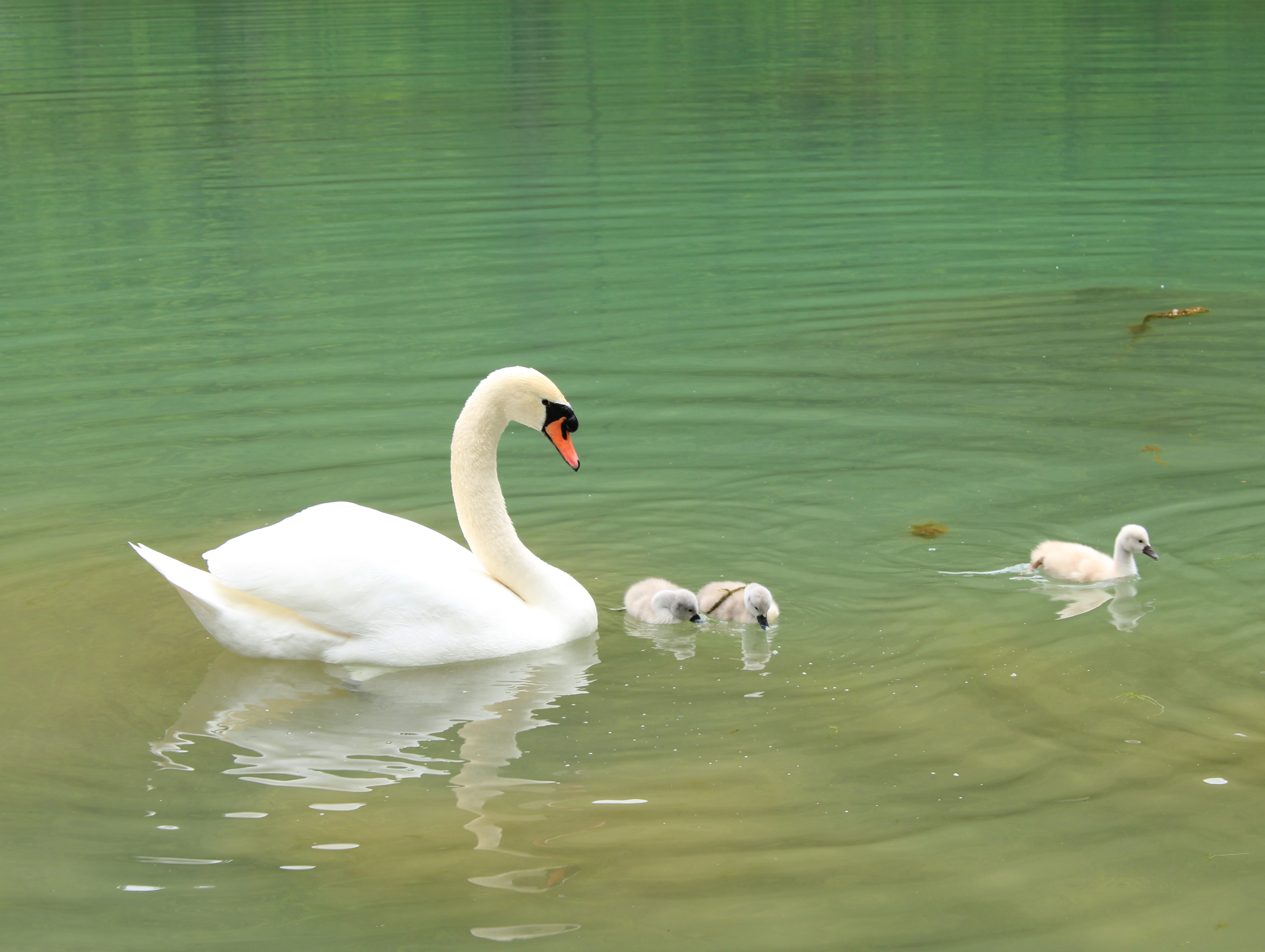
Swans are birds of the family Anatidae within the genus ''Cygnus''. The swans' closest relatives include the geese and ducks. Swans are grouped with the closely related geese in the subfamily Anserinae where they form the tribe Cygnini. Sometimes, they are considered a distinct subfamily, Cygninae. There are six living and many extinct species of swan; in addition, there is a species known as the coscoroba swan which is no longer considered one of the true swans. Swans usually mate for life, although "divorce" sometimes occurs, particularly following nesting failure, and if a mate dies, the remaining swan will take up with another. The number of eggs in each clutch ranges from three to eight. Etymology and terminology The English word ''swan'', akin to the German , Dutch and Swedish , is derived from Indo-European root ' ('to sound, to sing'). Young swans are known as '' cygnets'' or as '' swanlings''; the former derives via Old French or (diminutive suffix et 'l ... [...More Info...] [...Related Items...] OR: [Wikipedia] [Google] [Baidu] |
A1 Road (Great Britain)
The A1 is the longest numbered road in the UK, at . It connects London, the capital of England, with Edinburgh, the capital of Scotland. It passes through or near North London, Hatfield, Welwyn Garden City, Stevenage, Baldock, Letchworth Garden City, Biggleswade, St Neots, Huntingdon, Peterborough, Stamford, Grantham, Newark-on-Trent, Retford, Doncaster, York, Pontefract, Wetherby, Ripon, Darlington, Durham, Sunderland, Gateshead, Newcastle upon Tyne, Morpeth, Alnwick and Berwick-upon-Tweed. It was designated by the Ministry of Transport in 1921, and for much of its route it followed various branches of the historic Great North Road, the main deviation being between Boroughbridge and Darlington. The course of the A1 has changed where towns or villages have been bypassed, and where new alignments have taken a slightly different route. Several sections of the route have been upgraded to motorway standard and designated A1(M). Between the M25 (near London) and the A72 ... [...More Info...] [...Related Items...] OR: [Wikipedia] [Google] [Baidu] |
Lemsford
Lemsford is a village and parish in Hertfordshire, England. It is near Welwyn Garden City and Hatfield and is in the Hatfield Villages Ward of the Borough of Welwyn/Hatfield. Lemsford Springs is a small nature reserve. Its lagoons are important for birds such as the Green sandpiper. The yearly Lemsford Fete garners thousands of visitors and is a traditional English country fete. Held at St. John's School and Church, activities include maypole dancing, raffles and live music. History The parish was created in 1858 out of the parish of Bishop's Hatfield. However, the settlement is older. Buildings of interest Lemsford Mill Lemsford Mill, which is Grade II listed, is a 19th-century structure on the River Lea. It probably occupies the site of one of four mills at Hatfield which were recorded in the Domesday Book in 1086. It is now the headquarters of Ramblers Holidays, having been refurbished to provide office accommodation. It features a water wheel which generates electricity. ... [...More Info...] [...Related Items...] OR: [Wikipedia] [Google] [Baidu] |
Brocket Hall
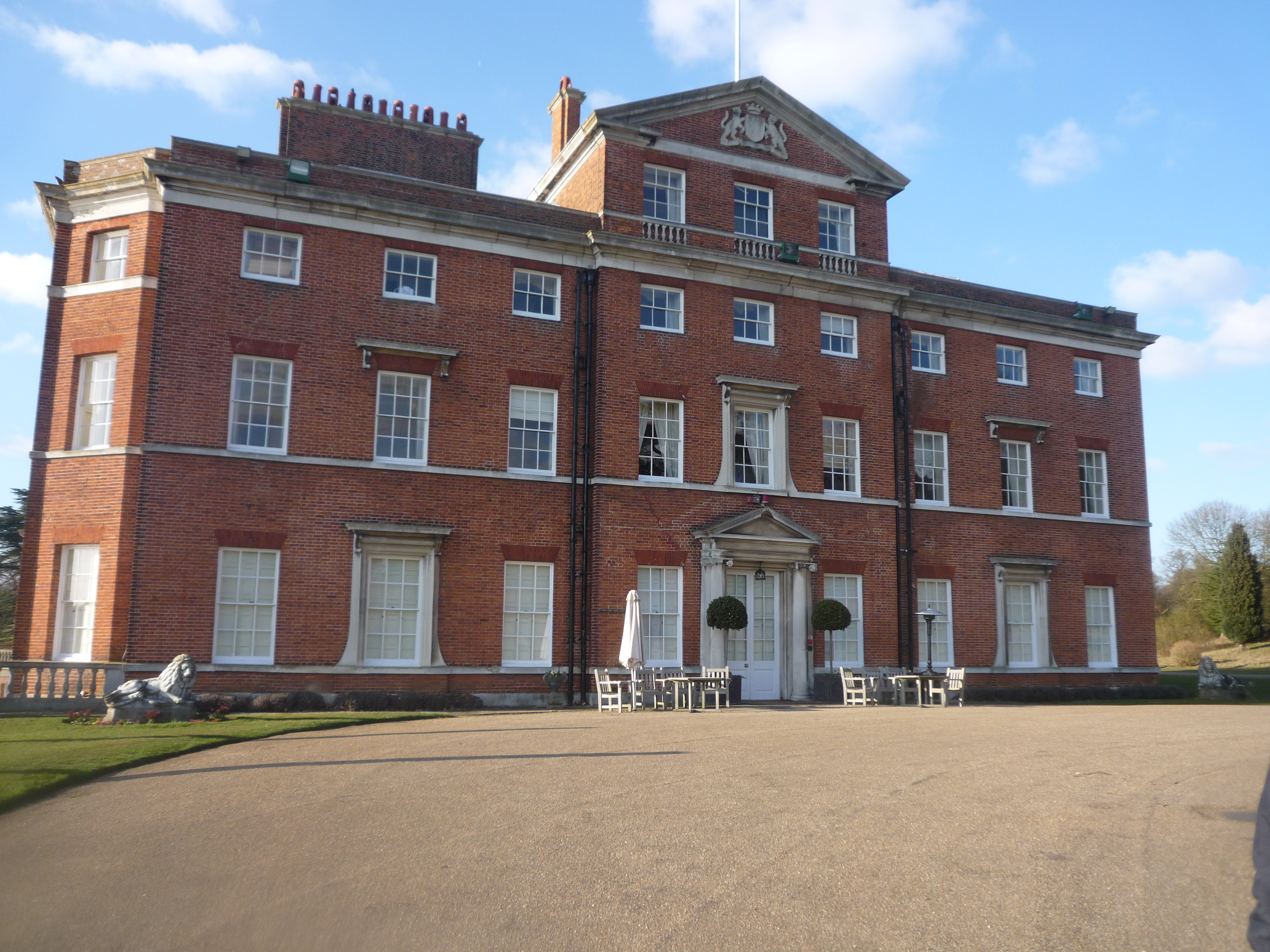
Brocket Hall is a neo-classical country house set in a large park at the western side of the urban area of Welwyn Garden City in Hertfordshire, England. The estate is equipped with two golf courses and seven smaller listed buildings, apart from the main house. The freehold on the estate is held by the 3rd Baron Brocket. The house is Grade I-listed. History On the parkland site were two predecessors, the first of which was built in 1239 as Watership or Durantshide Manor, early held variously of Hatfield Manor and the Bishop of Ely. One of these was built about 1430; whereas in 1413 John Mortimer held Waterships it is known in 1477 Thomas Brockett held both manors. The house was acquired by John Brocket in the early 1550s and passed to his son Sir John Brocket (Captain of Queen Elizabeth's personal guard) on his death in 1558. The building and park owe much of their appearance today to Sir Matthew Lamb, 1st Baronet, who purchased the estate in 1746 and commissioned Brocket ... [...More Info...] [...Related Items...] OR: [Wikipedia] [Google] [Baidu] |
Wheathampstead
Wheathampstead is a village and civil parish in Hertfordshire, England, north of St Albans. The population of the ward at the 2001 census was 6,058. Included within the parish is the small hamlet of Amwell. History Settlements in this area were made about 50 BC by Belgic invaders. They moved up the rivers Thames and Lea from what is now Belgium. Evidence for them was found in Devil's Dyke, at the eastern side of Wheathampstead. The Devil's Dyke earthworks are part of the remains of an ancient settlement of the Catuvellauni and thought to have been the tribe's original capital. The capital was moved to Verlamion (which after the Roman conquest the Romans would rename Verulamium, which in turn would become modern St Albans) in about 20 BC. Although silver Republican coins dating back to 100 BC are common finds around the verulam settlement. The Devil's Dyke is reputedly where Julius Caesar defeated Cassivellaunus in 54 BC, although this claim is disputed. Some historians sugges ... [...More Info...] [...Related Items...] OR: [Wikipedia] [Google] [Baidu] |
Dunstable Branch Lines
The Dunstable Branch Lines were railway branch lines that joined the English town of Dunstable to the main lines at Leighton Buzzard and Welwyn. The two lines were under separate ownership and joined just east of the Dunstable North station. The London and North Western Railway built the line from Leighton Buzzard station to Dunstable. This opened in 1848. The Luton, Dunstable and Welwyn Junction Railway planned a connecting line from the Great Northern Railway at Welwyn. The line between Dunstable and Luton opened in 1858. The company then amalgamated with the Hertford and Welwyn Junction Railway to form the Hertford, Luton and Dunstable Railway. The track to Welwyn was completed in 1860 and the line was taken over by the Great Northern in the following year. It became part of the London and North Eastern Railway from 1923 until British Railways was formed in 1948. Passenger services were withdrawn in 1965 under the Beeching Axe, and the track between Dunstable and Leighton ... [...More Info...] [...Related Items...] OR: [Wikipedia] [Google] [Baidu] |
Lea Valley
The Lea Valley, the valley of the River Lea, has been used as a transport corridor, a source of sand and gravel, an industrial area, a water supply for London, and a recreational area. The London 2012 Summer Olympics were based in Stratford, in the Lower Lea Valley. It is important for London's water supply, as the source of the water transported by the New River aqueduct, but also as the location for the Lee Valley Reservoir Chain, stretching from Enfield through Tottenham and Walthamstow. Geography Physical geography The catchment area of the River Lea is located in the central part of the London Basin, on that basin's northern flank. The main underlying geological formation of the upper part of the Lea catchment, north of Hoddesdon, is Cretaceous Chalk. The main underlying geological formation of the lower part of the Lea catchment, south of Hoddesdon, is Eocene London Clay. However, large areas of these formations are overlain by much more recent Quaternary forma ... [...More Info...] [...Related Items...] OR: [Wikipedia] [Google] [Baidu] |
Harpenden
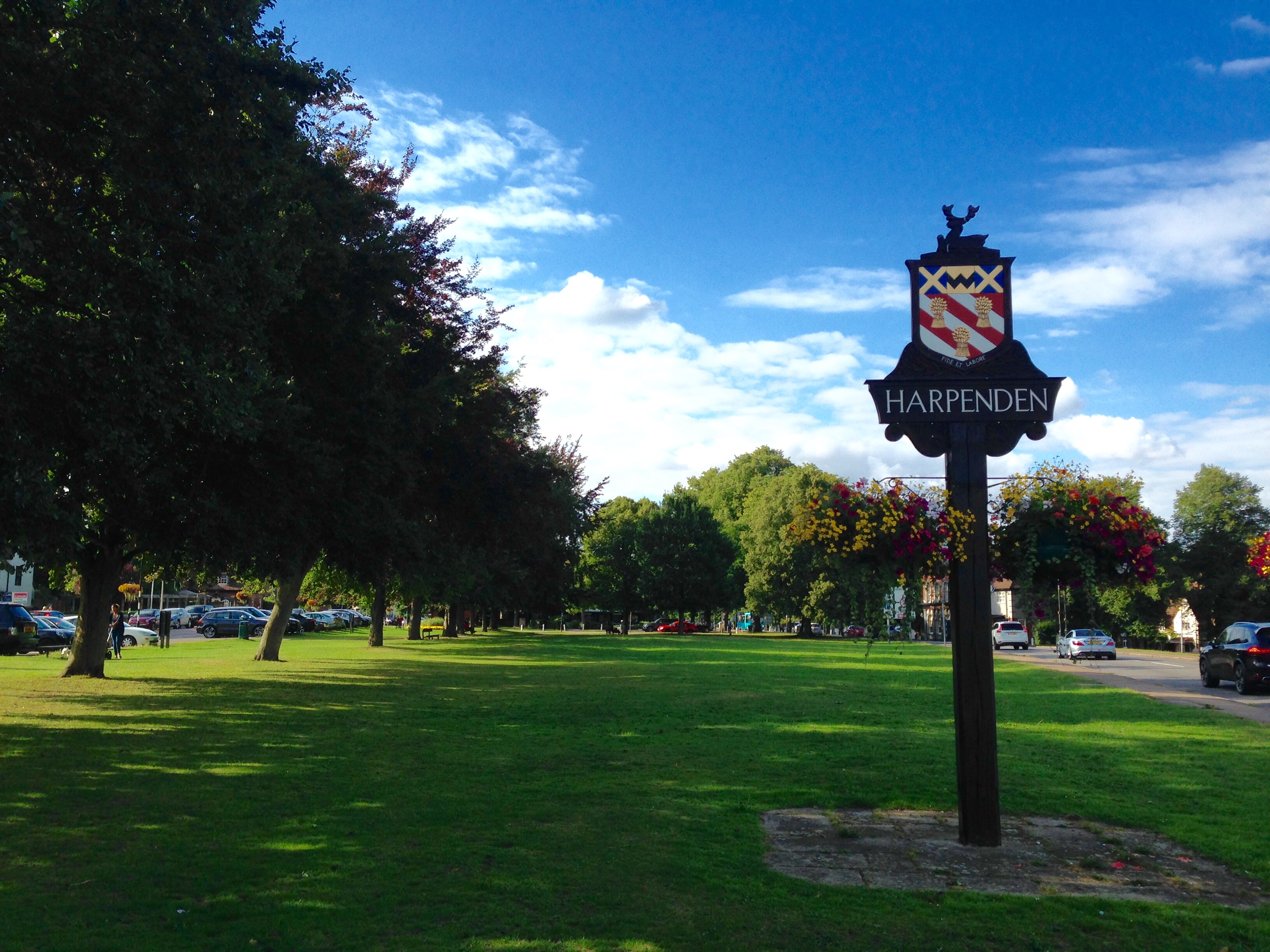
Harpenden () is a town and civil parish in the City and District of St Albans in the county of Hertfordshire, England. The population of the built-up area was 30,240 in the 2011 census, whilst the population of the civil parish was 29,448. Harpenden is a commuter town, with a direct rail connection through Central London and property prices well over triple the national average. History There is evidence of pre-Roman Belgic farmers in the area. In 1867 several items were found including a bronze escutcheon, rams-head shaped mounts, and a bronze bowl. There are Roman remains in land around Harpenden, for instance the site of a mausoleum in the park at Rothamsted. A tumulus near the river Lea was opened in the 1820s and it contained a stone sarcophagus of Romano-Celtic origin. Five objects dating from around 150 AD, were inside including a glass jug with a Mediterranean stamp and samian ware dishes used for libations. Up to the 13th century the area of the parish cons ... [...More Info...] [...Related Items...] OR: [Wikipedia] [Google] [Baidu] |
A505 Road
The A505 is an A-class road in England. It follows part of the route of the Icknield Way and the corresponding Icknield Way Path and runs from Leighton Buzzard in Bedfordshire to the A11 Abington Interchange North in Cambridgeshire. Route Bedfordshire – Leighton Buzzard to Luton The road begins at a roundabout with the A418, the A4146 and the B440 south of Leighton Buzzard as a wide A-Class Primary Route. The road passes through two roundabouts as a single carriageway, and acts as the Leighton Buzzard Bypass. To enter Leighton Buzzard from the A505, an advisable route is to use the A4012 North from the roundabout at Billington. Southbound on the B440 from here will take you towards Hemel Hempstead and Whipsnade Zoo. Continue along the A505 along a 50 MPH stretch with speed cameras to reach the A5 at a roundabout, where the A5 (in the form of a spur) replaces its existing eastbound route to form the Dunstable Northern Bypass to M1 Junction 11a. Going northbound on the ... [...More Info...] [...Related Items...] OR: [Wikipedia] [Google] [Baidu] |
Luton Airport
London Luton Airport is an international airport located in Luton, Bedfordshire, England, situated east of the town centre, and north of Central London. The airport is owned by London Luton Airport Ltd (LLAL), a company wholly owned by Luton Borough Council, and operated by London Luton Airport Operations Ltd (LLAOL). An airport was opened on the site on 16 July 1938. During the Second World War, the airport was used by fighters of the Royal Air Force. Commercial activity and general aviation flight training at Luton resumed during 1952. By the 1960s, Luton Airport was playing a key role in the development of the package holiday business; by 1969, a fifth of all holiday flights from the UK departed from Luton Airport. From the mid-1960s, executive aircraft have been based at the airport. During the late 1970s, an expansion plan was initiated at Luton to accommodate as many as 5 million passengers per year, although the airport experienced a reduction in passenger numbers ... [...More Info...] [...Related Items...] OR: [Wikipedia] [Google] [Baidu] |
St Mary's, Luton
St Mary's Church is an Anglican Church in the centre of the town of Luton, England. The church has a rich and long history, being over 900 years old and has been rebuilt and refurbished constantly over the centuries. The Church is one of the largest in Bedfordshire and considered a fine example of medieval architecture. The Church is part of the St Albans Diocese. The church is grade-I listed and the only one to be a grade-I listed building in the whole of Luton. History Original church The site of St Mary's has been the centre of worship for people in the area for over 1,000 years, and a church was built in about 930 AD by King Athelstan as an act of thanksgiving for victory over the Danes. The land here was owned by the king in Saxon and early Norman times and the church was very richly endowed. 12th century The current church was built by Robert, 1st Earl of Gloucester in 1121 and consecrated in 1137. The original structure of the church was a cruciform without aisles, ... [...More Info...] [...Related Items...] OR: [Wikipedia] [Google] [Baidu] |


