Pass Of Kilbride on:
[Wikipedia]
[Google]
[Amazon]
Pass of Kilbride () is a 
townland
A townland ( ga, baile fearainn; Ulster-Scots: ''toonlann'') is a small geographical division of land, historically and currently used in Ireland and in the Western Isles in Scotland, typically covering . The townland system is of Gaelic origi ...
in County Westmeath
"Noble above nobility"
, image_map = Island of Ireland location map Westmeath.svg
, subdivision_type = Sovereign state, Country
, subdivision_name = Republic of Ireland, Ireland
, subdivision_type1 = Provinces o ...
, Ireland
Ireland ( ; ga, Éire ; Ulster Scots dialect, Ulster-Scots: ) is an island in the Atlantic Ocean, North Atlantic Ocean, in Northwestern Europe, north-western Europe. It is separated from Great Britain to its east by the North Channel (Grea ...
. The townland is located on the border with County Offaly
County Offaly (; ga, Contae Uíbh Fhailí) is a county in Ireland. It is part of the Eastern and Midland Region and the province of Leinster. It is named after the ancient Kingdom of Uí Failghe. It was formerly known as King's County, in hono ...
and is in the civil parish
In England, a civil parish is a type of administrative parish used for local government. It is a territorial designation which is the lowest tier of local government below districts and counties, or their combined form, the unitary authority ...
of the same name. The M6 Motorway
The M6 motorway is the longest motorway in the United Kingdom. It is located entirely within England, running for just over from the Midlands to the border with Scotland. It begins at Junction 19 of the M1 and the western end of the A14 at t ...
runs through the south, with the R400 regional road running through the middle. The Monagh River
The Monagh River is a river in Ireland. The river flows through three counties Westmeath. Offaly and Meath. The river is also connected to other rivers in the area including Milltown River in Westmeath, and the Yellow River
The Yello ...
flows through the south of the area, with the Milltown River
The Milltown River is a river in Ireland. It flows from a small swampland in Milltownpass, a small village in the south of County Westmeath
"Noble above nobility"
, image_map = Island of Ireland location map Westmeath.svg
, subd ...
forming the western border as it meets the village of Milltownpass
Milltownpass () is a village in County Westmeath, Ireland. It is located in the south of the county on the R446 regional road (formerly the N6 national primary route). The old route was replaced by a dual-carriageway from Kinnegad to Tyrrell ...
, and the Kinnegad River
The Kinnegad River is a river in Kinnegad, County Westmeath, Ireland. The river is a tributary of the River Boyne, meeting it near the town of Clonard, County Meath
Clonard ()A. D. Mills, 2003, ''A Dictionary of British Place-Names'', Oxford ...
forming the eastern border. The Milltownpass Bog
Milltownpass Bog is a peat bog in County Westmeath, Ireland. The bog is near the village of Milltownpass on the R446 regional road.
As a raised bog of ecological interest, it has been declared a Natural Heritage Area.
See also
*Milltownpass ...
is in the northern part of the townland.

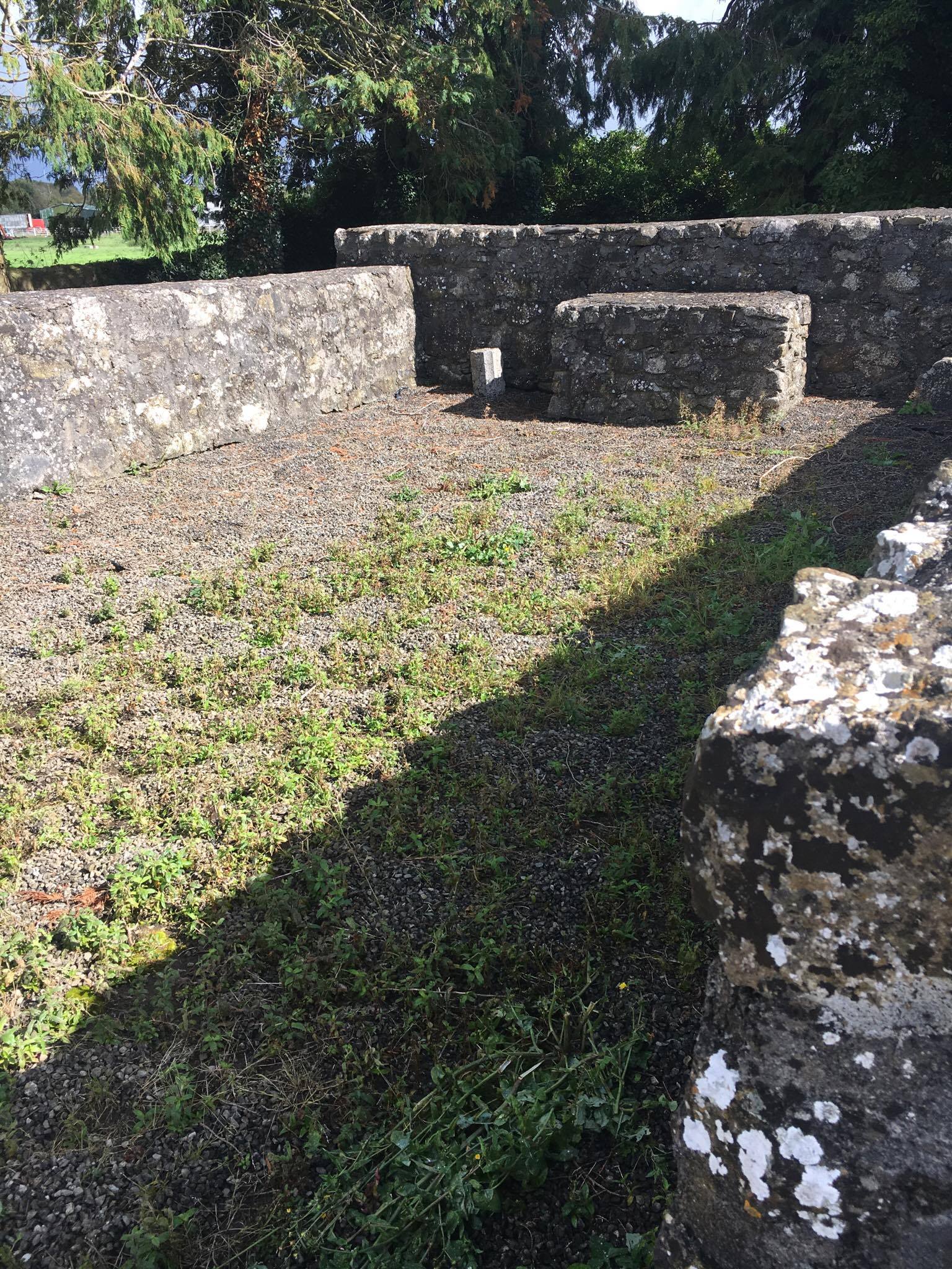
Pass of Kilbride Abbey
A partially reconstructedruined
Ruins () are the remains of a civilization's architecture. The term refers to formerly intact structures that have fallen into a state of partial or total disrepair over time due to a variety of factors, such as lack of maintenance, deliberate ...
abbey
An abbey is a type of monastery used by members of a religious order under the governance of an abbot or abbess. Abbeys provide a complex of buildings and land for religious activities, work, and housing of Christian monks and nuns.
The conce ...
is located in the townland on the outskirts of Milltownpass. In 1640, the land in Pass of Kilbride was owned by Nicholas Darcy, an Irish Papist
The words Popery (adjective Popish) and Papism (adjective Papist, also used to refer to an individual) are mainly historical pejorative words in the English language for Roman Catholicism, once frequently used by Protestants and Eastern Orthodox ...
. There is no evident church on Survey maps from 1656–59. Memorial stones in the small cemetery are post 18th Century.
In 1976, only a discernible outline, described as low grassy mounds were visible. In 1991 the outline of the building was restored, complete with a gap where the original doorway would have stood.NLI, MS 723-4 - National Library of Ireland, The parish maps of the Down Survey for the County of Westmeath, attested by W. Petty, in 1659. Copied by Daniel O’Brien. A set of 67 maps with accompanying terriers in two volumes, 1786-7. Dublin.
References