|
Pass Of Kilbride (civil Parish)
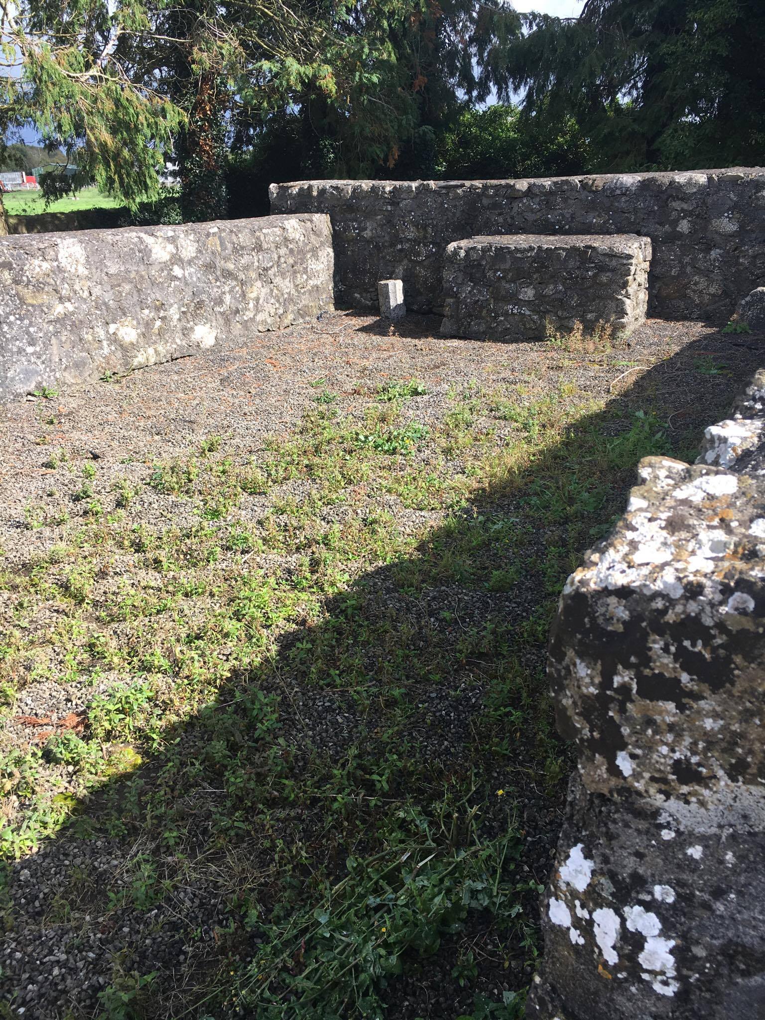
Pass of Kilbride () is a civil parish in County Westmeath, Ireland. It is located about south‑south‑east of Mullingar. Pass of Kilbride is one of 10 civil parishes in the barony of Fartullagh in the Province of Leinster. The civil parish covers . Pass of Kilbride civil parish comprises the village of Milltownpass and 5 townlands: Corcloon, Drumman, Gallstown, Milltown and Pass of Kilbride. An Abbey stands outside the village of Milltownpass, known locally as Pass of Kilbride Abbey. The neighbouring civil parishes are: Enniscoffey to the north, Killucan (barony of Farbill), Ballyboggan (County Meath) and Castlejordan (County Meath County Meath (; gle, Contae na Mí or simply ) is a county in the Eastern and Midland Region of Ireland, within the province of Leinster. It is bordered by Dublin to the southeast, Louth to the northeast, Kildare to the south, Offaly to the sou ...) to the east, Castlelost to the south and Kilbride to the west. [...More Info...] [...Related Items...] OR: [Wikipedia] [Google] [Baidu] |
Civil Parishes In Ireland
Civil parishes () are units of territory in the island of Ireland that have their origins in old Gaelic territorial divisions. They were adopted by the Anglo-Norman Lordship of Ireland and then by the Elizabethan Kingdom of Ireland, and were formalised as land divisions at the time of the Plantations of Ireland. They no longer correspond to the boundaries of Roman Catholic or Church of Ireland parishes, which are generally larger. Their use as administrative units was gradually replaced by Poor_law_union#Ireland, Poor Law Divisions in the 19th century, although they were not formally abolished. Today they are still sometimes used for legal purposes, such as to locate property in deeds of property registered between 1833 and 1946. Origins The Irish parish was based on the Gaelic territorial unit called a ''túath'' or ''Trícha cét''. Following the Norman invasion of Ireland, the Anglo-Normans, Anglo-Norman barons retained the ''tuath'', later renamed a parish or manor, as a un ... [...More Info...] [...Related Items...] OR: [Wikipedia] [Google] [Baidu] |
Drumman
Drumman, also known as Drummond is a townland in Milltownpass in County Westmeath, Ireland. The townland is in the civil parish of Pass of Kilbride and is on the border with County Offaly. The M6 Motorway cuts through the middle of the townland, and the R446 regional road forms the northern border with the townlands of Milltown and Corcloon. The village of Milltownpass is located to the east of the townland, with Rochfortbridge to the west. The Monagh River flows through the south of the townland. History At the time of the Griffith Valuation in 1868, only a single tenant is listed at Drumman. A number of local families held farmland in the area in later decades, including the Johnsons, Whelehans and McGuires. Drumman Lodge Drumman Lodge is an unused two story farmhouse, dating back to the 1740s. The home features bay windows, a natural slate roof, and a complex of outhouses. The building shows signs of being rebuilt c1815, making use of the buildings original materials. Be ... [...More Info...] [...Related Items...] OR: [Wikipedia] [Google] [Baidu] |
Castlelost (civil Parish)
Castlelost () is a civil parish in County Westmeath, Ireland. It is located about south of Mullingar. Castlelost is one of 10 civil parishes in the barony of Fartullagh in the Province of Leinster. The civil parish covers . Castlelost civil parish comprises the village of Rochfortbridge and 16 townlands: Castlelost, Castlelost West, Clontytallon, Derry, Farthingstown, Gallstown, Garrane, Gneevebane, Gortumly, Kilbrennan, Kiltotan and Collinstown, Oldtown, Piercetown, and Rahanine. The neighbouring civil parishes are: Carrick, Kilbride and Pass of Kilbride to the north, Castlejordan (County Meath) to the east, Castlejordan (County Offaly), Croghan (County Offaly) and Newtown to the south and Clonfad Clonfad () is a civil parish in County Westmeath, Ireland. It is located about south of Mullingar. Clonfad is one of 10 civil parishes in the barony of Fartullagh in the Province of Leinster. The civil parish covers . Clonfad civil parish compr ... to the West. [...More Info...] [...Related Items...] OR: [Wikipedia] [Google] [Baidu] |
Castlejordan (civil Parish)
Castlejordan () is a civil parish in County Meath and County Offaly, Ireland. It is located to the south of Kinnegad. Castlejordan lies in the baronies of Coolestown, Upper Moyfenrath and Warrenstown. Castlejordan civil parish comprises 27 townlands, with 15 in County Meath and 12 in County Offaly. The townlands in Castlejordan are: Ballydonnell, Ballyfore, Ballynagalshy, Baltigeer, Baltinoran, Cappaboggan, Castlejordan, Clongall, Derryhinch, Gortnahorna, Kildangan, Kilkeeran, Lewellensland, Toor, Toornafolla, Carrick, Clonlack, Clonmeen, Clonmore, Corbetstown, Derrygreenagh, Garr, Killowen, Knockdrin, Stonehouse, Toberdaly The neighbouring civil parishes are: Balfeaghan to the north and east, Croghan, Ballyburly and Ballymacwilliam to the south and Pass of Kilbride and Castlelost Castlelost is a townland in County Westmeath, Ireland. The townland is located in the civil parish of Castlelost. The R446 regional road runs through the middle of the area, and a section o ... [...More Info...] [...Related Items...] OR: [Wikipedia] [Google] [Baidu] |
County Meath
County Meath (; gle, Contae na Mí or simply ) is a county in the Eastern and Midland Region of Ireland, within the province of Leinster. It is bordered by Dublin to the southeast, Louth to the northeast, Kildare to the south, Offaly to the southwest, Westmeath to the west, Cavan to the northwest, and Monaghan to the north. To the east, Meath also borders the Irish Sea along a narrow strip between the rivers Boyne and Delvin, giving it the second shortest coastline of any county. Meath County Council is the local authority for the county. Meath is the 14th-largest of Ireland's 32 traditional counties by land area, and the 8th-most populous, with a total population of 220,296 according to the 2022 census. The county town and largest settlement in Meath is Navan, located in the centre of the county along the River Boyne. Other towns in the county include Trim, Kells, Laytown, Ashbourne, Dunboyne, Slane and Bettystown. Colloquially known as "The Royal County", the historic ... [...More Info...] [...Related Items...] OR: [Wikipedia] [Google] [Baidu] |
Farbill
Farbill () is a barony in east County Westmeath, in the Republic of Ireland. It was formed by 1672.Barony of Farbill ''townlands.ie'' Retrieved 30 May 2015 It is bordered by to the south and east and three other baronies: (to the south–west), (to the north–east) and (to ... [...More Info...] [...Related Items...] OR: [Wikipedia] [Google] [Baidu] |
Killucan (civil Parish)
Killucan () is a civil parish in County Westmeath, Ireland. It is located about east of Mullingar. Killucan is the sole civil parish in the barony of Farbill in the Province of Leinster. The civil parish covers . The neighbouring civil parishes are: * Killagh, Killulagh and Rathconnell to the north *Killaconnigan and Killyon (both in County Meath) to the east *Clonard (in County Meath) to the south * Enniscoffey, Lynn, Mullingar and Pass of Kilbride to the west ''The IreAtlas Townland Data Base'' Retrieved on 29 June 2015. Townlands Killucan civil parish comprises 77 townlands: * Aghamore * Annaskinnan * Ballei ...[...More Info...] [...Related Items...] OR: [Wikipedia] [Google] [Baidu] |
Enniscoffey (civil Parish)
Enniscoffey () is a civil parish in County Westmeath, Ireland. It is located about south–south–east of Mullingar. Enniscoffey is one of 10 civil parishes in the barony of Fartullagh in the Province of Leinster. The civil parish covers . Enniscoffey civil parish comprises 9 townlands: Ballintlevy, Bellfield aka Brannockstown, Blackislands aka Windmill, Brannockstown aka Bellfield, Caran aka Enniscoffey, Claremount aka Cummingstown, Gaybrook Demesne, Lemongrove aka Rathcam, and Mahonstown. The neighbouring civil parishes are Lynn to the north, Killucan (barony of Farbill) to the east, Kilbride to the south and Pass of Kilbride and Moylisker Moylisker () is a civil parish in County Westmeath, Ireland. It is located about south of Mullingar. Moylisker is one of 10 civil parishes in the barony of Fartullagh in the Province of Leinster Leinster ( ; ga, Laighin or ) is one o ... to the west. [...More Info...] [...Related Items...] OR: [Wikipedia] [Google] [Baidu] |
Pass Of Kilbride
Pass of Kilbride () is a townland in County Westmeath, Ireland. The townland is located on the border with County Offaly and is in the civil parish of the same name. The M6 Motorway runs through the south, with the R400 regional road running through the middle. The Monagh River flows through the south of the area, with the Milltown River forming the western border as it meets the village of Milltownpass, and the Kinnegad River forming the eastern border. The Milltownpass Bog is in the northern part of the townland. Pass of Kilbride Abbey A partially reconstructed ruined abbey is located in the townland on the outskirts of Milltownpass. In 1640, the land in Pass of Kilbride was owned by Nicholas Darcy, an Irish Papist The words Popery (adjective Popish) and Papism (adjective Papist, also used to refer to an individual) are mainly historical pejorative words in the English language for Roman Catholicism, once frequently used by Protestants and Eastern Orthodox .... There is ... [...More Info...] [...Related Items...] OR: [Wikipedia] [Google] [Baidu] |
Milltown, Pass Of Kilbride
Milltownpass () is a village in County Westmeath, Ireland. It is located in the south of the county on the R446 regional road (formerly the N6 national primary route). The old route was replaced by a dual-carriageway from Kinnegad to Tyrrellspass in 2006, bypassing the village. Milltownpass is the second largest village in the parish of Rochfortbridge. It was one of the first villages in Ireland to have its own electricity supply: a mill on the Milltown River providing power to the village long before rural electrification. The village is located close to the Milltownpass Bog. The Milltown River begins at the north side of the village and flows south to the County Offaly border where it splits into the Monagh River. Amenities in Milltownpass include Grennan's pub, social services, a community centre, St. Joseph's National Primary School, and funeral home. Local employers include Cole Arc Engineers, Wrights Windows and Skyclad. The local GAA team is Milltownpass GAA Millt ... [...More Info...] [...Related Items...] OR: [Wikipedia] [Google] [Baidu] |
Gallstown
Gaulstown, also spelt Gallstown is a townland in County Westmeath, Ireland. The townland is located in between the towns of Rochfortbridge and Milltownpass, close to the R446 regional road.. Neighbouring townlands include Bellfield, Corcloon, Drumman, Milltown and Windmill to the east, Gibbonstown and Gortumly to the west and Mahonstown to the north. History The townland is recorded on the Griffith Valuation in 1868, under Gallstown. A total of 10 tenants are listed in the townland, residing on property owned by the Lord Kilmaine. The Lord Kilmaine himself ( Francis Browne, 4th Baron Kilmaine) is also residing in the townland. Gaulstown House Gaulstown House was a large country house that stood on the townland. The house was home of the Rochfort family for centuries, before being passed to John Browne, 1st Baron Kilmaine and his descendents. It was largely demolished in an attack by the Irish Republican Army during the Irish War of Independence. Residents of the hou ... [...More Info...] [...Related Items...] OR: [Wikipedia] [Google] [Baidu] |


