Myloi, Argolis on:
[Wikipedia]
[Google]
[Amazon]
Myloi ( el, Μύλοι), is a village in the southwestern part of
Ephorate of Antiquities of Argolida
and can be visited with the price of admission.
Argolis
Argolis or Argolida ( el, Αργολίδα , ; , in ancient Greek and Katharevousa) is one of the regional units of Greece. It is part of the region of Peloponnese, situated in the eastern part of the Peloponnese peninsula and part of the tri ...
, Greece
Greece,, or , romanized: ', officially the Hellenic Republic, is a country in Southeast Europe. It is situated on the southern tip of the Balkans, and is located at the crossroads of Europe, Asia, and Africa. Greece shares land borders with ...
. Myloi was the seat of the former municipality of Lerna
In classical Greece, Lerna ( el, Λέρνη) was a region of springs and a former lake near the east coast of the Peloponnesus, south of Argos. Even though much of the area is marshy, Lerna is located on a geographically narrow point between moun ...
. It is 4 km southwest of Nea Kios
Nea Kios ( el, Νέα Κίος), is a small town and former municipality in Argolis, Peloponnese (region), Peloponnese, Greece. Since the 2011 local government reform it is part of the municipality Argos-Mykines, of which it is a municipal unit. Th ...
, 9 km south of Argos
Argos most often refers to:
* Argos, Peloponnese, a city in Argolis, Greece
** Ancient Argos, the ancient city
* Argos (retailer), a catalogue retailer operating in the United Kingdom and Ireland
Argos or ARGOS may also refer to:
Businesses
...
and 8 km west of Nafplio
Nafplio ( ell, Ναύπλιο) is a coastal city located in the Peloponnese in Greece and it is the capital of the regional unit of Argolis and an important touristic destination. Founded in antiquity, the city became an important seaport in the ...
. The Greek National Road 7
Greek National Road 7 ( el, Εθνική Οδός 7, abbreviated as EO7) is a single carriageway with at-grade intersections in the Peloponnese region in southern Greece. It connects the cities of Corinth and Kalamata, via Nemea
Nemea (; grc ...
passes through the village. It had a train station on the Corinth–Kalamata railway, but passenger service on this line was halted in 2010.
Situated on the northwestern coast of the Argolic Gulf The Argolic Gulf (), also known as the Gulf of Argolis, is a gulf of the Aegean Sea off the east coast of the Peloponnese, Greece. It is about 50 km long and 30 km wide. Its main port is Nafplio, at its northwestern end. At the entrance to ...
, Myloi is a popular fishing village and local tourist destination for its beaches and restaurants, hotels, market, and bakery open for most of the year.
Sites
Lerna
Lerna
In classical Greece, Lerna ( el, Λέρνη) was a region of springs and a former lake near the east coast of the Peloponnesus, south of Argos. Even though much of the area is marshy, Lerna is located on a geographically narrow point between moun ...
is a Bronze Age
The Bronze Age is a historic period, lasting approximately from 3300 BC to 1200 BC, characterized by the use of bronze, the presence of writing in some areas, and other early features of urban civilization. The Bronze Age is the second pri ...
settlement site located in Myloi that was occupied from the Neolithic to the Mycenean period (6th - 1st century BC). Excavated by the American School of Classical Studies in Athens
, native_name_lang = Greek
, image = American School of Classical Studies at Athens.jpg
, image_size =
, image_alt =
, caption = The ASCSA main building as seen from Mount Lykavittos
, latin_name =
, other_name =
, former_name =
, m ...
, several buildings were recovered with the most famous being the House of the Tiles, a large monumental building names after the remains of baked roofing tiles.
The site is managed by thEphorate of Antiquities of Argolida
and can be visited with the price of admission.
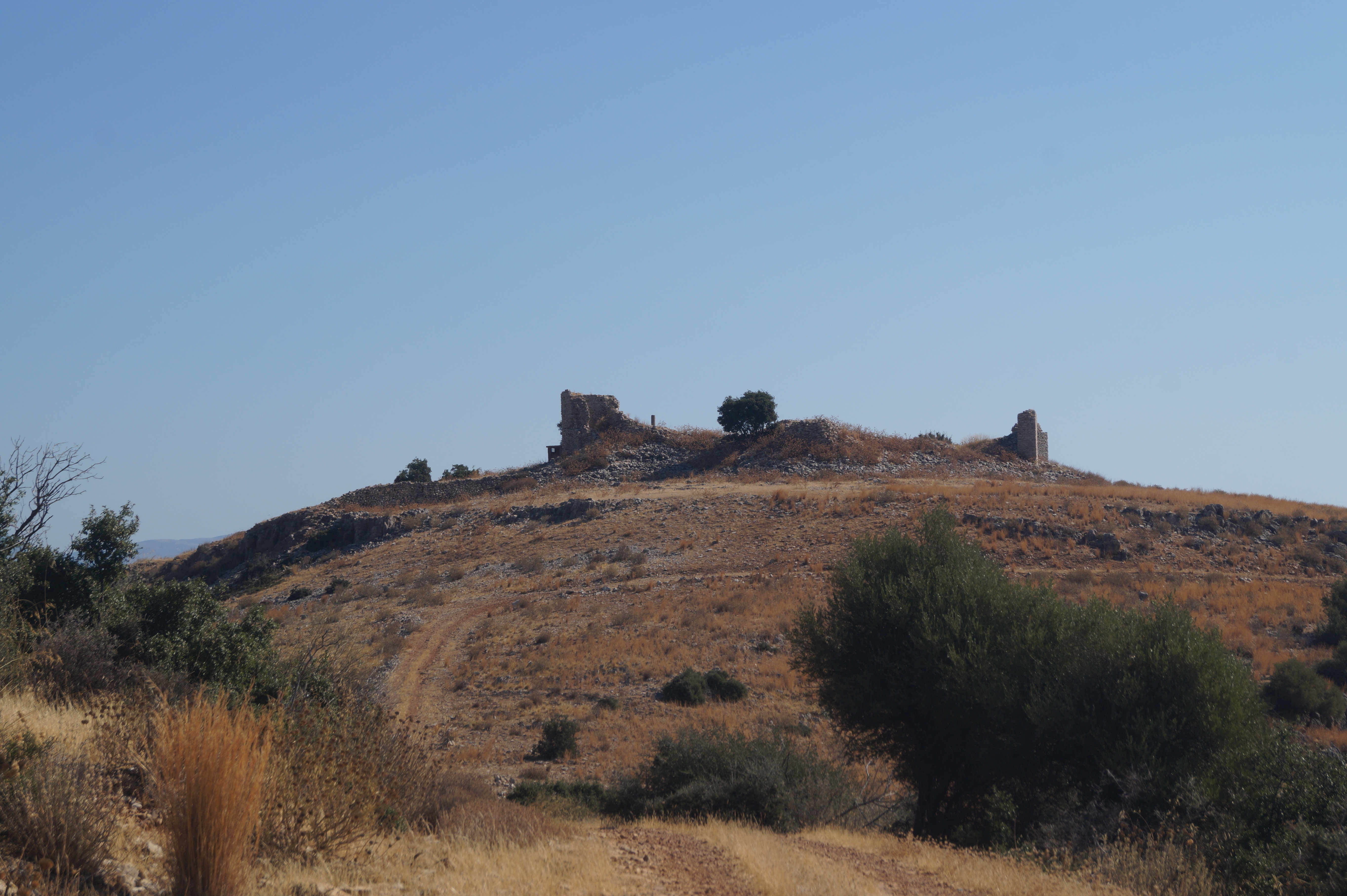
Castle Kiveri
Built during the 14th century AD, the remains of the Castle of Kiveri. are located on Pontinos Hill, overlooking the Argolic Gulf. While there are mentions of a Temple of Athena Saitis by Pausanias in this location, the structures that remain date to the Frankish period and are attributed to Gautier de Brienne. The castle and surrounding structures are said to have been destroyed during the firstOttoman–Venetian War (1463–1479)
The First Ottoman–Venetian War was fought between the Republic of Venice and her allies and the Ottoman Empire from 1463 to 1479. Fought shortly after the capture of Constantinople and the remnants of the Byzantine Empire by the Ottomans, it ...
.
Today, a few standing structures remaining and a modern church can be found on the top of the hill.
Population
References
See also
*List of settlements in Argolis
This is a list of settlements in Argolis, Greece.
* Achladokampos
* Adami, Argolis, Adami
* Agia Triada, Argolis, Agia Triada
* Agios Adrianos
* Agios Dimitrios, Argolis, Agios Dimitrios
* Agios Nikolaos, Argolis, Agios Nikolaos
* Alea, Argolis, ...
{{Argos-Mykines div
Populated places in Argolis