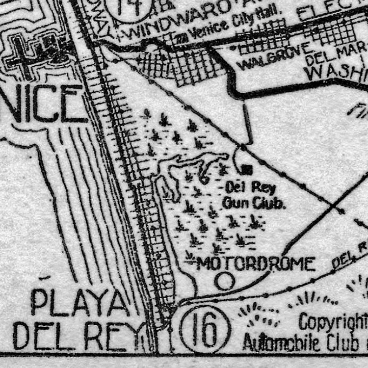
Motordrome, California on:
[Wikipedia]
[Google]
[Amazon]
 Motordrome is an archaic placename in

“Birdseye view of resorts near Los Angeles, California” incl Motordrome (via LMU Digital Collections)
Former settlements in Los Angeles County, California Former populated places in California {{LosAngelesCountyCA-geo-stub
 Motordrome is an archaic placename in
 Los Angeles County
Los Angeles County, officially the County of Los Angeles, and sometimes abbreviated as L.A. County, is the most populous county in the United States and in the U.S. state of California, with 9,861,224 residents estimated as of 2022. It is the ...
, California
California is a U.S. state, state in the Western United States, located along the West Coast of the United States, Pacific Coast. With nearly 39.2million residents across a total area of approximately , it is the List of states and territori ...
. It designates a rail spur that existed in the 1910s on the Redondo Beach via Del Rey Line, named for the Los Angeles Motordrome
The Los Angeles Motordrome was a circular wood board race track. It was located in Playa del Rey, California, and opened in 1910. In addition to automobile racing, it was used for motorcycle competition and aviation activities.
The Motordr ...
race track and airfield.
Even though the racetrack was destroyed in a fire in 1913, and the rails were removed by 1918, the place name persisted on USGS
The United States Geological Survey (USGS), formerly simply known as the Geological Survey, is a scientific agency of the United States government. The scientists of the USGS study the landscape of the United States, its natural resources, a ...
survey maps until at least the 1930s.
The Barnes Circus train partially derailed at Motordrome in 1914, injuring four.
Motordrome station lay at an elevation of 7 feet (2 m).
The coordinates for Motordrome preserved in the GNIS
The Geographic Names Information System (GNIS) is a database of name and locative information about more than two million physical and cultural features throughout the United States and its territories, Antarctica, and the associated states of ...
() place it near the present-day intersections of Jefferson Boulevard
Jefferson Boulevard is a street in Los Angeles and Culver City, California. Its eastern terminus is at Central Avenue east of Exposition Park. At its entrance to Culver City, it splits with National Boulevard. North of Sawtelle Boulevard, it ...
and Culver Boulevard, in what is now the Ballona Wetlands Ecological Reserve.


See also
*Alla, California
Alla is a former streetcar station and archaic place name located near Marina del Rey in the Westside region of Los Angeles County, California.
The former Glen Alla Park (now Bill Rosendahl Del Rey Park) is also derivative of this place name; t ...
* Alsace, California
Alsace is an archaic place name. Originally an interurban trolley stop, the name now informally designates an approximately five-block area of unincorporated Los Angeles County in the Westside region, surrounded by the north-of-Jefferson sect ...
* Cypress Grove, California
* Machado, California
Machado refers to three locations in Los Angeles, California, all named for the rancho-era Machado family. Machado is a name derived from Portuguese meaning "hatchet", the stop was probably more directly named for the Machado family of the Ranc ...
References
External links
“Birdseye view of resorts near Los Angeles, California” incl Motordrome (via LMU Digital Collections)
Former settlements in Los Angeles County, California Former populated places in California {{LosAngelesCountyCA-geo-stub