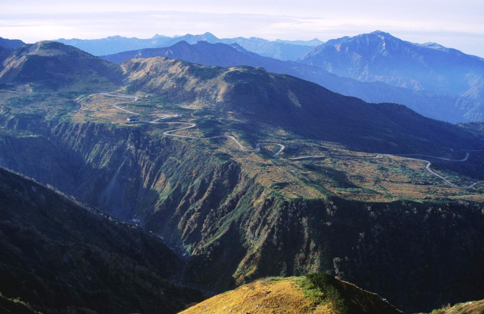
Midagahara Plateau on:
[Wikipedia]
[Google]
[Amazon]


 is a wetlands located near


 is a wetlands located near
 Tateyama Tateyama may refer to:
People with the surname
* Midori Tateyama, Japanese writer
* Shohei Tateyama (born 1981), Japanese baseball player
* Yoshinori Tateyama (born 1975), Japanese baseball player
* Homarefuji Yoshiyuki (born 1985), Japanese su ...
in Toyama Prefecture
is a prefecture of Japan located in the Chūbu region of Honshu. Toyama Prefecture has a population of 1,044,588 (1 June 2019) and has a geographic area of 4,247.61 km2 (1,640.01 sq mi). Toyama Prefecture borders Ishikawa Prefecture to the ...
, in Japan. the remaining 80,000 ha of wetlands have been designated a Ramsar Site
A Ramsar site is a wetland site designated to be of international importance under the Ramsar Convention,8 ha (O)
*** Permanent 8 ha (P)
*** Seasonal Intermittent < 8 ha(Ts)
**
 Midagahara is 2km of Horizontal length and 4km of vertical length.
Midagahara is a lava plateau formed by Tateyama volcano.
Midagahara is 2km of Horizontal length and 4km of vertical length.
Midagahara is a lava plateau formed by Tateyama volcano.野崎保、菊川茂:立山カルデラの形成と深層崩壊の歴史 -鳶泥と国見泥-
日本地すべり学会誌 Vol.49(2012) No.4 p.196-203
File:Kokumin-shukusha Tateyamaso, zenkei.jpg, TATEYAMA SOU of National youth hostels
File:Midagahara Hotel, zenkei.jpg, Midagahara Hotel
File:Midagahara (Tateyama), bun stop.jpg, Midagahara bus stop
Tateyama Kurobe Alpine Route
The is a mountain sightseeing route between Tateyama, Toyama and Ōmachi, Nagano, Japan. Opened on June 1, 1971, it is long, with a difference in elevation of as much as .
The Alpine Route goes through Tateyama in the Hida Mountains with man ...
.
Geography
 Midagahara is 2km of Horizontal length and 4km of vertical length.
Midagahara is a lava plateau formed by Tateyama volcano.
Midagahara is 2km of Horizontal length and 4km of vertical length.
Midagahara is a lava plateau formed by Tateyama volcano.日本地すべり学会誌 Vol.49(2012) No.4 p.196-203
Biota
There are Dactylorhiza aristata, Paris japonica,Lysichiton camtschatcensis
''Lysichiton camtschatcensis'', common name Asian skunk cabbage, white skunk cabbage, Far Eastern swamp lantern or Japanese swamp lantern, is a plant found in swamps and wet woods, along streams and in other wet areas of the Kamchatka Peninsula, ...
, Daylily
A daylily or day lily is a flowering plant in the genus ''Hemerocallis'' , a member of the family Asphodelaceae, subfamily Hemerocallidoideae. Despite the common name, it is not in fact a lily. Gardening enthusiasts and horticulturists have long ...
.
Facility
There are some Hotels.Access
There are Midagahara bus stops betweenBijodaira Station
is a funicular station in Tateyama, Nakaniikawa District, Toyama Prefecture, Japan.
Lines
*Tateyama Kurobe Kankō
**Tateyama Cable Car (Tateyama Kurobe Alpine Route
The is a mountain sightseeing route between Tateyama, Toyama and Ōmach ...
and Murodō Station
is a trolleybus station in Tateyama, Toyama, Japan. It is situated on the Murodō Plateau, 2,400 m above sea level.
Murodō is the main station providing access to the Japanese Alps, including Mount Tate and Mount Tsurugi.
Lines
*Tateyama Kur ...
on Tateyama Kurobe Alpine Route.
Private cars aren't allowed to pass in Midagahara to protect the environment.
See Also
*List of volcanoes in Japan
This is a list of active and extinct volcanoes in Japan. An Orange background indicates a volcano considered active by the Japan Meteorological Agency.
Hokkaido
Honshū
Izu Islands
Ogasawara Archipelago
The Ogasawara Archipelag ...
*List of lakes in Japan
The list of lakes in Japan ranked by surface area.
1) For lakes in the Hokkaidō region, Subprefecture is listed
See also
*List of lakes by area
*List of lakes by depth
*List of lakes by volume
References
*The Japanese Ministry of Land, Infra ...
References
External links Tateyama kurobe Geopark
See also
*Mount Tate
, commonly referred to as Tateyama, is a mountain located in the southeastern area of Toyama Prefecture, Japan. It is one of the tallest mountains in the Hida Mountains at . It is one of Japan's along with Mount Fuji and Mount Haku. Tateyama ...
*Chūbu-Sangaku National Park
is a national park in the Chūbu region of Japan. It was established around the Hida Mountains and encompasses parts of Nagano, Gifu, Toyama and Niigata prefectures. It was designated a national park on December 4, 1934, along with Daisetsuza ...
*Tateyama Kurobe Alpine Route
The is a mountain sightseeing route between Tateyama, Toyama and Ōmachi, Nagano, Japan. Opened on June 1, 1971, it is long, with a difference in elevation of as much as .
The Alpine Route goes through Tateyama in the Hida Mountains with man ...
{{Coord, 36.5666, 137.5333, display=title
Wetlands of Japan
Ramsar sites in Japan
Landforms of Toyama Prefecture
Tateyama, Toyama
Chūbu-Sangaku National Park
Tateyama Kurobe Alpine Route