May Zegzeg on:
[Wikipedia]
[Google]
[Amazon]
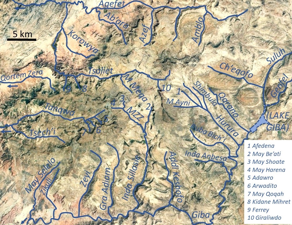
May Zegzeg is a river of the 

Nile
The Nile, , Bohairic , lg, Kiira , Nobiin language, Nobiin: Áman Dawū is a major north-flowing river in northeastern Africa. It flows into the Mediterranean Sea. The Nile is the longest river in Africa and has historically been considered ...
basin. Rising in the mountains of Dogu’a Tembien in northern Ethiopia
Ethiopia, , om, Itiyoophiyaa, so, Itoobiya, ti, ኢትዮጵያ, Ítiyop'iya, aa, Itiyoppiya officially the Federal Democratic Republic of Ethiopia, is a landlocked country in the Horn of Africa. It shares borders with Eritrea to the ...
, it flows southward to empty finally in Giba
Gilberto Amauri de Godoy Filho, known as Giba (born 23 December 1976), is a Brazilian former professional volleyball player who played as an outside hitter. For much of the 2000s, he was widely regarded as one of the best volleyball players in t ...
and Tekezé River
The Tekezé or Täkkäze River ( amh, ተከዜ, ti, ተከዘ; originally meaning "river" in Ge’ez, ), also spelled Takkaze, is a major river of Ethiopia. For part of its course it forms a section of the westernmost border of Ethiopia and Erit ...
.

Characteristics
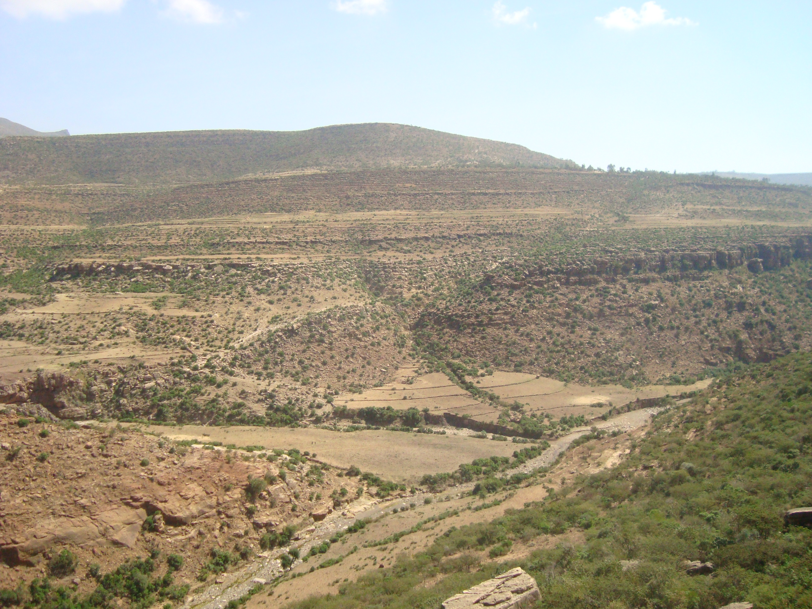
It is a confined river, locallymeander
A meander is one of a series of regular sinuous curves in the channel of a river or other watercourse. It is produced as a watercourse erodes the sediments of an outer, concave bank ( cut bank) and deposits sediments on an inner, convex bank ...
ing in its narrow alluvial plain, with an average slope gradient of 43 metres per kilometre. With its tributaries May Sho'ate
May Sho’ate (also called Argak'a) is a river of the Nile basin. Rising in the mountains of Degua Tembien, Dogu’a Tembien in northern Ethiopia, it flows southward to empty finally in Giba River, Giba and Tekezé River.
Characteristics
It ...
and May Harena
May Harena is a river of the Nile basin. Rising in the mountains of Dogu’a Tembien in northern Ethiopia, it flows eastward to empty finally in Giba and Tekezé River.
Characteristics
It is a confined ephemeral river with an average slope ...
, the river has cut a gorge. Jointly with adjacent May Be’ati River, this river is the source of Rubaksa River.

Flash floods and flood buffering
Runoff mostly happens in the form of high runoff discharge events that occur in a very short period (calledflash floods
A flash flood is a rapid flooding of low-lying areas: washes, rivers, dry lakes and depressions. It may be caused by heavy rain associated with a severe thunderstorm, hurricane, or tropical storm, or by meltwater from ice or snow flowing o ...
). These are related to the steep topography, often little vegetation cover and intense convective rainfall. The peaks of such flash floods have often a 50 to 100 times larger discharge than the preceding baseflow
Baseflow (also called drought flow, groundwater recession flow, low flow, low-water flow, low-water discharge and sustained or fair-weather runoff) is the portion of the streamflow that is sustained between precipitation events, fed to streams by d ...
.
The magnitude of floods in this river has however been decreased due to interventions in the catchment. At Habdi Luqmuts and on other steep slopes, exclosure
An exclosure, in an area being used extensively for grazing, is a limited area from which unwanted browsing animals, such as domestic cattle or wildlife such as deer, are excluded by fencing or other means.
Environmental protection
Most commonl ...
s have been established; the dense vegetation largely contributes to enhanced infiltration
Infiltration may refer to:
Science, medicine, and engineering
*Infiltration (hydrology), downward movement of water into soil
*Infiltration (HVAC), a heating, ventilation, and air conditioning term for air leakage into buildings
*Infiltration (me ...
, less flooding and better baseflow
Baseflow (also called drought flow, groundwater recession flow, low flow, low-water flow, low-water discharge and sustained or fair-weather runoff) is the portion of the streamflow that is sustained between precipitation events, fed to streams by d ...
. Physical conservation structures such as stone bunds and check dam
A steel check dam
A check dam is a small, sometimes temporary, dam constructed across a swale, drainage ditch, or waterway to counteract erosion by reducing water flow velocity. Check dams themselves are not a type of new technology; rather, the ...
s also intercept runoff.
Boulders and pebbles in the river bed
Boulders and pebbles encountered in the river bed can originate from any location higher up in the catchment, including the following lithological units: *Phonolite
Phonolite is an uncommon extrusive rock, of intermediate chemical composition between felsic and mafic, with texture ranging from aphanitic (fine-grained) to porphyritic (mixed fine- and coarse-grained). Phonolite is a variation of the igneous ...
plugs
* Upper basalt
* Interbedded lacustrine deposits
* Lower basalt
* Amba Aradam Formation
The Amba Aradam Formation is a Cretaceous sandstone formation in Ethiopia. It is up to 200 metres thick, for instance in the Degua Tembien district. As fossils are absent, the age of the Amba Aradam Formation was interpreted based on the age of a ...
* Antalo Limestone
The Antalo Limestone, also known as the Antalo Sequence, is a geological formation in Ethiopia. It is between 300 and 800 metres thick and comprises fossiliferous limestones and marls that were deposited in a reef. Marine microfossils have shown a ...
* Quaternary
The Quaternary ( ) is the current and most recent of the three periods of the Cenozoic Era in the geologic time scale of the International Commission on Stratigraphy (ICS). It follows the Neogene Period and spans from 2.58 million years ...
freshwater tufa
Tufa is a variety of limestone formed when carbonate minerals precipitate out of water in unheated rivers or lakes. Geothermally heated hot springs sometimes produce similar (but less porous) carbonate deposits, which are known as travertine. ...
May Zegzeg Integrated Catchment Management Project
As part of outreach accompanying research inDogu'a Tembien
Dogu'a Tembien (, "Upper Tembien", sometimes transliterated as Degua Tembien) is a woreda in Tigray Region, Ethiopia. It is named in part after the former province of Tembien. Nowadays, the mountainous district is part of the Southeastern Tigray ...
, the May Zegzeg Integrated Catchment Management Project was set up in 2004 in the catchment of the May Zegzeg River by researchers in cooperation with ADCS, a local NGO. The project included the implementation of conservation techniques to increase water infiltration and conserve the soil. The objective was to improve the livelihood of the communities of Harena, Hech'i
Ayninbirkekin is a ''tabia'' or municipality in the Dogu'a Tembien district of the Tigray Region of Ethiopia. Literal meaning of Ayninbirkekin in Tigrinya is "We will not bend". The ''tabia'' centre is in Halah village, located approximately 8&n ...
and Addi Qolqwal as well as to demonstrate and promote global catchment management
A drainage basin is an area of land where all flowing surface water converges to a single point, such as a river mouth, or flows into another body of water, such as a lake or ocean. A basin is separated from adjacent basins by a perimeter, the ...
in the district. The results of the implementation of site-specific conservation techniques aimed at increasing water infiltration and conserving soil were particularly monitored in the headwaters at May Sho'ate
May Sho’ate (also called Argak'a) is a river of the Nile basin. Rising in the mountains of Degua Tembien, Dogu’a Tembien in northern Ethiopia, it flows southward to empty finally in Giba River, Giba and Tekezé River.
Characteristics
It ...
: dry masonry stone bunds, check dams in gullies, and the set-aside of degraded rangelands which resulted in exclosure
An exclosure, in an area being used extensively for grazing, is a limited area from which unwanted browsing animals, such as domestic cattle or wildlife such as deer, are excluded by fencing or other means.
Environmental protection
Most commonl ...
s.
Natural boundary
Over its full course, this river constitutes the border betweenMika'el Abiy
Mika’el Abiy is a ''tabia'' or municipality in the Dogu’a Tembien district of the Tigray Region of Ethiopia. The ''tabia'' centre is in Megesta village, located approximately 7 km to the southeast of the ''woreda'' town Hagere Selam.
...
(at the west) and Ayninbirkekin
Ayninbirkekin is a ''tabia'' or municipality in the Degua Tembien, Dogu'a Tembien district of the Tigray Region of Ethiopia. Literal meaning of Ayninbirkekin in Tigrinya is "We will not bend". The ''tabia'' centre is in Halah village, located app ...
municipalities (at the east)
Trekking along the river
Trekking routes have been established across and along this river. The tracks are not marked on the ground but can be followed using downloaded .GPX files. * Trek 12, runs parallel to the river on the eastern bank, fromMay Sho'ate
May Sho’ate (also called Argak'a) is a river of the Nile basin. Rising in the mountains of Degua Tembien, Dogu’a Tembien in northern Ethiopia, it flows southward to empty finally in Giba River, Giba and Tekezé River.
Characteristics
It ...
to Rubaksa
In the rainy season, flash floods may occur and it is advised not to follow the river bed.
See also
*List of Ethiopian rivers
This is a list of streams and rivers in Ethiopia, arranged geographically by drainage basin. There is an alphabetic list at the end of this article.
Flowing into the Mediterranean
*''Nile (Egypt, Sudan)''
Atbarah River
*Mareb River (or G ...
References
{{reflist Rivers of Ethiopia Dogu'a Tembien Tigray Region Nile basin