Loxodromic Navigation on:
[Wikipedia]
[Google]
[Amazon]
 Loxodromic navigation (from

algorithms/ assistance program for loxodromic navigation
Navigation Spherical curves
 Loxodromic navigation (from
 Greek
Greek may refer to:
Greece
Anything of, from, or related to Greece, a country in Southern Europe:
*Greeks, an ethnic group.
*Greek language, a branch of the Indo-European language family.
**Proto-Greek language, the assumed last common ancestor ...
''λοξóς'', oblique, and ''δρóμος'', path) is a method of navigation by following a rhumb line
In navigation, a rhumb line, rhumb (), or loxodrome is an arc crossing all meridians of longitude at the same angle, that is, a path with constant bearing as measured relative to true north.
Introduction
The effect of following a rhumb li ...
, a curve on the surface of the Earth
Earth is the third planet from the Sun and the only astronomical object known to harbor life. While large volumes of water can be found throughout the Solar System, only Earth sustains liquid surface water. About 71% of Earth's surfa ...
that follows the same angle at the intersection with each meridian
Meridian or a meridian line (from Latin ''meridies'' via Old French ''meridiane'', meaning “midday”) may refer to
Science
* Meridian (astronomy), imaginary circle in a plane perpendicular to the planes of the celestial equator and horizon
* ...
. This serves to maintain a steady course in sailing.
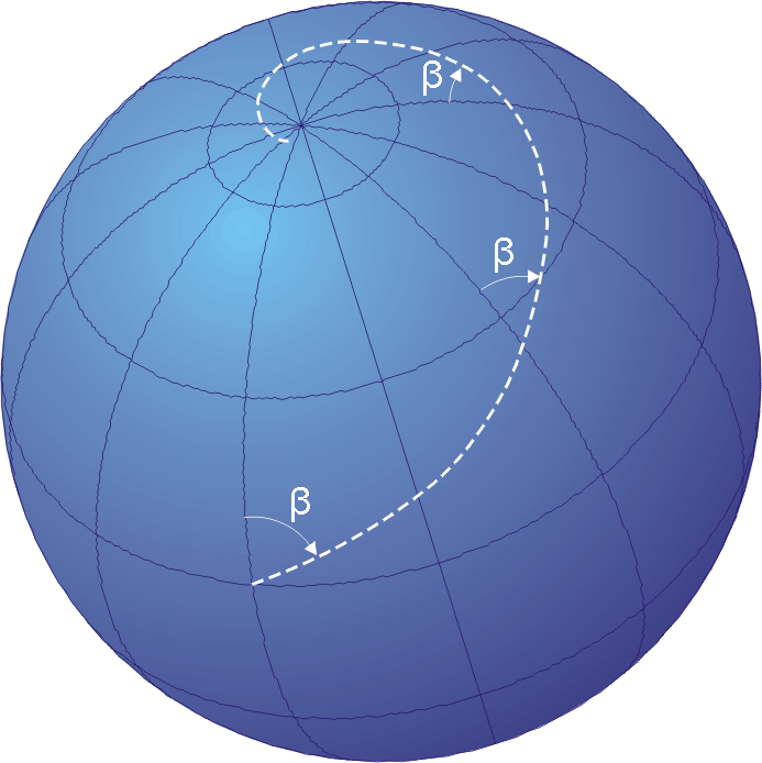
Navigating on a spherical surface with a fixed course ( in the figure) results in a spiral path that approaches the North Pole
The North Pole, also known as the Geographic North Pole or Terrestrial North Pole, is the point in the Northern Hemisphere where the Earth's axis of rotation meets its surface. It is called the True North Pole to distinguish from the Mag ...
for courses ranging from 270º to 090º and the South Pole
The South Pole, also known as the Geographic South Pole, Terrestrial South Pole or 90th Parallel South, is one of the two points where Earth's axis of rotation intersects its surface. It is the southernmost point on Earth and lies antipod ...
for courses from 090º to 270º. On a nautical chart
A nautical chart is a graphic representation of a sea area and adjacent coastal regions. Depending on the scale of the chart, it may show depths of water and heights of land (topographic map), natural features of the seabed, details of the coa ...
plotted according to the Mercator projection
The Mercator projection () is a cylindrical map projection presented by Flemish geographer and cartographer Gerardus Mercator in 1569. It became the standard map projection for navigation because it is unique in representing north as up and sou ...
, a loxodromic course appears as a straight line.
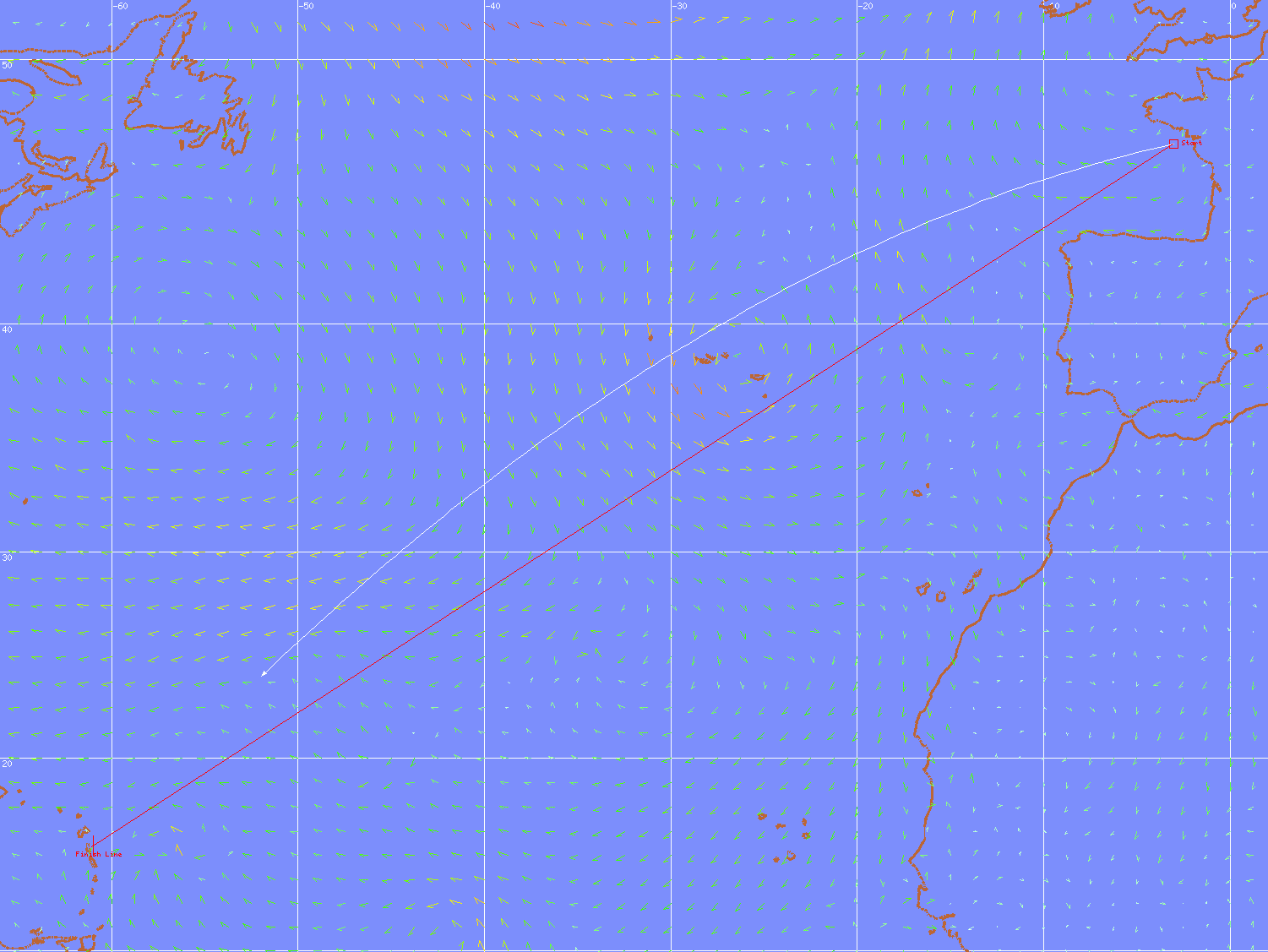
Comparison Chart

See also
* Great circle navigation * Windrose network *Map
A map is a symbolic depiction emphasizing relationships between elements of some space, such as objects, regions, or themes.
Many maps are static, fixed to paper or some other durable medium, while others are dynamic or interactive. Although ...
* Portolan map
Portolan charts are nautical charts, first made in the 13th century in the Mediterranean Sea, Mediterranean basin and later expanded to include other regions. The word ''portolan'' comes from the Italian language, Italian ''portulano'', meaning " ...
* Marine sandglass
A marine sandglass is a timepiece of simple design that is a relative of the common hourglass, a marine (nautical) instrument known since the 14th century (although reasonably presumed to be of very ancient use and origin). Sandglasses were used t ...
* Compass rose
A compass rose, sometimes called a wind rose, rose of the winds or compass star, is a figure on a compass, map, nautical chart, or monument used to display the orientation of the cardinal directions (north, east, south, and west) and their int ...
* Isoazimuthal The isoazimuth is the locus of the points on the Earth's surface whose initial orthodromic course with respect to a fixed point is constant.
That is, if the initial orthodromic course Z from the starting point ''S'' to the fixed point ''X'' is 8 ...
References
{{reflist *http://journals.cambridge.org/action/displayAbstract?fromPage=online&aid=6233256External links
algorithms/ assistance program for loxodromic navigation
Navigation Spherical curves