List Of Streets In Amsterdam on:
[Wikipedia]
[Google]
[Amazon]
List of streets in Amsterdam


A
* Anjeliersgracht Now named Westerstraat, the street filled in in 1861.D
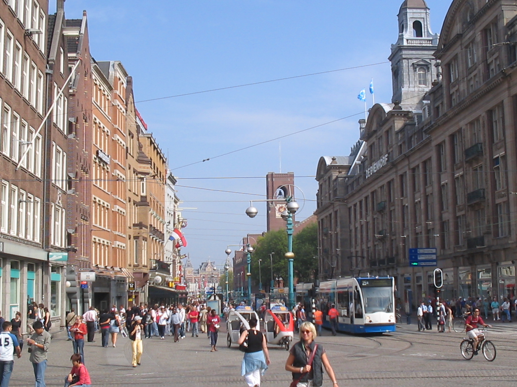
*Damrak
The Damrak is an avenue and partially filled in canal at the centre of Amsterdam, running between Amsterdam Centraal in the north and Dam Square in the south. It is the main street where people arriving at the station enter the centre of Amsterda ...
* De Clercqstraat
E
*Elandsgracht
The Elandsgracht is a street and former canal in Amsterdam, the Netherlands.
It runs between the Prinsengracht and the Singelgracht in the Jordaan neighborhood of the Amsterdam-Centrum district.
Bridge 169 over the Singelgracht and Bridge 107 ove ...
F
*Ferdinand Bolstraat
The Ferdinand Bolstraat is a street in Amsterdam, named after the artist Ferdinand Bol in 1872.
Description
The Ferdinand Bolstraat has traditionally been, and continues to be, primarily a shopping street. It is a major artery of the neighbo ...
G
* GoudsbloemgrachtH
*Heiligeweg
The Heiligeweg (Dutch - Holy Street or Holy Way) is the street in Amsterdam that used to lead from the Kapel ter Heilige Stede (Chapel of the Holy Site, a pilgrimage chapel on the site where the 1345 Miracle of Amsterdam occurred) to the Kalver ...
J
* JodenbreestraatK
*Kalverstraat
The Kalverstraat (, ) is a busy shopping street of Amsterdam, the capital of the Netherlands. The street runs roughly North-South for about 750 meters, from Dam Square to Muntplein square.
The Kalverstraat is the most expensive shopping stre ...
* Kromme Waal
L
* LindengrachtM
*Markengracht
The Markengracht was a canal in Amsterdam. For many years it was at the heart of the slums of the poor Jewish neighborhood. It was filled in 1968 as part of a complete rehabilitation of the area combined with construction of the IJtunnel, opened ...
*Marnixstraat
Marnixstraat is a main street in the Dutch city of Amsterdam , on the western border of the Jordaan in the Amsterdam-Centrum. The street is located between Haarlemmerplein and Leidseplein, parallel to Lijnbaansgracht.
History
Marnixstraat is a ...
is a main street in Amsterdam. A large bus depot and the main police station are located on the street.
* Martelaarsgracht
N
*Nes (Amsterdam)
Nes (; sometimes called de Nes, "the Nes") is a narrow, old, street in central Amsterdam, Netherlands. It runs parallel to and to the east of Rokin, between Dam Square to the north and Grimburgwal to the south.
The Dutch word ''nes'' means he ...
* Nieuwe Achtergracht
*Nieuwendijk, Amsterdam
The Nieuwendijk is a major shopping street in central Amsterdam. There are some 200 shops along the street. The street, which dates to the early medieval history of Amsterdam, counts 98 buildings with status.
The Nieuwendijk runs northeast from ...
* Nieuwezijds Achterburgwal
* Nieuwezijds Voorburgwal
P
* P.C. Hooftstraat * Palmgracht *Prins Hendrikkade
Prins Hendrikkade (Dutch for "Prince Henry's Quay") is a major street in the centre of Amsterdam. It passes Amsterdam Central Station, intersects the Damrak at the mouth of the Amstel river, and forms the southern end of the IJtunnel across the ...
R
* Raadhuisstraat * Rapenburg (Amsterdam) *Rokin
The Rokin is a canal and major street in the centre of Amsterdam. The street runs from Muntplein square to Dam square. The Rokin canal used to run from Muntplein square to Dam Square, but in 1936, the part between Spui square and Dam Square was ...
*Rozengracht
The Rozengracht is a street in the Jordaan neighbourhood of Amsterdam.
It runs between the Prinsengracht at the Westermarkt and the Singel canal at De Clercqstraat.
The name means "Rose canal".
The Rozengracht is one of the six former canals in ...
S
*Sarphatistraat
The Sarphatistraat is a street in the center of Amsterdam between Frederiksplein and Oostenburgergracht at the Cruquiuskade.
The street crosses the Amstel and forms an almost long connection between the southern part of the Grachtengordel and the ...
* Scheepstimmermanstraat
*Singel
The Singel is one of the canals of Amsterdam. The Singel encircled Amsterdam in the Middle Ages, serving as a moat around the city until 1585, when Amsterdam expanded beyond the Singel. The canal runs from the IJ bay, near the Central Statio ...
*Sint Antoniesbreestraat
The Sint Antoniesbreestraat ("St. Anthony's Broad Street") is a street in the centre of Amsterdam in the Netherlands. The street runs south from Nieuwmarkt square to the Sint Antoniesluis sluice gates, where it continues as the Jodenbreestraat. ...
* Spiegelgracht
* Spuistraat
V
* VijzelgrachtW
*Warmoesstraat
Warmoesstraat ('Chard Street') is one of the oldest streets in Amsterdam, running parallel to Damrak from Nieuwebrugsteeg to Dam Square. Its origins are in the 13th century. In the 16th and 17th century it was the shopping street. During the Dut ...
* Westerstraat
Z
*Zeedijk
Zeedijk (''English'': "Sea dike") is a street in the old centre of Amsterdam. The street is the northern and eastern boundary of De Wallen red-light district and runs between Prins Hendrikkade and Nieuwmarkt. Historically an area riddled with ...
* Zomerdijkstraat
* Zwanenburgwal
References
{{DEFAULTSORT:Streets in Amsterdam Amsterdam-related lists Streets in Amsterdam