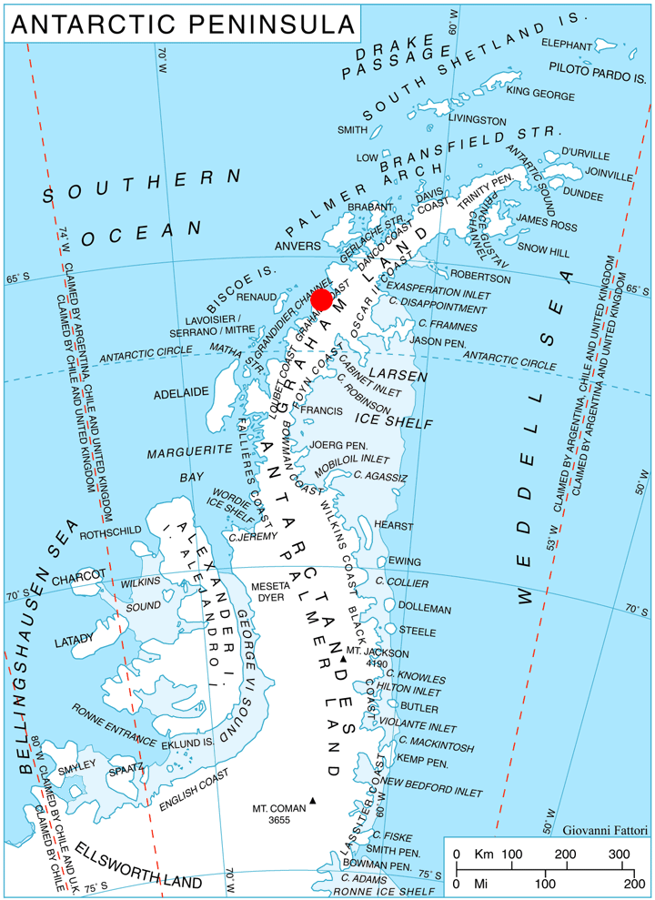
Lisiya Ridge on:
[Wikipedia]
[Google]
[Amazon]
 Lisiya Ridge ( bg, Лисийски хребет, ‘Lisiyski Hrebet’ \li-'siy-ski 'hre-bet\) is the ice-covered ridge rising to over 2100 mReference Elevation Model of Antarctica.
Polar Geospatial Center. University of Minnesota, 2019 at the base of
Antarctic Digital Database (ADD).
Scale 1:250000 topographic map of Antarctica. Scientific Committee on Antarctic Research (SCAR), 1993–2016.
Bulgarian Antarctic Gazetteer.
basic data
in English)
Lisiya Ridge.
SCAR
Lisiya Ridge.
Copernix satellite image Ridges of Graham Land Bulgaria and the Antarctic Graham Coast {{GrahamCoast-geo-stub
Polar Geospatial Center. University of Minnesota, 2019 at the base of
Magnier Peninsula
Magnier Peninsula is the mostly ice-covered peninsula projecting 18 km in northwest direction from Graham Coast in Graham Land, Antarctica. It is 17 km wide between Leroux Bay to the northeast and Bigo Bay to the southwest. Magnier Peaks rise ...
, Graham Coast
Graham Coast is the portion of the west coast of Graham Land in Antarctic Peninsula, extending 172 km between Cape Bellue to the southwest and Cape Renard to the northeast.
The coast is named after Sir James Graham, First Lord of the Admiral ...
on the west side of Antarctic Peninsula
The Antarctic Peninsula, known as O'Higgins Land in Chile and Tierra de San Martín in Argentina, and originally as Graham Land in the United Kingdom and the Palmer Peninsula in the United States, is the northernmost part of mainland Antarctic ...
, extending 16 km in northeast-southwest direction between the heads of Leroux Bay
Leroux Bay () is a bay long in a northwest–southeast direction and averaging wide, between Nunez Point and the narrow Magnier Peninsula surmounted by the Magnier Peaks and Lisiya Ridge, along the west coast of Graham Land, Antarctica. The ...
and Bigo Bay
Bigo Bay () is a bay long and wide, indenting the west coast of Graham Land between Cape Garcia and Magnier Peninsula surmounted by the Magnier Peaks and Lisiya Ridge.
The French Antarctic Expedition, 1908–10, first sighted this bay but ch ...
, and 11 km wide. Bounded by Comrie Glacier to the south and a tributary to Luke Glacier to the east. Featuring Mount Bigo at its southwest extremity and Mount Perchot in its central part. Precipitous, partly ice-free northwest slopes drained by the glaciers Muldava, Nesla
Nesla is a village in Dragoman Municipality, Sofia Province, western Bulgaria
Bulgaria (; bg, България, Bǎlgariya), officially the Republic of Bulgaria,, ) is a country in Southeast Europe. It is situated on the eastern flank of ...
and Kolosh
Kolosh ( fa, كلش) is a village in Minabad Rural District, Anbaran District, Namin County, Ardabil Province, Iran. At the 2006 census, its population was 744, in 224 families.
References
Towns and villages in Namin County
{{Namin-ge ...
.
The ridge is named after the settlement of Lisiya in Southwestern Bulgaria
Bulgaria (; bg, България, Bǎlgariya), officially the Republic of Bulgaria,, ) is a country in Southeast Europe. It is situated on the eastern flank of the Balkans, and is bordered by Romania to the north, Serbia and North Macedon ...
.
Location
Lisiya Ridge is centred at .British
British may refer to:
Peoples, culture, and language
* British people, nationals or natives of the United Kingdom, British Overseas Territories, and Crown Dependencies.
** Britishness, the British identity and common culture
* British English, ...
mapping in 1971.
Maps
*British Antarctic Territory
The British Antarctic Territory (BAT) is a sector of Antarctica claimed by the United Kingdom as one of its 14 British Overseas Territories, of which it is by far the largest by area. It comprises the region south of 60°S latitude and between ...
. Scale 1:200000 topographic map. DOS 610 Series, Sheet W 65 64. Directorate of Overseas Surveys, Tolworth, UK, 1971.
Antarctic Digital Database (ADD).
Scale 1:250000 topographic map of Antarctica. Scientific Committee on Antarctic Research (SCAR), 1993–2016.
Notes
References
Bulgarian Antarctic Gazetteer.
Antarctic Place-names Commission
The Antarctic Place-names Commission was established by the Bulgarian Antarctic Institute in 1994, and since 2001 has been a body affiliated with the Ministry of Foreign Affairs of Bulgaria.
The Commission approves Bulgarian place names in ...
. (details in Bulgarianbasic data
in English)
Lisiya Ridge.
SCAR
Composite Gazetteer of Antarctica
The Composite Gazetteer of Antarctica (CGA) of the Scientific Committee on Antarctic Research (SCAR) is the authoritative international gazetteer containing all Antarctic toponyms published in national gazetteers, plus basic information about th ...
External links
Lisiya Ridge.
Copernix satellite image Ridges of Graham Land Bulgaria and the Antarctic Graham Coast {{GrahamCoast-geo-stub