Kryoneri, Corinthia on:
[Wikipedia]
[Google]
[Amazon]
Kryoneri ( el, Κρυονέρι, before 1955: Μάτζανη - ''Matzani''Name changes of settlements in Greece
/ref>) is a village in
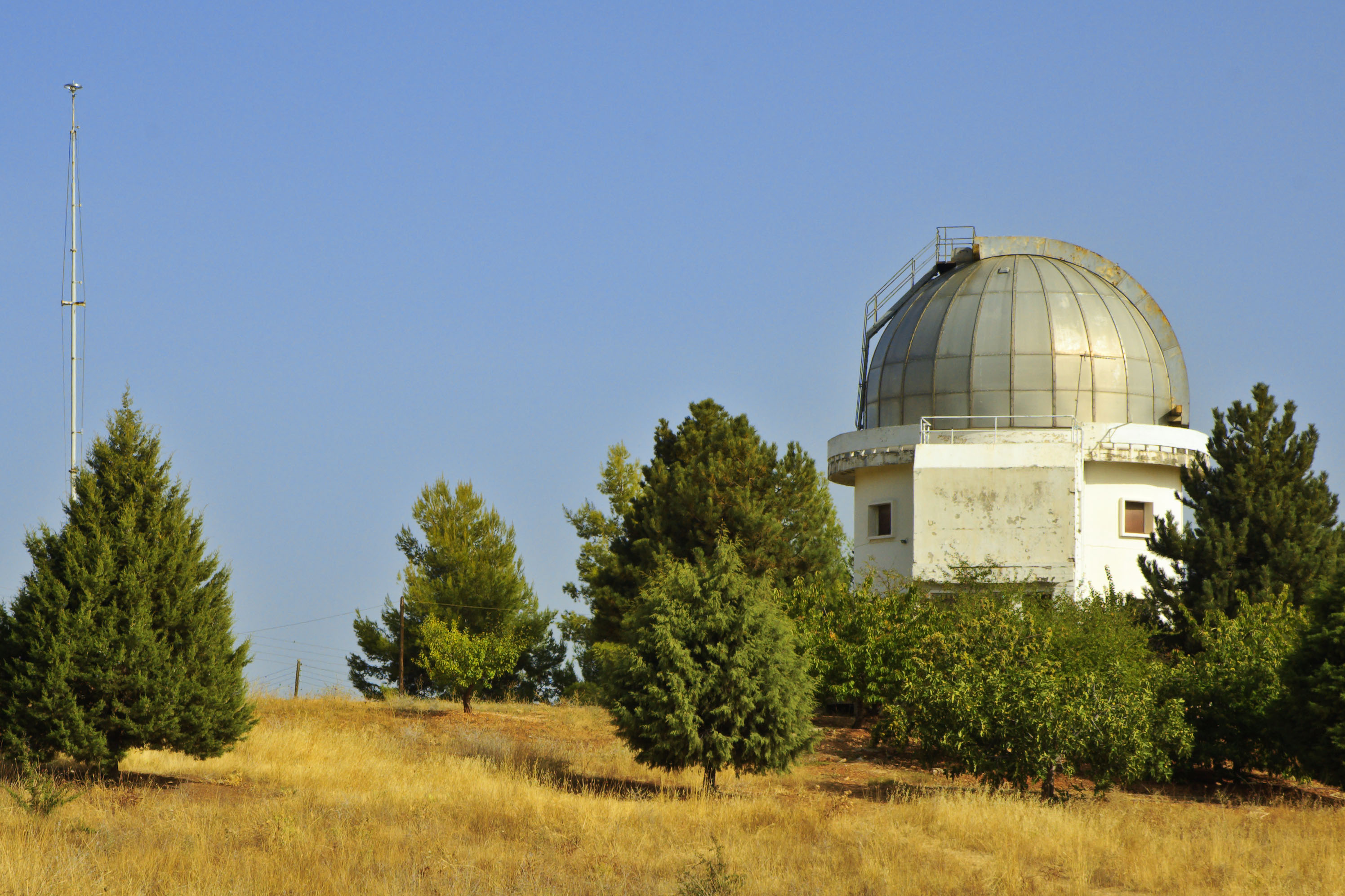
 The Kryoneri Astronomical Station observatory was built in 1974–75 at a height of 1000 meters. It has the second biggest telescope in Greece after the Chelmos Observatory. Its
/ref>) is a village in
Corinthia
Corinthia ( el, Κορινθία ''Korinthía'') is one of the regional units of Greece. It is part of the modern regions of Greece, region of Peloponnese (region), Peloponnese. It is situated around the city of Corinth, in the north-eastern part ...
regional unit, Greece
Greece,, or , romanized: ', officially the Hellenic Republic, is a country in Southeast Europe. It is situated on the southern tip of the Balkans, and is located at the crossroads of Europe, Asia, and Africa. Greece shares land borders ...
. It is 42 km southwest of Corinth
Corinth ( ; el, Κόρινθος, Kórinthos, ) is the successor to an ancient city, and is a former municipality in Corinthia, Peloponnese (region), Peloponnese, which is located in south-central Greece. Since the 2011 local government refor ...
, built at 740 m height, in the slopes of Velisa mountain (part of Cyllene mountain). Kryoneri is part of the municipality of Sikyona
Sikyona ( el, Σικυώνα) is a municipality in Corinthia, Greece. The seat of the municipality is in Kiato. Sikyona takes its name from the ancient city Sicyon, which was located in the same territory.
Municipality
The municipality Sikyona wa ...
. The village was flown through by a stream, tributary of Elisson River. Kryoneri has panoramic view towards northeast Corinthia until the coasts of Saronic and Corinthian gulf. Its population is 868 inhabitants according to 2011 census.
History
The first name of the settlement was Mergeni, which possibly means grass land. This name derived from theFranks
The Franks ( la, Franci or ) were a group of Germanic peoples whose name was first mentioned in 3rd-century Roman sources, and associated with tribes between the Lower Rhine and the Ems River, on the edge of the Roman Empire.H. Schutz: Tools, ...
who dominated the Peloponnese during the 13th and 14th centuries. The current name was given in 1954 which means a place with cold water. The village took part in the Greek War of Independence, where a chieftain from Kryoneri with the surname Stergiopoulos is mentioned.
Historical population
Places of interest
 The Kryoneri Astronomical Station observatory was built in 1974–75 at a height of 1000 meters. It has the second biggest telescope in Greece after the Chelmos Observatory. Its
 catoptric
Catoptrics (from grc-gre, κατοπτρικός ''katoptrikós'', "specular", from grc-gre, κάτοπτρον ''katoptron'' "mirror") deals with the phenomena of reflected light and image-forming optical systems using mirrors. A catoptric ...
lens is 122 cm diameter.
Located 4 km southwest of the village is the monastery of the Assumption of the Theotokos Lechova. It is built at 1050 m height. The catholicon of the monastery dates from Byzantine times, while other parts of the monastery belong to the 12th or 13th century.
Near the village there is a cemetery of the Mycenaean era
Mycenaean Greece (or the Mycenaean civilization) was the last phase of the Bronze Age in Ancient Greece, spanning the period from approximately 1750 to 1050 BC.. It represents the first advanced and distinctively Greek civilization in mainland ...
. It includes ruins of 10 vaulted tombs. In the place Koutroumbi there are some ruins of a Mycenaean acropolis.
References
{{Sikyona div Populated places in Corinthia