|
Sikyona
Sikyona ( el, Σικυώνα) is a municipality in Corinthia, Greece. The seat of the municipality is in Kiato. Sikyona takes its name from the ancient city Sicyon, which was located in the same territory. Municipality The municipality Sikyona was formed at the 2011 local government reform by the merger of the following 3 former municipalities, that became municipal units: *Feneos *Sikyona *Stymfalia The municipality has an area of 602.539 km2, the municipal unit 171.268 km2. The municipal unit Sikyona is subdivided into the following communities: * Archaia Sikyona-Vasiliko * Bozikas * Diminio * Gonoussa * Kato Diminio * Sikyona (Kiato) * Klimenti * Kryoneri * Laliotis * Megas Valtos * Mikros Valtos * Moulki * Paradeisi * Pasi * Souli * Titani Titani ( el, Τιτάνη, ''Titáni''; before 1927: Voivonta (Βοϊβοντά, ''Voïvontá''), from the Slavic title "voivode") is a village in the municipality of Sikyona, Corinthia, Greece. It is situated at the foot of the moun ... [...More Info...] [...Related Items...] OR: [Wikipedia] [Google] [Baidu] |
Kryoneri, Corinthia
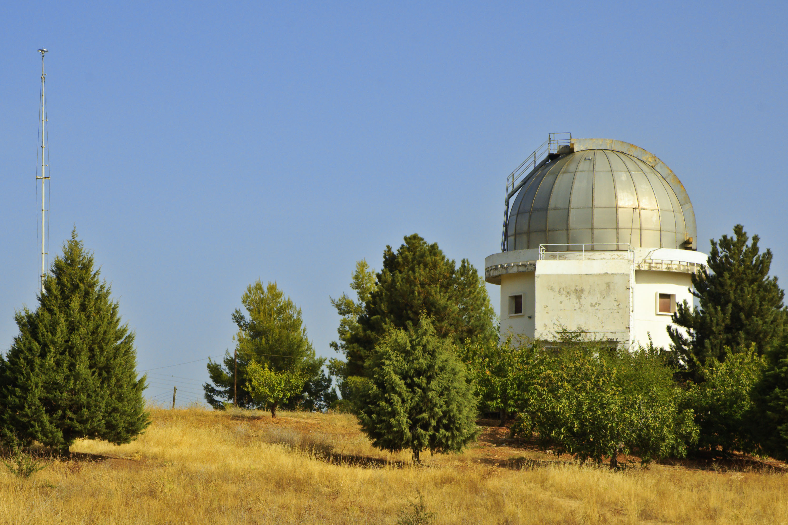
Kryoneri ( el, Κρυονέρι, before 1955: Μάτζανη - ''Matzani'') is a village in Corinthia regional unit, Greece. It is 42 km southwest of Corinth, built at 740 m height, in the slopes of Velisa mountain (part of Cyllene mountain). Kryoneri is part of the municipality of Sikyona. The village was flown through by a stream, tributary of Elisson River. Kryoneri has panoramic view towards northeast Corinthia until the coasts of Saronic and Corinthian gulf. Its population is 868 inhabitants according to 2011 census. History The first name of the settlement was Mergeni, which possibly means grass land. This name derived from the Franks who dominated the Peloponnese during the 13th and 14th centuries. The current name was given in 1954 which means a place with cold water. The village took part in the Greek War of Independence, where a chieftain from Kryoneri with the surname Stergiopoulos is mentioned. Historical population Places of interest The Kryoneri Astrono ... [...More Info...] [...Related Items...] OR: [Wikipedia] [Google] [Baidu] |
Bozikas
Bozikas ( el, Μποζικάς) is a village in the municipality of Sikyona, Corinthia, Greece. It is north of Nemea and southwest of Kiato. The village has about 250 inhabitants and is located at an elevation of . The red wine Agiorgitiko Agiorgitiko ( el, Αγιωργίτικο; also known as Aghiorghitiko) is a red Greek wine grape variety that, as of 2012, was the most widely planted red grape variety in Greece, ahead of Xynomavro. The grape has traditionally been grown in the ... is grown in the region. Olive oil is also produced in Bozikas. External links -Bozikas References {{Sikyona div Populated places in Corinthia ... [...More Info...] [...Related Items...] OR: [Wikipedia] [Google] [Baidu] |
Kiato
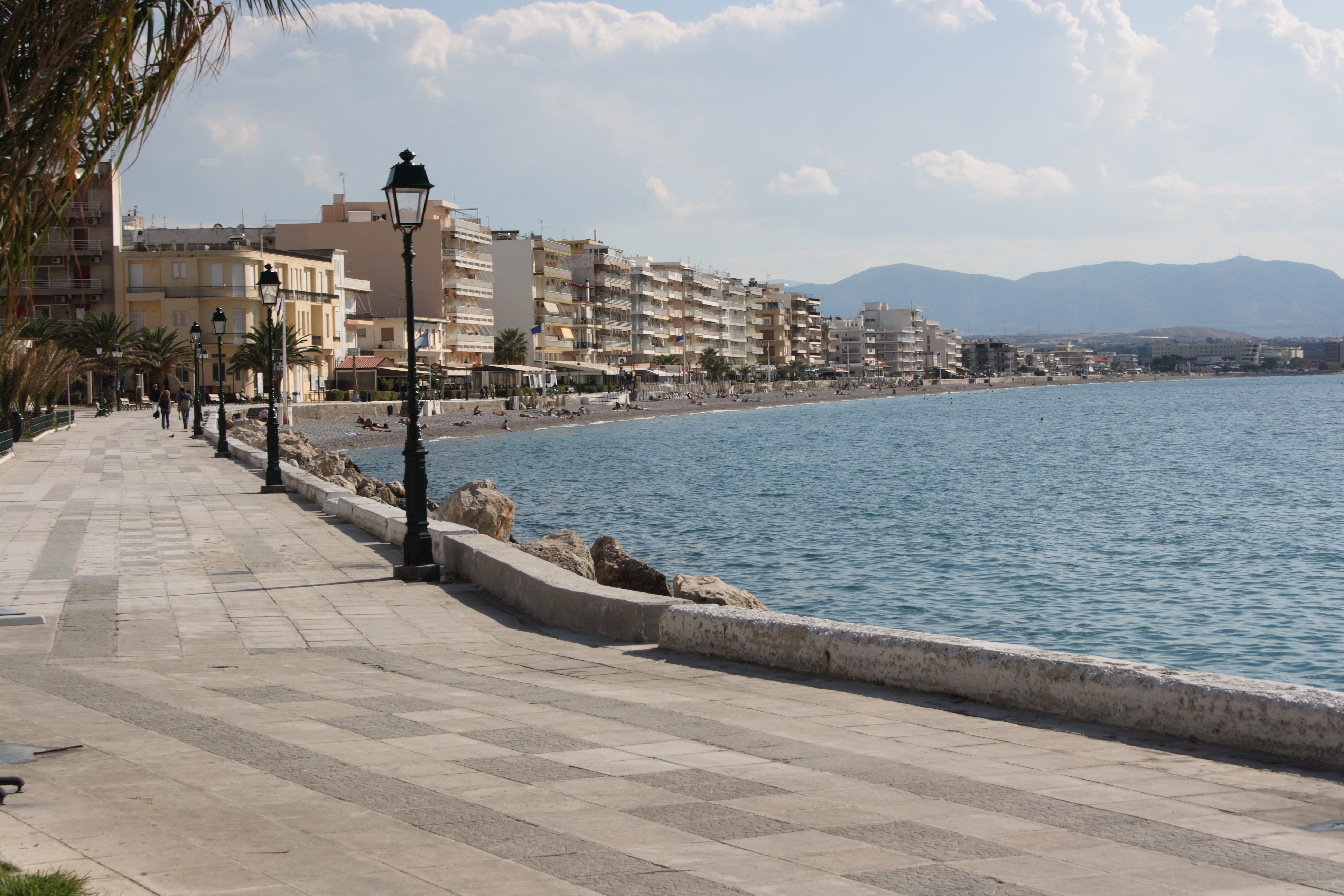
Kiato ( el, Κιάτο) is a town in the northern part of Corinthia in the Peloponnese, Greece. It is the seat of the municipality of Sikyona. Kiato is situated on the Gulf of Corinth, near the mouth of the river Asopos. It has much tourist activity mainly in the summer. The ancient city Sicyon was located 4 km southwest of present Kiato. Kiato is 4 km northwest of Velo, 13 km southeast of Xylokastro and 18 km northwest of Corinth. The Greek National Road 8A (Patras - Corinth - Athens) passes southwest of the town. It had a station on the now decommissioned Piraeus-Patras railway, and it is the western terminus of a Proastiakos (suburban railway) line to Athens. Public transit passengers traveling between Patras and Athens now switch between train and bus in Kiato. Historical population Notable people *Emilios T. Harlaftis (1965–2005), astrophysicist *Giannis Spanos (b. 1943-2019), composer * Alexandros Alexandris (b. 1968), footballer See also *List of se ... [...More Info...] [...Related Items...] OR: [Wikipedia] [Google] [Baidu] |
Corinthia
Corinthia ( el, Κορινθία ''Korinthía'') is one of the regional units of Greece. It is part of the region of Peloponnese. It is situated around the city of Corinth, in the north-eastern part of the Peloponnese peninsula. Geography Corinthia borders on Achaea to the west and southwest, the Gulf of Corinth and Attica to the north, the Saronic Gulf to the east, Argolis to the south and Arcadia to the southwest. The Corinth Canal, carrying ship traffic between the Ionian and the Aegean seas, is about east of Corinth, cutting through the Isthmus of Corinth. Corinthia is increasingly seen as part of the wider metropolitan area of Athens, with municipalities, such as Agioi Theodoroi in the easternmost part of the regional unit, being considered suburbs of Athens. The area around Corinth and the western Saronic including the southeastern part are made up of fault lines including the Corinth Fault, the Poseidon Fault and a fault running from Perahcora to Agioi Theodoroi. M ... [...More Info...] [...Related Items...] OR: [Wikipedia] [Google] [Baidu] |
Titani
Titani ( el, Τιτάνη, ''Titáni''; before 1927: Voivonta (Βοϊβοντά, ''Voïvontá''), from the Slavic title "voivode") is a village in the municipality of Sikyona, Corinthia, Greece. It is situated at the foot of the mountain Vesizas, above the left bank of the river Asopos, at 580 m elevation. The ancient city Titane was situated near the present village. In 2011, it had a population of 216. It is 1 km northeast of Bozikas, 15 km southwest of Kiato and 27 km west of Corinth. Population History Ancient Titane was part of the city-state of Sicyon. It is named after Titan, a brother of Helios. The city had a temple of Asclepius, built by Alexanor, a grandson of Asclepius. There were also a temple of Athena, and an altar of the Winds.Pausanias ''Description of Greece'' 2.11, 2.12 The acropolis of the ancient city has been excavated. See also *List of settlements in Corinthia This is a list of settlements in Corinthia, Greece. * Agioi Theodoroi * Ag ... [...More Info...] [...Related Items...] OR: [Wikipedia] [Google] [Baidu] |
Feneos
Feneos (Greek: Φενεός, Latin: ''Pheneus'') is a village and a former municipality in Corinthia, Peloponnese, Greece. Since the 2011 local government reform it is part of the municipality Sikyona, of which it is a municipal unit. The municipal unit has an area of 226.201 km2. Its population was 1,342 in 2011. The seat of the municipality was in Goura. The name comes from the ancient city of Pheneus. History In ancient times the area was considered part of Arcadia. Herodotus stated that the river Styx arises near Feneos. Feneos lies at the foot of Mount Cyllene, mythical birthplace of the god Hermes. It therefore served as an important cult centre for the god, notably during the annual festival of the Hermaea. Catullus (Poem 68) mentions the seasonal flooding of the plain and says it was drained by an underground channel dug by Hercules during his Twelve Labors. In the ''Aeneid,'' Evander's fond memories of a visit by Aeneas' father Anchises to Feneos are one factor ... [...More Info...] [...Related Items...] OR: [Wikipedia] [Google] [Baidu] |
Stymfalia
Stymfalia ( el, Στυμφαλία; grc, Στύμφαλος ''Stymphalos'') is a village and a former municipality in Corinthia, Peloponnese (region), Peloponnese, Greece, previously known by the name Matsiza (small cat in Albanian) due to its Arvanite population. Since the 2011 local government reform, it has formed part of the municipality of Sikyona, of which it is a municipal unit. The municipal unit has an area of 205.07 km2, while its population as of 2011 was 2,427. The seat of the municipality was in Kalianoi, 41 km southwest of the town of Kiato. The municipal unit occupies a mountain valley with an average altitude of 600 metres. Mount Kyllene dominates it to the NW, rising to a height of c. 2,400 metres. The largest village is Kaisari, but the principal antiquities are just south of the modern village of Stymfalia, a hamlet of c. 150 inhabitants. History In ancient Greece, Stymphalos, lying in this valley of northwestern Arcadia (ancient region), Arcadia ... [...More Info...] [...Related Items...] OR: [Wikipedia] [Google] [Baidu] |
Diminio, Corinthia
Diminio ( el, Διμηνιό) is a village in the municipality Sikyona, Corinthia, Greece. Greek Travel Pages Korinthia.net It is situated near the coast of the Gulf of Corinth. Transport Rail Diminio train station is currently open but will be serviced by the in the near future. Currently the nearest railway station serviced by the |
Gulf Of Corinth
The Gulf of Corinth or the Corinthian Gulf ( el, Κορινθιακός Kόλπος, ''Korinthiakόs Kόlpos'', ) is a deep inlet of the Ionian Sea, separating the Peloponnese from western mainland Greece. It is bounded in the east by the Isthmus of Corinth which includes the shipping-designed Corinth Canal and in the west by the Strait of Rion which widens into the shorter Gulf of Patras (part of the Ionian Sea) and of which the narrowest point is crossed since 2004 by the Rio–Antirrio bridge. The gulf is bordered by the large administrative divisions (regional units): Aetolia-Acarnania and Phocis in the north, Boeotia in the northeast, Attica in the east, Corinthia in the southeast and south and Achaea in the southwest. The gulf is in tectonic movement comparable to movement in parts of Iceland and Turkey, growing by per year. In the Middle Ages, the gulf was known as the Gulf of Lepanto (the Italian form of Naupactus). Shipping routes between the Greek commercial port ... [...More Info...] [...Related Items...] OR: [Wikipedia] [Google] [Baidu] |
Sicyon
Sicyon (; el, Σικυών; ''gen''.: Σικυῶνος) or Sikyon was an ancient Greek city state situated in the northern Peloponnesus between Corinth and Achaea on the territory of the present-day regional unit of Corinthia. An ancient monarchy at the times of the Trojan War, the city was ruled by a number of tyrants during the Archaic and Classical period and became a democracy in the 3rd century BC. Sicyon was celebrated for its contributions to ancient Greek art, producing many famous painters and sculptors. In Hellenistic times it was also the home of Aratus of Sicyon, the leader of the Achaean League. History Sicyon was built on a low triangular plateau about 3 kilometres (two miles) from the Corinthian Gulf. Between the city and its port lay a fertile plain with olive groves and orchards. In Mycenean times Sicyon had been ruled by a line of twenty-six mythical kings and then seven priests of Apollo. The king-list given by Pausanias comprises twenty-four kings, beg ... [...More Info...] [...Related Items...] OR: [Wikipedia] [Google] [Baidu] |
Velo, Greece
Velo ( el, Βέλο) is a town and a former municipality in Corinthia, Peloponnese (region), Peloponnese, Greece. Since the 2011 local government reform it is part of the municipality Velo-Vocha, of which it is a municipal unit. The municipal unit has an area of 76.952 km2. It is situated on the Gulf of Corinth coast, about 15 km west from Corinth, and 5 km southeast of Kiato. Greek National Road 8, the old Corinth-Patras highway, passes through the town. The community has an elementary school, a secondary school, a semi-professional soccer team named Ellas Velou and a square called 'Liberty square'. Subdivisions The municipal unit Velo is subdivided into the following communities (constituent villages in brackets): * Velo (Velo, Sataiika) * Ellinochori, Corinthia, Ellinochori * Kokkoni * Krines * Nerantza * Poulitsa * Stimagka * Tarsina, Corinthia, Tarsina Historical population Notable people *Stathis Psaltis, actor *Alexis Kougias, lawyer *Tryfon Papoutsis, a ... [...More Info...] [...Related Items...] OR: [Wikipedia] [Google] [Baidu] |


.jpg)