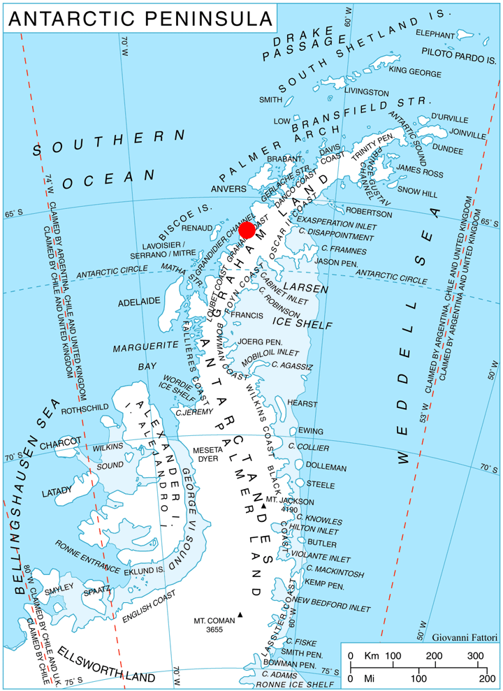
Kolosh Glacier on:
[Wikipedia]
[Google]
[Amazon]
 Kolosh Glacier ( bg, ледник Колош, lednik Kolosh, ) is the 6.7 km long and 3.6 km wide glacier on
Antarctic Digital Database (ADD).
Scale 1:250000 topographic map of Antarctica. Scientific Committee on Antarctic Research (SCAR), 1993–2016.
Bulgarian Antarctic Gazetteer.
basic data
in English)
SCAR Composite Gazetteer of Antarctica
Kolosh Glacier.
Copernix satellite image Bulgaria and the Antarctic Glaciers of Graham Coast {{GrahamCoast-glacier-stub
Magnier Peninsula
Magnier Peninsula is the mostly ice-covered peninsula projecting 18 km in northwest direction from Graham Coast in Graham Land, Antarctica. It is 17 km wide between Leroux Bay to the northeast and Bigo Bay to the southwest. Magnier Peaks rise ...
, Graham Coast on the west side of Antarctic Peninsula
The Antarctic Peninsula, known as O'Higgins Land in Chile and Tierra de San Martín in Argentina, and originally as Graham Land in the United Kingdom and the Palmer Peninsula in the United States, is the northernmost part of mainland Antarctic ...
, situated south of Nesla Glacier
Nesla Glacier ( bg, ледник Несла, lednik Nesla, ) is the 6.2 km (3.2 mi) long and 2 km (1.2 mi) wide glacier on Magnier Peninsula, Graham Coast on the west side of Antarctic Peninsula, situated southwest of Muldava Glacier and ...
. It drains the west slopes of Lisiya Ridge
Lisiya Ridge ( bg, Лисийски хребет, ‘Lisiyski Hrebet’ \li-'siy-ski 'hre-bet\) is the ice-covered ridge rising to over 2100 mMount Bigo
Mount Bigo () is a 1,980 m mountain in Lisiya Ridge on Magnier Peninsula, Graham Coast in Graham Land, standing immediately southwest of Mount Perchot at the head of Bigo Bay. It was discovered by the French Antarctic Expedition of 1908–10 and ...
, and flows northwestwards into Bigo Bay
Bigo Bay () is a bay long and wide, indenting the west coast of Graham Land between Cape Garcia and Magnier Peninsula surmounted by the Magnier Peaks and Lisiya Ridge.
The French Antarctic Expedition, 1908–10, first sighted this bay but ch ...
next south of the terminus of Nesla Glacier.
The glacier is named after Kolosh Peak in Konyavska Mountain, Western Bulgaria.
Location
Kolosh Glacier is centred at . British mapping in 1971.Maps
* British Antarctic Territory. Scale 1:200000 topographic map. DOS 610 Series, Sheet W 65 64. Directorate of Overseas Surveys, Tolworth, UK, 1971.Antarctic Digital Database (ADD).
Scale 1:250000 topographic map of Antarctica. Scientific Committee on Antarctic Research (SCAR), 1993–2016.
References
Bulgarian Antarctic Gazetteer.
Antarctic Place-names Commission
The Antarctic Place-names Commission was established by the Bulgarian Antarctic Institute in 1994, and since 2001 has been a body affiliated with the Ministry of Foreign Affairs of Bulgaria.
The Commission approves Bulgarian place names in ...
. (details in Bulgarianbasic data
in English)
SCAR Composite Gazetteer of Antarctica
External links
Kolosh Glacier.
Copernix satellite image Bulgaria and the Antarctic Glaciers of Graham Coast {{GrahamCoast-glacier-stub