Kapelvej (Nørrebro) on:
[Wikipedia]
[Google]
[Amazon]
Kapelvej () is a street in the

 The former chapel (No. 4) us now operated as a cultural centre under the name . The building was designed by Valdemar Ingemann and built in 1867–1868 under supervision of city builder
Nørrebro
Nørrebro (, ) is one of the 10 official districts of Copenhagen, Denmark. It is northwest of the city centre, beyond the location of the old Northern Gate (''Nørreport''), which, until dismantled in 1856, was near the current Nørreport station ...
district of Copenhagen
Copenhagen ( or .; da, København ) is the capital and most populous city of Denmark, with a proper population of around 815.000 in the last quarter of 2022; and some 1.370,000 in the urban area; and the wider Copenhagen metropolitan ar ...
, Denmark
)
, song = ( en, "King Christian stood by the lofty mast")
, song_type = National and royal anthem
, image_map = EU-Denmark.svg
, map_caption =
, subdivision_type = Sovereign state
, subdivision_name = Danish Realm, Kingdom of Denmark
...
. It runs from Nørrebrogade
Nørrebrogade is the principal shopping street of the Nørrebro district of Copenhagen, Denmark. It runs from The Lakes in the southeast to Nørrebro station in the northwest, linking Frederiksborggade and Queen Louise's Bridge with Frederikssun ...
in the northeast to Ågade in the southwest. It first part follows the southeast wall of Assistens Cemetery
Assistens Cemetery ( da, Assistens Kirkegård) is the name of a number of cemeteries in Denmark. The common nominator is, as the first part of the name implies (Latin: ''assistens'' meaning assisting), an assisting cemetery for a town's churches. ...
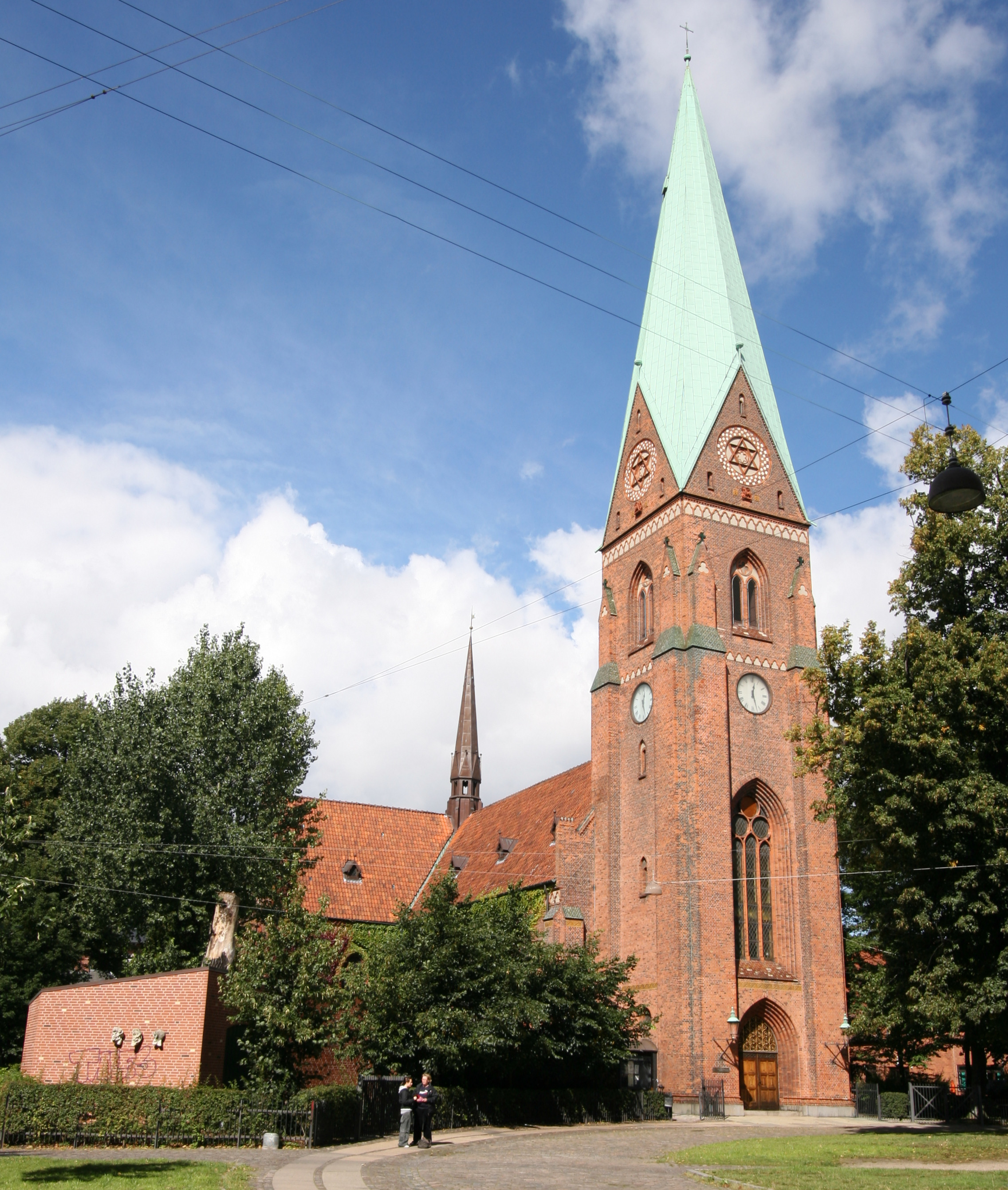
. The Neo-Gothic Holy Cross Church is located at the corner with Hans Tavsens Gade. The street is blocked for cars at Tjørnegade.
History
Assistens Cemetery
Assistens Cemetery ( da, Assistens Kirkegård) is the name of a number of cemeteries in Denmark. The common nominator is, as the first part of the name implies (Latin: ''assistens'' meaning assisting), an assisting cemetery for a town's churches. ...
was founded on the north side of the road in 1760. The road received its current name in 1869 after the new chapel which was built at No. 2-4. The street was later home to the entertainment venue Lille Ravnsborg. On 16 December 1889, the Copenhagen City Council
The Copenhagen City Council (Danish: ) is the municipal government of Copenhagen, Denmark, and has its seat at Copenhagen City Hall.
The city council is Copenhagen's highest political authority and sets the framework for the committees' tasks. ...
granted funds for the establishment of the first playground in Copenhagen at Kapelvej.
Notable buildings and residents

 The former chapel (No. 4) us now operated as a cultural centre under the name . The building was designed by Valdemar Ingemann and built in 1867–1868 under supervision of city builder
 Niels Sigfred Nebelong
Niels Sigfred Nebelong (14 October 1806 – 9 October 1871) was a Danish architect who worked in the Historicist style. He was city architect in Copenhagen from 1863 and also designed many lighthouses around Denmark in his capacity as residen ...
.
Holy Cross Church (No. 38) was built to a Neo-Gothic design by Hermann Baagøe Storck in 1887–1890. The former school Kapelvej School (No. 42) was built in 1879. From 1933 until 1960 it also housed the teacher training college Blaagaard Seminarium
Blaagaard Seminarium (also spelled Blågård Seminarium) has been the name of two teacher training colleges both originating in the Nørrebro district of Copenhagen, Denmark. The first of them, which was the first teacher training college in Denma ...
. On the other side of the street is the former St. Joseph's Hospital. The wings on Kapelvej and Korsgade are from 1900–1901 and were built as an extension to Christian Hansen's original hospital building in Griffenfeldsgade
Griffenfeldsgade is a street in the Nørrebro district of Copenhagen, Denmark, running from Nørrebrogade in the northeast to Åboulevard on the border to Frederiksberg in the southwest from where it continues as H. C. Ørsteds Vej. The street has ...
from 1875.
Transport
The Nørrebros Runddel City Circle Line station is located approximately 540 metres from the northern end of the street. Nuuks Plads, also on the City Circle Line, is located approximately 600 metres from the southern part of the street by way ofRantzausgade
Rantzausgade is a street in the Nørrebro district of Copenhagen, Denmark. It runs from Åboulevard in the southeast to Jagtvej in the northeast where its name changes to Borups Allé.
History
Rantzausgade was originally called Nordvestvej ("No ...
. Forum Station, served by the M1 and M2 lines, is located approximately 540 metres from the southern end of the street by way of H.C. Ørsteds Vej and Rolighedsvej
Rolighedsvej is a street in the Frederiksberg district of Copenhagen, Denmark. It runs from Falkoner Allé in the northwest to Bülowsvej in the southeast, linking Godthåbsvej with Rosenørns Allé. The street is dominated by the University of Co ...
9.
See also
* StefansgadeReferences
External links
{{coord, 55.6883, N, 12.5527, E, source:wikidata, display=title Streets in Nørrebro