Grays Bay on:
[Wikipedia]
[Google]
[Amazon]
Grays Bay is an 
 Grays Bay was proposed as the site of a potential dock facility. In 2007 Wolfden Resources received a favourable review "for its copper/zinc mine proposal from the Nunavut Impact Review Board (NIRB)." The proposal included plans for a 53-kilometre all-weather road that would include a dock facility at Grays Bay on the Coronation Gulf, and will parallel the Kennartic River to the mine site at High Lake."
Arctic
The Arctic ( or ) is a polar regions of Earth, polar region located at the northernmost part of Earth. The Arctic consists of the Arctic Ocean, adjacent seas, and parts of Canada (Yukon, Northwest Territories, Nunavut), Danish Realm (Greenla ...
waterway in Kitikmeot Region
Kitikmeot Region (; Inuktitut: ''Qitirmiut'' ) is an administrative region of Nunavut, Canada. It consists of the southern and eastern parts of Victoria Island with the adjacent part of the mainland as far as the Boothia Peninsula, together ...
, Nunavut
Nunavut ( , ; iu, ᓄᓇᕗᑦ , ; ) is the largest and northernmost Provinces and territories of Canada#Territories, territory of Canada. It was separated officially from the Northwest Territories on April 1, 1999, via the ''Nunavut Act'' ...
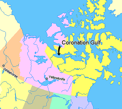
, Canada. It is located in Coronation Gulf
Coronation Gulf lies between Victoria Island and mainland Nunavut in Canada. To the northwest it connects with Dolphin and Union Strait and thence the Beaufort Sea and Arctic Ocean; to the northeast it connects with Dease Strait and thence Queen M ...
. Hepburn Island
Hepburn Island is an island located in the south of the Coronation Gulf, just across Grays Bay from the mainland. It is in the Kitikmeot Region, Nunavut
Nunavut ( , ; iu, ᓄᓇᕗᑦ , ; ) is the largest and northernmost territory of Ca ...
is located at its mouth. The Tree River and the Annielik River flow into the bay.
It is the ancestral home of the Kogluktuaryumiut, a Copper Inuit
Copper Inuit, also known as Kitlinermiut and Inuinnait, are a Canadian Inuit group who live north of the tree line, in what is now the Kitikmeot Region of Nunavut and in the Inuvialuit Settlement Region in the Inuvik Region of the Northwest ...
subgroup.
Grays Bay is on the Northwest Passage route.

Northwest Passage
 Grays Bay was proposed as the site of a potential dock facility. In 2007 Wolfden Resources received a favourable review "for its copper/zinc mine proposal from the Nunavut Impact Review Board (NIRB)." The proposal included plans for a 53-kilometre all-weather road that would include a dock facility at Grays Bay on the Coronation Gulf, and will parallel the Kennartic River to the mine site at High Lake."
Minerals and Metals Group
MMG Limited is a mid-tier global resources company that mines, explores and develops base metal projects around the world. MMG's largest shareholder is China Minmetals with 68%. The multibillion-dollar Izok Corridor project is projected to produce 180,000 tonnes of zinc and another 50,000 tonnes of copper a year. In order to do this "Izok Lake would be drained, the water dammed and diverted to a nearby lake. Three smaller lakes at High Lake would also be drained. Grays Bay would be substantially filled in."
In their August 2012 proposal which has since been revised, MMG Minerals described the planned facilities at the Grays Bay Port that would "include a dock, concentration storage shed, fuel storage facilities and a camp. These facilities will support storage of concentrate, loading of bulk-carrier ships, and re-supply of fuel and goods for the Project." The Grays Bay port would be open three months of the year to "ship ore in two directions through both ends of the Northwest Passage."
References
Bays of Kitikmeot Region Former populated places in the Kitikmeot Region {{KitikmeotNU-geo-stub