Goat River (Kootenay River Tributary) on:
[Wikipedia]
[Google]
[Amazon]
 The Goat River is tributary of the Kootenay River in the
Topographic map of the upper Goat RiverTopographic map of the lower Goat River
{{authority control Rivers of British Columbia Tributaries of the Kootenay River East Kootenay
 The Goat River is tributary of the Kootenay River in the
 Canadian province
Within the geographical areas of Canada, the ten provinces and three territories are sub-national administrative divisions under the jurisdiction of the Canadian Constitution. In the 1867 Canadian Confederation, three provinces of British North ...
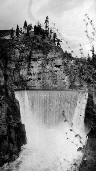
of British Columbia. The river meets the Kootenay near the town of Creston. The Goat River Dam, constructed in the 1930s, was an early source of electricity for the town. Before dikes were built, the river was a major source of spring flooding in the Creston valley.
Course
in length, the Goat River rises in the central Purcell Mountains just west of Mallaindane Pass and flows largely south until meeting Kitchener Creek. From this confluence, it bends southwest towards the towns ofErickson Erickson may refer to:
Places
;Canada
*Erickson, Manitoba, a town
*Erickson, British Columbia an unincorporated area
;United States
* Erickson Corner, Connecticut, an unincorporated community
* Erickson Landing, Michigan, an unincorporated communit ...
and Creston. Its lower reaches are the route of the southern mainline of the Canadian Pacific Railway
The Canadian Pacific Railway (french: Chemin de fer Canadien Pacifique) , also known simply as CPR or Canadian Pacific and formerly as CP Rail (1968–1996), is a Canadian Class I railway incorporated in 1881. The railway is owned by Canadi ...
and the Crowsnest Highway. The total area of the Goat River drainage is approximately .
History
In the 1860s, the lower Goat River valley became part of the route for the Dewdney Trail, connecting the gold fields of Wild Horse Creek with the coast. Surveyed and constructed by Edgar Dewdney and Walter Moberly, the trail was seen as a countermeasure to American encroachment into the southern Kootenays. The demand for electricity in the growing town of Creston led to the construction of the Goat River Dam in the early 1930s. The concrete arch dam is located five kilometers east of Creston. It operated until the large power projects of the 1950s in the Kootenays reduced the need for the generating station, which suffered from ice buildup in winter and an inconstant water supply. It was decommissioned and sold in 1979.See also
*List of British Columbia rivers
The following is a partial list of rivers of British Columbia, organized by watershed. Some large creeks are included either because of size or historical importance
(See Alphabetical List of British Columbia rivers ). Also included are lakes th ...
References
External links
Topographic map of the upper Goat River
{{authority control Rivers of British Columbia Tributaries of the Kootenay River East Kootenay