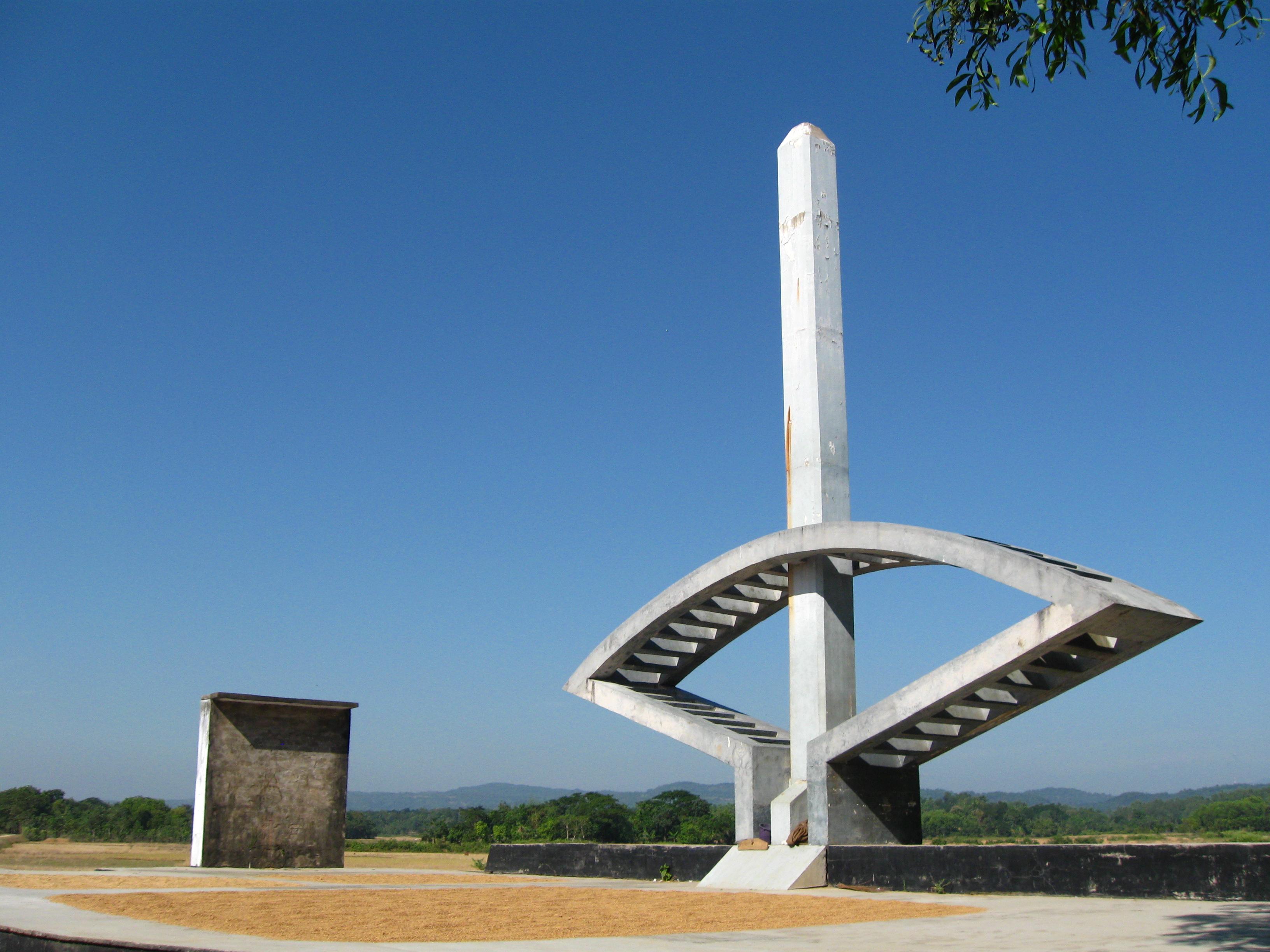
Durgapur Upazila, Netrokona on:
[Wikipedia]
[Google]
[Amazon]
Durgapur ( bn, দূর্গাপুর) (also referred to as Susang Durgapur) is an
Details
eduguardian.com; accessed 3 September 2015.


upazila
An ''upazila'' ( bn, উপজেলা, upôzela, lit=sub-district pronounced: ), formerly called ''thana'', is an administrative region in Bangladesh, functioning as a sub-unit of a district. It can be seen as an analogous to a county or a ...
of the Netrokona District
Netrokona ( bn, নেত্রকোণা) is a district of the Mymensingh Division in northern Bangladesh.
Etymology
The headquarters of Netrokona District was located at the end of the Mogra River and was called Natorkona. Many people believe ...
in the Mymensingh Division
Mymensingh Division ( bn, ময়মনসিংহ বিভাগ) is one of the eight administrative divisions of Bangladesh. It has an area of and a population of 11,370,000 as of the 2011 census. It was created in 2015 from districts prev ...
of Bangladesh
Bangladesh (}, ), officially the People's Republic of Bangladesh, is a country in South Asia. It is the eighth-most populous country in the world, with a population exceeding 165 million people in an area of . Bangladesh is among the mos ...
.
Geography
Durgapur is located at . It has 32,245 households and a total land area of 293.42 km2.Demographics
According to2011 Bangladesh census
In 2011, the Bangladesh Bureau of Statistics, conducted a national census in Bangladesh, which provided a provisional estimate of the total population of the country as 142,319,000. The previous decennial census was the 2001 census. Data were reco ...
, Durgapur had a population of 224,873. Males constituted 49.67% of the population and females 50.33%. Muslims formed 90.10% of the population, Hindus 5.87%, Christians 3.89%, and others 0.14%. Durgapur had a literacy rate of 39.52% for the population 7 years and above.
At the 1991 Bangladesh census
A census is the procedure of systematically acquiring, recording and calculating information about the members of a given population. This term is used mostly in connection with national population and housing censuses; other common censuses incl ...
, Durgapur had a population of 169,135, of whom 83,795 were aged 18 or older. Males constituted 50.49% of the population, and females 49.51%. Durgapur had an average literacy rate
Literacy in its broadest sense describes "particular ways of thinking about and doing reading and writing" with the purpose of understanding or expressing thoughts or ideas in written form in some specific context of use. In other words, huma ...
of 23% (7+ years), compared to the national average of 32.4%.
Composition of Durgapur Thana
Total Households: 8,250 1. Bangali; Total Village: 48; Total Household: 4,778; Language Practiced: Bengali; Religion Practiced: Islam; 2. Banai; Total Village: 1; Total Household: 6; Language Practiced: Banai; Religion Practiced: Hinduism; 3. Buna / Buno; Total Village: 3; Total Household: 37; Language Practiced: Bengali; Religion Practiced: Hinduism; Buna / Buno in Other Districts: Dhaka, Gazipur, Mymensingh, Rajbari, Sherpur, Tangail, Bagerhat, Jessore, Jhenaidah, Khulna, Kushtia, Magura, Satkhira, Bogra, Dinajpur, Joypurhat, Naogaon, Natore, Nilphamari, Pabna, Rajshahi, Sirajganj, Maulvibazar; 4. Garo; Number of Villages they lived with bangali: 10; Total Household: 924; Language Practiced: Achik / Garo (98.08%), Deal (1.92%); Religion Practiced: Christianity (99.96%), Shangsharik (0.04%); Garo lived in Other Districts: Sherpur, Mymensingh, Banderban, Chittagong, 5. Hajong; Number of Villages they lived with bangali: 08; Total Household: 505; Language Practiced: Hajong; Religion Practiced: Hinduism; Hajong in Other Districts: Mymensingh, Sherpur, Sunamganj; The city's area is 293.42 sq km It is an ancient town situated on the banks of the river Somessori. This habitation known as a tourist area. There are civil and criminal courts here from British rule regime. population Density 710 (per km2) literacy in rate in village 31.0% and in town 52.3% Population of the town 22661 and village 175665eduguardian.com; accessed 3 September 2015.
Administration
Durgapur Thana was formed in 1874 and converted into upazila was 1982. Durgapur Upazila is divided into Durgapur Municipality and sevenunion parishad
Union council ( bn, ইউনিয়ন পরিষদ, translit=iūniyan pariṣad, translit-std=IAST), also known as union parishad, rural council, rural union and simply union, is the smallest rural administrative and local government unit ...
s: Bakaljora, Birisiri, Chandigarh, Durgapur, Gaokandia, Kakairgara, and Kullagora. The union parishads are subdivided into 129 mauzas and 210 villages.
Durgapur Municipality is subdivided into 9 wards and 30 mahalla
is an Arabic word variously translated as district, quarter, ward, or "neighborhood" in many parts of the Arab world, the Balkans, Western Asia, the Indian subcontinent, and nearby nations.
History
Historically, mahallas were autonomous social ins ...
s.
Notable residents
*Mustaque Ahmed Ruhi
Mustaque Ahmed Ruhi (born 19 June 1974) is a Public Figure and incumbent member of Parliament from Netrokona-1. In 2008, he was elected as a member of the Bangladesh Awami League nominee in the general election. He is a former AGS and VP conse ...
- Former Member of 9th National Parliament of 157th constituency which included this area.
Points of interest
Transport
Over last 10 years, Durgapur has become a famous tourist spot. The most common transport used to visit Durgapur is bus or train. Every night at 11.50 PM, a train named Haor Express leaves Dhaka for Netrokona. Direct bus from Dhaka to Durgapur is available from Dhaka Mohakhali Inter City Bus Terminal, it usually takes 5 hours to reach Durgapur by bus. The roads of Durgapur are highly damaged as innumerable trucks filled with wet sand from the Someshwari river travel them without following proper protocol.Gallery

See also
*Upazilas of Bangladesh
An ''upazila'' ( bn, উপজেলা, upôzela, lit=sub-district pronounced: ), formerly called ''thana'', is an administrative region in Bangladesh, functioning as a sub-unit of a district. It can be seen as an analogous to a county or a ...
* Districts of Bangladesh
* Divisions of Bangladesh
References