Dry Creek, South Australia on:
[Wikipedia]
[Google]
[Amazon]
 Dry Creek is a mostly
Burford Gardens - Wonderful Public Enthusiasm
''The Mail'' 14 April 1923 p.1 Retrieved 8 July 2011
The buildings of the former Dry Creek explosives depot, now State heritage-listed, are on Magazine Road between the Salisbury Highway South Road Connector and the salt pans.


City of Salisbury
City of Port Adelaide Enfield
{{City of Salisbury suburbs Suburbs of Adelaide
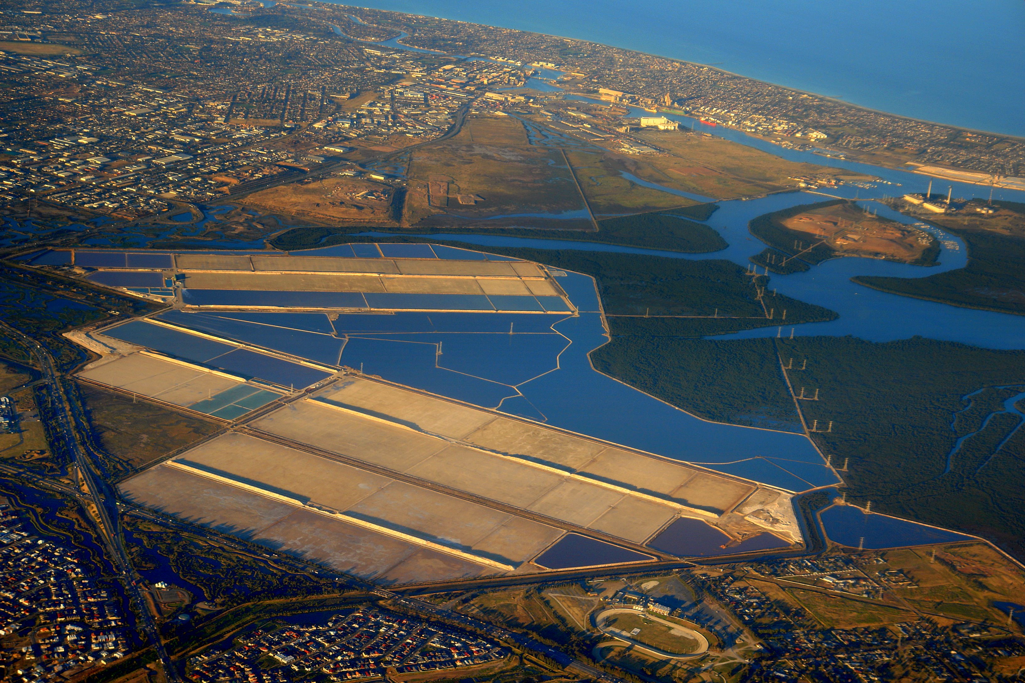
 Dry Creek is a mostly
 industrial suburb
An industrial suburb is a community, near a large city, with an industrial economy. These communities may be established as tax havens or as places where zoning promotes industry, or they may be industrial towns that become suburbs by urban ...
north of Adelaide
Adelaide ( , ; ) is the list of Australian capital cities, capital and most populous city of South Australia, as well as the list of cities in Australia by population, fifth-most populous city in Australia. The name "Adelaide" may refer to ei ...
, containing significant wetlands
A wetland is a distinct semi-aquatic ecosystem whose groundcovers are flooded or saturated in water, either permanently, for years or decades, or only seasonally. Flooding results in oxygen-poor ( anoxic) processes taking place, especially ...
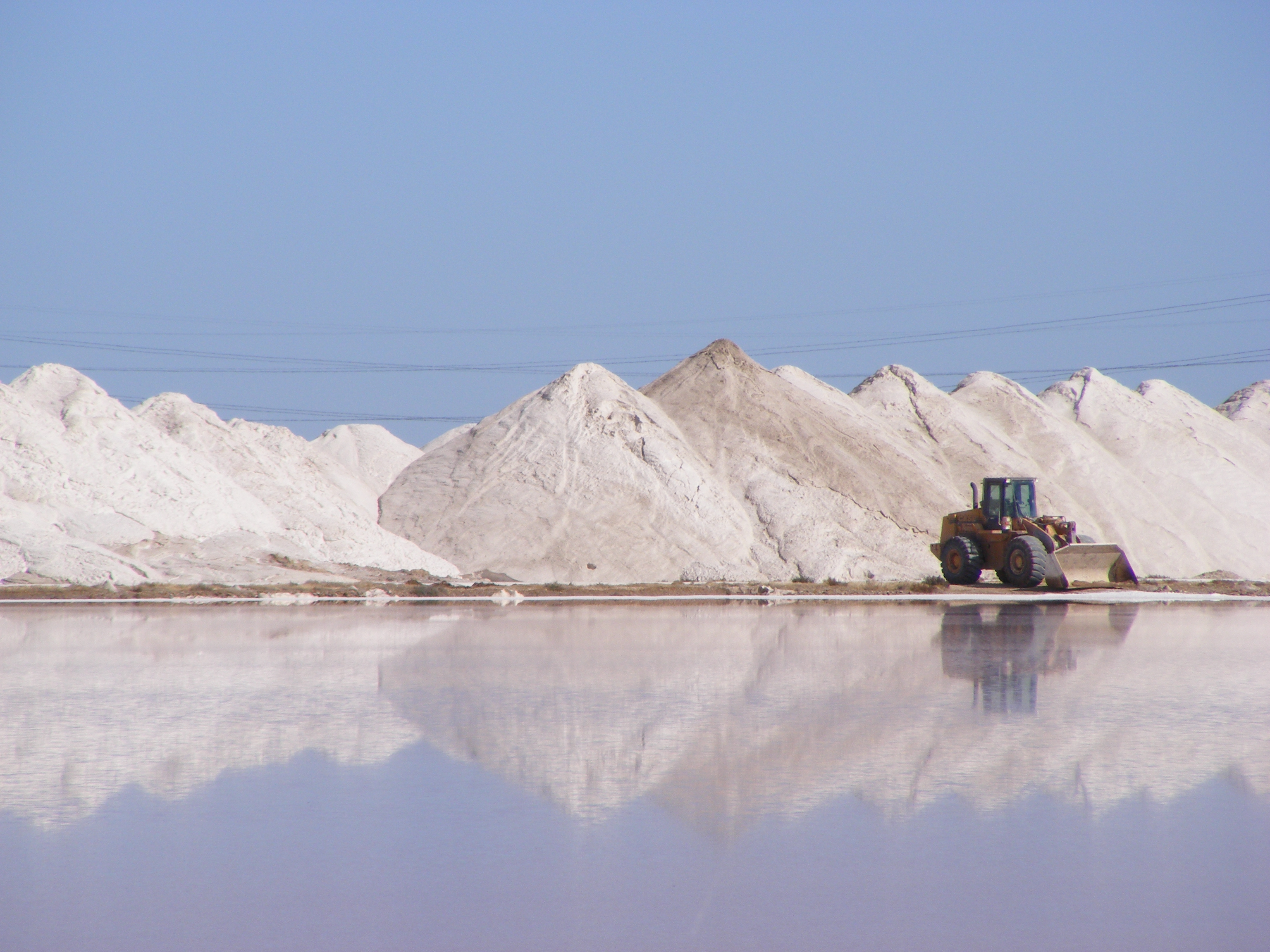
. A substantial area was devoted to salt crystallisation pans until 2014, with plans to redevelop the site for housing.
This housing plan, first put forward in 2008, was revived in 2013, for a proposed 10,000 homes. Salt production ceased in 2014, and in 2016 Ridley Corporation, which managed the salt pans, sold the land to Adelaide Resource Recovery.
Description
It is named for the Dry Creek, a stream and drain which flows through the suburb and into Swan Alley, a tidal distributary ofBarker Inlet
The Barker Inlet is a tidal inlet of the Gulf St Vincent in Adelaide, South Australia, named after Captain Collet Barker who first sighted it in 1831. It contains one of the southernmost mangrove forests in the world, a dolphin sanctuary, ...
, Gulf St Vincent
Gulf St Vincent, sometimes referred to as St Vincent Gulf, St Vincent's Gulf or Gulf of St Vincent, is the eastern of two large inlets of water on the southern coast of Australia, in the state of South Australia, the other being the larger Sp ...
.
It was the site of the soapworks of W. H. Burford & Sons from 1923 (adjacent to the Dry Creek railway station, and formerly used for smelting ore from Broken Hill) and a pioneering "garden suburb" for its employees, designed by W. J. Earle (who also laid out Cadbury's model town at Claremont, Tasmania
Claremont is a rural / residential locality in the local government areas (LGA) of Glenorchy (75%) and Derwent Valley (25%) in the Hobart and South-east LGA regions of Tasmania. The locality is about north of the town of Glenorchy. The 2021 ...
). The name Burford Gardens has vanished, but its streets remain: Flame Avenue, Gum Avenue, Wattle Avenue, Grevillea Avenue and Bushwood Avenue.''The Mail'' 14 April 1923 p.1 Retrieved 8 July 2011
Wetlands
The Dry Creek wetlands are composed of many separate sections running from the eastern edge of the suburb to the sea outlet of Dry Creek. They form part of thestorm water
Stormwater, also written storm water, is water that originates from precipitation (storm), including heavy rain and meltwater from hail and snow. Stormwater can soak into the soil ( infiltrate) and become groundwater, be stored on depressed lan ...
management system for the City of Salisbury
The City of Salisbury is a local government area (LGA) located in the northern suburbs of Adelaide, South Australia. Its neighbours are the City of Playford, City of Tea Tree Gully and City of Port Adelaide Enfield.
Encompassing an area of ...
and the City of Port Adelaide Enfield
The City of Port Adelaide Enfield (PAE),City of Port Adelaide Enfield, PAE Today, Issue 19, Autumn 2024 located across inner north and north-western suburbs of Adelaide, is one of the largest metropolitan councils within South Australia. It was ...
and are connected to numerous drains that run across the Adelaide Plains
The Adelaide Plains (Kaurna name Tarndanya) is a plain in South Australia lying between the coast ( Gulf St Vincent) on the west and the Mount Lofty Ranges on the east. The southernmost tip of the plain is in the southern seaside suburbs of A ...
including the eponymous Dry Creek, as well as being the outflow point for storm water pipes. Some of the wetlands have been extensively landscaped
Landscape architecture is the design of outdoor areas, landmarks, and structures to achieve environmental, social-behavioural, or aesthetic outcomes. It involves the systematic design and general engineering of various structures for constructi ...
but have only limited public access.
The wetlands form a fauna and flora haven with one of the southernmost mangrove
A mangrove is a shrub or tree that grows mainly in coastal saline water, saline or brackish water. Mangroves grow in an equatorial climate, typically along coastlines and tidal rivers. They have particular adaptations to take in extra oxygen a ...
habitats in the world, extensive reed and samphire
Samphire is a name given to a number of succulent salt-tolerant plants (halophytes) that tend to be associated with water bodies.
* Rock samphire ('' Crithmum maritimum'') is a coastal species with white flowers that grows in Ireland, the Uni ...
beds and a large bird and fish population. They discharge via North Arm creek into the Barker Inlet
The Barker Inlet is a tidal inlet of the Gulf St Vincent in Adelaide, South Australia, named after Captain Collet Barker who first sighted it in 1831. It contains one of the southernmost mangrove forests in the world, a dolphin sanctuary, ...
of Gulf St Vincent
Gulf St Vincent, sometimes referred to as St Vincent Gulf, St Vincent's Gulf or Gulf of St Vincent, is the eastern of two large inlets of water on the southern coast of Australia, in the state of South Australia, the other being the larger Sp ...
. The wetlands are part of the Gulf St Vincent Important Bird Area
The Gulf St Vincent Important Bird Area comprises land extending along the coast of Gulf St Vincent, north of Adelaide, South Australia.
Description
The Gulf St Vincent Important Bird Area (IBA) is a strip of coastline containing the continuo ...
.
Transport

Dry Creek railway station
Dry Creek railway station is located on the Gawler railway line, Gawler line. Situated in the inner northern Adelaide suburb of Dry Creek, South Australia, Dry Creek, it is from Adelaide railway station, Adelaide station.
History
Dry Creek ...
is located on the Gawler railway line. The Northfield railway line
The Northfield railway line (formerly Stockade railway line) was a railway line in northern Adelaide running Dry Creek, South Australia, Dry Creek and Northfield, South Australia, Northfield. The line branched east from the Gawler railway line ...
, which branched eastwards from Dry Creek station, was closed in 1987.
Dry Creek was a site of a bogie exchange
A bogie ( ) (or truck in North American English) comprises two or more wheelsets (two wheels on an axle), in a frame, attached under a vehicle by a pivot. Bogies take various forms in various modes of transport. A bogie may remain normally ...
used to overcome a Break of gauge
With railways, a break of gauge occurs where a line of one track gauge (the distance between the rails, or between the wheels of trains designed to run on those rails) meets a line of a different gauge. Trains and railroad car, rolling stock g ...
.
The Port River Expressway
Port River Expressway is a freeway-grade road. The expressway links Port Adelaide and the Lefevre Peninsula across the north-western suburbs of Adelaide to major interstate routes via North-South Motorway.
The expressway is grade-separated a ...
traverses Dry Creek east–west, and the North–South Motorway provides a new north–south route through the suburb.
See also
*Northern Connector
Northern may refer to the following:
Geography
* North, a point in direction
* Northern Europe, the northern part or region of Europe
* Northern Highland, a region of Wisconsin, United States
* Northern Province, Sri Lanka
* Northern Range, a r ...
References

External links
City of Salisbury
City of Port Adelaide Enfield
{{City of Salisbury suburbs Suburbs of Adelaide