Britannia Illustrata on:
[Wikipedia]
[Google]
[Amazon]

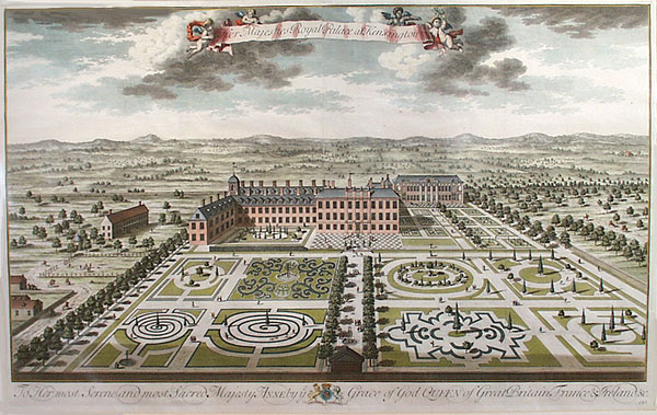
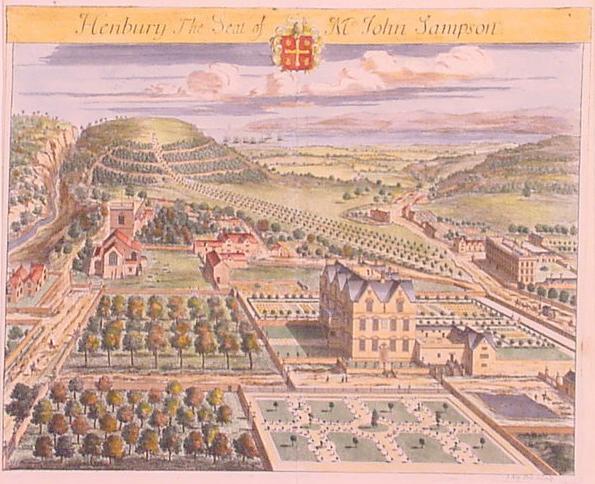
 ''Britannia Illustrata'', also known as ''Views of Several of the Queens Palaces and also of the Principal Seats of the Nobility & Gentry of Great Britain'' is a 170709 map plate folio of parts of Great Britain, arguably the most important work of Dutch draughtsman
Illustrations
at

 ''Britannia Illustrata'', also known as ''Views of Several of the Queens Palaces and also of the Principal Seats of the Nobility & Gentry of Great Britain'' is a 170709 map plate folio of parts of Great Britain, arguably the most important work of Dutch draughtsman
 Jan Kip
Johannes "Jan" Kip (1652/53, Amsterdam – 1722, Westminster) was a Dutch draftsman, engraver and print dealer. Together with Leonard Knyff, he made a speciality of engraved views of English country houses.
Life
Kip was a pupil of Bastiaen St ...
, who collaborated with Leonard Knijff. The folio consisted of a range of large, detailed folded colored and black and white drawings which today provides a valuable insight into land and buildings at country estates at the time.
The volume is among the most important English topographical publications of the 18th century. Architecture is rendered with care, and the settings of parterre
A ''parterre'' is a part of a formal garden constructed on a level substrate, consisting of symmetrical patterns, made up by plant beds, low hedges or coloured gravels, which are separated and connected by paths. Typically it was the part of ...
s and radiating avenues driven through woods or planted across fields, garden paths gates and toolsheds are illustrated in detail, and staffed with figures and horses, coaches pulling into forecourts, water-craft on rivers, in line with the traditions of the Low Countries
The term Low Countries, also known as the Low Lands ( nl, de Lage Landen, french: les Pays-Bas, lb, déi Niddereg Lännereien) and historically called the Netherlands ( nl, de Nederlanden), Flanders, or Belgica, is a coastal lowland region in N ...
. Some of the plates are in the Siennese "map perspective". At Althorp
Althorp (popularly pronounced ) is a Grade I listed stately home and estate in the civil parish of Althorp, in West Northamptonshire, England of about . By road it is about northwest of the county town of Northampton and about northwest of ...
in Northamptonshire
Northamptonshire (; abbreviated Northants.) is a county in the East Midlands of England. In 2015, it had a population of 723,000. The county is administered by
two unitary authorities: North Northamptonshire and West Northamptonshire. It is ...
, the map revealed in detail the changes to the gardens by André Le Nôtre from earlier maps and depictions. Kip updated the plates in the 1720s.
References
External links
Illustrations
at
Google Images
Google Images (previously Google Image Search) is a search engine owned by Google that allows users to search the World Wide Web for images. It was introduced on July 12, 2001 due to a demand for pictures of the green Versace dress of Jennifer ...
1707 works
Maps of England
Maps of the United Kingdom
Topography
Country houses in England
18th-century maps and globes
{{map-stub