Bournemouth Coast Path on:
[Wikipedia]
[Google]
[Amazon]
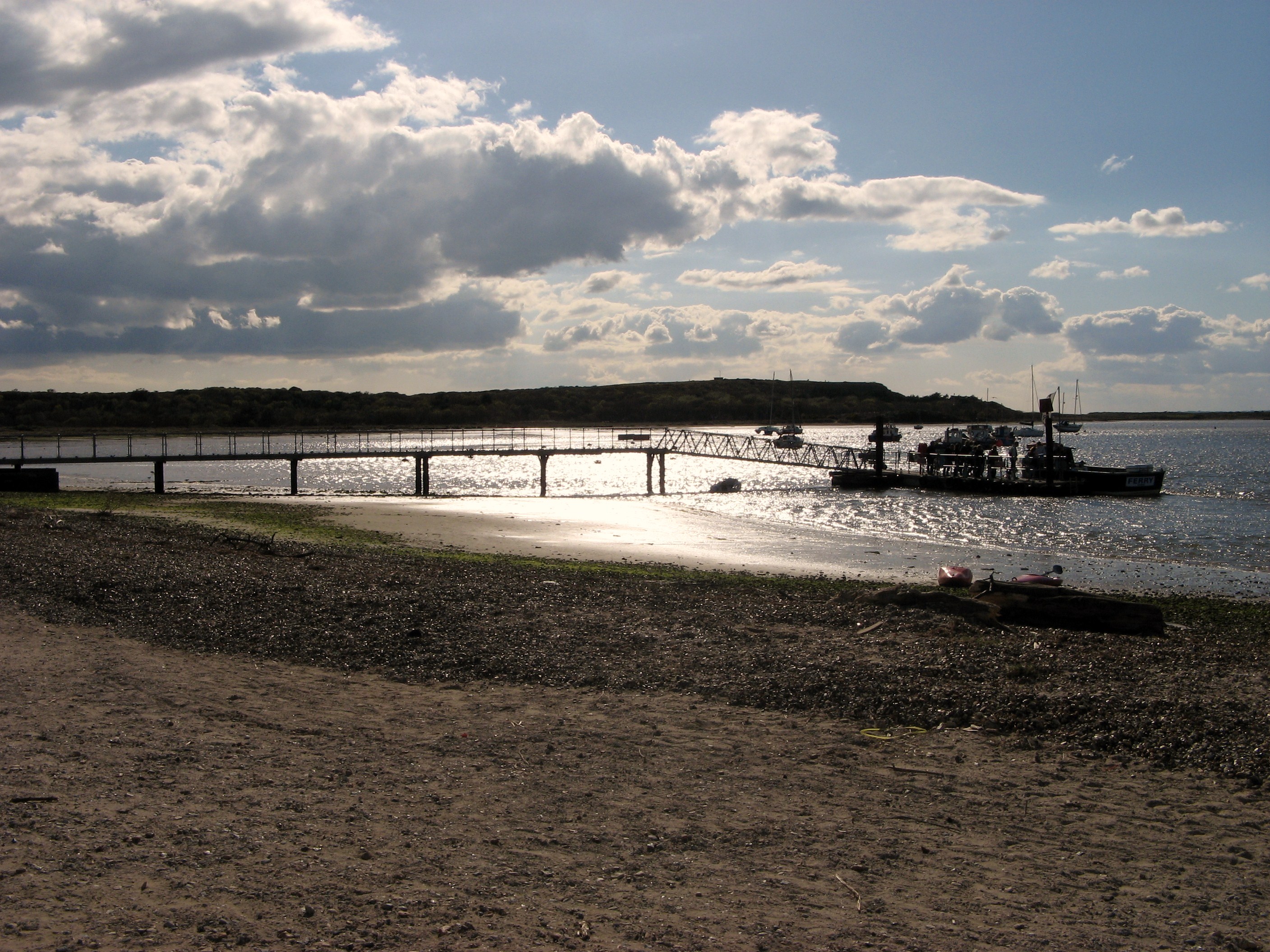
The Bournemouth Coast Path is a 20-mile-long
 Between Hengistbury Head and Mudeford the path uses a
Exploring the Bournemouth Coast Path
{{Authority control Tourist attractions in Bournemouth Footpaths in Hampshire Long-distance footpaths in England Coastal paths in England Footpaths in Dorset
footpath
A footpath (also pedestrian way, walking trail, nature trail) is a type of thoroughfare that is intended for use only by pedestrians and not other forms of traffic such as motorized vehicles, bicycles and horses. They can be found in a wide ...
through Dorset
Dorset ( ; archaically: Dorsetshire , ) is a county in South West England on the English Channel coast. The ceremonial county comprises the unitary authority areas of Bournemouth, Christchurch and Poole and Dorset (unitary authority), Dors ...
and Hampshire
Hampshire (, ; abbreviated to Hants) is a ceremonial county, ceremonial and non-metropolitan county, non-metropolitan counties of England, county in western South East England on the coast of the English Channel. Home to two major English citi ...
, England
England is a country that is part of the United Kingdom. It shares land borders with Wales to its west and Scotland to its north. The Irish Sea lies northwest and the Celtic Sea to the southwest. It is separated from continental Europe b ...
from Sandbanks
Sandbanks is an affluent neighbourhood of Poole, Dorset, on the south coast of England, situated on a narrow spit of around 1 km2 or 0.39 sq mi extending into the mouth of Poole Harbour.
It is known for its high property prices and for it ...
to Milford-on-Sea
Milford on Sea, often hyphenated, is a large village or small town and a civil parish on the Hampshire coast. The parish had a population of 4,660 at the 2011 census and is centred about south of Lymington. Tourism and businesses for quite pr ...
.
The path follows the coastline and goes through Bournemouth
Bournemouth () is a coastal resort town in the Bournemouth, Christchurch and Poole council area of Dorset, England. At the 2011 census, the town had a population of 183,491, making it the largest town in Dorset. It is situated on the Southern ...
, Boscombe
Boscombe is a suburb of Bournemouth, England. Historically in Hampshire, but today in Dorset, it is located to the east of Bournemouth town centre and west of Southbourne.
Originally a sparsely inhabited area of heathland, from around 1865 B ...
, Southbourne, Hengistbury Head
Hengistbury Head (), formerly also called Christchurch Head, is a headland jutting into the English Channel between Bournemouth and Mudeford in the English county of Dorset. It is a site of international importance in terms of its archaeology ...
, Mudeford
Mudeford ( ) is a harbourside and beachside parish based on a former fishing village in the east of Christchurch, Dorset, England (historically in Hampshire), fronting water on two sides: Christchurch Harbour and the sands of Avon Beach.
The Riv ...
and Highcliffe
Highcliffe-on-Sea (usually simply Highcliffe) is a seaside town in Dorset in England, administered since April 2019 as part of the unitary authorities of England, unitary authority of Bournemouth, Christchurch and Poole. It forms part of the So ...
.ferry
A ferry is a ship, watercraft or amphibious vehicle used to carry passengers, and sometimes vehicles and cargo, across a body of water. A passenger ferry with many stops, such as in Venice, Italy, is sometimes called a water bus or water taxi ...
to cross Christchurch Harbour
Christchurch Harbour is a natural harbour in the county of Dorset, on the south coast of England named after the nearby town of Christchurch.
Two rivers, the Avon and the Stour, flow into the Harbour at its northwest corner. The harbour is g ...
. In winter, when the ferry does not usually run, there is a 3-mile detour through Christchurch
Christchurch ( ; mi, Ōtautahi) is the largest city in the South Island of New Zealand and the seat of the Canterbury Region. Christchurch lies on the South Island's east coast, just north of Banks Peninsula on Pegasus Bay. The Avon River / ...
.
The Bournemouth Coast Path performs an important role by connecting the South West Coast Path
The South West Coast Path is England's longest waymarked long-distance footpath and a National Trail. It stretches for , running from Minehead in Somerset, along the coasts of Devon and Cornwall, to Poole Harbour in Dorset. Because it rises a ...
(by the Sandbanks Ferry
Sandbanks Ferry is a vehicular chain ferry which crosses the entrance of Poole Harbour in the English county of Dorset. The route runs from Sandbanks to Studland and in doing so connects the coastal parts of the towns of Bournemouth and Poo ...
) in the west and the Solent Way
The Solent Way is a long-distance trail, footpath in Hampshire, southern England. With the exception of a few inland diversions, the path follows the coast of the Solent, the sea strait that separates the mainland from the Isle of Wight. The ...
in the east.
See also
*Long-distance footpaths in the UK
There are hundreds of long-distance footpaths in the United Kingdom designated in publications from public authorities, guidebooks and OS maps. They are mainly used for hiking and walking, but some may also be used, in whole or in part, for mou ...
References
External links
Exploring the Bournemouth Coast Path
{{Authority control Tourist attractions in Bournemouth Footpaths in Hampshire Long-distance footpaths in England Coastal paths in England Footpaths in Dorset