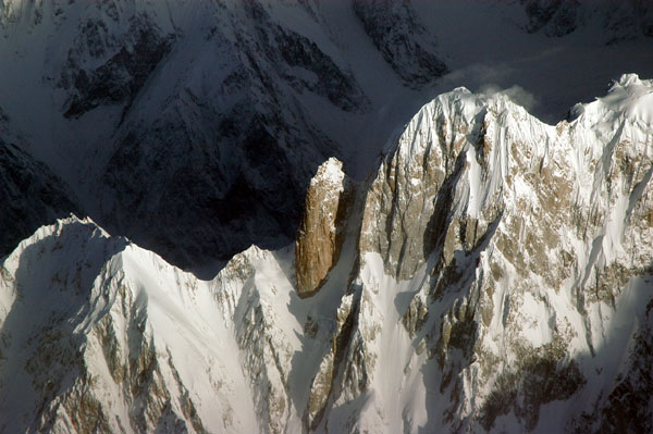
Batura Valley on:
[Wikipedia]
[Google]
[Amazon]
__NOTOC__
The Batura Muztagh () mountains are a sub-range of the 
Himalayan Index
and is not always correct. In particular it is not clear if Batura Sar has really had four ascents or only three. # Sometimes called Batura I. # Sometimes called Ultar II or Bojohagur Duanasir II. # Also known as Sang-e-Marmar (or Sangemarmar), and sometimes referred to by locals as Marble Peak. # The heights given for this peak vary between 6949m and 7050m. # This elevation is approximate.
Himalayan IndexA clickable map of the Batura Muztagh
(Corrected versions of SRTM data; look for the "Batura Sar" tile) Mountain ranges of the Karakoram Mountain ranges of Gilgit-Baltistan
Karakoram
The Karakoram is a mountain range in Kashmir region spanning the borders of Pakistan, China, and India, with the northwest extremity of the range extending to Afghanistan and Tajikistan. Most of the Karakoram mountain range falls under the ...
mountain range
A mountain range or hill range is a series of mountains or hills arranged in a line and connected by high ground. A mountain system or mountain belt is a group of mountain ranges with similarity in form, structure, and alignment that have arise ...
. They are located in between central hunza and upper hunza(Gojal valley
Gojal ( Wakhi: , Kyrgyz: ), also called Upper Hunza, is situated in the north western part of Pakistan. It borders China at the Khunjerab Pass, and Afghanistan at the Chapursan valley. In 2019, Gojal Valley became the second Sub-Division within ...
) in the Hunza district
The Hunza District ( ur, ) is one of the 14 districts of the Pakistani province of Gilgit-Baltistan. It was established in 2015 by the division of the Hunza–Nagar District in accordance with a government decision to establish more administrati ...
of the Gilgit-Baltistan
Gilgit-Baltistan (; ), formerly known as the Northern Areas, is a region administered by Pakistan as an administrative territory, and constituting the northern portion of the larger Kashmir region which has been the subject of a dispute bet ...
province in northern Pakistan
Pakistan ( ur, ), officially the Islamic Republic of Pakistan ( ur, , label=none), is a country in South Asia. It is the world's List of countries and dependencies by population, fifth-most populous country, with a population of almost 24 ...
.
They are the westernmost sub-range of the Karakoram, running from Chalt village in Bar Valley in the east to Kampir Dior in the Kurumbar Valley in the west, and they separate the Hindu Raj
The Hindu Raj ( ur, , translation: "Hindu rule" in Sanskrit) is a mountain range in northern Pakistan, between the Hindu Kush and the Karakoram ranges. Its highest peak is Koyo Zom, 6,872 m (22,546 ft). Other notable peaks include Buni Zom, ...
range from the Karakoram range. The Muchu Chhish
Muchu Chhish () is a mountain in the Batura Muztagh sub-range of the Karakoram in Hunza Valley, a disputed region administrated by Pakistan. The valley is also claimed by India, which considers it to be within the union territory of Ladakh. Locat ...
peak located in this sub-range remains the second highest unclimbed peak in the world.

Selected peaks in the Batura Muztagh
Books, pamphlets, and maps about Batura Muztagh
*''High Asia: An Illustrated History of the 7000 Metre Peaks'' by Jill Neate, *''Batura Mustagh'' (sketch map and pamphlet) by Jerzy Wala, 1988. *''Orographical Sketch Map of the Karakoram'' by Jerzy Wala, 1990. Published by the Swiss Foundation for Alpine Research.See also
* List of Highest Mountains of the World * List of mountains in PakistanNotes
# This data is from thHimalayan Index
and is not always correct. In particular it is not clear if Batura Sar has really had four ascents or only three. # Sometimes called Batura I. # Sometimes called Ultar II or Bojohagur Duanasir II. # Also known as Sang-e-Marmar (or Sangemarmar), and sometimes referred to by locals as Marble Peak. # The heights given for this peak vary between 6949m and 7050m. # This elevation is approximate.
References
External links
{{Commons category, Batura MuztaghHimalayan Index
(Corrected versions of SRTM data; look for the "Batura Sar" tile) Mountain ranges of the Karakoram Mountain ranges of Gilgit-Baltistan