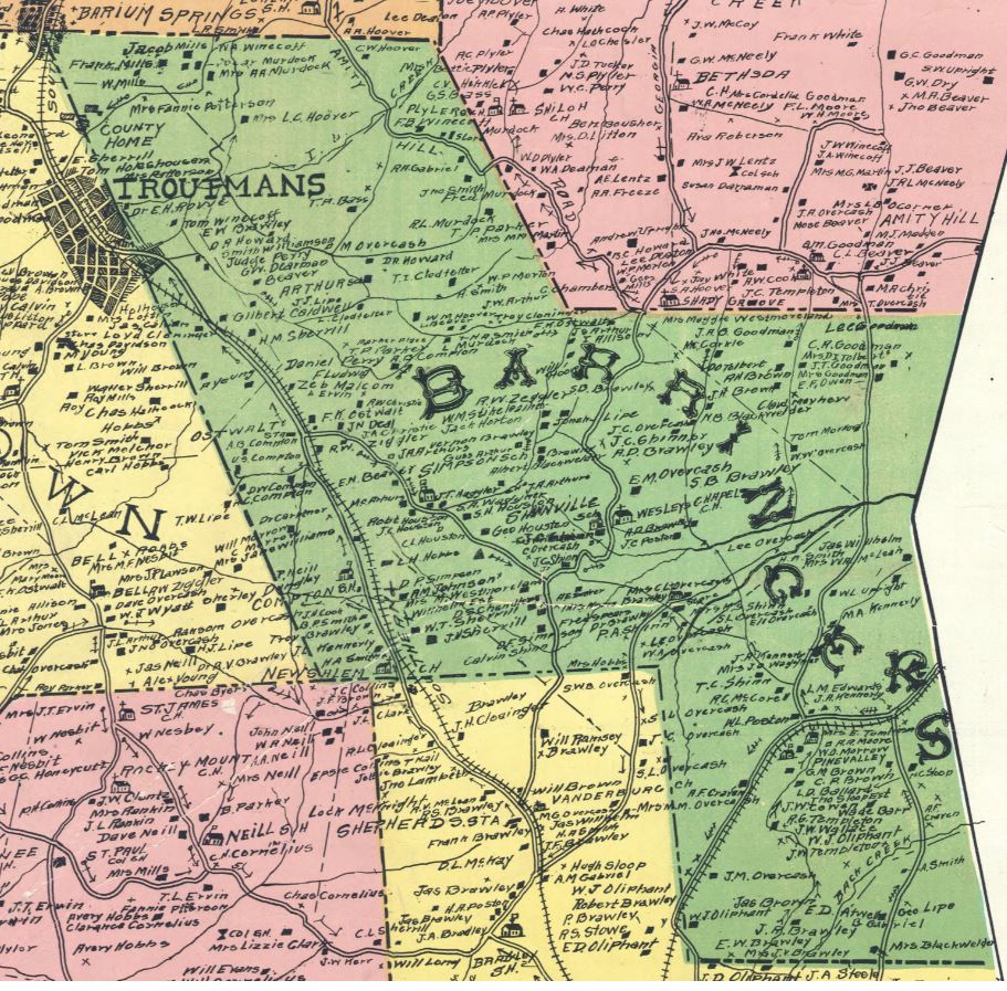
Barringer Township on:
[Wikipedia]
[Google]
[Amazon]
Barringer Township is a non-functioning

township
A township is a kind of human settlement or administrative subdivision, with its meaning varying in different countries.
Although the term is occasionally associated with an urban area, that tends to be an exception to the rule. In Australia, Ca ...
in Iredell County, North Carolina
North Carolina () is a state in the Southeastern region of the United States. The state is the 28th largest and 9th-most populous of the United States. It is bordered by Virginia to the north, the Atlantic Ocean to the east, Georgia and So ...
, United States. By the requirements of the North Carolina Constitution of 1868, the counties were divided into townships
A township is a kind of human settlement or administrative subdivision, with its meaning varying in different countries.
Although the term is occasionally associated with an urban area, that tends to be an exception to the rule. In Australia, Ca ...
, including sixteen in Iredell County.Keever, Homer M.; ''Iredell Piedmont County'', with illustrations by Louise Gilbert and maps by Mildred Jenkins Miller, published for the Iredell County Bicentennial Commission by Brady Printing Company from type set by the Statesville Record and Landmark, copyright, November 1976, by Homer M. Keever''The Heritage of Iredell County, 1980'', published by the Genealogical Society of Iredell County, PO Box 946, Statesville, North Carolina 28677, , 642 pages with index''The Heritage of Iredell County, NC Vol II, 2000'', published by the Genealogical Society of Iredell County, PO Box 946, Statesville, North Carolina 29866, LC # 00-110956, 574 pages with index
Geography
Barringer Township covers an area of 30.41 square miles (78.76 km2), and of this, 0.07 square miles (0.18 km2), or 0.23 percent, is water. Barringer Township lies on the western edge of the Yadkin–Pee Dee River Basin. Bodies of water within Barringer Township include the following. * I-L Creek * Kerr Branch * Rocky Branch * Weathers Creek * Withrow Creek
Communities
* Mazeppa, unincorporated * Mooresville, city (part) * Statesville, city (part) * Troutman, town (part)Adjacent townships
The U.S. Census Bureau shows the following townships adjacent to Barringer. *Chambersburg
Chambersburg is a borough in and the county seat of Franklin County, in the South Central region of Pennsylvania, United States. It is in the Cumberland Valley, which is part of the Great Appalachian Valley, and north of Maryland and the Mas ...
(north)
* Mount Ulla, Rowan County (east)
* Coddle Creek
Coddle Creek is a stream/river that rises near Mooresville in Iredell County, North Carolina. It flows through most of northwestern Cabarrus County, North Carolina where it empties into Rocky River near Harrisburg, North Carolina
Harrisburg, a ...
(south)
* Davidson
Davidson may refer to:
* Davidson (name)
* Clan Davidson, a Highland Scottish clan
* Davidson Media Group
* Davidson Seamount, undersea mountain southwest of Monterey, California, USA
* Tyler Davidson Fountain, monument in Cincinnati, Ohio, USA
* ...
(southwest)
* Fallstown (west)
* Statesville Township (northwest)
Transportation
Airports
* Atwell Airport, a private airport with the Federal Aviation Administration (FAA) identifier of 1NC2, owned by Scott Atwell of Mooresville, is within Barringer Township.Major highways
* * *References
{{authority control Townships in Iredell County, North Carolina 1868 establishments in North Carolina