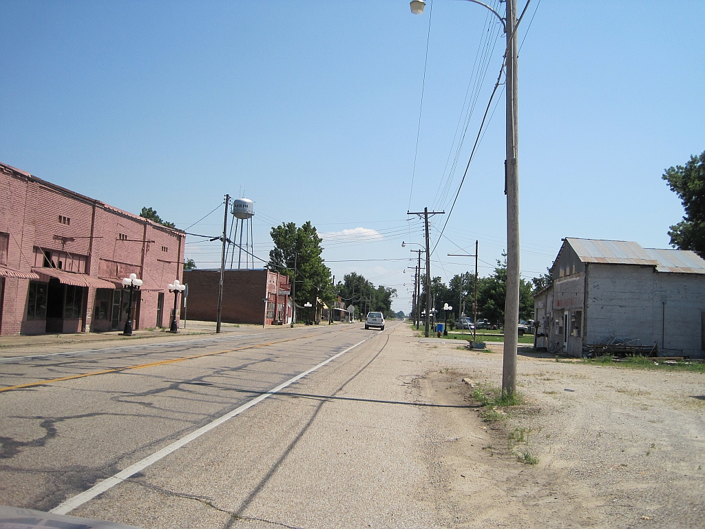
Arkansas Highway 158 on:
[Wikipedia]
[Google]
[Amazon]
Arkansas Highway 158 (AR 158, Hwy. 158) is a designation for two

state highway
A state highway, state road, or state route (and the equivalent provincial highway, provincial road, or provincial route) is usually a road that is either ''numbered'' or ''maintained'' by a sub-national state or province. A road numbered by a ...
s in northeast Arkansas. The main segment of runs east from Highway 1 to US Route 61
U.S. Route 61 or U.S. Highway 61 (U.S. 61) is a major United States highway that extends between New Orleans, Louisiana and the city of Wyoming, Minnesota. The highway generally follows the course of the Mississippi River and is designated ...
(US 61) in Luxora. A short route of runs from U.S. Route 49
U.S. Route 49 (US 49) is a north–south United States highway. The highway's northern terminus is in Piggott, Arkansas, at an intersection with US Route 62/ Highway 1/ Highway 139 (US 62/AR 1/AR 139). Its southern terminus is ...
across railroad tracks in rural Craighead County.
Route description

Greenfield to Luxora
AR 158 begins at AR 1 in Greenfield. The route runs east and begins toconcur
In Western jurisprudence, concurrence (also contemporaneity or simultaneity) is the apparent need to prove the simultaneous occurrence of both ("guilty action") and ("guilty mind"), to constitute a crime; except in crimes of strict liability ...
with AR 163 north. AR 158 then heads east, crossing US 63
U.S. Route 63 (US 63) is a , north–south United States Highway primarily in the Midwestern United States, Midwestern and Southern United States. The southern terminus of the route is at Interstate 20 (I-20) in Ruston, Louisiana; the northe ...
and AR 463 near Bay. The route continues east then north to meet AR 18 in Bowman. AR 18/ AR 135/AR 158 run together until Black Oak
Black Oak may refer to:
Places in the United States
* Black Oak, Arkansas
* Black Oak, Daviess County, Indiana
* Black Oak, Lake County, Indiana, a neighborhood of Gary, Indiana
* Black Oak, Missouri
Other
* Black Oak Arkansas
Black Oak Ar ...
, with AR 135/AR 158 continuing together until Caraway
Caraway, also known as meridian fennel and Persian cumin (''Carum carvi''), is a biennial plant in the family Apiaceae, native to western Asia, Europe, and North Africa.
Etymology
The etymology of "caraway" is unclear. Caraway has been ...
.
The route continues east to meet AR 77 in Lennie. AR 158 runs east to cross Interstate 55
Interstate 55 (I-55) is a major Interstate Highway in the central United States. As with most primary Interstates that end in a five, it is a major cross-country, north–south route, connecting the Gulf of Mexico to the Great Lakes. The h ...
and US 61
U.S. Route 61 or U.S. Highway 61 (U.S. 61) is a major United States highway that extends between New Orleans, Louisiana and the city of Wyoming, Minnesota. The highway generally follows the course of the Mississippi River and is designated ...
before Luxora. The route terminates at US 61 in north Luxora.
Craighead County
The route begins atUS 49
U.S. Route 49 (US 49) is a north–south United States highway. The highway's northern terminus is in Piggott, Arkansas, at an intersection with US Route 62/ Highway 1/ Highway 139 (US 62/AR 1/AR 139). Its southern terminus ...
and runs briefly east across the Union Pacific Railroad
The Union Pacific Railroad , legally Union Pacific Railroad Company and often called simply Union Pacific, is a freight-hauling railroad that operates 8,300 locomotives over routes in 23 U.S. states west of Chicago and New Orleans. Union Paci ...
tracks. The route then curves north parallel to US 49, with the roadway terminating at an agricultural facility.
History
The route was first designated AR 158 in 1936. The highways was a gravel/stone road from AR 77 east to Luxora. The route was extended west to the Caraway area in 1952, but remained entirely gravel. A segment of AR 158 was added from Bay to Lunsford around 1960. The short route was added to the state highway system in 1979.Major intersections
Mile markers reset at concurrencies. , colspan=6 align=center, concurrency north, , colspan=4 align=center, concurrency south, , colspan=5 align=center, concurrency east, , colspan=5 align=center, concurrency south, , colspan=6 align=center, AR 158 main segment ends, AR 158 rural segment begins atU.S. Route 49
U.S. Route 49 (US 49) is a north–south United States highway. The highway's northern terminus is in Piggott, Arkansas, at an intersection with US Route 62/ Highway 1/ Highway 139 (US 62/AR 1/AR 139). Its southern terminus is ...
See also
*List of state highways in Arkansas
The following is a list of state highways in Arkansas. The state does not use a numbering convention. Generally the two-digit odd numbered highways run north–south with a few exceptions; and even-numbered two-digit state highways run east–we ...
References
External links
{{commons category-inline, Arkansas Highway 158 158 Transportation in Poinsett County, Arkansas Transportation in Craighead County, Arkansas Transportation in Mississippi County, Arkansas