|
Arkansas Highway 18
Highway 18 (AR 18 and Hwy. 18) is an east–west state highway of in Northeast Arkansas. Route description AR 18 begins at AR 69 near Jacksonport. Brief concurrencies begins with AR 17 and US 67 (Future I-57) in Newport, and Arkansas Highway 18S leads to Newport Municipal Airport as AR 18 continues east. The route runs east to AR 37 in Grubbs before turning north at Uno to AR 226 in Cash. AR 18 joins AR 91 and becomes King's Highway. AR 18/AR 91 run together with US 63 into Jonesboro. AR 18 breaks and runs as Highland Dr., meeting US 49/ AR 1. After Jonesboro, AR 18 meets AR 158 and AR 135 in Lake City. The three routes continue east to Black Oak, when AR 18 turns north. AR 18 briefly runs with AR 139 in Monette before continuing east. AR 18B is created in Manila, and AR 18 meets AR 77. The route briefly meets AR 181 near Dell before turning northeast to Blytheville. AR 18 meets AR 151 and US 61 in downtown Blytheville. The route continues east to cros ... [...More Info...] [...Related Items...] OR: [Wikipedia] [Google] [Baidu] |
Jacksonport, Arkansas
Jacksonport is a town in Jackson County, Arkansas, United States, along the White River at its confluence with the Black River. The population was 212 at the 2010 census. History Jacksonport was once an important steamboat stop on the White River. During the Civil War the town served as a transportation hub for Confederate forces. Jacksonport was the terminus of the Batesville and Brinkley Railroad, later called the White and Black River Valley Railway, which reached the town from Brinkley, Arkansas in November of 1886. The line was subsequently operated by the Chicago, Rock Island and Pacific Railway until closed in 1940. Geography Jacksonport is located at (35.640990, -91.308860). According to the United States Census Bureau, the town has a total area of , all land. Demographics As of the census of 2000, there were 235 people, 104 households, and 66 families residing in the town. The population density was 252.0/km2 (661.7/mi2). There were 114 housing units at an ... [...More Info...] [...Related Items...] OR: [Wikipedia] [Google] [Baidu] |
Newport Municipal Airport (Arkansas)
Newport Municipal Airport is a city-owned public-use airport located five nautical miles (6 mi, 9 km) northeast of the central business district of Newport, a city in Jackson County, Arkansas, United States. It is included in the National Plan of Integrated Airport Systems for 2011–2015, which categorized it as a ''general aviation'' airport. History Newport was chosen as a site for an Army Airfield during World War II through the encouragement of Congressman Wilbur D. Mills. The flat land already lent itself to airport usage as most trees had been cleared and the ground had been drained for farming. The project was announced in the middle of May 1942 and construction began almost immediately. 34 farm families were displaced from the main site, along with those living at the auxiliary sites. Construction was rapid given the emergency wartime conditions and within three months the post was to be in full operation. The airfield consisted of four concret ... [...More Info...] [...Related Items...] OR: [Wikipedia] [Google] [Baidu] |
Monette, Arkansas
Monette is a city in Craighead County, Arkansas, United States. The population was 1,506 at the 2020 census. History On December 10, 2021, a large and violent EF4 tornado part of a large tornado outbreak struck Monette. One person was killed at a nursing home on the north side of town. Geography Monette is located in eastern Craighead County at (35.890969, -90.344247). According to the United States Census Bureau, the city has a total area of , of which , or 0.19%, is water. Ecologically, Monette is located within the St. Francis Lowlands ecoregion within the larger Mississippi Alluvial Plain. The St. Francis Lowlands are a flat region mostly covered with row crop agriculture today, though also containing sand blows and sunken lands remaining from the 1811–12 New Madrid earthquakes. Waterways have mostly been channelized, causing loss of aquatic and riparian wildlife habitat. The St. Francis Sunken Lands Wildlife Management Area, which preserves some of the bottomland ... [...More Info...] [...Related Items...] OR: [Wikipedia] [Google] [Baidu] |
Arkansas Highway 139
Highway 139 (AR 139, Ark. 139, and Hwy. 139) is a designation for two north–south state highways in the Upper Arkansas Delta. One route of begins at Highway 158 in Caraway and runs north to Missouri Supplemental Route F at the Missouri state line. A second route of runs from US Highway 412 (US 412) to Missouri Route 51 at the Missouri state line. Both routes are maintained by the Arkansas State Highway and Transportation Department (AHTD). Route description Caraway to Missouri AR 139 begins in Caraway at AR 158. The route runs north to AR 18 in Monette. AR 139 continues north to the Missouri state line to terminate at MO-SSR-F. Brighton to Missouri Arkansas Highway 139 is a state highway of in Greene and Clay Counties.Arkansas State Highway and Transportation DepartmentAHTD Greene County mapRetrieved on August 23, 2009.Arkansas State Highway and Transportation DepartmentAHTD Clay County mapRetrieved on August 23, 2009. The route lies close to the St. Fr ... [...More Info...] [...Related Items...] OR: [Wikipedia] [Google] [Baidu] |
Black Oak, Arkansas
Black Oak is a town in Craighead County, Arkansas, United States. The population was 262 at the 2010 census. It is included in the Jonesboro, Arkansas Metropolitan Statistical Area. Black Oak is the namesake of 1970s rock band Black Oak Arkansas and the setting of John Grisham's novel '' A Painted House''. Geography Black Oak is located in eastern Craighead County at (35.836510, -90.367504). It is east of Jonesboro, the county seat, and south of Monette. According to the United States Census Bureau, the town has a total area of , all land. Ecologically, Black Oak is located within the St. Francis Lowlands ecoregion within the larger Mississippi Alluvial Plain. The St. Francis Lowlands are a flat region mostly covered with row crop agriculture today, though also containing sand blows and sunken lands remaining from the 1811–12 New Madrid earthquakes. Waterways have mostly been channelized, causing loss of aquatic and riparian wildlife habitat. The St. Francis Sunken L ... [...More Info...] [...Related Items...] OR: [Wikipedia] [Google] [Baidu] |
Lake City, Arkansas
Lake City is a city in Craighead County, Arkansas, United States, along the St. Francis River. Lake City is one of two county seats in Craighead County. The population was 2,326 as of the 2020 census. It is included in the Jonesboro, Arkansas Metropolitan Statistical Area. Geography Lake City is located in eastern Craighead County at (35.817866, -90.439927), along the west bank of the St. Francis River. It is east of downtown Jonesboro. According to the United States Census Bureau, the town has a total area of , of which is land and , or 1.35%, is water. List of highways * Highway 18 * Highway 135 * Highway 158 Notable facts and former residents The St. Francis River Bridge located in Lake City is the only lift bridge in the world that has been raised only once since its construction. To construct a four-lane highway, a new bridge was constructed in 2002 and the lift bridge was moved to a location just south of the new bridge where it remains as a landmark. Bart Ba ... [...More Info...] [...Related Items...] OR: [Wikipedia] [Google] [Baidu] |
Arkansas Highway 135
Highway 135 (AR 135, Ark. 135, Hwy. 135) is a north–south state highway in northeast Arkansas. The route of runs from Interstate 555 (I-555) near Tyronza north through Paragould to US 62. Route description AR 135 begins at Interstate 555 south of Tyronza and runs north to intersect AR 118 before meeting AR 14/ AR 140 in Lepanto. The route continues north to Caraway, where it meets concurs with AR 158. The concurrency ends in Black Oak, when AR 135 begins to arrow west with AR 18. The route leaves AR 18 in Lake City, after which it angles north to Paragould. In Paragould, AR 135 meets US 412 and US 49/ AR 1 before exiting town headed north. The route meets AR 34 north of Oak Grove Heights, which it follows until Lafe. The route leaves AR 34 and shoots northwest to Hooker, where it meets AR 141. After Hooker, the route straightens north, meeting AR 90 for a brief concurrency before terminating at US 62 east of Corning. History The section of Highway 1 ... [...More Info...] [...Related Items...] OR: [Wikipedia] [Google] [Baidu] |
Arkansas Highway 158
Arkansas Highway 158 (AR 158, Hwy. 158) is a designation for two state highways in northeast Arkansas. The main segment of runs east from Highway 1 to US Route 61 (US 61) in Luxora. A short route of runs from U.S. Route 49 across railroad tracks in rural Craighead County. Route description Greenfield to Luxora AR 158 begins at AR 1 in Greenfield. The route runs east and begins to concur with AR 163 north. AR 158 then heads east, crossing US 63 and AR 463 near Bay. The route continues east then north to meet AR 18 in Bowman. AR 18/ AR 135/AR 158 run together until Black Oak, with AR 135/AR 158 continuing together until Caraway. The route continues east to meet AR 77 in Lennie. AR 158 runs east to cross Interstate 55 and US 61 before Luxora. The route terminates at US 61 in north Luxora. Craighead County The route begins at US 49 and runs briefly east across the Union Pacific Railroad tracks. The route then curves north parallel to US 49, with the roadway ... [...More Info...] [...Related Items...] OR: [Wikipedia] [Google] [Baidu] |
Arkansas Highway 1
Highway 1 (AR 1, Ark. 1, and Hwy. 1) is a north–south state highway in east Arkansas. The route of runs from US Route 278 (US 278) in McGehee north to Supplemental Route BB at the Missouri state line. One of the original 1926 state highways, Highway 1 has remained very close to its original routing. The highway contains an overlap of approximately with U.S. Route 49. Route description McGehee to Back Gate Arkansas Highway 1 begins at U.S. Route 278 in downtown McGehee and runs northwest (along the Union Pacific Railroad tracks) for three blocks before turning northeast at an intersection with AR 159. The highway continues across US 65/ US 165 and exits town in a northeastern direction, passing McGehee High School. AR 1 meets Arkansas Highway 4, which runs south to Arkansas City before curving north to Rohwer, which was a Japanese American internment camp during World War II. AR 1 passes the Kemp Cotton Gin Historic District, R ... [...More Info...] [...Related Items...] OR: [Wikipedia] [Google] [Baidu] |
Arkansas Highway 91
Highway 91 (AR 91, Ark. 91, and Hwy. 91) is a north–south state highway in the Upper Arkansas Delta. The route of begins at US Highway 49 (US 49) and Highway 1 at Jonesboro and runs north to US 412 in Walnut Ridge. The route is maintained by the Arkansas State Highway and Transportation Department (AHTD). Route description AR 91 begins in northwest Jonesboro at US 63 BUS. The route runs west in a concurrency with AR 18 over US 63 as Dan Avenue. The concurrency continues west as Kings Highway until AR 18 turns south near Dryden. AR 91 meets AR 230 and AR 228 briefly in rural Lawrence County before again crossing US 63. The route continues north to cross US 67 (Future I-57) before terminating at US 412 in Walnut Ridge. Major intersections See also * List of state highways in Arkansas The following is a list of state highways in Arkansas. The state does not use a numbering convention. Generally the two-digit odd numbered highways run north� ... [...More Info...] [...Related Items...] OR: [Wikipedia] [Google] [Baidu] |
Cash, Arkansas
Cash is a city in western Craighead County, Arkansas, United States. The population was 342 at the 2010 census. Cash Arkansas population was of mostly white with 99.8% and partial Puerto Rican ethnicity. It is included in the Jonesboro, Arkansas Metropolitan Statistical Area. The name "Cash" is a corruption of the Cache River. Geography Cash is located at (35.798207, -90.933464). According to the United States Census Bureau, the town has a total area of 1.0 km2 (0.4 mi2), all land. List Of Highways * Highway 18 * Highway 226 Demographics As of the census of 2010, there were 342 people, 120 households, and 90 families residing in the town. The population density was 306.8/km2 (804.4/mi2). There were 141 housing units at an average density of 147.1/km2 (385.8/mi2). The racial makeup of the town was 98.98% White, 0.68% Black or African American and 0.34% Asian. 0.68% of the population were Hispanic or Latino of any race. There were 120 households, out of w ... [...More Info...] [...Related Items...] OR: [Wikipedia] [Google] [Baidu] |
Arkansas Highway 226
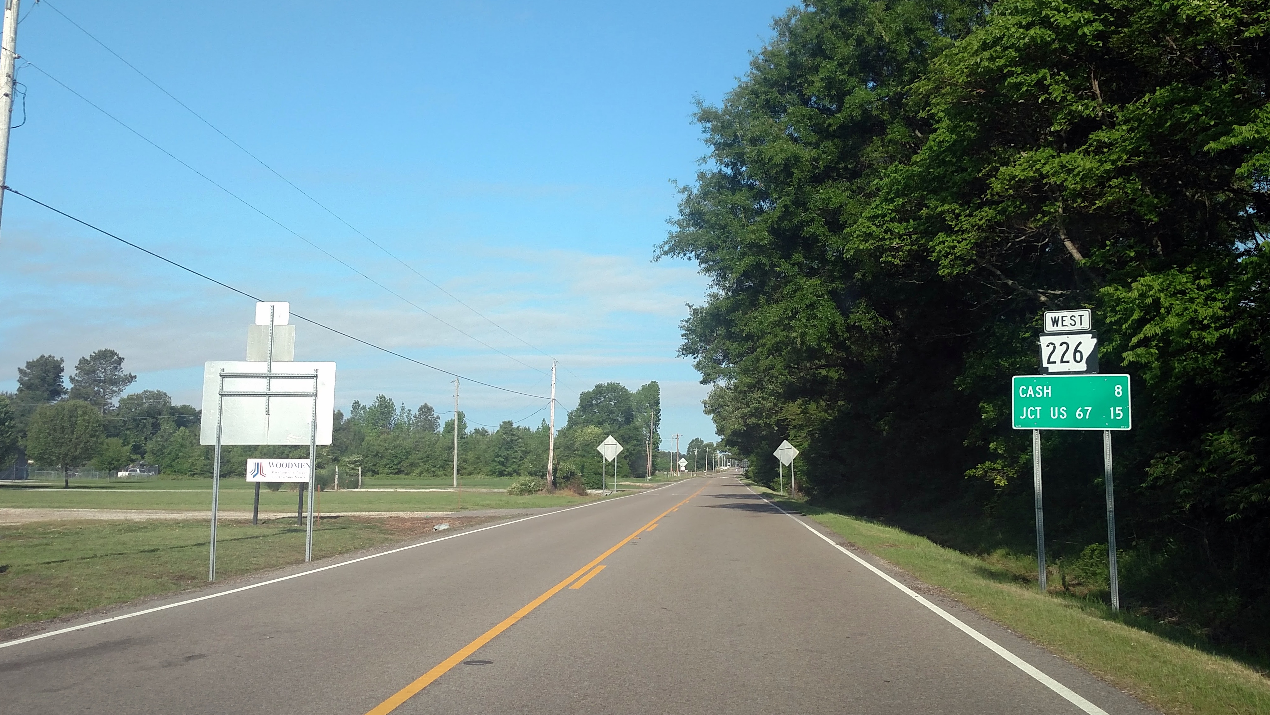
Arkansas Highway 226 is a designation for two state highways in northeast Arkansas. The main segment of runs east from an intersection of U.S. Route 67/Arkansas Highway 367 to I-555/US 63/ AR 18 in Jonesboro. A short route of runs in rural Jackson County west of Tuckerman. Route description Western Jackson County AR 226 runs east from Jackson CR 278 to cross AR 17 to AR 37, where it terminates. Swifton to Jonesboro The route then runs due east near Swifton through AR 18 in Cash, also meeting AR 349 near Jonesboro. Highway 226 winds into Jonesboro, meeting US 63/AR 18 and terminating. The route is two-lane undivided for most of its length, passing through flat, square farmland. In 2012, construction was completed that widened four miles of the highway to a four-lane divided facility from the highway's intersection with U.S. 67 (Future I-57) to just west of Cash. This was the first section of a larger plan that will ultimately widen Highway 226 to four lanes divided ... [...More Info...] [...Related Items...] OR: [Wikipedia] [Google] [Baidu] |


