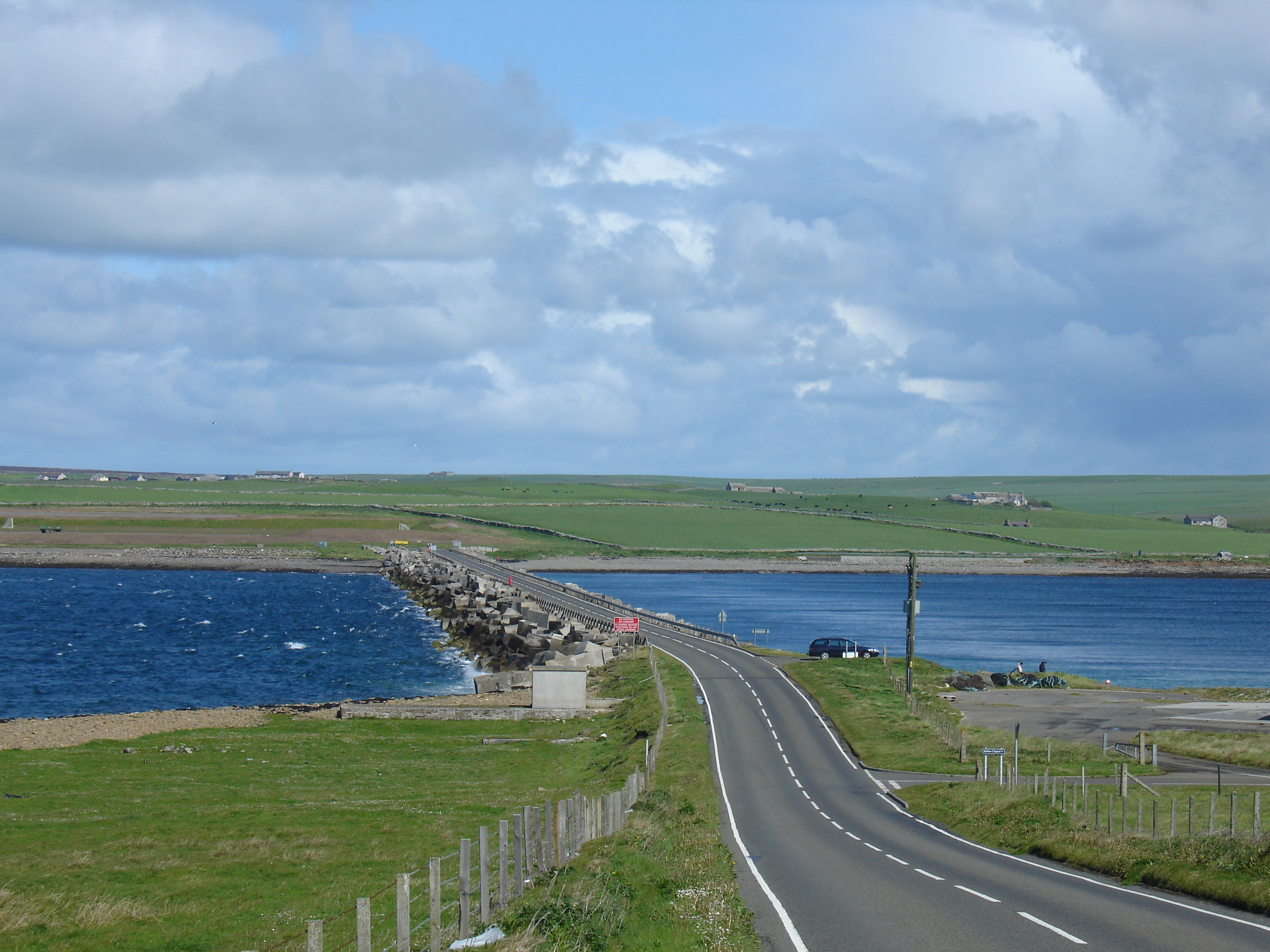
A961 road on:
[Wikipedia]
[Google]
[Amazon]
The A961 is a single-carriageway road on the eastern side of Scapa Flow in the Orkney Islands, connecting the town of  Proceeding southwards from Kirkwall, the road travels south to St Mary's, from where it crosses
Kirkwall
Kirkwall ( sco, Kirkwaa, gd, Bàgh na h-Eaglaise, nrn, Kirkavå) is the largest town in Orkney, an archipelago to the north of mainland Scotland.
The name Kirkwall comes from the Norse name (''Church Bay''), which later changed to ''Kirkv ...
on the Orkney Mainland
The Mainland, also known as Hrossey and Pomona, is the main island of Orkney, Scotland. Both of Orkney's burghs, Kirkwall and Stromness, lie on the island, which is also the heart of Orkney's ferry and air connections.
Seventy-five per cent of O ...
to Burwick at the southern end of South Ronaldsay.
The road links four islands to the mainland, crossing four causeways known collectively as the Churchill Barriers
The Churchill Barriers are four causeways in the Orkney islands with a total length of . They link the Orkney Mainland in the north to the island of South Ronaldsay via Burray and the two smaller islands of Lamb Holm and Glimps Holm.
The ba ...
, which were built during World War II
World War II or the Second World War, often abbreviated as WWII or WW2, was a world war that lasted from 1939 to 1945. It involved the vast majority of the world's countries—including all of the great powers—forming two opposing ...
as naval defences to protect the natural harbour of Scapa Flow after a successful attack by a German U-boat
U-boats were naval submarines operated by Germany, particularly in the First and Second World Wars. Although at times they were efficient fleet weapons against enemy naval warships, they were most effectively used in an economic warfare ro ...
.
 Proceeding southwards from Kirkwall, the road travels south to St Mary's, from where it crosses
 Kirk Sound
Kirk is a Scottish and former Northern English word meaning "church". It is often used specifically of the Church of Scotland. Many place names and personal names are also derived from it.
Basic meaning and etymology
As a common noun, ''kirk' ...
on the first Churchill Barrier to the island of Lamb Holm
Lamb Holm is a small uninhabited island in Orkney, Scotland. The Italian Chapel, constructed during the Second World War, is the island's main attraction.
Lamb Holm is classified by the National Records of Scotland as an uninhabited island tha ...
, site of the Italian Chapel
The Italian Chapel is a highly ornate Catholic chapel on Lamb Holm in the Orkney Islands. It was built during World War II by Italian prisoners of war, who were housed on the previously uninhabited island while they constructed the Churchill B ...
built by the Italian prisoners of war who built the barriers.
The second barrier carries the road to the island of Glimps Holm
Glimps Holm or Glims Holm ( non, Glums Holm) is a small uninhabited islet in Orkney, Scotland.
Geography
Glimps Holm lies in Holm Sound, one of the eastern entrances to Scapa Flow, between Mainland, Orkney and the island of Burray. The Churc ...
, from where the third barrier connects to the larger island of Burray
Burray () is one of the Orkney Islands in Scotland. It lies to the east of Scapa Flow and is one of a chain of islands linked by the Churchill Barriers.
Geography and geology
Burray lies between Mainland, Orkney and South Ronaldsay, and is ...
. From the southern shore of Burray, the fourth Churchill barrier (which has accumulated large sand dunes and no longer looks a barrier) passes onto the much larger South Ronaldsay, the southernmost island of Orkney. The road turns south-west to the village of St Margaret's Hope, from where it continues south to Burwick, near the southernmost point of Orkney.
References
External links
AA Road Atlas of Great Britain, 2006 Roads in Scotland Transport in Orkney {{Orkney-stub