|
The Minch
The Minch ( gd, An Cuan Sgitheanach, ', ', '), also called North Minch, is a strait in north-west Scotland, separating the north-west Scottish Highlands, Highlands and the northern Inner Hebrides from Lewis and Harris in the Outer Hebrides. It was known as ("Scotland's fjord/firth") in Old Norse. The Lower Minch (), also known as the Little Minch, is the Minch's southern extension, separating Skye from the lower Outer Hebrides: North Uist, Benbecula, South Uist, Barra etc. It opens into the Sea of the Hebrides. The Little Minch is the northern limit of the Sea of the Hebrides. Geography The Minch and Lower Minch form part of the Inner Seas off the West Coast of Scotland, as defined by the International Hydrographic Organization. The Minch ranges from wide and is approximately long. It is believed to be the site of the Ullapool bolide impact, biggest meteorite ever to hit the British Isles. The Lower Minch is about wide. In June 2010 Eilidh Macdonald became the first person ... [...More Info...] [...Related Items...] OR: [Wikipedia] [Google] [Baidu] |
International Hydrographic Organization
The International Hydrographic Organization (IHO) is an intergovernmental organisation representing hydrography. , the IHO comprised 98 Member States. A principal aim of the IHO is to ensure that the world's seas, oceans and navigable waters are properly surveyed and charted. It does this through the setting of international standards, the co-ordination of the endeavours of the world's national hydrographic offices, and through its capacity building program. The IHO enjoys observer status at the United Nations, where it is the recognised competent authority on hydrographic surveying and nautical charting. When referring to hydrography and nautical charting in Conventions and similar Instruments, it is the IHO standards and specifications that are normally used. History The IHO was established in 1921 as the International Hydrographic Bureau (IHB). The present name was adopted in 1970, as part of a new international Convention on the IHO adopted by the then member nations. T ... [...More Info...] [...Related Items...] OR: [Wikipedia] [Google] [Baidu] |
Weavers Point
Weavers Point ( gd, Rubha an Fhigheadair) is a headland to the north of the entrance to Loch Maddy, on the north eastern coastline of North Uist in the Western Isles of Scotland. There has been a lighthouse on the headland since 1980. Lighthouse The light is modern construction established in 1980. It is a skeletal tower covered by aluminium panels with the light on the top, the characteristic light is not available. See also * List of lighthouses in Scotland * List of Northern Lighthouse Board lighthouses This is a list of the currently operational lighthouses of the Northern Lighthouse Board (NLB). The list is divided by geographical location, and then by whether the lighthouses are classed by the NLB as a 'major lighthouse' or a 'minor light'. F ... References External links Northern Lighthouse Board Picture of Weavers Point Lighthouse North Uist Headlands of Scotland Landforms of the Outer Hebrides {{WesternIsles-geo-stub ... [...More Info...] [...Related Items...] OR: [Wikipedia] [Google] [Baidu] |
An T-Iasgair
An t-Iasgair (Scottish Gaelic for ''the Fisherman'') is a skerry in the Little Minch, to the north of the Trotternish peninsula of Skye. It lies 1.5 miles north north west of Ru Bornesketaig and is marked by a navigation light. It is the largest and highest in a group of three rocks, with smaller neighbours of Sgeir nan Ruideag and An Dubh Sgeir. See also * List of lighthouses in Scotland * List of Northern Lighthouse Board lighthouses This is a list of the currently operational lighthouses of the Northern Lighthouse Board (NLB). The list is divided by geographical location, and then by whether the lighthouses are classed by the NLB as a 'major lighthouse' or a 'minor light'. F ... References External links Northern Lighthouse Board Closeup of the light Landforms of the Isle of Skye Skerries of Scotland Islands of Highland (council area) {{WesternIsles-geo-stub ... [...More Info...] [...Related Items...] OR: [Wikipedia] [Google] [Baidu] |
Waternish Point
Waternish or Vaternish Point (Scottish Gaelic Rubha Bhatairnis) is the northwestern promontory of the Waternish Waternish or Vaternish ( gd, Bhàtairnis) is a peninsula approximately long on the island of Skye, Scotland, situated between Loch Dunvegan and Loch Snizort in the northwest of the island, and originally inhabited and owned by Clan MacNeacail/M ... peninsula on Skye. Its chief feature is the steep cliff above a rocky beach. Above the cliff grassy terrain rises gently to the abandoned settlement of Unish, now only ruins. The grassland over the point is considered part of the point. It was once farmed from Unish. Waternish Point has housed the Vaternish Lighthouse since 1924. Geography Vaternish Point is a rugged, uncultivated high promontory. Footnotes External links {{commons category Landforms of the Isle of Skye Headlands of Scotland Landforms of Highland (council area) ... [...More Info...] [...Related Items...] OR: [Wikipedia] [Google] [Baidu] |
Neist Point
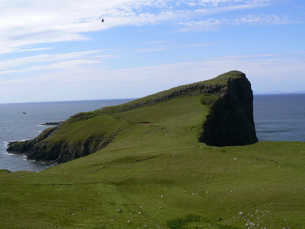
Neist Point ( gd, Rubha na h-Eist) is a viewpoint on the most westerly point of Skye. Neist Point Lighthouse has been located there since 1909. Geography Neist Point is the most westerly point on the Duirinish peninsula on the Isle of Skye. It projects into The Minch and provides a walk and viewpoint. Natural history Basalt at Neist Point is very similar to that at the Giant's Causeway in Northern Ireland. A steep path leads down from the road. Whales, dolphins, porpoises and basking shark can be seen from the point. Common seabirds include gannets, black guillemots, razorbills and European shags. Several rare plants, including saxifrage ''Saxifraga'' is the largest genus in the family Saxifragaceae, containing about 465 species of holarctic perennial plants, known as saxifrages or rockfoils. The Latin word ''saxifraga'' means literally "stone-breaker", from Latin ' ("rock" or " ...s are found on the point. References External links {{Coord, 57.421, N, 6.787, W, regi ... [...More Info...] [...Related Items...] OR: [Wikipedia] [Google] [Baidu] |
Hyskeir
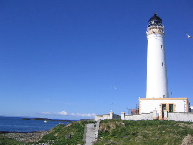
Hyskeir ( gd, Òigh-sgeir) or Heyskeir is a low-lying rocky islet (a skerry) in the Inner Hebrides, Scotland. The Hyskeir Lighthouse marks the southern entrance to the Minch. Geography Hyskeir lies in the southern entrance to the Minch, 10 kilometres southwest of the island of Canna and 14 kilometres west of Rùm. Garbh Sgeir is a rock that lies next to the islet and the landing place for Hyskeir lies in the channel between the two. Both islands are unoccupied. Òigh-sgeir is composed of hexagonal pitchstone columns. The owner of the island in the 19th and early 20th centuries was Philip Ollas. At that time sheep from Canna were brought to make use of the summer grazing. Etymology Hyskeir is from the Old Norse ''sker'' meaning skerry. ''Òigh-sgeir'' is Gaelic for 'maiden' or 'virgin rock', ''sgeir'' also meaning skerry. The English name 'Maiden Rock' has also been used. Lighthouse Hyskeir Lighthouse was established in 1904. The building marks the southern end of the M ... [...More Info...] [...Related Items...] OR: [Wikipedia] [Google] [Baidu] |
Ushenish
Ushenish is a headland on the remote east coast of South Uist in the Outer Hebrides of Scotland. Ushenish Lighthouse The Ushenish Lighthouse is an active lighthouse located in South Uist, Outer Hebrides, Scotland. History Ushenish Lighthouse was designed by engineers, David and Thomas Stevenson. Established in 1857, it incorporated a new 'condensing' appara ... has been on the headland since 1857. Footnotes {{reflist South Uist Headlands of Scotland Landforms of the Outer Hebrides ... [...More Info...] [...Related Items...] OR: [Wikipedia] [Google] [Baidu] |
Barra Head
Barra Head, also known as Berneray ( gd, Beàrnaraigh; sco, Barra Heid), is the southernmost island of the Outer Hebrides in Scotland. Within the Outer Hebrides, it forms part of the Barra Isles archipelago. Originally, Barra Head only referred to the southernmost headland of Berneray but is now a common name for the entire island. The highest point of the island is Sotan, a Marilyn. There are numerous prehistoric structures on the island and permanent occupation by 20–50 individuals occurred throughout the historic period, peaking in the 19th century. The economy of the residents was based on agriculture, fishing and fowling. The cliffs provide nesting sites for seabirds in such profusion that Berneray has been designated as a Special Protection Area. The Barra Head Lighthouse, designed by Robert Stevenson, has operated since 1833. From 1931 to 1980 Barra Head was inhabited only by the lighthouse keepers and their wives but the lighthouse is now automated and t ... [...More Info...] [...Related Items...] OR: [Wikipedia] [Google] [Baidu] |
Caledonian MacBrayne
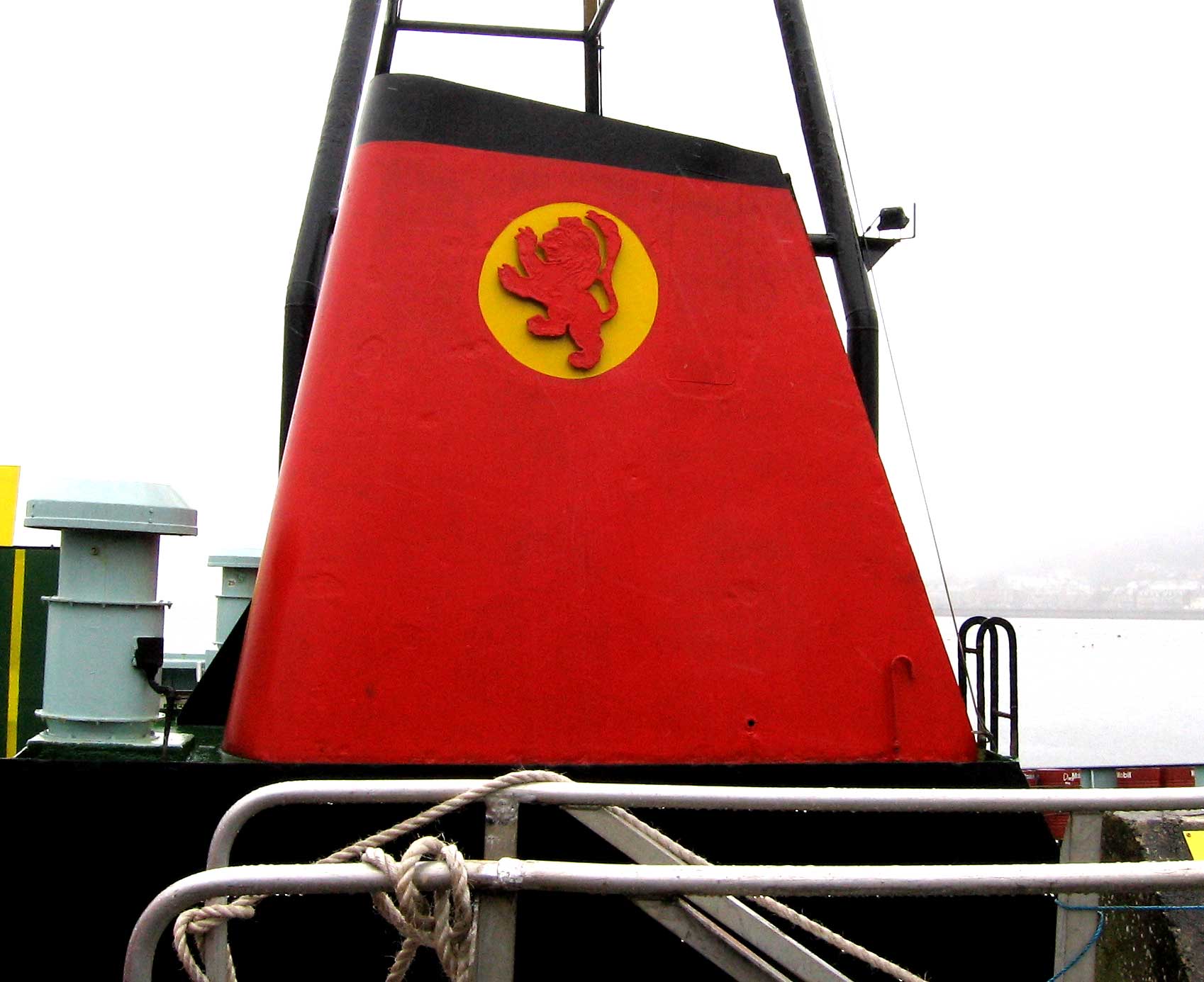
Caledonian MacBrayne ( gd, Caledonian Mac a' Bhriuthainn), usually shortened to CalMac, is the major operator of passenger and vehicle ferries, and ferry services, between the mainland of Scotland and 22 of the major islands on Scotland's west coast. Since 2006, the company's official name has been CalMac Ferries Ltd, although it still operates as Caledonian MacBrayne. In 2006, it also became a subsidiary of holding company David MacBrayne, which is owned by the Scottish Government. History David MacBrayne MacBrayne's, initially known as David Hutcheson & Co., began in 1851 as a private steamship operator when G. and J. Burns, operators of the largest of the Clyde fleets, decided to concentrate on coastal and transatlantic services and handed control of their river and Highland steamers to a new company in which Hutcheson, their manager of these services, became senior partner. One of the other partners was David MacBrayne (1817-1907), nephew of Messrs. Burns. In 1878, the ... [...More Info...] [...Related Items...] OR: [Wikipedia] [Google] [Baidu] |
Ferry
A ferry is a ship, watercraft or amphibious vehicle used to carry passengers, and sometimes vehicles and cargo, across a body of water. A passenger ferry with many stops, such as in Venice, Italy, is sometimes called a water bus or water taxi. Ferries form a part of the public transport systems of many waterside cities and islands, allowing direct transit between points at a capital cost much lower than bridges or tunnels. Ship connections of much larger distances (such as over long distances in water bodies like the Mediterranean Sea) may also be called ferry services, and many carry vehicles. History In ancient times The profession of the ferryman is embodied in Greek mythology in Charon, the boatman who transported souls across the River Styx to the Underworld. Speculation that a pair of oxen propelled a ship having a water wheel can be found in 4th century Roman literature "''Anonymus De Rebus Bellicis''". Though impractical, there is no reason why it could not work ... [...More Info...] [...Related Items...] OR: [Wikipedia] [Google] [Baidu] |


