|
Tripod (surveying)
A surveyor's tripod is a device used to support any one of a number of surveying instruments, such as theodolites, total stations, Dumpy level, levels or transits. History The modern sturdy, but portable, tripod stand with three leg pairs hinged to a triangular metal head was invented and first manufactured for sale by Sir Francis Ronalds in the late 1820s in Croydon. He sold 140 of the stands in the decade 1830-40 and his design was soon imitated by others. Older surveying tripods had slightly different features compared to modern ones. For example, on some older tripods, the instrument had its own footplate and did not need to move laterally relative to the tripod head. For this reason, the head of the tripod was not a flat footplate but was simply a large diameter fitting. Threads on the outside of the head engaged threads on the instrument's footplate. No other mounting screw was used. Fixed length legs were also seen on older instruments. Instrument height was adjusted by ... [...More Info...] [...Related Items...] OR: [Wikipedia] [Google] [Baidu] |
Surveyors Tripod
Surveying or land surveying is the technique, profession, art, and science of determining the land, terrestrial Two-dimensional space#In geometry, two-dimensional or Three-dimensional space#In Euclidean geometry, three-dimensional positions of Point (geometry), points and the Euclidean distance, distances and angles between them. A land surveying professional is called a land surveyor. These points are usually on the surface of the Earth, and they are often used to establish maps and boundaries for ownership, locations, such as the designed positions of structural components for construction or the surface location of subsurface features, or other purposes required by government or civil law, such as property sales. Surveyors work with elements of geodesy, geometry, trigonometry, regression analysis, physics, engineering, metrology, programming languages, and the law. They use equipment, such as total stations, robotic total stations, theodolites, Satellite navigation, GNSS rec ... [...More Info...] [...Related Items...] OR: [Wikipedia] [Google] [Baidu] |
Surveying Instruments
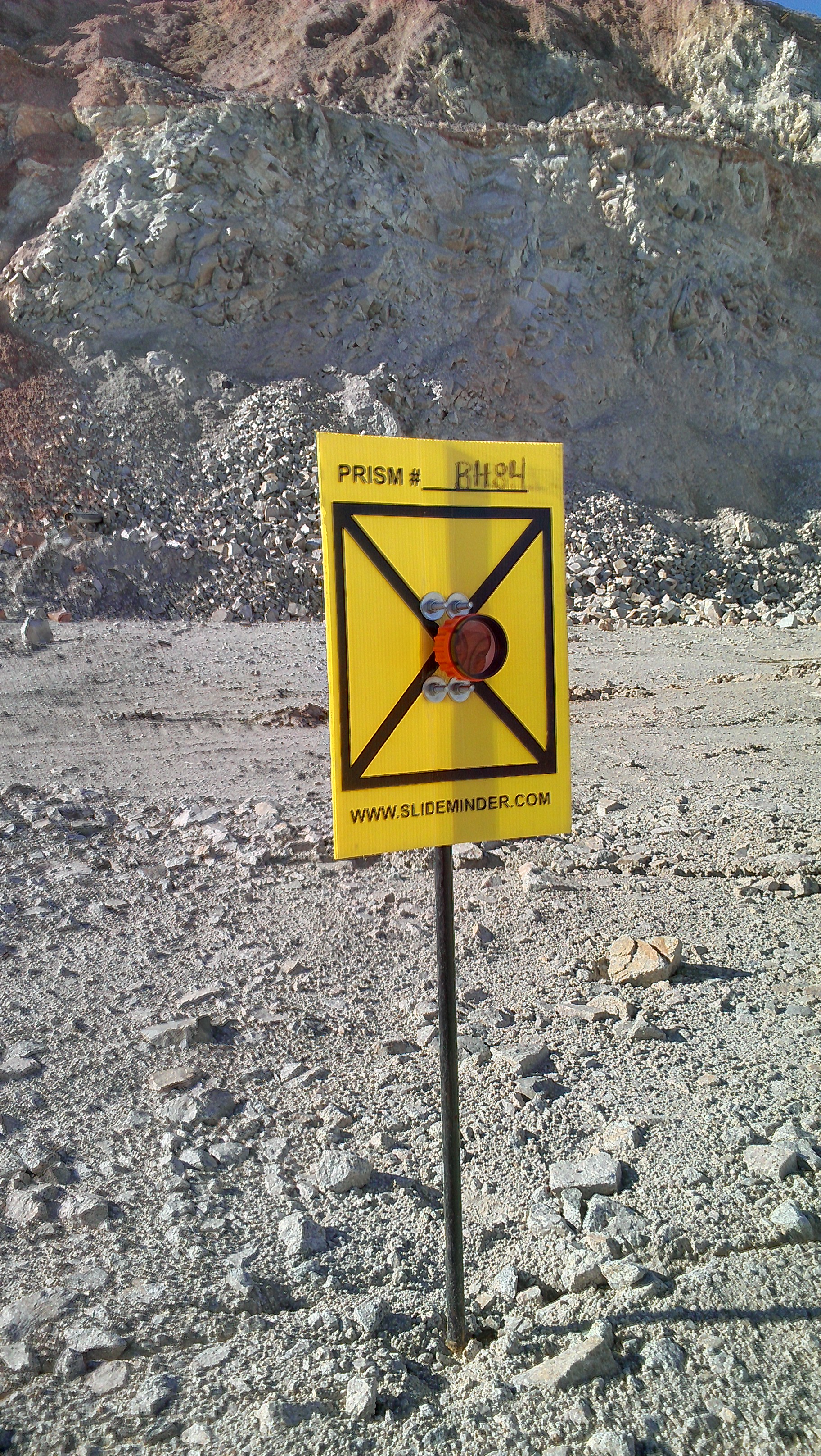
Instruments used in surveying include: * Alidade * Alidade table * Cosmolabe * Dioptra * Dumpy level * Engineer's chain * Geodimeter * Graphometer * Groma (surveying) * Laser scanning * Level * Level staff * Measuring tape * Plane table * Pole (surveying) * Prism (surveying) (corner cube retroreflector) * Prismatic compass (angle measurement) * Ramsden surveying instruments * Ranging rod * Surveyor's chain * Surveyor's compass * Tachymeter (surveying) * Tape (surveying) * Tellurometer * Theodolite ** Half theodolite ** Plain theodolite ** Simple theodolite ** Great theodolite ** Non-transit theodolite ** Transit theodolite ** Seconds theodolite ** Electronic theodolite ** Mining theodolite ** Suspension theodolite ** Traveling theodolite ** Pibal theodolite ** Registering theodolite ** Gyro-theodolite ** Construction theodolite ** Photo-theodolite ** Robotic theodolite ** Vernier theodolite * Total station * Transit (surveying) * Tripod (surveying) * Universal instr ... [...More Info...] [...Related Items...] OR: [Wikipedia] [Google] [Baidu] |
Theodolite
A theodolite () is a precision optical instrument for measuring angles between designated visible points in the horizontal and vertical planes. The traditional use has been for land surveying, but it is also used extensively for building and infrastructure construction, and some specialized applications such as meteorology and rocket launching. It consists of a moveable telescope mounted so it can rotate around horizontal and vertical axes and provide angular readouts. These indicate the orientation of the telescope, and are used to relate the first point sighted through the telescope to subsequent sightings of other points from the same theodolite position. These angles can be measured with accuracies down to microradians or seconds of arc. From these readings a plan can be drawn, or objects can be positioned in accordance with an existing plan. The modern theodolite has evolved into what is known as a total station where angles and distances are measured electronically, and ... [...More Info...] [...Related Items...] OR: [Wikipedia] [Google] [Baidu] |
Total Station
A total station (TS) or total station theodolite (TST) is an electronic/optical instrument used for surveying and building construction. It is an electronic transit theodolite integrated with electronic distance measurement (EDM) to measure both vertical and horizontal angles and the slope distance from the instrument to a particular point, and an on-board computer to collect data and perform triangulation calculations. Robotic or motorized total stations allow the operator to control the instrument from a distance via remote control. In theory, this eliminates the need for an assistant staff member as the operator holds the retroreflector and controls the total station from the observed point. In practice however, an assistant surveyor is often needed when the surveying is being conducted in busy areas such as on a public carriageway or construction site. This is to prevent people from disrupting the total station as they walk past, which would neccesitate resetting the tripo ... [...More Info...] [...Related Items...] OR: [Wikipedia] [Google] [Baidu] |
Dumpy Level
A level is an optical instrument used to establish or verify points in the same horizontal plane in a process known as levelling, and is used in conjunction with a levelling staff to establish the relative height levels of objects or marks. It is widely used in surveying and construction to measure height differences and to transfer, measure, and set heights of known objects or marks. It is also known as a surveyor's level, builder's level, dumpy level or the historic "Y" level. It operates on the principle of establishing a visual level relationship between two or more points, for which an inbuilt telescope and a highly accurate bubble level are used to achieve the necessary accuracy. Traditionally the instrument was completely adjusted manually to ensure a level line of sight, but modern automatic versions self-compensate for slight errors in the coarse levelling of the instrument, and are thereby quicker to use. The optical level should not be confused with a theodolite, w ... [...More Info...] [...Related Items...] OR: [Wikipedia] [Google] [Baidu] |
Francis Ronalds
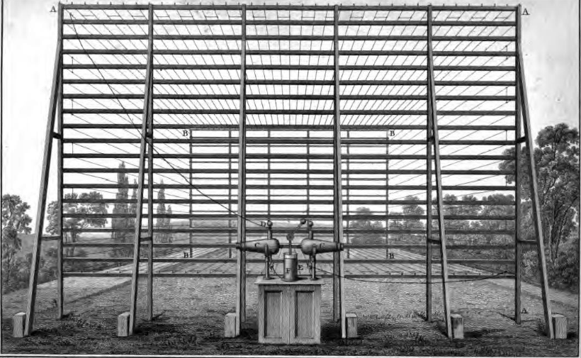
Sir Francis Ronalds FRS (21 February 17888 August 1873) was an English scientist and inventor, and arguably the first electrical engineer. He was knighted for creating the first working electric telegraph over a substantial distance. In 1816 he laid an eight-mile length of iron wire between wooden frames in his mother's garden and sent pulses using electrostatic generators. Upbringing and family Born to Francis Ronalds and Jane (née Field), wholesale cheesemongers, at their business premises in Upper Thames Street, London, he attended Unitarian minister Eliezer Cogan's school before being apprenticed to his father at the age of 14 through the Drapers' Company. He ran the large business for some years. The family later resided in Canonbury Place and Highbury Terrace, both in Islington, at Kelmscott House in Hammersmith, Queen Square in Bloomsbury, at Croydon, and on Chiswick Lane. Several of Ronalds' eleven brothers and sisters also led noteworthy lives. His younges ... [...More Info...] [...Related Items...] OR: [Wikipedia] [Google] [Baidu] |
Croydon
Croydon is a large town in south London, England, south of Charing Cross. Part of the London Borough of Croydon, a local government district of Greater London. It is one of the largest commercial districts in Greater London, with an extensive shopping district and night-time economy. The entire town had a population of 192,064 as of 2011, whilst the wider borough had a population of 384,837. Historically an ancient parish in the Wallington hundred of Surrey, at the time of the Norman conquest of England Croydon had a church, a mill, and around 365 inhabitants, as recorded in the Domesday Book of 1086. Croydon expanded in the Middle Ages as a market town and a centre for charcoal production, leather tanning and brewing. The Surrey Iron Railway from Croydon to Wandsworth opened in 1803 and was an early public railway. Later 19th century railway building facilitated Croydon's growth as a commuter town for London. By the early 20th century, Croydon was an important industria ... [...More Info...] [...Related Items...] OR: [Wikipedia] [Google] [Baidu] |
Surveying
Surveying or land surveying is the technique, profession, art, and science of determining the terrestrial two-dimensional or three-dimensional positions of points and the distances and angles between them. A land surveying professional is called a land surveyor. These points are usually on the surface of the Earth, and they are often used to establish maps and boundaries for ownership, locations, such as the designed positions of structural components for construction or the surface location of subsurface features, or other purposes required by government or civil law, such as property sales. Surveyors work with elements of geodesy, geometry, trigonometry, regression analysis, physics, engineering, metrology, programming languages, and the law. They use equipment, such as total stations, robotic total stations, theodolites, GNSS receivers, retroreflectors, 3D scanners, LiDAR sensors, radios, inclinometer, handheld tablets, optical and digital levels, subsurface locators, d ... [...More Info...] [...Related Items...] OR: [Wikipedia] [Google] [Baidu] |
Surveyors Tripod Head
Surveying or land surveying is the technique, profession, art, and science of determining the terrestrial two-dimensional or three-dimensional positions of points and the distances and angles between them. A land surveying professional is called a land surveyor. These points are usually on the surface of the Earth, and they are often used to establish maps and boundaries for ownership, locations, such as the designed positions of structural components for construction or the surface location of subsurface features, or other purposes required by government or civil law, such as property sales. Surveyors work with elements of geodesy, geometry, trigonometry, regression analysis, physics, engineering, metrology, programming languages, and the law. They use equipment, such as total stations, robotic total stations, theodolites, GNSS receivers, retroreflectors, 3D scanners, LiDAR sensors, radios, inclinometer, handheld tablets, optical and digital levels, subsurface locators, dron ... [...More Info...] [...Related Items...] OR: [Wikipedia] [Google] [Baidu] |
Surveyors Tripod Foot
Surveying or land surveying is the technique, profession, art, and science of determining the terrestrial two-dimensional or three-dimensional positions of points and the distances and angles between them. A land surveying professional is called a land surveyor. These points are usually on the surface of the Earth, and they are often used to establish maps and boundaries for ownership, locations, such as the designed positions of structural components for construction or the surface location of subsurface features, or other purposes required by government or civil law, such as property sales. Surveyors work with elements of geodesy, geometry, trigonometry, regression analysis, physics, engineering, metrology, programming languages, and the law. They use equipment, such as total stations, robotic total stations, theodolites, GNSS receivers, retroreflectors, 3D scanners, LiDAR sensors, radios, inclinometer, handheld tablets, optical and digital levels, subsurface locators, dron ... [...More Info...] [...Related Items...] OR: [Wikipedia] [Google] [Baidu] |
Plumb Bob
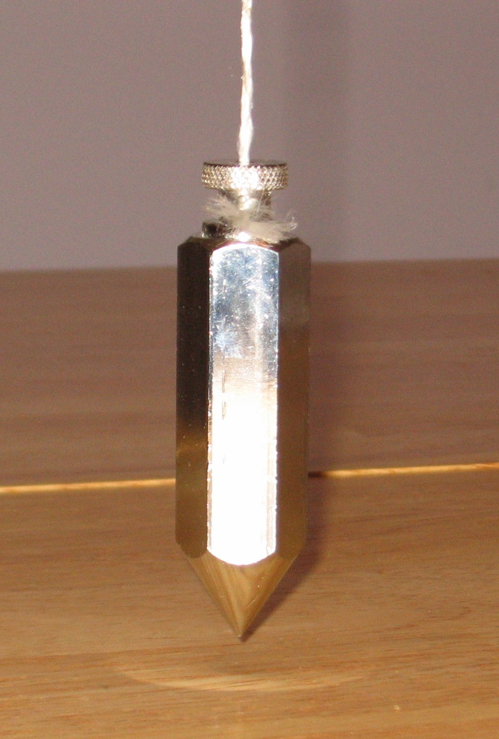
A plumb bob, plumb bob level, or plummet, is a weight, usually with a pointed tip on the bottom, suspended from a string and used as a vertical reference line, or plumb-line. It is a precursor to the spirit level and used to establish a vertical datum. It is typically made of stone, wood, or lead, but can also be made of other metals. If it is used for decoration, it may be made of bone or ivory. The instrument has been used since at least the time of ancient EgyptDenys A. Stocks. Experiments in Egyptian archaeology: stoneworking technology in ncient Egypt'. Routledge; 2003. . p. 180. to ensure that constructions are "plumb", or vertical. It is also used in surveying, to establish the nadir with respect to gravity of a point in space. It is used with a variety of instruments (including levels, theodolites, and steel tapes) to set the instrument exactly over a fixed survey marker or to transcribe positions onto the ground for placing a marker. Etymology The ''plu ... [...More Info...] [...Related Items...] OR: [Wikipedia] [Google] [Baidu] |
Benchmark (surveying)
The term benchmark, bench mark, or survey benchmark originates from the chiseled horizontal marks that surveyors made in stone structures, into which an angle-iron could be placed to form a "bench" for a leveling rod, thus ensuring that a leveling rod could be accurately repositioned in the same place in the future. These marks were usually indicated with a chiseled arrow below the horizontal line. The term is generally applied to any item used to mark a point as an elevation reference. Frequently, bronze or aluminum disks are set in stone or concrete, or on rods driven deeply into the earth to provide a stable elevation point. If an elevation is marked on a map, but there is no physical mark on the ground, it is a spot height. Purpose The height of a benchmark is calculated relative to the heights of nearby benchmarks in a network extending from a ''fundamental benchmark''. A fundamental benchmark is a point with a precisely known relationship to the vertical datum of t ... [...More Info...] [...Related Items...] OR: [Wikipedia] [Google] [Baidu] |
_crop.jpg)


