|
The Wirral
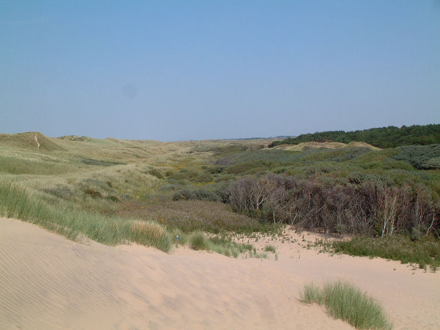
The Wirral Peninsula (), known locally as the Wirral, is a peninsula in North West England. The roughly rectangular peninsula is about long and wide, and is bounded by the Dee Estuary to the west, the Mersey Estuary to the east, and Liverpool Bay to the north. Historically, the Wirral was wholly in Cheshire; in the Domesday Book, its border with the rest of the county was placed at "two arrow falls from Chester city walls". However, since the Local Government Act 1972, only the southern third has been in Cheshire, with almost all the rest lying in the Metropolitan Borough of Wirral, Merseyside. An area of saltmarsh and reclaimed land adjoining the south-west of the peninsula lies in the Welsh county of Flintshire. Toponymy The name Wirral literally means " myrtle corner", from the Old English , a myrtle tree, and , an angle, corner or slope. It is supposed that the land was once overgrown with bog myrtle, a plant no longer found in the area, but plentiful around Formby, t ... [...More Info...] [...Related Items...] OR: [Wikipedia] [Google] [Baidu] |
Fort Perch Rock
Fort Perch Rock is a former defence installation situated at the mouth of Liverpool Bay in New Brighton. Built in the 1820s to defend the Port of Liverpool, it is now a tourist attraction and museum. It has been used as a venue for musical concerts and has been listed as a Grade II* Listed Building. The Fort's cafe "The Mess" is open daily from 9 am. A World War 2 escape room concept "Escape The Fort" runs within the fort. History Fort Perch Rock is a coastal defence battery built between 1825 and 1829, with the foundation stone being laid in 1826. It was built to protect the Port of Liverpool and proposed as a fortified lighthouse to replace the old Perch Rock Light; however, a separate lighthouse was built. The fort was built on an area known as Black Rock, and was cut off at high tide. However, coastal reclamation has made it fully accessible. The Fort covers an area of about , with enough space for 100 men. It was built with red sandstone from the Runcorn quarries. ... [...More Info...] [...Related Items...] OR: [Wikipedia] [Google] [Baidu] |
Local Government Act 1972
The Local Government Act 1972 (c. 70) is an act of the Parliament of the United Kingdom that reformed local government in England and Wales on 1 April 1974. It was one of the most significant acts of Parliament to be passed by the Heath Government of 1970–74. The act took the total number of councils in England from 1,245 to 412 (excluding parish councils), and in Wales to 45. Its pattern of two-tier metropolitan and non-metropolitan county and district councils remains in use today in large parts of England, although the metropolitan county councils were abolished in 1986, and both county and district councils have been replaced with unitary authorities in many areas since the 1990s. In Wales, too, the Act established a similar pattern of counties and districts, but these have since been entirely replaced with a system of unitary authorities. Elections were held to the new authorities in 1973, and they acted as "shadow authorities" until the handover date. Elect ... [...More Info...] [...Related Items...] OR: [Wikipedia] [Google] [Baidu] |
Hoylake
Hoylake () is a coast, seaside town in the Metropolitan Borough of Wirral, Merseyside, England. It is at the north west of the Wirral Peninsula, near West Kirby and where the River Dee, Wales, River Dee meets the Irish Sea. At the 2021 United Kingdom census, 2021 census, the built up area had a population of 5,315. In the nineteenth century, the town grew up around the small fishing village of Hoose (), a settlement that was recorded in the Domesday Book of 1086 within the Hundreds of Cheshire, Hundred of Wirral Hundred, 'Wilaveston' (Historic counties of England, historically part of Cheshire). The town takes its name from 'Hoyle Lake', a nearby channel of water out towards Hilbre Island that provided a safe anchorage for shipping. History In 1690, William III of England, William III set sail from Hoylake, then known as ''Hyle'' or ''High-lake'', with a 10,000-strong army to Ireland, where his army was to take part in the Battle of the Boyne. The location of departure remains ... [...More Info...] [...Related Items...] OR: [Wikipedia] [Google] [Baidu] |
Irby, Merseyside
Irby () is a village on the Wirral Peninsula, in Merseyside, England. The village covers an area of 20 square kilometres. To the north of Irby lies the associated Hamlet (place), hamlet of Irby Hill. It is part of the Greasby, Frankby and Irby (ward), Greasby, Frankby and Irby Ward of the Metropolitan Borough of Wirral and is within the parliamentary constituency of Wirral West. According to the 2001 United Kingdom census, 2001 census, Irby had a population of 6,110, By the time of the 2011 United Kingdom census, 2011 census a separate statistic for Irby was no longer maintained. However, the total population of Greasby, Frankby and Irby Ward was 13,991. History The name Irby ''(Iri býr)'' is of Viking origin, meaning "farmstead or settlement of the Irish people, Irish". It is derived from the Old Norse words ''Íri'' (Irishman) and ''bȳ'' (a farmstead or settlement). Historically, the name has been spelt as ''Irreby'' (1096) and ''Ireby'' (1232). Other nearby towns and vil ... [...More Info...] [...Related Items...] OR: [Wikipedia] [Google] [Baidu] |
Greasby
Greasby () is a large village on the Wirral Peninsula, Merseyside, England. A predominantly residential area, it is contiguous with Upton to the east and Saughall Massie to the north. The small village of Frankby is to the immediate west. Historically within the county of Cheshire, it is part of the Greasby, Frankby and Irby Ward of the Metropolitan Borough of Wirral and is in the parliamentary constituency of Wirral West. At the 2001 census, Greasby had 9,830 inhabitants, with the total population of the ward at 14,667. In the 2011 census the population of Greasby was not measured. However the total population of Greasby, Frankby and Irby Ward was 13,991. History The earliest known human settlement in Merseyside has been found at Greasby, believed to date from approximately 7000 BC. A rectangular floor of sandstone slabs and pebbles suggests regular use by the nomadic hunters of that period. The remains of burnt hazelnut shells found at the site were used for rad ... [...More Info...] [...Related Items...] OR: [Wikipedia] [Google] [Baidu] |
Mesolithic
The Mesolithic (Ancient Greek language, Greek: μέσος, ''mesos'' 'middle' + λίθος, ''lithos'' 'stone') or Middle Stone Age is the Old World archaeological period between the Upper Paleolithic and the Neolithic. The term Epipaleolithic is often used synonymously, especially for outside northern Europe, and for the corresponding period in Epipaleolithic Near East, the Levant and Epipaleolithic Caucasus, Caucasus. The Mesolithic has different time spans in different parts of Eurasia. It refers to the final period of hunter-gatherer cultures in Europe and the Middle East, between the end of the Last Glacial Maximum and the Neolithic Revolution. In Europe it spans roughly 15,000 to 5,000 Before Present, BP; in the Middle East (the Epipalaeolithic Near East) roughly 20,000 to 10,000 Before Present, BP. The term is less used of areas farther east, and not at all beyond Eurasia and North Africa. The type of culture associated with the Mesolithic varies between areas, b ... [...More Info...] [...Related Items...] OR: [Wikipedia] [Google] [Baidu] |
Hundred Of Wirral
The Hundred of Wirral is the ancient administrative area for the Wirral Peninsula. Its name is believed to have originated from the ''Hundred of Wilaveston'', the historic name for Willaston, which was an important assembly point in the Wirral Hundred during the Middle Ages. The ''ton'' suffix in a place name normally indicates a previous use as a meeting location for officials. During its existence, the hundred was one of the Hundreds of Cheshire. Since local government reorganisation, implemented on 1 April 1974, the area is split between Merseyside (Metropolitan Borough of Wirral) and Cheshire. Villages The Hundred 100 or one hundred (Roman numerals, Roman numeral: C) is the natural number following 99 (number), 99 and preceding 101 (number), 101. In mathematics 100 is the square of 10 (number), 10 (in scientific notation it is written as 102). The standar ... contained the following villages: References Metropolitan Borough of Wirral Hundreds of Cheshire Lo ... [...More Info...] [...Related Items...] OR: [Wikipedia] [Google] [Baidu] |
Habitat
In ecology, habitat refers to the array of resources, biotic factors that are present in an area, such as to support the survival and reproduction of a particular species. A species' habitat can be seen as the physical manifestation of its ecological niche. Thus "habitat" is a species-specific term, fundamentally different from concepts such as Biophysical environment, environment or vegetation assemblages, for which the term "habitat-type" is more appropriate. The physical factors may include (for example): soil, moisture, range of temperature, and Luminous intensity, light intensity. Biotic index, Biotic factors include the availability of food and the presence or absence of Predation, predators. Every species has particular habitat requirements, habitat generalist species are able to thrive in a wide array of environmental conditions while habitat specialist species require a very limited set of factors to survive. The habitat of a species is not necessarily found in a ge ... [...More Info...] [...Related Items...] OR: [Wikipedia] [Google] [Baidu] |
Formby
Formby is a town and Civil parishes in England, civil parish in the Metropolitan Borough of Sefton, Merseyside, England. Historic counties of England, Historically in Lancashire, three manors are recorded in the Domesday Book of 1086 under "Fornebei", Halsall, Walton and Poynton. Cockle (bivalve), Cockle raking and shrimp fishing lasted into the 19th century. By 1872, the township and sub-district was made up of two chapelries (St Peter's Church, Formby, St Peter's and St Luke's Church, Formby, St Luke's), Birkdale township, the hamlets of Ainsdale and Raven-Meols and Altcar parish. The Section dedicated to Formby. Formby was built on the plain adjoining the Irish Sea coast a few miles north of the Crosby, Merseyside, Crosby channel. A commuter town for Liverpool, Formby is also a tourist destination with Day-tripper, day trippers attracted to its beaches, sand dunes and wildlife, particularly the endangered red squirrel and natterjack toad. The area is conserved by the Nati ... [...More Info...] [...Related Items...] OR: [Wikipedia] [Google] [Baidu] |
Old English
Old English ( or , or ), or Anglo-Saxon, is the earliest recorded form of the English language, spoken in England and southern and eastern Scotland in the Early Middle Ages. It developed from the languages brought to Great Britain by Anglo-Saxon settlers in the mid-5th century, and the first Old English literature dates from the mid-7th century. After the Norman Conquest of 1066, English was replaced for several centuries by Anglo-Norman language, Anglo-Norman (a langues d'oïl, type of French) as the language of the upper classes. This is regarded as marking the end of the Old English era, since during the subsequent period the English language was heavily influenced by Anglo-Norman, developing into what is now known as Middle English in England and Early Scots in Scotland. Old English developed from a set of Anglo-Frisian or Ingvaeonic dialects originally spoken by Germanic tribes traditionally known as the Angles (tribe), Angles, Saxons and Jutes. As the Germanic settlers ... [...More Info...] [...Related Items...] OR: [Wikipedia] [Google] [Baidu] |
Bog Myrtle
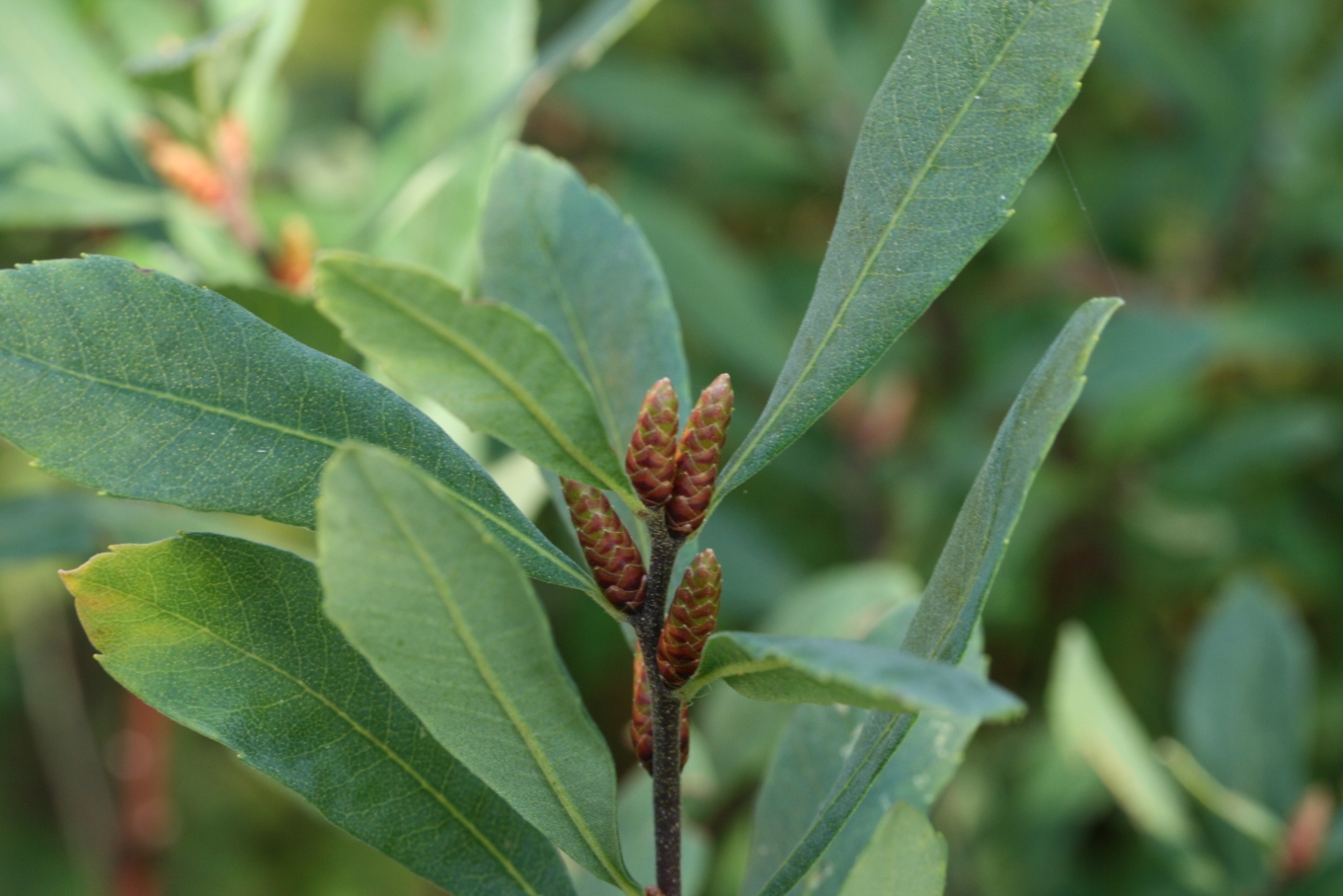
''Myrica gale'' is a species of flowering plant in the family Myricaceae native to parts of Eurasia and North America. Common names include bog-myrtle, sweet willow, Dutch myrtle, and sweetgale. Description ''Myrica gale'' is a deciduous shrub growing to tall and 1 m wide. The leaves are spirally arranged, simple, long, oblanceolate with a tapered base and broader tip, and a crinkled or finely toothed margin. The red–orange flowers are catkins, with male and female catkins on separate plants (dioecious). The fruit is a small, waxy drupe. Distribution and habitat Bog-myrtle is distributed throughout parts of the Northern Hemisphere, including Japan, North Korea, Russia, mainland Europe, the British Isles, Canada and the United States. It typically grows in acidic peat bogs, and to cope with these difficult nitrogen-poor growing conditions, the roots have nitrogen-fixing actinobacteria which enable the plants to grow. Ecology Sweetgale can grow in a narrow band in the ... [...More Info...] [...Related Items...] OR: [Wikipedia] [Google] [Baidu] |
Flintshire
Flintshire () is a county in the north-east of Wales. It borders the Irish Sea to the north, the Dee Estuary to the north-east, the English county of Cheshire to the east, Wrexham County Borough to the south, and Denbighshire to the west. Connah's Quay is the largest town, and Flintshire County Council is based in Ewloe. The county covers , with a population of 155,000 in 2021. After Connah's Quay (16,771), the largest settlements are Flint (13,736), Buckley (16,127) and Mold (10,123). The east of the county is industrialised and contains the Deeside conurbation, which extends into Cheshire and has a population of 53,568. The adjacent coast is also home to industry, but further west has been developed for tourism, particularly at Talacre. Inland, the west of the county is sparsely populated and characterised by gentle hills, including part of the Clwydian Range and Dee Valley AONB. The county is part of the preserved county of Clwyd. The county is named after th ... [...More Info...] [...Related Items...] OR: [Wikipedia] [Google] [Baidu] |


