|
Sidoarjo
Sidoarjo Regency ( jv, ꦑꦧꦸꦥꦠꦺꦤ꧀ꦱꦶꦢꦲꦂꦗ, Kabupatèn Sidaharja) is a regency in East Java, Indonesia. It is bordered by Surabaya city and Gresik Regency to the north, by Pasuruan Regency to the south, by Mojokerto Regency to the west and by the Madura Strait to the east. It has an area of 714.24 km2, making it the smallest regency in East Java. As at the 2010 census, Sidoarjo Regency had a population of 2,191,489; while the 2020 census showed a small decline to 2,033,760,Badan Pusat Statistik, Jakarta, 2021. notably in the northern part of the regency immediately bordering Surabaya. The regency is part of the urban region surrounding Surabaya, known as 'Gerbangkertosusila' area. Administrative districts The Sidoarjo Regency is divided into eighteen administrative districts (''kecamatan''). The districts are tabulated below with their areas and their populations at the 2010 census and the 2020 census. The table also includes the number of administr ... [...More Info...] [...Related Items...] OR: [Wikipedia] [Google] [Baidu] |
Sidoarjo Railway Station
Sidoarjo Station (SDA) is a railway station located in Lemahputro, Sidoarjo, Sidoarjo Regency, East Java, Indonesia. The station passes the railway to the east (Jember-Banyuwangi) and the path to Malang-Blitar. The station located at the height of + 4 meters is included in the Operation Area VIII Surabaya. History The station initially had seven track with track 1 as a straight track, but track 5 has now been evicted for new platforms and tracks 6 and 7 have now been evicted in 1992 for the purpose of shop development. Formerly this station contained locomotive depot and warehouse, but was demolished in 1992 due to the construction of shop. From track 4, the dead track that leads to is reactivated as part of the relocation of the Wonokromo–Bangil railway line following the hot mudflow in Porong. As a first-class train station, almost all trains stop at this station. Only freight trains (tank and cement) are passing directly / do not stop. Services Passenger trains that ... [...More Info...] [...Related Items...] OR: [Wikipedia] [Google] [Baidu] |
List Of Districts Of East Java
The province of East Java in Indonesia is divided into 29 ''kabupaten'' (or regencies) and 9 ''kotamadya'' (or cities); these in turn are divided administratively into districts, known as ''kecamatan'', of which there were 666 in 2020. These comprise 8,501 administrative villages (''kelurahan'' in urban areas and ''desa'' in rural areas). The districts of East Java, with the regency or city each falls into, are as follows: A-E *Ajung, Jember *Ambulu, Jember *Ambunten, Sumenep *Ampelgading, Malang *Arjasa, Jember *Arjasa, Situbondo *Arjasa, Sumenep *Arjosari, Pacitan *Arosbaya, Bangkalan *Asembagus, Situbondo *Asemrowo, Surabaya *Babadan, Ponorogo *Babat, Lamongan * Badas *Badegan, Ponorogo *Bagor, Nganjuk *Bakung, Blitar *Balen, Bojonegoro *Balerejo, Madiun *Balong, Ponorogo *Balongbendo, Sidoarjo *Balongpanggang, Gresik *Balung, Jember *Bancar, Tuban *Bandar Kedungmulyo, Jombang *Bandar, Pacitan *Bandung, Tulungagung *Bangil, Pasuruan *Bangilan, Tuban *Bangkalan, Bangkalan *B ... [...More Info...] [...Related Items...] OR: [Wikipedia] [Google] [Baidu] |
Surabaya
Surabaya ( jv, ꦱꦸꦫꦧꦪ or jv, ꦯꦹꦫꦨꦪ; ; ) is the capital city of the Provinces of Indonesia, Indonesian province of East Java and the List of Indonesian cities by population, second-largest city in Indonesia, after Jakarta. Located on the northeastern border of Java island, on the Madura Strait, it is one of the earliest port cities in Southeast Asia. According to the Government of Indonesia, National Development Planning Agency, Surabaya is one of the Regions of Indonesia#Development regions, four main central cities of Indonesia, alongside Jakarta, Medan, and Makassar. The city has a population of 2.87 million within its city limits at the 2020 census and 9.5 million in the extended Surabaya metropolitan area, making it the List of metropolitan areas in Indonesia, second-largest metropolitan area in Indonesia. The city was settled in the 10th century by the Janggala, Kingdom of Janggala, one of the two Javanese kingdoms that was formed in 1045 when ... [...More Info...] [...Related Items...] OR: [Wikipedia] [Google] [Baidu] |
East Java
East Java ( id, Jawa Timur) is a Provinces of Indonesia, province of Indonesia located in the easternmost hemisphere of Java island. It has a land border only with the province of Central Java to the west; the Java Sea and the Indian Ocean border its northern and southern coasts, respectively, while the narrow Bali Strait to the east separates Java from Bali by around . Located in eastern Java (island), Java, the province also includes the island of Madura Island, Madura (which is connected to Java by the longest bridge in Indonesia, the Suramadu Bridge), as well as the Kangean Islands, Kangean islands and other smaller island groups located further east (in the northern Bali Sea) and Masalembu Islands, Masalembu archipelagos in the north. Its capital is Surabaya, the Largest cities in Indonesia, second largest city in Indonesia, a major industrial center and also a major business center. Banyuwangi is the largest regency in East Java and the largest on the island of Java. The p ... [...More Info...] [...Related Items...] OR: [Wikipedia] [Google] [Baidu] |
Gerbangkertosusila
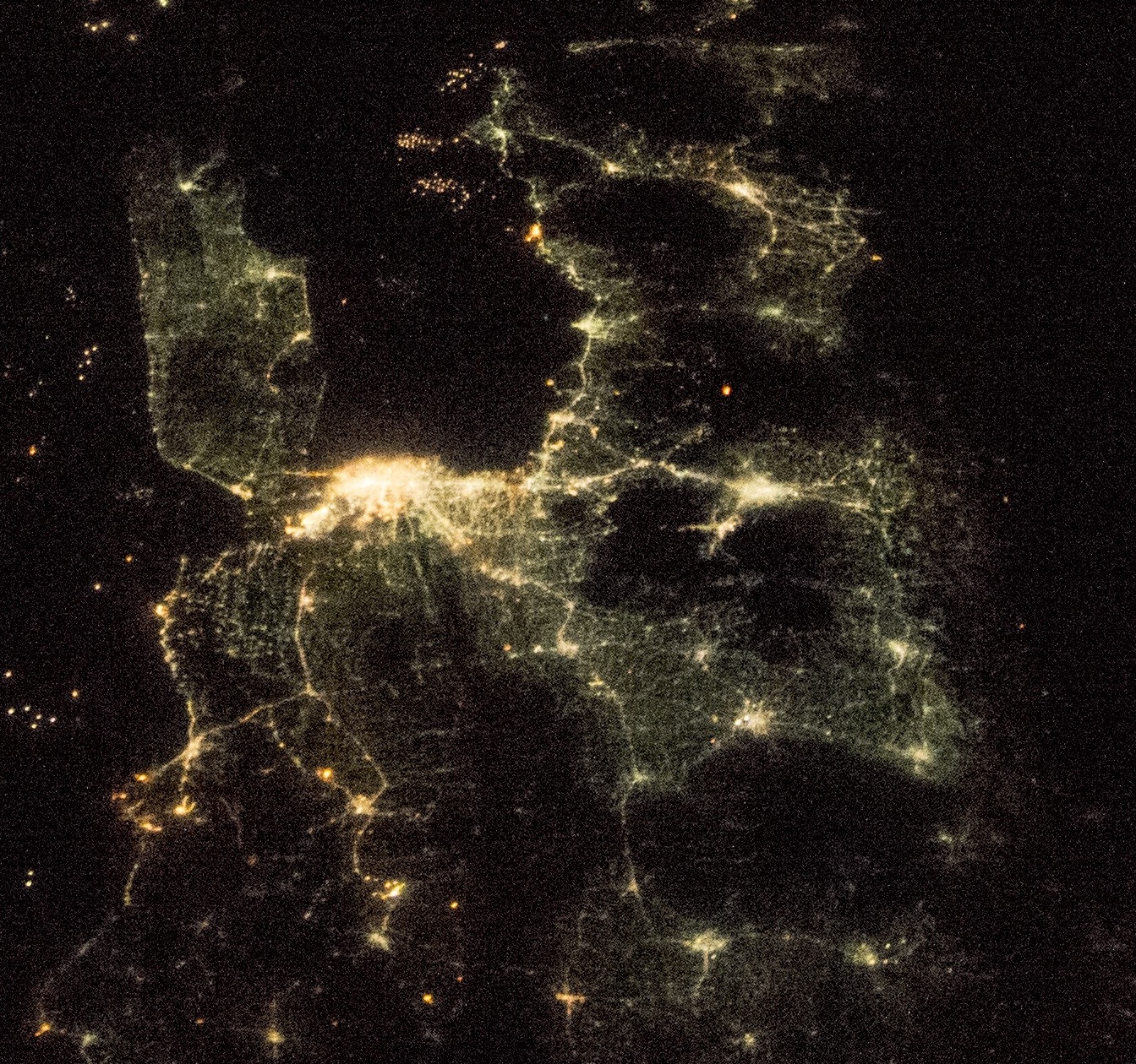
The Surabaya metropolitan area, or known locally as Gerbangkertosusila ( jv, ꦒꦼꦂꦧꦁꦏꦼꦂꦠꦱꦸꦱꦶꦭ, Gerbangkertasusila, from ''Gresik-Bangkalan-Mojokerto-Surabaya-Sidoarjo-Lamongan''), is a metropolitan area in East Java, Indonesia. It is the country's second-largest metropolitan area, after Jakarta metropolitan area. Definition Grebangkertosusila is an official acronym of "Gresik Bangkalan Mojokerto Surabaya Sidoarjo Lamongan", a main metropolitan or planning area in East Java consisting of the seven cities and regencies with those names (Mojokerto is both a city and a regency). It has an area of 5,925.843 km2, and at the 2020 Census had a population of 9,924,509. The national government regards the Surabaya Metropolitan Area as including only Surabaya, Sidoarjo Regency, and Gresik Regency, known as "Zona Surabaya Raya". Gresik Regency includes Bawean Island, covering some 196 km2 and lying north of Java; however Bawean Island is excluded from ... [...More Info...] [...Related Items...] OR: [Wikipedia] [Google] [Baidu] |
Waru, Sidoarjo
Waru is a district in Sidoarjo Regency, East Java East Java ( id, Jawa Timur) is a Provinces of Indonesia, province of Indonesia located in the easternmost hemisphere of Java island. It has a land border only with the province of Central Java to the west; the Java Sea and the Indian Ocean bord .... The Purabaya bus station is located in this district. Villages Waru consists of 17 villages namely: * Berbek * Bungurasih * Janti * Kedungrejo * Kepuhkiriman * Kureksari * Madaeng * Ngingas * Pepelegi * Tambakoso * Tambakrejo * Tambaksawah * Tambaksumur * Tropodo * Wadungasri * Waru * Wedoro References External links * * Sidoarjo Regency Districts of East Java {{eJava-geo-stub ... [...More Info...] [...Related Items...] OR: [Wikipedia] [Google] [Baidu] |
Porong
Porong is a district in Sidoarjo Regency, East Java, Indonesia. It has a population of 68,243 (2018). Located about south of the regency seat, it bordered by Krembung in the west, Pasuruan Regency in the south, Tanggulangin in the north. Villages Porong consists of 19 villages A village is a clustered human settlement or community, larger than a hamlet but smaller than a town (although the word is often used to describe both hamlets and smaller towns), with a population typically ranging from a few hundred to ... namely: *Candipari *Gedang *Glagahharum *Jatirejo *Juwetkenongo *Kebakalan *Kebonagung *Kedungboto *Kedungsolo *Kesambi *Lajuk *Mindi *Pamotan *Pesawahan *Plumbon *Porong *Renokenongo *Siring *Wunut References External links * Sidoarjo Regency districts of East Java {{EJava-geo-stub ... [...More Info...] [...Related Items...] OR: [Wikipedia] [Google] [Baidu] |
List Of Regencies And Cities Of Indonesia
Regencies (''kabupaten'') and cities (''kota'') are the second-level administrative subdivision in Indonesia, immediately below the provinces, and above the districts. Regencies are roughly equivalent to American counties, although most cities in the United States are below the counties. Following the implementation of decentralization beginning on 1 January 2001, regencies and city municipalities became the key administrative units responsible for providing most governmental services. Each of regencies and cities has their own local government and legislative body. The difference between a regency and a city lies in demography, size, and economy. Generally, a regency comprises a rural area larger than a city, but also often includes various towns. A city usually has non-agricultural economic activities. A regency is headed by a regent (''bupati''), while a city is headed by a mayor (''wali kota''). All regents, mayors, and members of legislatures are directly elected via ele ... [...More Info...] [...Related Items...] OR: [Wikipedia] [Google] [Baidu] |
Madura Strait
Madura Strait is a stretch of water that separates the Indonesian islands of Java and Madura, in the province of East Java. The islands of Kambing, Giliraja, Genteng, and Ketapang lie in the Strait. The Suramadu Bridge, the longest in Indonesia, spans the strait between Surabaya on Java and Bangkalan on Madura. In some old Western and old Indonesian sources, the strait commonly appears as Surabaya Strait (Indonesian: ''Selat Surabaya''), but this name is not accepted in the official cartography. Geography The Madura Strait is located in the east of the province of northern East Java, precisely in the southwest, north, and east of the city of Surabaya; east of Sidoarjo Regency; west and south of the island of Madura; and north of the Pasuruan, Probolinggo, and Situbondo area. In this strait there are also small islands, including Kambing Island, Giliraja Island, and Genteng Island near the island of Madura, and Ketapang Island in the coastal waters of Probolinggo Regency. As a ... [...More Info...] [...Related Items...] OR: [Wikipedia] [Google] [Baidu] |
Mojokerto Regency
Mojokerto Regency ( id, Kabupaten Mojokerto; jv, ꦑꦧꦸꦥꦠꦺꦤ꧀ꦩꦗꦏꦼꦂꦠ, translit=Kabupatèn Måjåkertå) is a regency in East Java Province of Indonesia. It is part of the Surabaya metropolitan area (known as Gerbangkertosusila) which comprises Gresik Regency, Bangkalan Regency, Mojokerto Regency, Mojokerto City, Surabaya City, Sidoarjo Regency, and Lamongan Regency. The Regency covers an area of 692.15 sq. km (excluding the independent city of Mojokerto). The population of the Regency was 908,004 in 2000, but had risen to 1,025,443 at the 2010 Census and to 1,119,209 at the 2020 Census; the official estimate as at mid 2021 was 1,125,522. Many of them earn their living as small farmers and craftsmen (consisting shoemakers, furniture makers, and souvenir makers). The administrative capital is the town of Mojosari. Administrative Districts The Regency is divided into eighteen districts (''kecamatan''), tabulated below with their areas and population tot ... [...More Info...] [...Related Items...] OR: [Wikipedia] [Google] [Baidu] |
Sedati
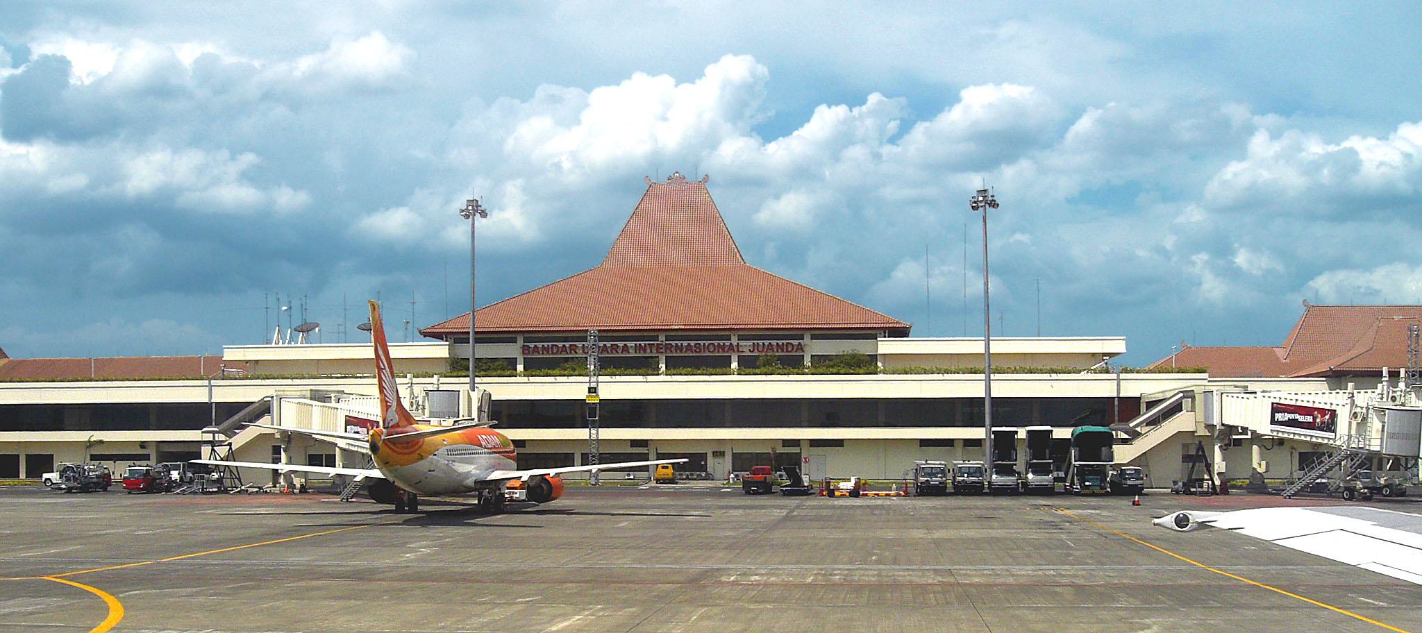
Sedati is a district in the Sidoarjo Regency in Java, Indonesia. Juanda International Airport Juanda International Airport (JIA) ( id, Bandar Udara Internasional Juanda) , is an international airport located in Sedati, Sidoarjo. It is now the third busiest airport in Indonesia (after Soekarno-Hatta and Ngurah Rai airport). This airpo ... is located in this district. Districts of East Java Sidoarjo Regency {{EJava-geo-stub ... [...More Info...] [...Related Items...] OR: [Wikipedia] [Google] [Baidu] |


