|
Storm Beach
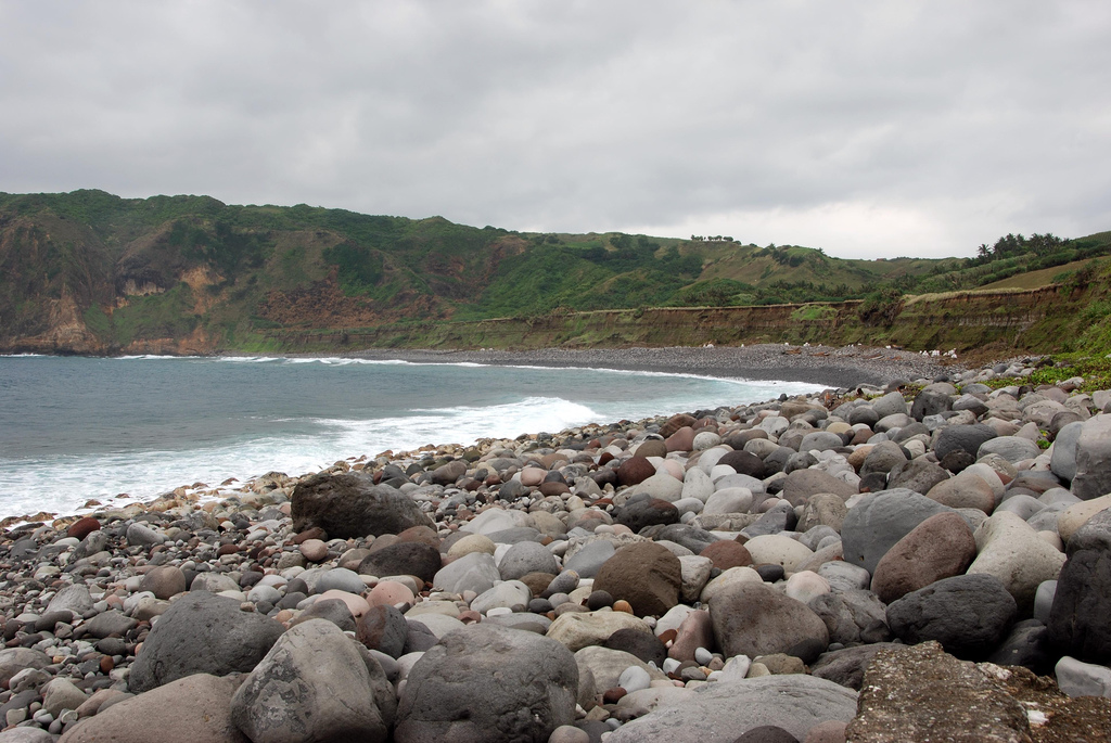
A storm beach is a beach affected by particularly fierce wind wave, waves, usually with a very long fetch (geography), fetch. The resultant landform is often a very steep beach (up to 45°) composed of rounded Cobble (geology), cobbles, shingle beach, shingle and occasionally sand. The stones usually have an obvious Grade (slope), grading of pebbles, from large to small, with the larger diameter stones typically arrayed at the highest beach elevations. It may also contain many small parts of shipwrecked boats. Examples A noted textbook example is the long Chesil Beach in Dorset, one of three major shingle structures in Britain. It also connects the Isle of Portland to the mainland at Abbotsbury, west of the resort of Weymouth, Dorset, Weymouth. Other examples appear in the Shetland Islands, Shetland and Orkney Islands, as well as the Scotland, Scottish mainland at Caithness. The beaches of Lakshdweep Islands are also storm beaches. Gallery File:Storm Beach - geograph.org.uk - ... [...More Info...] [...Related Items...] OR: [Wikipedia] [Google] [Baidu] |
Abbotsbury
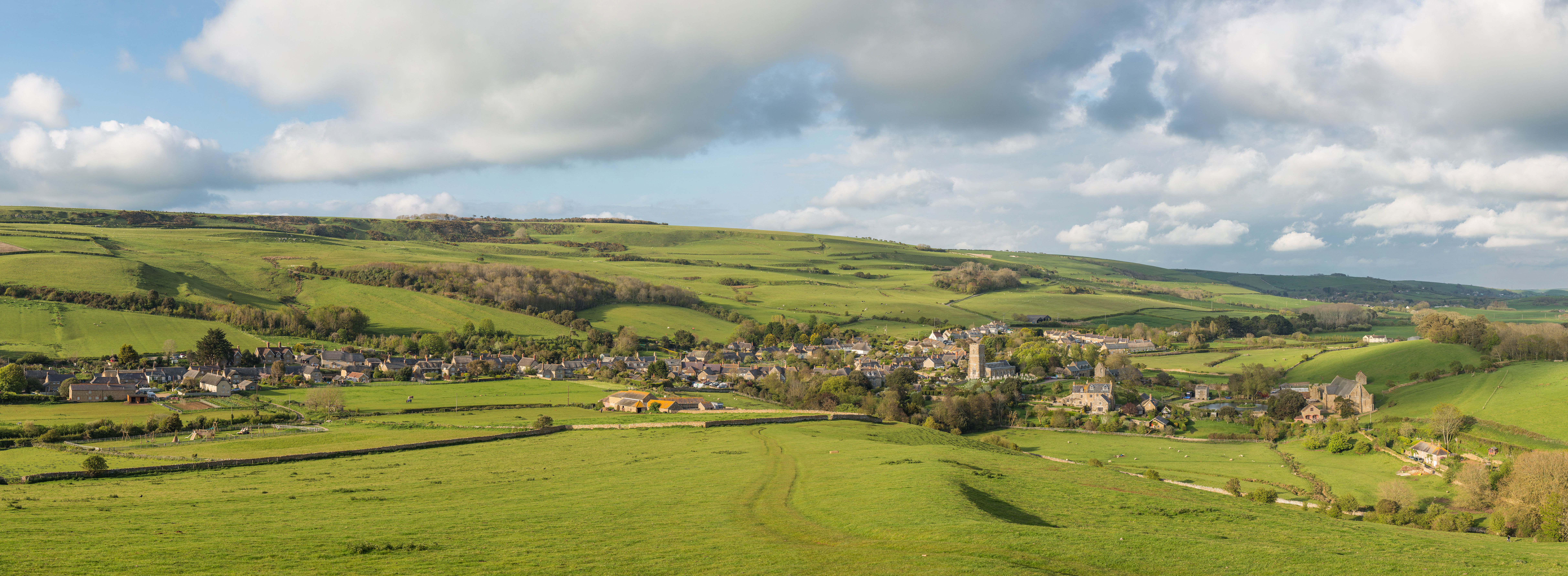
Abbotsbury is a village and civil parish in the English county of Dorset. The settlement is in the unitary authority of Dorset about inland from the English Channel coast. The village, including Chesil Beach, the swannery and subtropical gardens, is owned by the Ilchester Estate, which owns of land in Dorset. In the 2011 census the civil parish had a population of 481. The coastline within the parish of Abbotsbury includes a section of long Chesil Beach that is part of the Jurassic Coast, a World Heritage Site. Abbotsbury is known for its swannery, subtropical gardens and surviving abbey buildings, including St Catherine's Chapel, a 14th-century pilgrimage chapel that stands on a hill between the village and the coast. Geography Abbotsbury village is in the Dorset unitary authority administrative area, situated amidst hills about inland from the English Channel coast at Chesil Beach, an barrier beach which south of the village encloses The Fleet, a brackish coast ... [...More Info...] [...Related Items...] OR: [Wikipedia] [Google] [Baidu] |
Eilean An Tigh
:''"Eilean an Taighe", or "Eilean Taigh" is a fairly common island name'' Eilean an T(a)ighe, meaning "House Island" (lit. "Island of the House"), is one of the Shiant Islands. It is joined to Garbh Eilean by an isthmus, so they each form part of what is actually a single island. History Before the 1820s, the island was called ''Eilean na Cille'' ("church island"),Haswell-Smith (2004) pp. 275-76. and there is evidence of a church, possibly dedicated to the Virgin Mary, near the site of the present cottage.Haswell-Smith (2004) pp. 277-78. Eilean Mhuire, one of the other islands in the Shiants, also takes its name from Mary. In the mid-18th century, 40 people were living there, but by 1770 they had all left. In the 1820s a shepherd and his wife were resident, but, by 1842, they too had gone. From 1862 to 1901, another shepherd, Donald Campbell, and his wife and two daughters lived there. The daughters, Mòr and Catriona, were apparently very beautiful, and attracted the attenti ... [...More Info...] [...Related Items...] OR: [Wikipedia] [Google] [Baidu] |
Garbh Eilean, Shiant Islands
Garbh Eilean (Scottish Gaelic ''Rough Isle'') is one of the Shiant Islands at the south end of the Minch on the west coast of Scotland. Geology In geological terms, these islands essentially represent an extension of the Trotternish peninsula of Skye. The rocks are volcanic, and at 60 Ma, very young by Hebridean standards. Dolerite columns on the north side of Garbh Eilean are over tall and about across. Similar to those at Staffa and the Giant's Causeway, they were formed by the slow cooling of volcanic rocks deep underground. Intrusion sills show a progression in their chemical compositions, from olivine-rich rocks at the base to rocks with very little or no olivine at the top. The sills are thought to have formed by crystal settling. Recent study has suggested that at least one of the sills represents a multiple intrusion. In some places the basalt is overlain by Jurassic mudstone, which weathers to form much more fertile soil than elsewhere in the Western Isles. ... [...More Info...] [...Related Items...] OR: [Wikipedia] [Google] [Baidu] |
Lochbuie, Mull
Lochbuie ( gd, Locha Buidhe, meaning "yellow loch") is a settlement on the Isle of Mull in Scotland about west of Craignure. Geography Once known as the "Garden of Mull", the fertile land around the main village of seventeen houses is surrounded by hills, with the narrow valley to the east containing both Loch Uisg and the only road to the estate. The settlement lies at the head of Loch Buie, a sea loch which contains the tidal islands of Eilean Mòr and Eilean Uamh Ghuaidhre. Frank Lockwood's Island (or Eilean Sneth Dian) lies in the Firth of Lorne, just offshore from the Laggan peninsula to the south. This island is named after Frank Lockwood who was Solicitor General for England and Wales from 1894 to 1895 and the brother-in-law of the 21st MacLean of Lochbuie. The highest hills in the area are Ben Buie whose summit is above sea level to the north, the Druim Fada range reaching to the south and Craig Ben, at to the east, overlooking Loch Spelve. A track allows walkin ... [...More Info...] [...Related Items...] OR: [Wikipedia] [Google] [Baidu] |
Berm
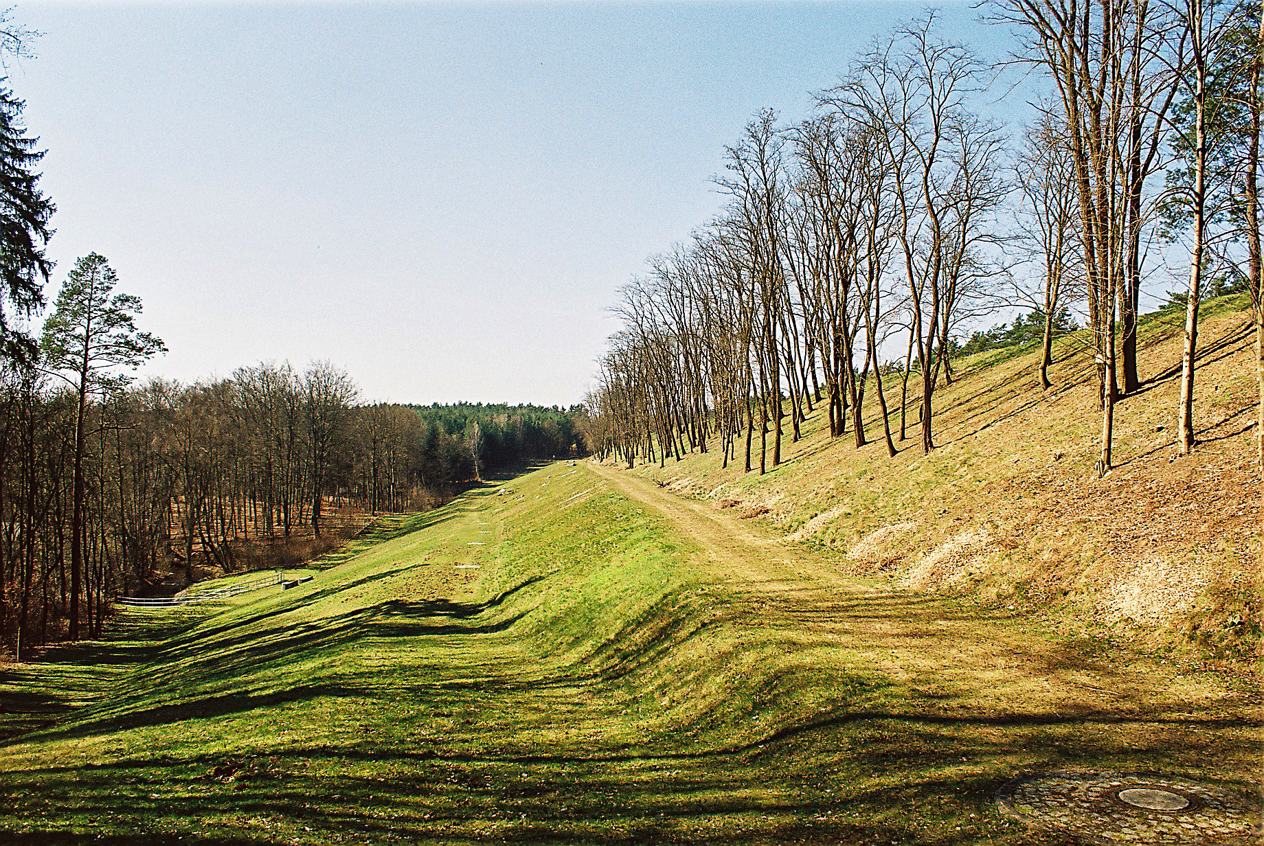
A berm is a level space, shelf, or raised barrier (usually made of compacted soil) separating areas in a vertical way, especially partway up a long slope. It can serve as a terrace road, track, path, a fortification line, a border/ separation barrier for navigation, good drainage, industry, or other purposes. Etymology The word is one of Middle Dutch and came into usage in English via French. Military use History In medieval military engineering, a berm (or berme) was a level space between a parapet or defensive wall and an adjacent steep-walled ditch or moat. It was intended to reduce soil pressure on the walls of the excavated part to prevent its collapse. It also meant that debris dislodged from fortifications would not fall into (and fill) a ditch or moat. In the trench warfare of World War I, the name was applied to a similar feature at the lip of a trench, which served mainly as an elbow-rest for riflemen. Modern usage In modern military engineering, a berm is ... [...More Info...] [...Related Items...] OR: [Wikipedia] [Google] [Baidu] |
Shingle Beach
A shingle beach (also referred to as rocky beach or pebble beach) is a beach which is armoured with pebbles or small- to medium-sized cobbles (as opposed to fine sand). Typically, the stone composition may grade from characteristic sizes ranging from diameter. While this beach landform is most commonly found in Europe, examples are found in Bahrain, North America, and a number of other world regions, such as the west coast of New Zealand's South Island, where they are associated with the shingle fans of braided rivers. Though created at shorelines, post-glacial rebound can raise shingle beaches as high as above sea level, as on the High Coast in Sweden. The ecosystems formed by this unique association of rock and sand allow colonization by a variety of rare and endangered species. Formation Shingle beaches are typically steep, because the waves easily flow through the coarse, porous surface of the beach, decreasing the effect of backwash erosion and increasing the formati ... [...More Info...] [...Related Items...] OR: [Wikipedia] [Google] [Baidu] |
Caithness
Caithness ( gd, Gallaibh ; sco, Caitnes; non, Katanes) is a historic county, registration county and lieutenancy area of Scotland. Caithness has a land boundary with the historic county of Sutherland to the west and is otherwise bounded by sea. The land boundary follows a watershed and is crossed by two roads (the A9 and the A836) and by one railway (the Far North Line). Across the Pentland Firth, ferries link Caithness with Orkney, and Caithness also has an airport at Wick. The Pentland Firth island of Stroma is within Caithness. The name was also used for the earldom of Caithness ( 1334 onwards) and for the Caithness constituency of the Parliament of the United Kingdom (1708 to 1918). Boundaries are not identical in all contexts, but the Caithness area lies entirely within the Highland council area. Toponymy The ''Caith'' element of the name ''Caithness'' comes from the name of a Pictish tribe known as the ''Cat'' or ''Catt'' people, or ''Catti'' (see Kingdom of Ca ... [...More Info...] [...Related Items...] OR: [Wikipedia] [Google] [Baidu] |
Scotland
Scotland (, ) is a country that is part of the United Kingdom. Covering the northern third of the island of Great Britain, mainland Scotland has a border with England to the southeast and is otherwise surrounded by the Atlantic Ocean to the north and west, the North Sea to the northeast and east, and the Irish Sea to the south. It also contains more than 790 islands, principally in the archipelagos of the Hebrides and the Northern Isles. Most of the population, including the capital Edinburgh, is concentrated in the Central Belt—the plain between the Scottish Highlands and the Southern Uplands—in the Scottish Lowlands. Scotland is divided into 32 administrative subdivisions or local authorities, known as council areas. Glasgow City is the largest council area in terms of population, with Highland being the largest in terms of area. Limited self-governing power, covering matters such as education, social services and roads and transportation, is devolved from the Scott ... [...More Info...] [...Related Items...] OR: [Wikipedia] [Google] [Baidu] |
Orkney Islands
Orkney (; sco, Orkney; on, Orkneyjar; nrn, Orknøjar), also known as the Orkney Islands, is an archipelago in the Northern Isles of Scotland, situated off the north coast of the island of Great Britain. Orkney is 10 miles (16 km) north of the coast of Caithness and has about 70 islands, of which 20 are inhabited. The largest island, the Mainland, has an area of , making it the sixth-largest Scottish island and the tenth-largest island in the British Isles. Orkney’s largest settlement, and also its administrative centre, is Kirkwall. Orkney is one of the 32 council areas of Scotland, as well as a constituency of the Scottish Parliament, a lieutenancy area, and an historic county. The local council is Orkney Islands Council, one of only three councils in Scotland with a majority of elected members who are independents. The islands have been inhabited for at least years, originally occupied by Mesolithic and Neolithic tribes and then by the Picts. Orkney was col ... [...More Info...] [...Related Items...] OR: [Wikipedia] [Google] [Baidu] |
Shetland Islands
Shetland, also called the Shetland Islands and formerly Zetland, is a subarctic archipelago in Scotland lying between Orkney, the Faroe Islands and Norway. It is the northernmost region of the United Kingdom. The islands lie about to the northeast of Orkney, from mainland Scotland and west of Norway. They form part of the border between the Atlantic Ocean to the west and the North Sea to the east. Their total area is ,Shetland Islands Council (2012) p. 4 and the population totalled 22,920 in 2019. The islands comprise the Shetland constituency of the Scottish Parliament. The local authority, the Shetland Islands Council, is one of the 32 council areas of Scotland. The islands' administrative centre and only burgh is Lerwick, which has been the capital of Shetland since 1708, before which time the capital was Scalloway. The archipelago has an oceanic climate, complex geology, rugged coastline, and many low, rolling hills. The largest island, known as " the Mainland", ha ... [...More Info...] [...Related Items...] OR: [Wikipedia] [Google] [Baidu] |
Weymouth, Dorset
Weymouth is a seaside town in Dorset, on the English Channel coast of England. Situated on a sheltered bay at the mouth of the River Wey, south of the county town of Dorchester, Weymouth had a population of 53,427 in 2021. It is the third largest settlement in Dorset after Bournemouth and Poole. The history of the town stretches back to the 12th century and includes roles in the spread of the Black Death, the settlement of the Americas and the development of Georgian architecture. It was a major departure point for the Normandy Landings during World War II. Prior to local government reorganisation in April 2019, Weymouth formed a borough with the neighbouring Isle of Portland. Since then the area has been governed by Dorset Council. Weymouth, Portland and the Purbeck district are in the South Dorset parliamentary constituency. A seaside resort, Weymouth and its economy depend on tourism. Visitors are attracted by its harbour and position, halfway along the Jurassic Coast ... [...More Info...] [...Related Items...] OR: [Wikipedia] [Google] [Baidu] |


