|
Sail Bogey
A sail bogey or sail trolley is a wind-driven vehicle that runs along railway tracks. Examples Spurn railway The Spurn railway, built along Spurn Head on the Yorkshire coast of England was built in the First World War and ran until the early 1950s and included sail bogies as part of its rolling stock. Teesmouth lifeboat In the early days of the Teesmouth lifeboat, its crew were sometimes able, subject to wind conditions, to travel out to the lifeboat station at South Gare on a sail bogey. Others Other locations to have used sail bogies include: * Cliffe, Kent * Gosport * Herne Bay Pier, KentInformation from display at Herne Bay Museum (see :File:Herne Bay Museum 0007.jpg) * Camber Railway near Port Stanley, The Falkland Islands * the Dagebüll–Oland–Langeneß island railway, connecting the town of Dagebüll with the Halligen Oland and Langeneß, Germany Replica More recently, in 2005, a replica of a 19th-century sail bogey was built and demonstrated on the Ffestiniog R ... [...More Info...] [...Related Items...] OR: [Wikipedia] [Google] [Baidu] |
Pier Tram C 1855
Seaside pleasure pier in England.html" ;"title="Brighton, England">Brighton, England. The first seaside piers were built in England in the early 19th century. A pier is a raised structure that rises above a body of water and usually juts out from its shore, typically supported by piling, piles or column, pillars, and provides above-water access to offshore areas. Frequent pier uses include fishing, [oat docking and access for both passengers and cargo, and oceanside recreation. Bridges, buildings, and walkways may all be supported by architectural piers. Their open structure allows tides and currents to flow relatively unhindered, whereas the more solid foundations of a quay or the closely spaced piles of a wharf can act as a breakwater, and are consequently more liable to silting. Piers can range in size and complexity from a simple lightweight wooden structure to major structures extended over . In American English, a pier may be synonymous with a dock. Piers have been b ... [...More Info...] [...Related Items...] OR: [Wikipedia] [Google] [Baidu] |
Camber Railway
The Camber Railway was a narrow gauge railway located on the Falkland Islands in the South Atlantic. It was one of the most southerly railways in the world. The Camber Railway was constructed to support the Admiralty wireless station, supplying coal to generators which powered the station. It ran along the north side of Stanley Harbour for about . History There were two Kerr, Stuart and Company "Wren" class 0-4-0 steam tank locomotives. The system fell into disuse after the wireless station was modernised. Parts of the infrastructure were used in the Falklands War The Falklands War ( es, link=no, Guerra de las Malvinas) was a ten-week undeclared war between Argentina and the United Kingdom in 1982 over two British dependent territories in the South Atlantic: the Falkland Islands and its territorial de ...; rails were taken for use in some defensive structures. Fleet * KS "Wren" class steam locomotives - 2 (KS 2388/15 and 2392/15) * wooden wagon cars - 3 * steam cr ... [...More Info...] [...Related Items...] OR: [Wikipedia] [Google] [Baidu] |
Ffestiniog Railway
The Ffestiniog Railway ( cy, Rheilffordd Ffestiniog) is a heritage railway based on narrow-gauge, located in Gwynedd, Wales. It is a major tourist attraction located mainly within the Snowdonia National Park. The railway is roughly long and runs from the harbour at Porthmadog to the slate mining town of Blaenau Ffestiniog, travelling through forested and mountainous terrain. The line is single track throughout with four intermediate passing places. The first mile of the line out of Porthmadog runs atop an embankment called ''the Cob'', which is the dyke of the polder known as Traeth Mawr. The Festiniog Railway Company, which owns the railway, is the oldest surviving railway company in the world. It also owns the Welsh Highland Railway, which was re-opened fully in 2011. The two railways share the same track gauge and meet at Porthmadog station, with occasional trains working the entire route from Blaenau Ffestiniog to Caernarfon. History The railway company is prope ... [...More Info...] [...Related Items...] OR: [Wikipedia] [Google] [Baidu] |
Replica Of Spooner's Boat, Boston Lodge Works, Ffestiniog Railway - Geograph
A 1:1 replica is an exact copy of an object, made out of the same raw materials, whether a molecule, a work of art, or a commercial product. The term is also used for copies that closely resemble the original, without claiming to be identical. Also has the same weight and size as original. Replicas have been sometimes sold as originals, a type of fraud. Most replicas have more innocent purposes. Fragile originals need protection, while the public can examine a replica in a museum. Replicas are often manufactured and sold as souvenirs. An inverted replica complements the original by filling its gaps. Sometimes the original never existed. It is logically impossible for there to be a replica of something that never existed. Replicas and reproductions can be related to any form of licensing an image for others to use, whether it is through photos, postcards, prints, miniature or full size copies they represent a resemblance of the original object. Not all incorrectly attributed ite ... [...More Info...] [...Related Items...] OR: [Wikipedia] [Google] [Baidu] |
Langeneß
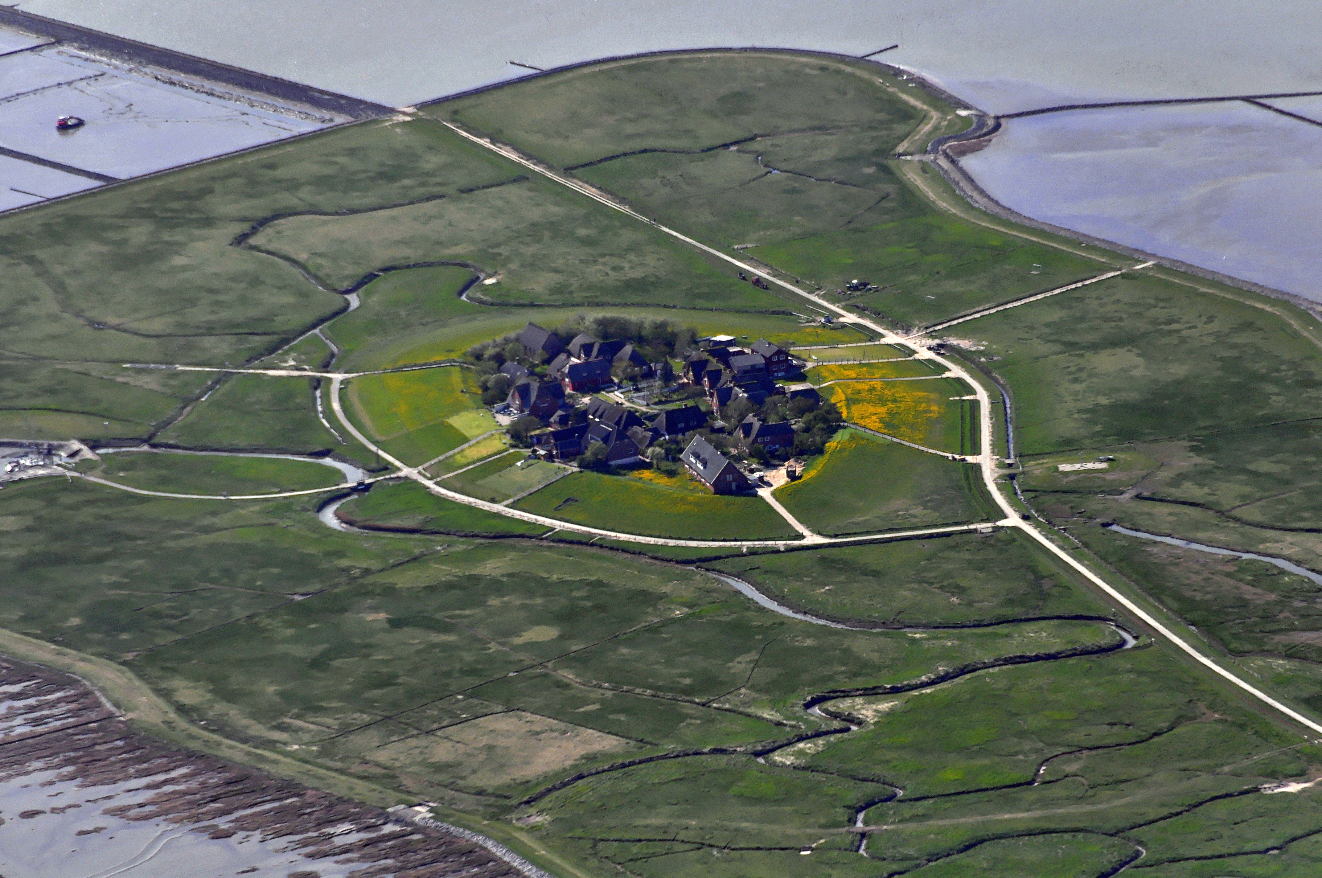
( da, Langenæs, North Frisian ''Nees'') is a municipality in the district of Nordfriesland, in Schleswig-Holstein, Germany. It consists of the halligen (islands) Langeneß and Oland. Before the flood of 1634 the two islands were directly attached. Langeneß itself has 16 Warften and is the largest Hallig. It has about 100 inhabitants and 58 households. There is a junior school and an information centre providing information about the national park and the Wadden-Sea at Peterswarf. A railway connects Langeneß to the mainland at Dagebüll Dagebüll () ( Mooring North Frisian: ''Doogebel''; da, Dagebøl) is a municipality located at the west coast of Schleswig-Holstein in the Nordfriesland district, Germany. Today's Dagebüll was created in 1978 as a merger of the municipalities ... via Oland. There is also a daily ferry service. References External links * Halligen Tidal islands of Germany Nordfriesland Islands of Schleswig-Holstein {{germany-i ... [...More Info...] [...Related Items...] OR: [Wikipedia] [Google] [Baidu] |
Oland (Frisian Island)
Oland ( da, Øland, North Frisian: ''Ualöönist'') is a small hallig which is connected by a narrow gauge railway to the mainland and to hallig Langeneß. In 2019, the population was estimated, unofficially, to be 16 people. Germany's smallest lighthouse is located here, being also the only one with a thatched roof Thatching is the craft of building a roof with dry vegetation such as straw, water reed, sedge (''Cladium mariscus''), rushes, heather, or palm branches, layering the vegetation so as to shed water away from the inner roof. Since the bulk of .... References External links Halligen Former municipalities in Schleswig-Holstein Tidal islands of Germany Islands of Schleswig-Holstein {{Nordfriesland-geo-stub ... [...More Info...] [...Related Items...] OR: [Wikipedia] [Google] [Baidu] |
Halligen
The ''Halligen'' (German, singular ''Hallig'', ) or the ''halliger'' (Danish, singular ''hallig'') are small islands without protective dikes. They are variously pluralized in English as the Halligen, Halligs, Hallig islands, or Halligen islands. There are ten German ''halligen'' in the North Frisian Islands on Schleswig-Holstein's Wadden Sea-North Sea coast in the district of Nordfriesland and one hallig at the west coast of Denmark (Mandø). The name is cognate to Old-English ''halh'', meaning "slightly raised ground isolated by marsh". The very existence of the ''halligen'' is a result of frequent floods and poor coastal protection. The floods were much more common in the Middle Ages and coastal protection was much poorer. The ''halligen'' have areas ranging from 7 to 956 ha, and are often former parts of the mainland, separated therefrom by storm tide erosion. Some are also parts of once much bigger islands sundered by the same forces. Sometimes, owing to sediment deposition, ... [...More Info...] [...Related Items...] OR: [Wikipedia] [Google] [Baidu] |
Dagebüll
Dagebüll () ( Mooring North Frisian: ''Doogebel''; da, Dagebøl) is a municipality located at the west coast of Schleswig-Holstein in the Nordfriesland district, Germany. Today's Dagebüll was created in 1978 as a merger of the municipalities of Fahretoft, Juliane-Marien-Koog and Waygaard. Dagebüll used to be a Hallig, the oldest houses were built on artificial dwelling hills which in parts can still be seen today. In 1704 the area was secured by sea dikes. Districts Dagebüll Kirche The district of Kirche (Church; North Frisian: ''Doogebel Schörk'') is situated in the centre of the Dagebüll polder, constituting the core of the former Hallig. Many old farmsteads can still be found on dwelling hills. When the church was built in 1731, it did not yet have a bell tower. Only when funds had been raised in 1905/1906, it was decided to build a tower. Dagebüll Hafen The district of Dagebüll Hafen (Dagebüll Harbor; North Frisian: ''Doogebel Huuwen'') is located about 3 ... [...More Info...] [...Related Items...] OR: [Wikipedia] [Google] [Baidu] |
Dagebüll–Oland–Langeneß Island Railway
The Dagebüll–Oland–Langeneß island railway () is a gauge ''Feldbahn'' in North Frisia that connects Dagebüll to the Halligen (low-lying islands) of Oland and Langeneß. Gallery Oland-lorenbahn-1.jpg, Crossing the dike Dyke (UK) or dike (US) may refer to: General uses * Dyke (slang), a slang word meaning "lesbian" * Dike (geology), a subvertical sheet-like intrusion of magma or sediment * Dike (mythology), ''Dikē'', the Greek goddess of moral justice * Dikes, ... at Dagebüll 03-07-dagebuell-by-RalfR-157.jpg, Maintenance of way (track work) 03-07-dagebuell-by-RalfR-158.jpg, Construction work of the WSA References Literature * * External links Halligbahn Oland–LangeneßSegellore* ttp://www.planet-wissen.de/laender_leute/nordsee/halligen/halligen_verkehr.jsp WDR: „Planet Wissen“ zu Halligen und Segelloren* * YouTube Railway lines in Schleswig-Holstein 900 mm gauge railways in Germany {{Germany-rail-transport-stub ... [...More Info...] [...Related Items...] OR: [Wikipedia] [Google] [Baidu] |
Stanley, Falkland Islands
Stanley (; also known as Port Stanley) is the capital city of the Falkland Islands. It is located on the island of East Falkland, on a north-facing slope in one of the wettest parts of the islands. At the 2016 census, the city had a population of 2,460. The entire population of the Falkland Islands was 3,398 on Census Day on 9 October 2016. Stanley is represented by five of the eight elected members of the Legislative Assembly of the Falkland Islands, Stacy Bragger, Barry Elsby, Mark Pollard, Roger Spink and Leona Vidal Roberts. An elected Town Council of Stanley existed from 1948 to 1973. On 20 May 2022, it was announced that, as part of the Platinum Jubilee Civic Honours, Stanley would receive city status. On 14 June 2022, Stanley received letters patent, formally awarding it city status. Facilities and infrastructure Stanley is the main shopping centre on the islands and the hub of East Falkland's road network. Attractions include the Falkland Islands Museum, Governme ... [...More Info...] [...Related Items...] OR: [Wikipedia] [Google] [Baidu] |
Spurn Head
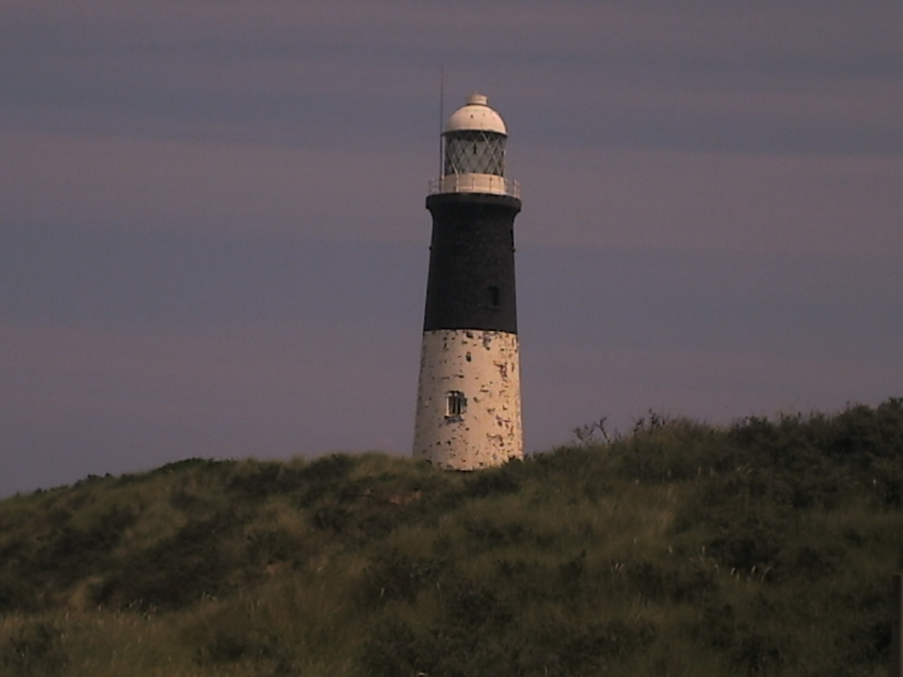
Spurn is a narrow sand tidal island located off the tip of the coast of the East Riding of Yorkshire, England that reaches into the North Sea and forms the north bank of the mouth of the Humber Estuary. It was a spit with a semi-permanent connection to the mainland, but a storm in 2013 made the road down to the end of Spurn impassable to vehicles at high tide. The island is over long, almost half the width of the estuary at that point, and as little as wide in places. The southernmost tip is known as Spurn Head or Spurn Point and is the home to an RNLI lifeboat station and two disused lighthouses. It forms part of the civil parish of Easington. Spurn Head covers above high water and of foreshore. It has been owned since 1960 by the Yorkshire Wildlife Trust and is a designated national nature reserve, heritage coast and is part of the Humber Flats, Marshes and Coast Special Protection Area. History Spurn Head was known to classical authors, such as Ptolemy as ''Oce ... [...More Info...] [...Related Items...] OR: [Wikipedia] [Google] [Baidu] |


.jpg)
