|
Rauk
A rauk is a column-like landform in Sweden and Norway, often equivalent to a stack. Rauks often occur in groups called "raukfält" or "rauk fields". The limestone rauks of Gotland in the Baltic Sea are among the best known examples. Sweden Rauks are common on the island of Gotland, Sweden and on the smaller islands belonging to Gotland County. Fårö island in Gotland, is particularly rich in rauks. While Fårö is on the northern end of Gotland Holmhällars raukfält at Vamlingbo in the southern end of Gotland is also rich in rauks. Rauks in Gotland often occur in groups or fields, so-called ''raukfält''. Rauks can be found both near Gotland's many cliffs or far away from these. Other localities with rauks include Byrum on northwestern Öland neighboring Blå Jungfrun island, Hovs Hallar and Kullaberg in northwestern Scania and Härnön in northern Sweden's High Coast. Rauks on Öland are made up of limestone. A few rauks are located in the Scandinavian Mountains in n ... [...More Info...] [...Related Items...] OR: [Wikipedia] [Google] [Baidu] |
Baltic Klint
The Baltic Klint (Clint, Glint; et, Balti klint, sv, Baltiska klinten, russian: Балтийско-Ладожский уступ, Глинт) is an erosional limestone escarpment and cuesta on several islands of the Baltic Sea, in Estonia, in Leningrad Oblast of Russia and in the islands of Gotland and Öland of Sweden. It was featured on the reverse of the 50 krooni note of 1928 and on the 100 krooni note of 1992. The Baltic Klint is active landform showing some retreat in the present. However it is not known to which degree the Baltic Klint originated in postglacial time or if it evolved from cliff-like forms sculpted by the Fennoscandian Ice Sheet. In Gotland 20th century cliff retreat rates have been estimated at 0.15 to 0.78 cm/year. Retreat of the Baltic Klint in Gotland has widened shore platforms. Geography The Baltic Klint extends approximately 1200 km from the island of Öland in Sweden through the continental shelf and the Estonian islands of Osmussaa ... [...More Info...] [...Related Items...] OR: [Wikipedia] [Google] [Baidu] |
Byrums Raukar
Byrums raukar are a geological formation of a group of rauks (Swedish term for stacks) on the western shore in the north of Öland, Sweden (the island forming the Kalmar Strait with the Swedish mainland) near the village of Byrum. The group consists of about 120 limestone stacks, rich in fossils, of up to high on a stretch of beach. The area is about 3 hectares, is a Natural Monument III and a nature reserve A nature reserve (also known as a wildlife refuge, wildlife sanctuary, biosphere reserve or bioreserve, natural or nature preserve, or nature conservation area) is a protected area of importance for flora, fauna, or features of geological or ... since 1935. References External links Byrums raukar Nature Reserveon protectedplanet.net {{DEFAULTSORT:Byrum's raukar Baltic Klint Nature reserves in Sweden Öland Limestone formations Geology of Sweden Stacks (geology) ... [...More Info...] [...Related Items...] OR: [Wikipedia] [Google] [Baidu] |
Vamlingbo
Vamlingbo is a populated area, a socken (not to be confused with parish), on the Swedish island of Gotland. It comprises the same area as the administrative Vamlingbo District, established on 1January 2016. Geography Vamlingbo is the name of the socken as well as the district. It is also the name of the small village surrounding the medieval Vamlingbo Church, sometimes referred to as ''Vamlingbo kyrkby''. Vamlingbo is situated on the south tip of Gotland. , Vamlingbo Church belongs to Hoburg parish in Sudrets pastorat, along with the churches in Öja, Hamra, Sundre and Fide. Two of the asteroids in the Asteroid belt, 9372 Vamlingbo and 10105 Holmhällar, are named after this socken and the stack area. Holmhällar Holmhällar is a beach and a rauk area along the Vamlingbo south coast, right across from Heligholmen island. At Holmhällar is the Holm fishing village with stone fishing huts that are several hundred years old. Adjacent to the stack area are the beaches of ... [...More Info...] [...Related Items...] OR: [Wikipedia] [Google] [Baidu] |
Fårö
Fårö () or Fåre in Gutnish is a Baltic Sea island just north of the island of Gotland, itself off mainland Sweden's southeastern coast. It is the second-largest island in the province and it is a popular summer resort. It has its own language, Faroymal, a dialect of Gutnish. Fårö is also the name of the populated area () consisting of both Fårö and Gotska Sandön islands. It comprises the same area as the administrative Fårö District, established on 1January 2016. Geography The island is separated from Gotland by the narrow Fårö-strait, and connected by two car ferries, operated by the Swedish Transport Administration. It has a total area of , of which are water areas or islets. On the islands of Fårö and Gotland are rock formations called rauk. They are a result of erosion during the Ice age and are unique to Gotland and Fårö. The medieval Fårö Church is on Fårö. , Fårö Church along with Gotska Sandön Chapel on Gotska Sandön belongs to Fårö parish ... [...More Info...] [...Related Items...] OR: [Wikipedia] [Google] [Baidu] |
Gotland
Gotland (, ; ''Gutland'' in Gutnish), also historically spelled Gottland or Gothland (), is Sweden's largest island. It is also a province, county, municipality, and diocese. The province includes the islands of Fårö and Gotska Sandön to the north, as well as the Karlsö Islands ( Lilla and Stora) to the west. The population is 61,001, of which about 23,600 live in Visby, the main town. Outside Visby, there are minor settlements and a mainly rural population. The island of Gotland and the other areas of the province of Gotland make up less than one percent of Sweden's total land area. The county formed by the archipelago is the second smallest by area and is the least populated in Sweden. In spite of the small size due to its narrow width, the driving distance between the furthermost points of the populated islands is about . Gotland is a fully integrated part of Sweden with no particular autonomy, unlike several other offshore island groups in Europe. Historically there was ... [...More Info...] [...Related Items...] OR: [Wikipedia] [Google] [Baidu] |
Sweden 2018-08-05 (44113488995)
Sweden, formally the Kingdom of Sweden,The United Nations Group of Experts on Geographical Names states that the country's formal name is the Kingdom of SwedenUNGEGN World Geographical Names, Sweden./ref> is a Nordic country located on the Scandinavian Peninsula in Northern Europe. It borders Norway to the west and north, Finland to the east, and is connected to Denmark in the southwest by a bridgetunnel across the Öresund. At , Sweden is the largest Nordic country, the third-largest country in the European Union, and the fifth-largest country in Europe. The capital and largest city is Stockholm. Sweden has a total population of 10.5 million, and a low population density of , with around 87% of Swedes residing in urban areas in the central and southern half of the country. Sweden has a nature dominated by forests and a large amount of lakes, including some of the largest in Europe. Many long rivers run from the Scandes range through the landscape, primarily emp ... [...More Info...] [...Related Items...] OR: [Wikipedia] [Google] [Baidu] |
Sarek National Park
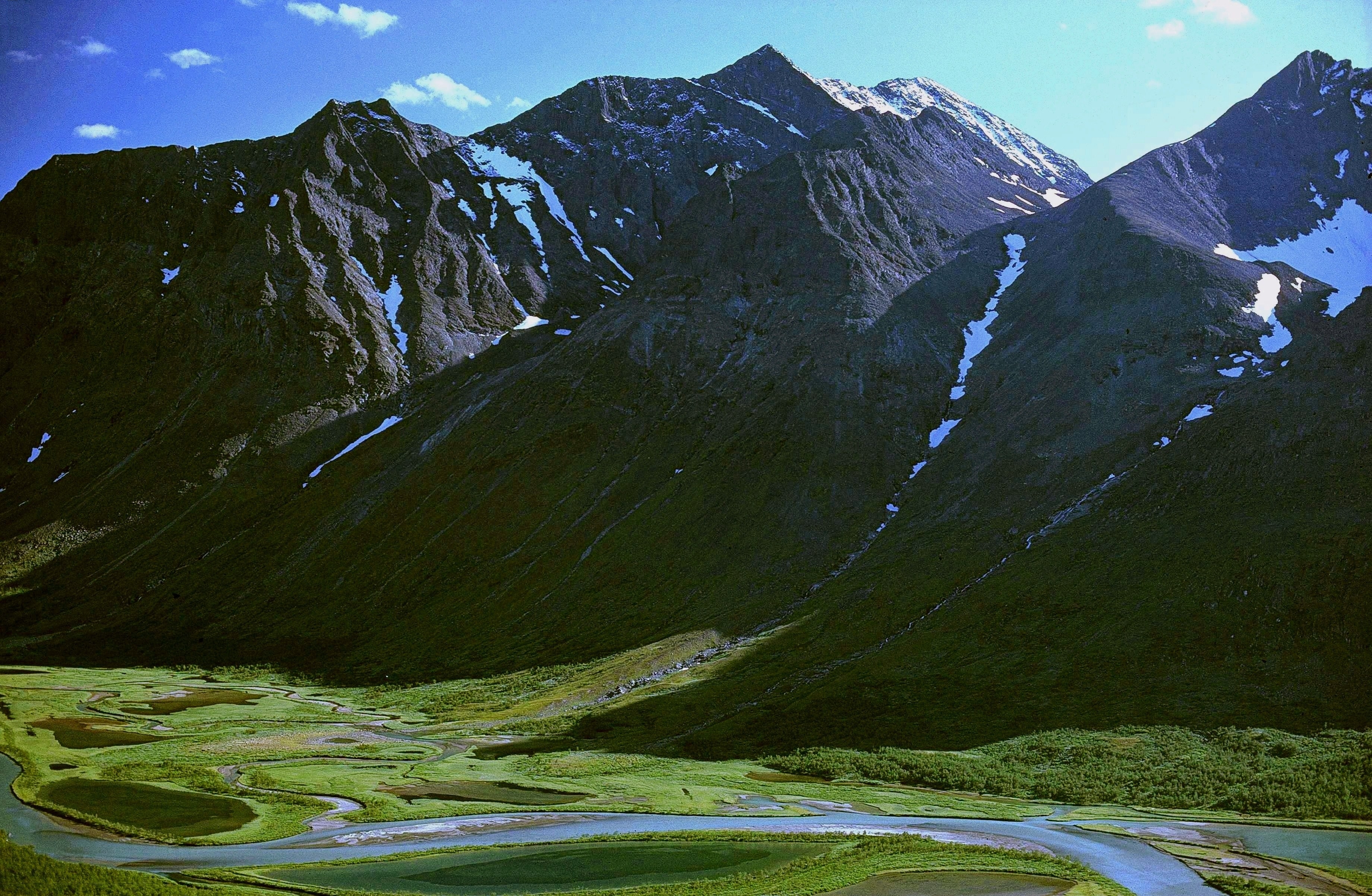
Sarek National Park ( sv, Sareks nationalpark) is a national park in Jokkmokk Municipality, Lapland in northern Sweden. Established in 1909, the park is the oldest national park in Europe. It is adjacent to two other national parks, namely Stora Sjöfallet and Padjelanta. The shape of Sarek National Park is roughly circular with an average diameter of about . The most noted features of the national park are six of Sweden's thirteen peaks over located within the park's boundaries. Among these is the second highest mountain in Sweden, Sarektjåkkå, whilst the massif Áhkká is located just outside the park. The park has about 200 peaks over , 82 of which have names. Sarek is also the name of a geographical area which the national park is part of. The Sarek mountain district includes a total of eight peaks over . Due to the long trek, the mountains in the district are seldom climbed. There are approximately 100 glaciers in Sarek National Park. Sarek is a popular area for hikers ... [...More Info...] [...Related Items...] OR: [Wikipedia] [Google] [Baidu] |
Padjelanta National Park
Padjelanta ( sv, Padjelanta nationalpark) is a national park in Norrbotten County in northern Sweden. Established in 1963, it is the largest national park in Sweden with an area of , and part of the UNESCO World Heritage Site Laponia established in 1996. Etymology and the presence of the Sámi people The name of the park derives from the Lule Sami word ''Badjelánnda'', which translates to ''the higher land'' – a straightforward description of the region. Today the three Sámi villages Duorbun, Jåhkågasska and Sirges let their reindeer graze in Padjelanta in the summer, using the traditional settlements of Stáloluokta, Árasluokta and Sállohávrre. The National Park contains Bronze Age rock carvings. Nature The park, which borders on Norway in the west, is primarily comprised by a vast plateau around the two unusually large lakes Vastenjávrre and Virihávrre – the latter of which is often referred to as ''"the most beautiful lake in Sweden"''. Consequen ... [...More Info...] [...Related Items...] OR: [Wikipedia] [Google] [Baidu] |
Petrifaction
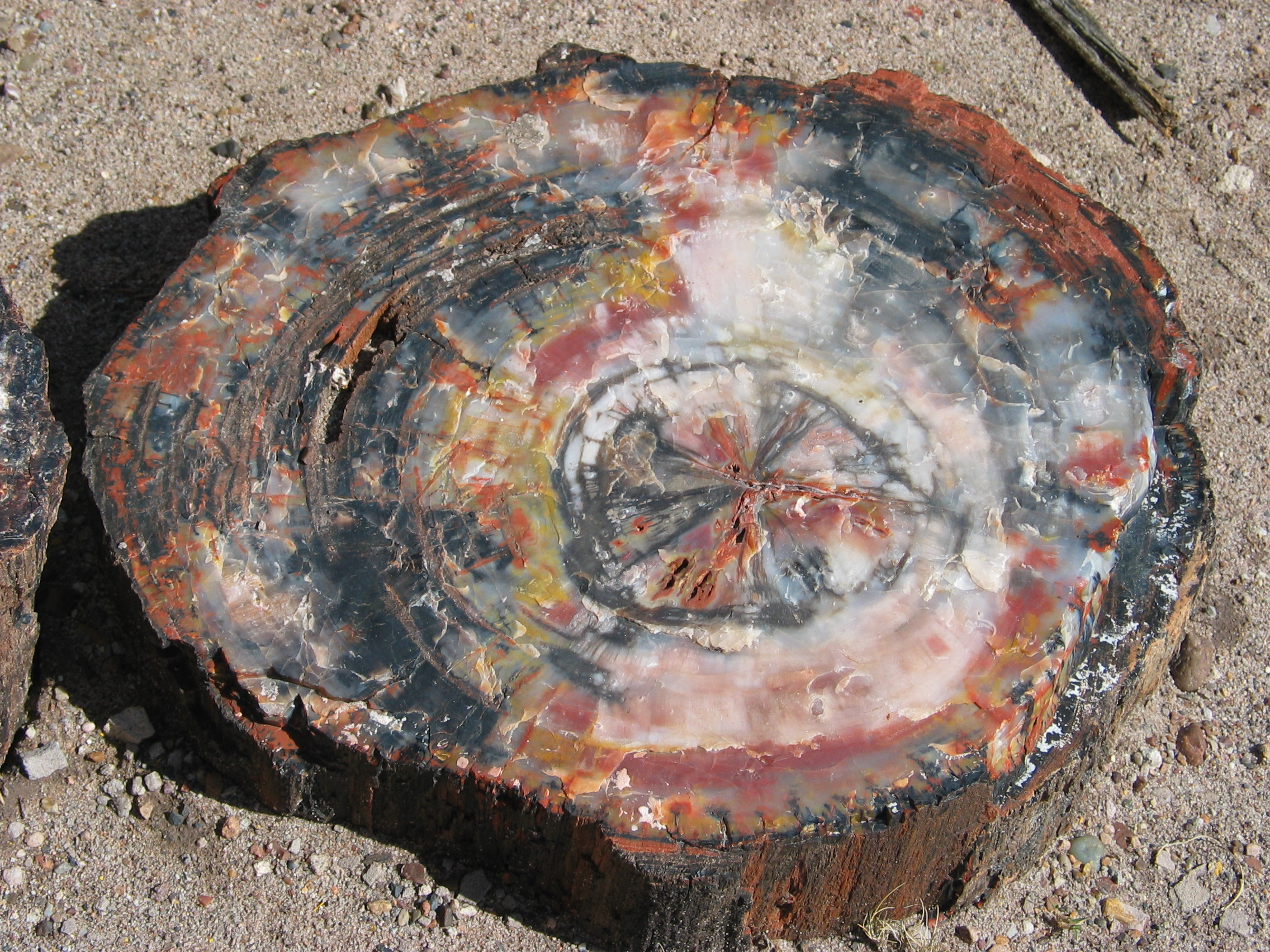
In geology, petrifaction or petrification () is the process by which organic material becomes a fossil through the replacement of the original material and the filling of the original pore spaces with minerals. Petrified wood typifies this process, but all organisms, from bacteria to vertebrates, can become petrified (although harder, more durable matter such as bone, beaks, and shells survive the process better than softer remains such as muscle tissue, feathers, or skin). Petrifaction takes place through a combination of two similar processes: permineralization and replacement. These processes create replicas of the original specimen that are similar down to the microscopic level. Processes Permineralization One of the processes involved in petrifaction is permineralization. The fossils created through this process tend to contain a large amount of the original material of the specimen. This process occurs when groundwater containing dissolved minerals (most commonly ... [...More Info...] [...Related Items...] OR: [Wikipedia] [Google] [Baidu] |
High Coast
The High Coast ( sv, Höga Kusten) is a part of the coast of Sweden on the Gulf of Bothnia, in the Ångermanland province of northeast Sweden, centered in the area of the municipalities of Kramfors, Härnösand, Sollefteå and Örnsköldsvik. It is notable as an area for research on post-glacial rebound and eustacy, in which the land rises as the covering glaciers melt, a phenomenon first recognised and studied there. Since the last ice age, the land has risen 300 meters, which accounts for the region's unusually tall cliffs. The High Coast is part of the Swedish/Finnish High Coast/Kvarken Archipelago UNESCO World Heritage Site because of its exceptional geology and unique example of isostatic rebound. Geology The relief of the High Coast is that of a large scale joint valley terrain that dissects uplifted remnants of the Sub-Cambrian peneplain. During the Ice Ages of the past 2-3 million years, the High Coast was repeatedly covered by continental ice sheet, including the Fenn ... [...More Info...] [...Related Items...] OR: [Wikipedia] [Google] [Baidu] |
.jpg)


