|
Mljet
Mljet (; la, Melita, it, Meleda) is the southernmost and easternmost of the larger Adriatic islands of the Dalmatia region of Croatia. The National Park includes the western part of the island, Veliko jezero, Malo jezero, Soline Bay and a sea belt 500 m wide from the most prominent cape of Mljet covering an area of 54 km2. The central parts of the park are Veliko jezero with the Isle of St. Mary, Malo jezero and the villages of Gove─æari, Pola─Źe and Pomena.Naklad Naprijet, ''The Croatian Adriatic Tourist Guide'', pg. 338, Zagreb (1999), Population According to the 2011 census, Mljet has population of 1,088. Ethnic Croats make up 97.33% of the population. History Mljet was discovered by ancient Greco-Roman geographers, who wrote the first records and descriptions. The island was first described by Scylax of Caryanda in the 6th century BC; others prefer the text, Periplus of Pseudo-Scylax. In both texts, it is named Melite and supported by Apollonius of Rhodes.Bryant, Jacob ... [...More Info...] [...Related Items...] OR: [Wikipedia] [Google] [Baidu] |
Dubrovnik-Neretva County
The Dubrovnik-Neretva County (; hr, Dubrova─Źko-neretvanska ┼Šupanija, ) is the southernmost county of Croatia, located in south Dalmatia. The county seat is Dubrovnik and other large towns are Kor─Źula, Metkovi─ć, Opuzen and Plo─Źe. The Municipality of Neum, which belongs to neighbouring Bosnia and Herzegovina, divides the county in two parts which are connected only by the Pelje┼Īac Bridge. The southern part of the county consists of Dubrovnik and the surrounding area, including the Pelje┼Īac peninsula, and the islands of Kor─Źula, Lastovo, Mljet, ┼Āipan, Lopud and Kolo─Źep. The northern part of the county includes the Neretva Delta, the Ba─ćina lakes north of Plo─Źe, and a swath of hinterland near the southernmost slopes of Biokovo and around the hill of Rujnica. The northern part of the Mljet island is a national park. The Lastovo archipelago is a designated nature park. The southernmost tip of the county is the Prevlaka peninsula at the border with Montenegro. It is the onl ... [...More Info...] [...Related Items...] OR: [Wikipedia] [Google] [Baidu] |
Adriatic Sea
The Adriatic Sea () is a body of water separating the Italian Peninsula from the Balkan Peninsula. The Adriatic is the northernmost arm of the Mediterranean Sea, extending from the Strait of Otranto (where it connects to the Ionian Sea) to the northwest and the Po Valley. The countries with coasts on the Adriatic are Albania, Bosnia and Herzegovina, Croatia, Italy, Montenegro, and Slovenia. The Adriatic contains more than 1,300 islands, mostly located along the Croatian part of its eastern coast. It is divided into three basins, the northern being the shallowest and the southern being the deepest, with a maximum depth of . The Otranto Sill, an underwater ridge, is located at the border between the Adriatic and Ionian Seas. The prevailing currents flow counterclockwise from the Strait of Otranto, along the eastern coast and back to the strait along the western (Italian) coast. Tidal movements in the Adriatic are slight, although larger amplitudes are known to occur occasi ... [...More Info...] [...Related Items...] OR: [Wikipedia] [Google] [Baidu] |
Dalmatia
Dalmatia (; hr, Dalmacija ; it, Dalmazia; see #Name, names in other languages) is one of the four historical region, historical regions of Croatia, alongside Croatia proper, Slavonia, and Istria. Dalmatia is a narrow belt of the east shore of the Adriatic Sea, stretching from the island of Rab in the north to the Bay of Kotor in the south. The Dalmatian Hinterland ranges in width from fifty kilometres in the north, to just a few kilometres in the south; it is mostly covered by the rugged Dinaric Alps. List of islands of Croatia, Seventy-nine islands (and about 500 islets) run parallel to the coast, the largest (in Dalmatia) being Bra─Ź, Pag (island), Pag, and Hvar. The largest city is Split, Croatia, Split, followed by Zadar and ┼Āibenik. The name of the region stems from an Illyrians, Illyrian tribe called the Dalmatae, who lived in the area in classical antiquity. Later it became a Dalmatia (Roman province), Roman province, and as result a Romance languages, Romance culture ... [...More Info...] [...Related Items...] OR: [Wikipedia] [Google] [Baidu] |
Adriatic
The Adriatic Sea () is a body of water separating the Italian Peninsula from the Balkans, Balkan Peninsula. The Adriatic is the northernmost arm of the Mediterranean Sea, extending from the Strait of Otranto (where it connects to the Ionian Sea) to the northwest and the Po Valley. The countries with coasts on the Adriatic are Albania, Bosnia and Herzegovina, Croatia, Italy, Montenegro, and Slovenia. The Adriatic contains more than 1,300 islands, mostly located along the Croatian part of its eastern coast. It is divided into three basins, the northern being the shallowest and the southern being the deepest, with a maximum depth of . The Otranto Sill, an underwater ridge, is located at the border between the Adriatic and Ionian Seas. The prevailing currents flow counterclockwise from the Strait of Otranto, along the eastern coast and back to the strait along the western (Italian) coast. Tidal movements in the Adriatic are slight, although acqua alta, larger amplitudes are known to ... [...More Info...] [...Related Items...] OR: [Wikipedia] [Google] [Baidu] |
Pola─Źe
Pola─Źe is a village in Croatia , image_flag = Flag of Croatia.svg , image_coat = Coat of arms of Croatia.svg , anthem = "Lijepa na┼Īa domovino"("Our Beautiful Homeland") , image_map = , map_caption = , capit .... It is connected by the D120 highway. References {{commonscat, Pola─Źe Populated places in Dubrovnik-Neretva County Mljet ... [...More Info...] [...Related Items...] OR: [Wikipedia] [Google] [Baidu] |
Narentines
The Narentines were a South Slavic tribe that occupied an area of southern Dalmatia centered at the river Neretva (), active in the 9th and 10th centuries, noted as pirates on the Adriatic. Named ''Narentani'' in Venetian sources, Greek sources call them ''Paganoi'', "pagans", as they were for long pagan, in a time when neighbouring tribes were Christianized. The tribe were fierce enemies of the Republic of Venice, having attacked Venetian merchants and clergy passing on the Adriatic, and even raided close to Venice itself, as well as defeated the doge several times. VenetianŌĆōNarentine peace treaties did not last long, as the Narentines quickly returned to piracy. They were finally defeated in a Venetian crackdown at the turn of the 10th century and disappeared from sources by the 11th century. Terminology The word ''Narentine'' is a demonym derived from the local Neretva River ( lat, Narenta). The terms "Narentines", "Pagania" or "Pagans" are found in two contemporary source ... [...More Info...] [...Related Items...] OR: [Wikipedia] [Google] [Baidu] |
Ancient Greeks
Ancient Greece ( el, ß╝Ö╬╗╬╗╬¼Žé, Hell├Īs) was a northeastern Mediterranean civilization, existing from the Greek Dark Ages of the 12thŌĆō9th centuries BC to the end of classical antiquity ( AD 600), that comprised a loose collection of culturally and linguistically related city-states and other territories. Most of these regions were officially unified only once, for 13 years, under Alexander the Great's empire from 336 to 323 BC (though this excludes a number of Greek city-states free from Alexander's jurisdiction in the western Mediterranean, around the Black Sea, Cyprus, and Cyrenaica). In Western history, the era of classical antiquity was immediately followed by the Early Middle Ages and the Byzantine period. Roughly three centuries after the Late Bronze Age collapse of Mycenaean Greece, Greek urban poleis began to form in the 8th century BC, ushering in the Archaic period and the colonization of the Mediterranean Basin. This was followed by the age of Classical Gree ... [...More Info...] [...Related Items...] OR: [Wikipedia] [Google] [Baidu] |
Zachlumia
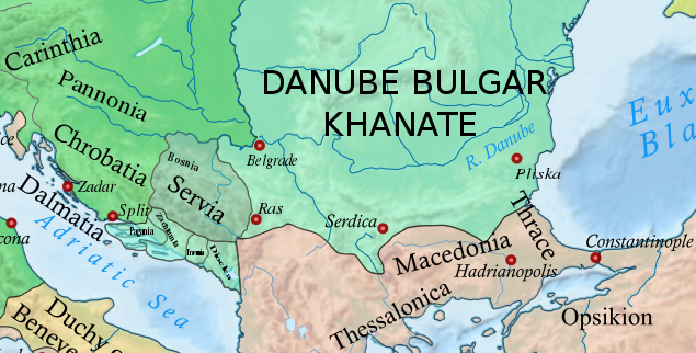
Zachlumia or Zachumlia ( sh-Latn-Cyrl, separator=" / ", Zahumlje, ąŚą░čģčāą╝čÖąĄ, ), also Hum, was a medieval principality located in the modern-day regions of Herzegovina and southern Dalmatia (today parts of Bosnia and Herzegovina and Croatia, respectively). In some periods it was a fully independent or semi-independent South Slavic principality. It maintained relations with various foreign and neighbouring powers (Byzantine Empire, First Bulgarian Empire, Kingdom of Croatia, Principality of Serbia) and later was subjected (temporarily or for a longer period) to Kingdom of Hungary, Kingdom of Serbia, Kingdom of Bosnia, Duchy of Saint Sava and at the end to the Ottoman Empire. Etymology Zachlumia is a derivative of ''Hum'', from Proto-Slavic '' *x┼Łlm┼Ł'', borrowed from a Germanic language (cf. Proto-Germanic '' *hulma-''), meaning ''"Hill"''. South Slavic ''Zahumlje'' is named after the mountain of Hum (za + Hum "behind the Hum"), above Bona, at the mouth of the Buna. The p ... [...More Info...] [...Related Items...] OR: [Wikipedia] [Google] [Baidu] |
Roman Empire
The Roman Empire ( la, Imperium Romanum ; grc-gre, ╬Æ╬▒Žā╬╣╬╗╬Ą╬»╬▒ Žäß┐Č╬Į ß┐¼Žē╬╝╬▒╬»Žē╬Į, Basile├Ła t├┤n Rh┼Źma├Ł┼Źn) was the post-Republican period of ancient Rome. As a polity, it included large territorial holdings around the Mediterranean Sea in Europe, North Africa, and Western Asia, and was ruled by emperors. From the accession of Caesar Augustus as the first Roman emperor to the military anarchy of the 3rd century, it was a Principate with Italia as the metropole of its provinces and the city of Rome as its sole capital. The Empire was later ruled by multiple emperors who shared control over the Western Roman Empire and the Eastern Roman Empire. The city of Rome remained the nominal capital of both parts until AD 476 when the imperial insignia were sent to Constantinople following the capture of the Western capital of Ravenna by the Germanic barbarians. The adoption of Christianity as the state church of the Roman Empire in AD 380 and the fall of the Western ... [...More Info...] [...Related Items...] OR: [Wikipedia] [Google] [Baidu] |
Honey
Honey is a sweet and viscous substance made by several bees, the best-known of which are honey bees. Honey is made and stored to nourish bee colonies. Bees produce honey by gathering and then refining the sugary secretions of plants (primarily floral nectar) or the secretions of other insects, like the honeydew of aphids. This refinement takes place both within individual bees, through regurgitation and enzymatic activity, as well as during storage in the hive, through water evaporation that concentrates the honey's sugars until it is thick and viscous. Honey bees stockpile honey in the hive. Within the hive is a structure made from wax called honeycomb. The honeycomb is made up of hundreds or thousands of hexagonal cells, into which the bees regurgitate honey for storage. Other honey-producing species of bee store the substance in different structures, such as the pots made of wax and resin used by the stingless bee. Honey for human consumption is collected from wild ... [...More Info...] [...Related Items...] OR: [Wikipedia] [Google] [Baidu] |
Constantine VII Porphyrogenitos
Constantine VII Porphyrogenitus (; 17 May 905 ŌĆō 9 November 959) was the fourth Emperor of the Macedonian dynasty of the Byzantine Empire, reigning from 6 June 913 to 9 November 959. He was the son of Emperor Leo VI and his fourth wife, Zoe Karbonopsina, and the nephew of his predecessor Alexander. Most of his reign was dominated by co-regents: from 913 until 919 he was under the regency of his mother, while from 920 until 945 he shared the throne with Romanos Lekapenos, whose daughter Helena he married, and his sons. Constantine VII is best known for the ''Geoponika'' (Žä╬¼ ╬│╬Ą╬┐ŽĆ╬┐╬Į╬╣╬║╬¼), an important agronomic treatise compiled during his reign, and three, perhaps four, books; ''De Administrando Imperio'' (bearing in Greek the heading ╬ĀŽüßĮĖŽé ŽäßĮĖ╬Į ß╝┤╬┤╬╣╬┐╬Į Žģß╝▒ßĮĖ╬Į ß┐¼Žē╬╝╬▒╬ĮŽī╬Į), ''De Ceremoniis'' (╬Ā╬ĄŽüßĮČ Žäß┐åŽé ╬Æ╬▒Žā╬╣╬╗╬Ą╬»╬┐Žģ ╬ż╬¼╬Š╬ĄŽēŽé), '' De Thematibus'' (╬Ā╬ĄŽüßĮČ ╬Ė╬Ą╬╝╬¼ŽäŽē╬Į ╬å╬Į╬▒Žä╬┐╬╗ß┐åŽé ╬║╬▒ßĮČ ╬öŽŹŽā╬ĄŽēŽé), and ''Vita Basilii'' (╬ ... [...More Info...] [...Related Items...] OR: [Wikipedia] [Google] [Baidu] |


.jpg)


