|
Mesovortex
A mesovortex is a small-scale rotational feature found in a convective storm, such as a quasi-linear convective system (QLCS, i.e. squall line), a supercell, or the eyewall of a tropical cyclone. Mesovortices range in diameter from tens of miles to a mile or less and can be immensely intense. Eyewall mesovortex An ''eyewall mesovortex'' is a small-scale rotational feature found in an eyewall of an intense tropical cyclone. Eyewall mesovortices are similar, in principle, to small "suction vortices" often observed in multiple-vortex tornadoes. In these vortices, wind speed can be up to 10% higher than in the rest of the eyewall. Eyewall mesovortices are most common during periods of intensification in tropical cyclones. Eyewall mesovortices often exhibit unusual behavior in tropical cyclones. They usually revolve around the low pressure center, but sometimes they remain stationary. Eyewall mesovortices have even been documented to cross the eye of a storm. These phenomena have bee ... [...More Info...] [...Related Items...] OR: [Wikipedia] [Google] [Baidu] |
Mesoscale Convective System
A mesoscale convective system (MCS) is a complex of thunderstorms that becomes organized on a scale larger than the individual thunderstorms but smaller than extratropical cyclones, and normally persists for several hours or more. A mesoscale convective system's overall cloud and precipitation pattern may be round or linear in shape, and include weather systems such as tropical cyclones, squall lines, lake-effect snow events, polar lows, and mesoscale convective complexes (MCCs), and generally forms near weather fronts. The type that forms during the warm season over land has been noted across North and South America, Europe, and Asia, with a maximum in activity noted during the late afternoon and evening hours. Forms of MCS that develop within the tropics use either the Intertropical Convergence Zone (ITCZ) or monsoon troughs as a focus for their development, generally within the warm season between spring and fall. One exception is that of lake-effect snow bands, which form d ... [...More Info...] [...Related Items...] OR: [Wikipedia] [Google] [Baidu] |
Squall Line
A squall line, or more accurately a quasi-linear convective system (QLCS), is a line of thunderstorms, often forming along or ahead of a cold front. In the early 20th century, the term was used as a synonym for cold front (which often are accompanied by abrupt and gusty wind shifts). Linear thunderstorm structures often contain heavy precipitation, hail, frequent lightning, strong straight-line winds, and occasionally tornadoes or waterspouts. Particularly strong straight-line winds can occur where the linear structure forms into the shape of a bow echo. Tornadoes can occur along waves within a line echo wave pattern (LEWP), where mesoscale low-pressure areas are present. Some bow echoes can grow to become derechos as they move swiftly across a large area. On the back edge of the rainband associated with mature squall lines, a wake low can be present, on very rare occasions associated with a heat burst. Theory Polar front theory was developed by Jacob Bjerknes, derived from a dens ... [...More Info...] [...Related Items...] OR: [Wikipedia] [Google] [Baidu] |
Mesovortex Image
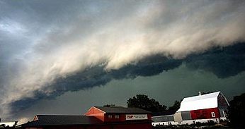
A mesovortex is a small-scale rotational feature found in a convective storm, such as a quasi-linear convective system (QLCS, i.e. squall line), a supercell, or the eyewall of a tropical cyclone. Mesovortices range in diameter from tens of miles to a mile or less and can be immensely intense. Eyewall mesovortex An ''eyewall mesovortex'' is a small-scale rotational feature found in an eyewall of an intense tropical cyclone. Eyewall mesovortices are similar, in principle, to small "suction vortices" often observed in multiple-vortex tornadoes. In these vortices, wind speed can be up to 10% higher than in the rest of the eyewall. Eyewall mesovortices are most common during periods of intensification in tropical cyclones. Eyewall mesovortices often exhibit unusual behavior in tropical cyclones. They usually revolve around the low pressure center, but sometimes they remain stationary. Eyewall mesovortices have even been documented to cross the eye of a storm. These phenomena have been ... [...More Info...] [...Related Items...] OR: [Wikipedia] [Google] [Baidu] |
Rotation
Rotation, or spin, is the circular movement of an object around a '' central axis''. A two-dimensional rotating object has only one possible central axis and can rotate in either a clockwise or counterclockwise direction. A three-dimensional object has an infinite number of possible central axes and rotational directions. If the rotation axis passes internally through the body's own center of mass, then the body is said to be ''autorotating'' or '' spinning'', and the surface intersection of the axis can be called a ''pole''. A rotation around a completely external axis, e.g. the planet Earth around the Sun, is called ''revolving'' or ''orbiting'', typically when it is produced by gravity, and the ends of the rotation axis can be called the ''orbital poles''. Mathematics Mathematically, a rotation is a rigid body movement which, unlike a translation, keeps a point fixed. This definition applies to rotations within both two and three dimensions (in a plane and in space, ... [...More Info...] [...Related Items...] OR: [Wikipedia] [Google] [Baidu] |
Allen Press
Allen Press is a printer and publisher of scientific, academic and scholarly journals as well as commercial trade publications. Founded by Harold Allen (publisher), Harold Allen in 1935, the company is located in Lawrence, KS, Lawrence, Kansas. Journals It is the publisher, amongst others, of the ''Journal of Parasitology'' (American Society of Parasitologists), ''Phycologia'' (International Phycological Society), and the ''Proceedings of the Biological Society of Washington'' (Biological Society of Washington). External links * Publishing companies of the United States Publishing companies established in 1935 Companies based in Kansas 1935 establishments in Kansas Academic publishing companies Allen Press academic journals, * {{US-publish-company-stub ... [...More Info...] [...Related Items...] OR: [Wikipedia] [Google] [Baidu] |
Mesonet
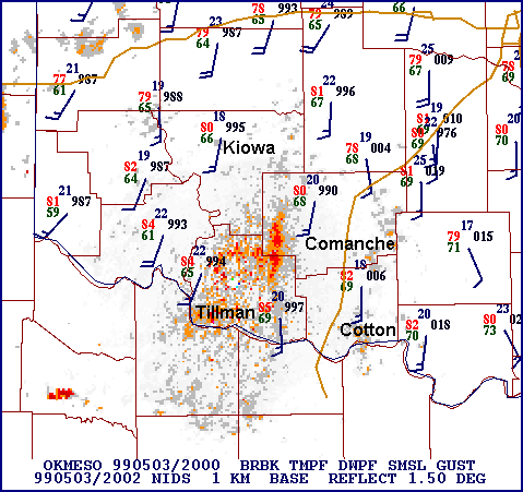
In meteorology and climatology, a mesonet, portmanteau of mesoscale network, is a network of automated weather and, often, environmental monitoring stations designed to observe mesoscale meteorological phenomena and/or microclimates. Dry lines, squall lines, and sea breezes are examples of phenomena observed by mesonets. Due to the space and time scales associated with mesoscale phenomena and microclimates, weather stations comprising a mesonet are spaced closer together and report more frequently than synoptic scale observing networks, such as the WMO Global Observing System (GOS) and US ASOS. The term mesonet refers to the collective group of these weather stations, which are usually owned and operated by a common entity. Mesonets generally record in situ surface weather observations but some involve other observation platforms, particularly vertical profiles of the planetary boundary layer (PBL). Other environmental parameters may include insolation and various variables of ... [...More Info...] [...Related Items...] OR: [Wikipedia] [Google] [Baidu] |
NEXRAD
NEXRAD or Nexrad (Next-Generation Radar) is a network of 160 high-resolution S-band Doppler weather radars operated by the National Weather Service (NWS), an agency of the National Oceanic and Atmospheric Administration (NOAA) within the United States Department of Commerce, the Federal Aviation Administration (FAA) within the Department of Transportation, and the U.S. Air Force within the Department of Defense. Its technical name is WSR-88D (''Weather Surveillance Radar, 1988, Doppler''). NEXRAD detects precipitation and atmospheric movement or wind. It returns data which when processed can be displayed in a mosaic map which shows patterns of precipitation and its movement. The radar system operates in two basic modes, selectable by the operator – a slow-scanning ''clear-air mode'' for analyzing air movements when there is little or no activity in the area, and a ''precipitation mode'', with a faster scan for tracking active weather. NEXRAD has an increased emphasis on autom ... [...More Info...] [...Related Items...] OR: [Wikipedia] [Google] [Baidu] |
Weather Satellite
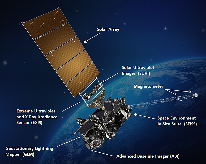
A weather satellite or meteorological satellite is a type of Earth observation satellite that is primarily used to monitor the weather and climate of the Earth. Satellites can be polar orbiting (covering the entire Earth asynchronously), or geostationary (hovering over the same spot on the equator). While primarily used to detect the development and movement of storm systems and other cloud patterns, meteorological satellites can also detect other phenomena such as city lights, fires, effects of pollution, auroras, sand and dust storms, snow cover, ice mapping, boundaries of ocean currents, and energy flows. Other types of environmental information are collected using weather satellites. Weather satellite images helped in monitoring the volcanic ash cloud from Mount St. Helens and activity from other volcanoes such as Mount Etna. Smoke from fires in the western United States such as Colorado and Utah have also been monitored. El Niño and its effects on weather are monitored ... [...More Info...] [...Related Items...] OR: [Wikipedia] [Google] [Baidu] |
Weather Radar
Weather radar, also called weather surveillance radar (WSR) and Doppler weather radar, is a type of radar used to locate precipitation, calculate its motion, and estimate its type (rain, snow, hail etc.). Modern weather radars are mostly pulse-Doppler radars, capable of detecting the motion of rain droplets in addition to the intensity of the precipitation. Both types of data can be analyzed to determine the structure of storms and their potential to cause severe weather. During World War II, radar operators discovered that weather was causing echoes on their screen, masking potential enemy targets. Techniques were developed to filter them, but scientists began to study the phenomenon. Soon after the war, surplus radars were used to detect precipitation. Since then, weather radar has evolved on its own and is now used by national weather services, research departments in universities, and in television stations' weather departments. Raw images are routinely used and speciali ... [...More Info...] [...Related Items...] OR: [Wikipedia] [Google] [Baidu] |
Surface Weather Observation
Surface weather observations are the fundamental data used for safety as well as climatological reasons to forecast weather and issue warnings worldwide. They can be taken manually, by a weather observer, by computer through the use of automated weather stations, or in a hybrid scheme using weather observers to augment the otherwise automated weather station. The ICAO defines the International Standard Atmosphere (ISA), which is the model of the standard variation of pressure, temperature, density, and viscosity with altitude in the Earth's atmosphere, and is used to reduce a station pressure to sea level pressure. Airport observations can be transmitted worldwide through the use of the METAR observing code. Personal weather stations taking automated observations can transmit their data to the United States mesonet through the Citizen Weather Observer Program (CWOP), the UK Met Office through their Weather Observations Website (WOW), or internationally through the Weather Und ... [...More Info...] [...Related Items...] OR: [Wikipedia] [Google] [Baidu] |
Mesolow
A squall is a sudden, sharp increase in wind speed lasting minutes, as opposed to a wind gust, which lasts for only seconds. They are usually associated with active weather, such as rain showers, thunderstorms, or heavy snow. Squalls refer to the increase of the sustained winds over that time interval, as there may be higher gusts during a squall event. They usually occur in a region of strong sinking air or cooling in the mid-atmosphere. These force strong localized upward motions at the leading edge of the region of cooling, which then enhances local downward motions just in its wake. Etymology There are different versions of the word's origins: * By one version, the word appears to be Nordic in origin, but its etymology is considered obscure. It probably has its roots in the word ''skvala'' an Old Norse word meaning literally ''to squeal''. * By another version, it is an alteration of ''squeal'' influenced by ''bawl''. Character of the wind The term "squall" is used to refe ... [...More Info...] [...Related Items...] OR: [Wikipedia] [Google] [Baidu] |
Low-pressure Area
In meteorology, a low-pressure area, low area or low is a region where the atmospheric pressure is lower than that of surrounding locations. Low-pressure areas are commonly associated with inclement weather (such as cloudy, windy, with possible rain or storms), while high-pressure areas are associated with lighter winds and clear skies. Winds circle anti-clockwise around lows in the northern hemisphere, and clockwise in the southern hemisphere, due to opposing Coriolis force, Coriolis forces. Low-pressure systems form under areas of wind divergence that occur in the upper levels of the Atmosphere of Earth, atmosphere (aloft). The formation process of a low-pressure area is known as cyclogenesis. In Meteorology#Dynamic meteorology, meteorology, atmospheric divergence aloft occurs in two kinds of places: * The first is in the area on the east side of upper Trough (meteorology), troughs, which form half of a Rossby wave within the Westerlies (a trough (meteorology), trough with la ... [...More Info...] [...Related Items...] OR: [Wikipedia] [Google] [Baidu] |
_eye_close-up.jpg)


